
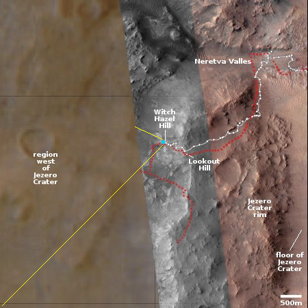
The barren hills west of Jezero Crater
Click for full panorama.
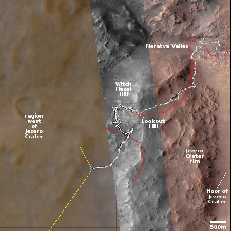
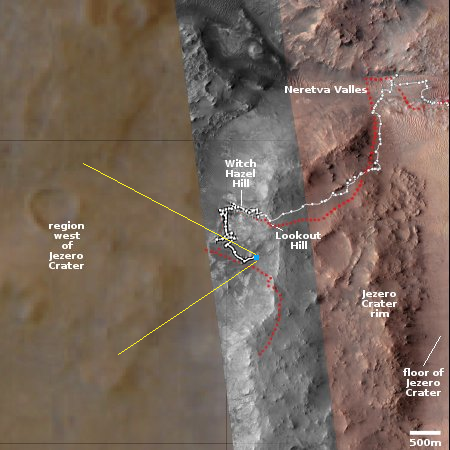
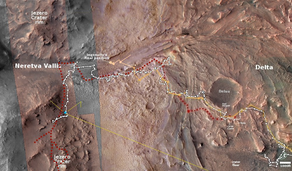
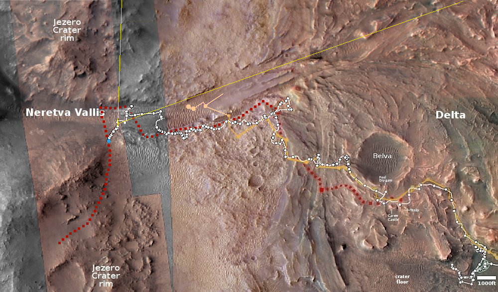
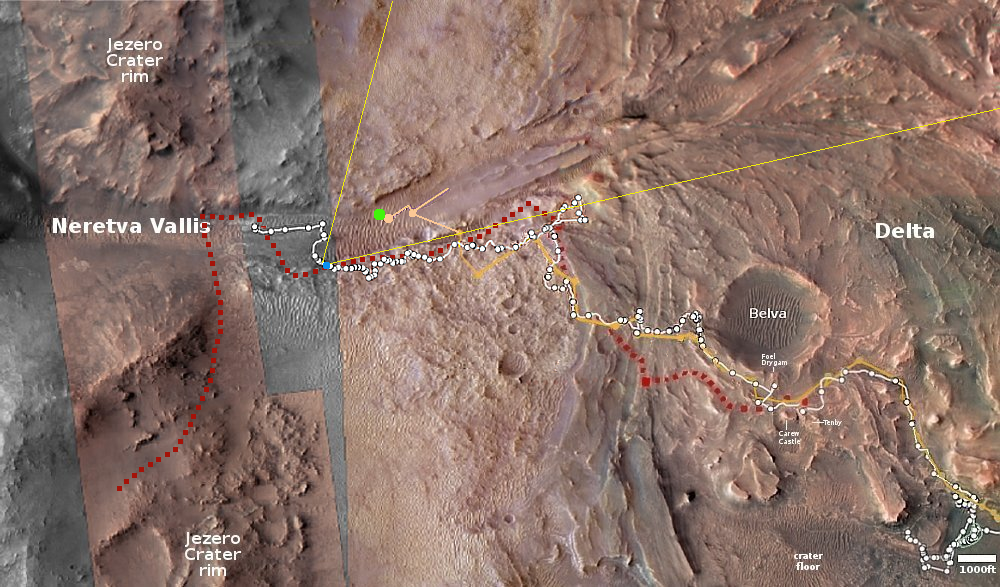
Click for interactive map.
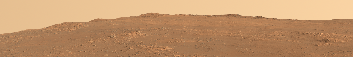
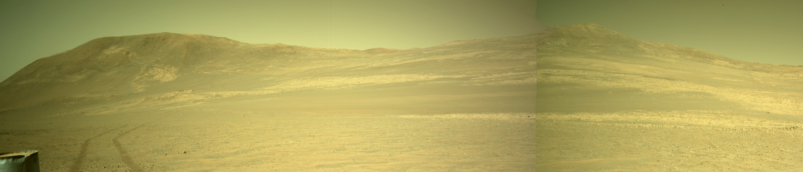
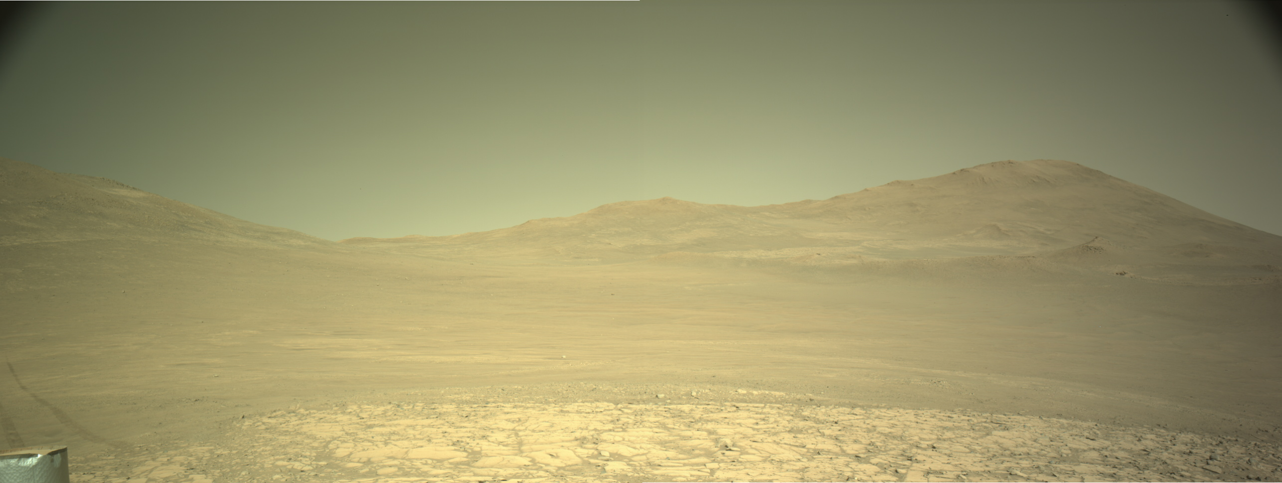
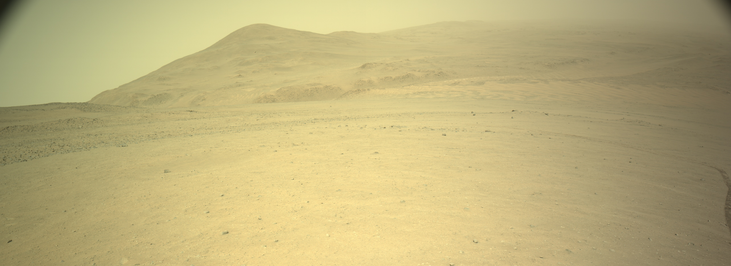
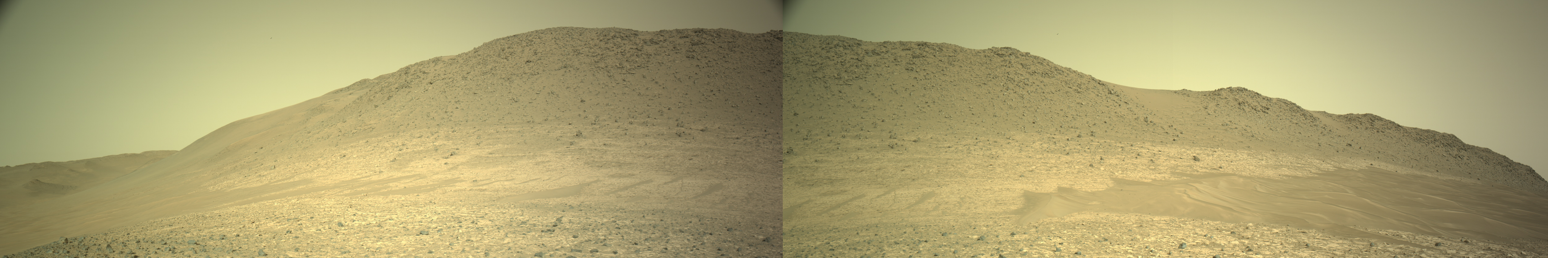
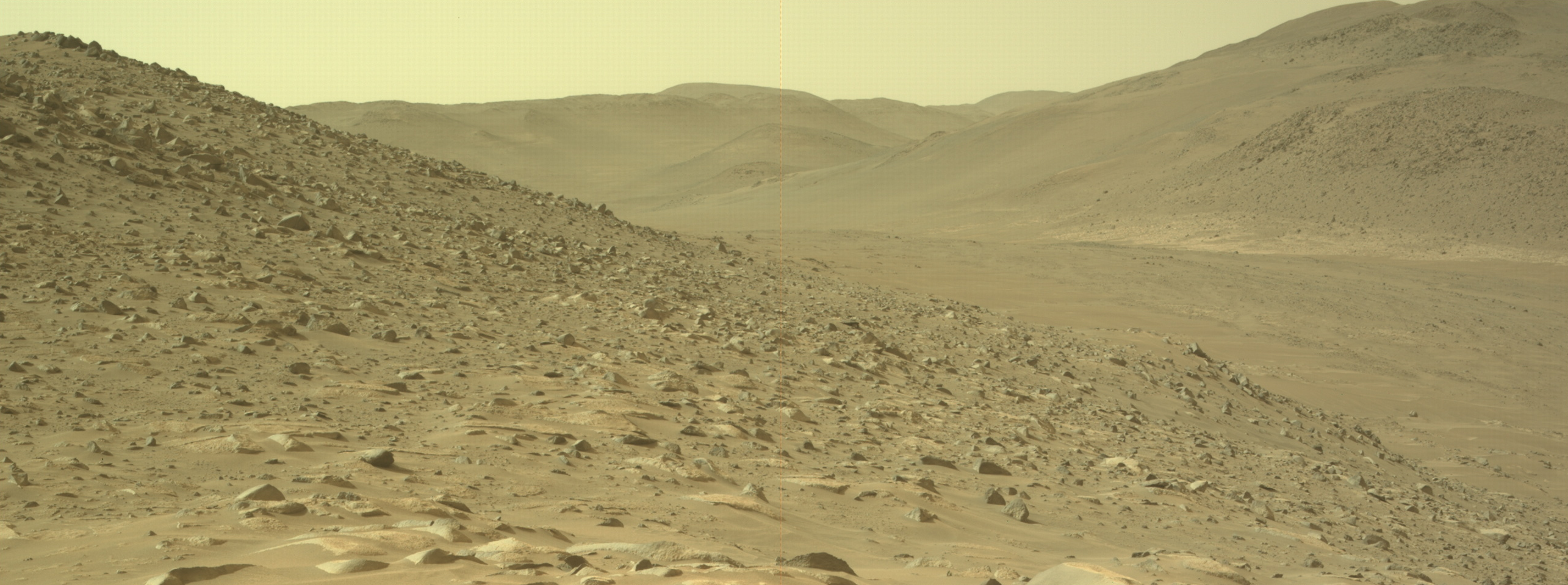
Cool image time! The panorama above, cropped and reduced to post here, was created on April 5, 2026 using 46 pictures taken by one of the high resolution camera’s on the Mars rover Perseverance. It also attempts to show this terrain in natural color.
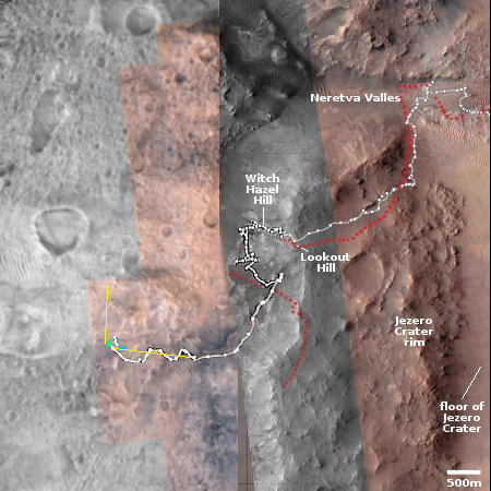
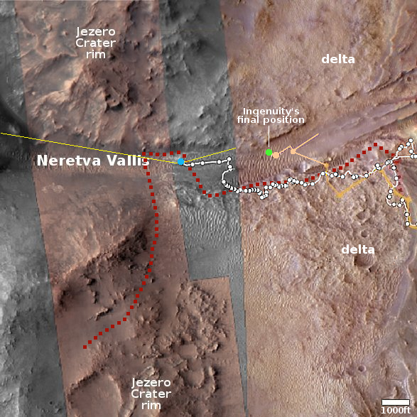
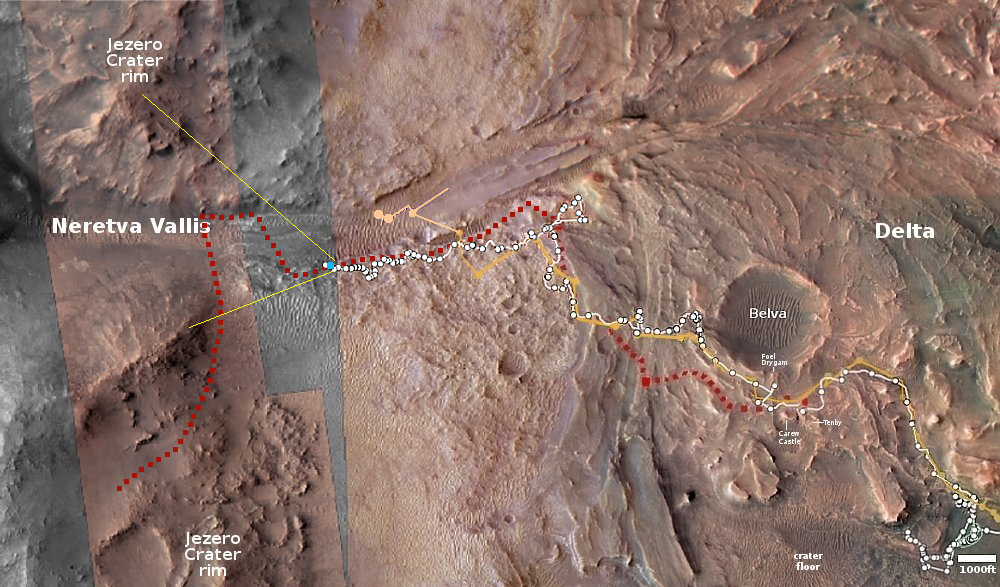
The blue dot on the overview map to the right marks Perseverance’s present location. The green dot indicates where I think the rover was when the panorama was taken. (Note: I think the press release incorrectly lists the Sol number for these dates, but as I am not sure I can only guess.) The yellow lines indicate approximately the terrain seen in the full panorama.
As the press release notes, “the panorama offers one of the richest geological vistas of the rover’s mission, revealing a windswept landscape of diverse rock textures.” It also appears this is the direction the rover is presently headed.
I ask my readers to once again look at this panorama. It shows an utterly barren terrain. There is no life here, and if there ever was it was gone billions of years ago and never did much to shape the landscape. While some at NASA and in the planetary community like to tout the possibility of life on Mars in order to lobby for funding, the reality we see says there is none, and that life will only appear on Mars when humans finally arrive there to build new human societies.

Click for full panorama.
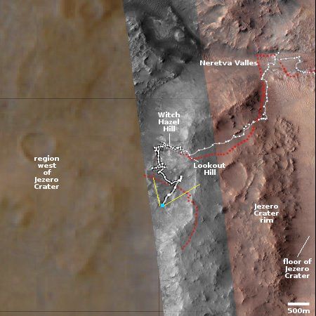
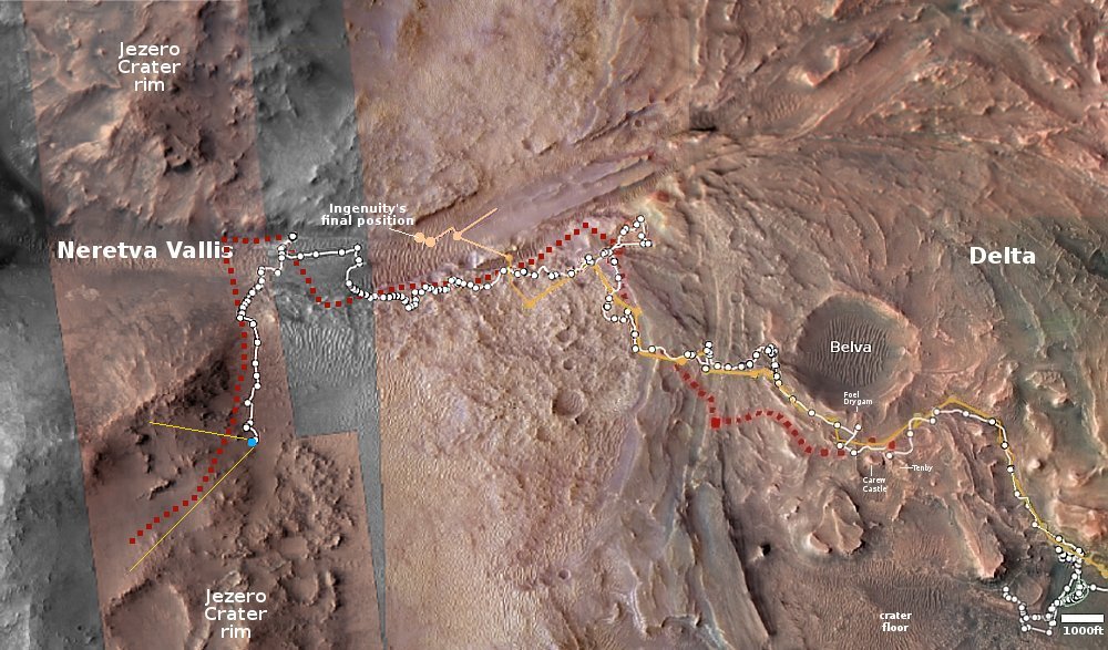
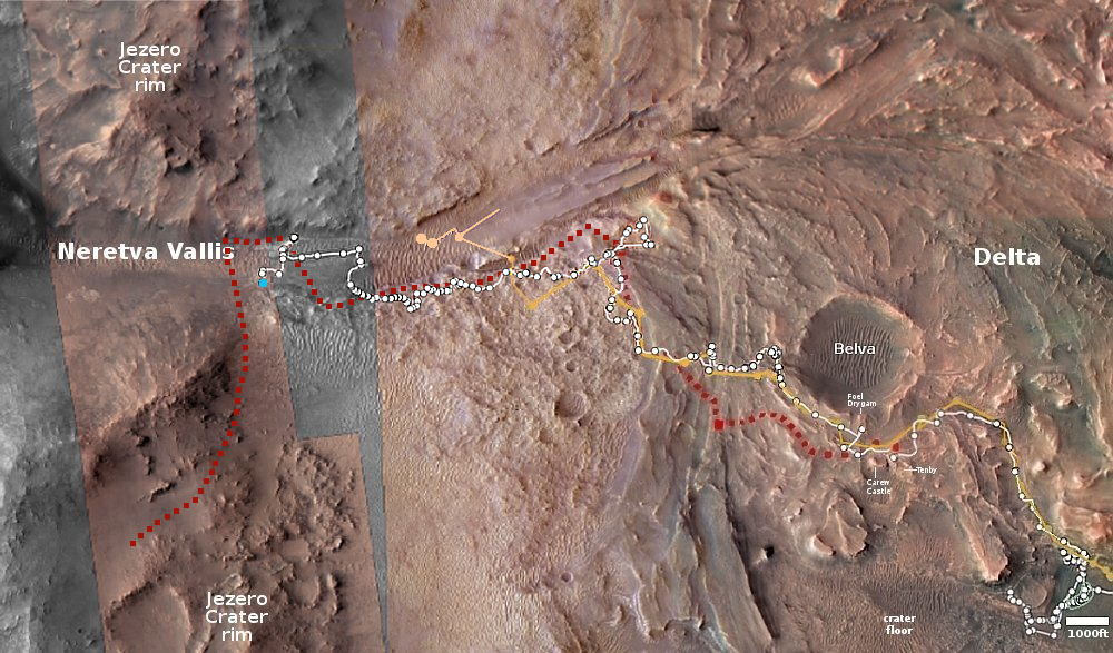
Click for interactive map.
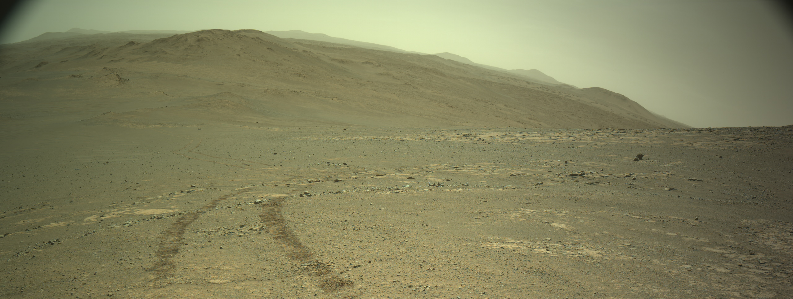
Cool image time! The panorama above, cropped and reduced to post here, was created on April 5, 2026 using 46 pictures taken by one of the high resolution camera’s on the Mars rover Perseverance. It also attempts to show this terrain in natural color.
The blue dot on the overview map to the right marks Perseverance’s present location. The green dot indicates where I think the rover was when the panorama was taken. (Note: I think the press release incorrectly lists the Sol number for these dates, but as I am not sure I can only guess.) The yellow lines indicate approximately the terrain seen in the full panorama.
As the press release notes, “the panorama offers one of the richest geological vistas of the rover’s mission, revealing a windswept landscape of diverse rock textures.” It also appears this is the direction the rover is presently headed.
I ask my readers to once again look at this panorama. It shows an utterly barren terrain. There is no life here, and if there ever was it was gone billions of years ago and never did much to shape the landscape. While some at NASA and in the planetary community like to tout the possibility of life on Mars in order to lobby for funding, the reality we see says there is none, and that life will only appear on Mars when humans finally arrive there to build new human societies.


