Rosetta special science issue

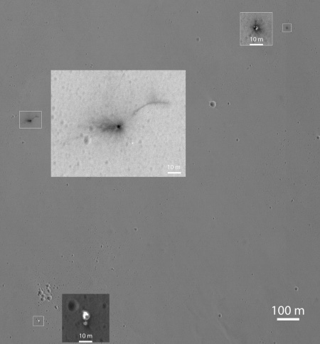
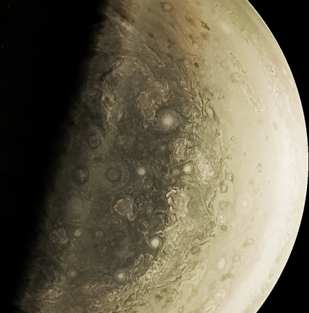
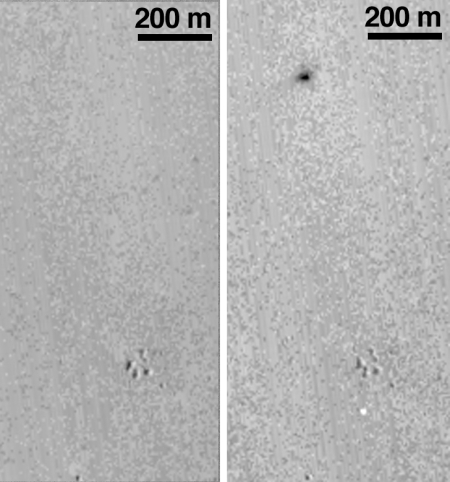
For those who want to read some interesting science papers, on Friday the journal Astronomy & Astrophysics published a special issue devoted to the results from Rosetta and Philae.

The issue includes 46 papers, many of which are open access and thus available at no cost to the general public. Many were published previously and include their press releases. These earlier results have already been posted here at BtB, but now they the results are gathered together in one place.

An Enceladus close look

Enceladus at 77 miles

Cool image time! The image on the right is the first processed close-up image released from Cassini’s fly-by of Saturn’s moon Enceladus on Wednesday. The resolution is about 50 feet per pixel, taken from about 77 miles away. This surface, in the general area where Enceladus vents lie, reminds me of a thick field of snow that has begun to melt away.

Since the fly-by got within 30 miles, even higher resolution images should follow.

Greenland ice sheet not covered in soot

The uncertainty of science: A new study of the Greenland ice sheet has found that the darkening sensed there by satellites is not caused by dust and soot deposited by forest fires and industry but was instead caused by the slow degradation of the sensors on the satellites themselves.

In trying to explain the apparent decline in reflectivity, lead author Chris Polashenski, an adjunct assistant professor at Dartmouth’s Thayer School of Engineering and a research geophysicist at the U.S. Army Corps of Engineers Cold Regions Research and Engineering Laboratory, and his colleagues analyzed dozens of snow-pit samples from the 2012-2014 snowfalls across northern Greenland and compared them with samples from earlier years. The results showed no significant change in the quantity of black carbon deposited for the past 60 years or the quantity and mineralogical makeup of dust compared to the last 12,000 years, meaning that deposition of these light absorbing impurities is not a primary cause of reflectivity reduction or surface melting in the dry snow zone. Algae growth, which darkens ice, also was ruled out as a factor.

Instead, the findings suggest the apparent decline in the dry snow zone’s reflectivity is being caused by uncorrected degradation of sensors in NASA’s aging MODIS satellites and that the declining trend will likely disappear when new measurements are reprocessed.

In other words, this story is another case of fear-mongering environmentalists and climate scientists (but I repeat myself) prematurely blaming human activity on the destruction of the environment.

Enceladus flyby images begin arriving

Enceladus

Cool image time! The first images from Cassini’s close flyby of Saturn’s moon Enceladus on Wednesday have started to arrive.

None have yet been processed, though the press release above provided a distant view of the moon’s plumes as the spacecraft approached. The image on the right, showing the moon itself, is one of the flyby I pulled off from the raw image website. Expect some interesting views to appear there throughout the day, with a more detailed press release tomorrow.

Fiber optic cable damaged on Mauna Kea

On the same day hundreds of protesters were blocking construction vehicles from reaching the top of Mauna Kea, the fiber optic connection between the observatories on the summit malfunctioned. Workers have now discovered that the malfunction was caused by a damaged cable that police are now investigating.

The report does not provide any real details, so this failure could be quite innocent. That police are now investigating it and that it took place on the same day as the protests however suggests that it was sabotage.

Oxygen in Comet 67P/C-G coma

The uncertainty of science: Unexpectedly scientists using Rosetta data have discovered oxygen in the coma of Comet 67P/C-G.

It was not immediately clear where the oxygen came from. The team discovered that water and oxygen were often found together — an indication that similar processes released both molecules. But Bieler and his colleagues ruled out many scenarios in which oxygen arises as a by-product when energetic particles such as photons and electrons split apart water. Instead, the researchers argue that the oxygen is a remnant from when 67P formed billions of years ago, a process that may have trapped the gas in small grains of ice and rock that coalesced to create the comet’s solid core.

But many models of the early Solar System rule this out because most oxygen tends to pair off with hydrogen. Given this affinity, it is tricky to adjust models of the early Solar System to allow for the survival of gaseous O2, says Mike A’Hearn, an astronomer at the University of Maryland in College Park and a co-investigator on Alice. But he adds that it may be possible with the right chemical abundances and temperature conditions.

A mother and father is still the best for kids

Science discovers the obvious: Several new studies have found again that children generally do better in a stable family with a mother and a father than in any other combination.

In recent weeks, a barrage of new evidence has come to light demonstrating what was once common sense. “Family structure matters” (in the words of my American Enterprise Institute colleague Brad Wilcox, who is also the director of the National Marriage Project at the University of Virginia). Princeton University and the left-of-center Brookings Institution released a study that reported “most scholars now agree that children raised by two biological parents in a stable marriage do better than children in other family forms across a wide range of outcomes.” Why this is so is still hotly contested.

Another study, co-authored by Wilcox, found that states with more married parents do better on a broad range of economic indicators, including upward mobility for poor children and lower rates of child poverty. On most economic indicators, the Washington Post summarized, “the share of parents who are married in a state is a better predictor of that state’s economic health than the racial composition and educational attainment of the state’s residents.”

I think it amusing that some scientists wonder “why this is so.” I also realize that by stating this obvious fact of nature I and these scientists are being racist homophobes who want to oppress minorities, but who am I to argue with reality?

Comet 67P/C-G has passed peak brightness

Using both ground-based and Rosetta observations scientists have now measured when the comet reached its peak brightness as well as how much material it lost during this orbit’s closest approach to the Sun.

Based on Rosetta’s pre-perihelion measurements that indicate the dust:gas ratio was approximately 4 , that means roughly 80% of the material being lost is dust, with the rest dominated by water, CO, and CO2 ices. (Note: at the time of that blog post an estimate of 3 was made for perihelion, but the actual data has yet to be analysed.) In any case, using 3 and 4 respectively, the total mass loss rate at its peak is likely in the range of about 100,000–115,000 tonnes per day.

Of course, that’s not a huge amount compared to the comet’s overall mass of around 10 billion tonnes. But nevertheless, a very simple calculation reveals that if, for example, the comet lost that much mass continuously for 100 days, it would correspond to roughly 0.4-0.5 metres of its surface being removed in that time.

In other words, the surface lost about 1.5 feet during close approach.

Peak brightness occurred near the end of August, and has been declining since.

Dawn begins descent to final orbit around Ceres

Engineers have fired up Dawn’s ion engine and have begun lowering the spacecraft’s orbit downward.

The spacecraft is now on its way to the final orbit of the mission, called the low-altitude mapping orbit. Dawn will spend more than seven weeks descending to this vantage point, which will be less than 235 miles (380 kilometers) from the surface of Ceres. In mid-December, Dawn will begin taking observations from this orbit, including images at a resolution of 120 feet (35 meters) per pixel.

They’ve also released a nice mosaic showing the double bright spots in Occator Crater as well as the surrounding terrain.

Pluto’s meandering canyons

canyons of Pluto

Cool image time! In scrolling through the new raw images downloaded from New Horizons today I came across an image, one of several, that showed what clearly appeared to be meandering canyons carved by flowing liquid.

To show it here, I have cropped it and reduced its size somewhat, highlighting the most interesting features. As you can see, the largest canyon not only appears to have a dark floor, it cuts right through an older crater. Smaller canyons do the same thing. In addition, many of the craters seem to be ponded with the same dark material that floors the canyons, while some of the smaller canyons show tributaries that come together, just like rivers. Are these flows of liquid nitrogen?

I eagerly await the conclusions of the scientists, who are probably only slightly less baffled by these features as I am.

Be sure and check out the full image, as well as the other raw images. The data continue to come in from New Horizons, but the science team is no longer under the same kind of public pressure to make announcements or hold press conferences. There are gems hidden there that are worth looking at, even if they are not as yet accompanied by any scientific analysis.

Pluto in 3D

The New Horizons science team has released its first 3D image of the surface of Pluto.

You need red/blue stereo glasses to view it.

The image shows an ancient, heavily cratered region of Pluto, dotted with low hills and cut by deep fractures, which indicate extension of Pluto’s crust. Analysis of these stereo images shows that the steep fracture in the upper left of the image is about 1 mile (1.6 kilometers) deep, and the craters in the lower right part of the image are up to 1.3 miles (2.1 km) deep. Smallest visible details are about 0.4 miles (0.6 kilometers) across.

My impression of the image, using the glasses, makes me wonder if they have exaggerated the vertical depth so that it would stand out. The craters look more like pits than craters. And if they didn’t exaggerate the vertical depth, then that means that impacts on Pluto produce craters that are very different than those seen in the inner solar system.

Mysterious piece of space junk to hit Earth

A piece of unidentified space junk, discovered in a long elliptical orbit going out far beyond the Moon, has been calculated to hit the Earth over the Indian Ocean on November 13.

WT1190F was detected by the Catalina Sky Survey, a program aimed at discovering asteroids and comets that swing close to Earth. At first scientists didn’t know what to make of this weird body. But they quickly computed its trajectory, after collecting more observations and unearthing 2012 and 2013 sightings from telescope archives, says independent astronomy software developer Bill Gray, who has been working to track the debris with NASA’s Jet Propulsion Laboratory in Pasadena, California.

WT1190F travels a highly elliptical orbit, swinging out twice as far as the Earth-Moon distance, Gray says. Gray’s calculations show that it will hit the Earth at 6:20 UTC, falling about 65 kilometres off the southern tip of Sri Lanka. Much if not all of it will burn up in the atmosphere, but “I would not necessarily want to be going fishing directly underneath it,” Gray says.

What makes the object interesting is that they don’t know when it was launched or how it got in the orbit it is in. It could even be something from the Apollo lunar missions.

The largest astronomical image ever

Astronomers have assembled the largest single image of the entire Milky Way ever taken.

It is 46 billion pixels across.

The amazing view of the Milky Way was built out of 268 individual views of the galaxy that includes the sun and the Earth, captured night after night over the course of five years with telescopes in Chile’s Atacama Desert. Astronomers at Ruhr-Universität Bochum used the data to examine stars whose brightness changes over time — and the image portrays more than 50,000 new objects with variable brightness that have never been recorded before.

Another Pluto Moon revealed

Kerberos

The uncertainty of science: The New Horizons science team has released their best image of Pluto’s moon Kerberos, finding it to be nothing like what they expected.

Before the New Horizons encounter with Pluto, researchers had used Hubble Space Telescope images to “weigh” Kerberos by measuring its gravitational influence on its neighboring moons. That influence was surprisingly strong, considering how faint Kerberos was. They theorized that Kerberos was relatively large and massive, appearing faint only because its surface was covered in dark material. But the small, bright-surfaced, Kerberos now revealed by these new images show that that idea was incorrect, for reasons that are not yet understood.

Instead, Kerberos is much smaller than expected, and its surface is bright, suggesting it is covered by relatively clean ice. It is also double lobed, kind of like Comet 67P/C-G.

Earth might be one of the universe’s first habitable planets

The uncertainty of science: An analysis of data from the Hubble Space Telescope and Kepler suggests that the Earth might be one of the first planets in the universe to harbor life.

I label this result uncertain because it is based on what I consider to be a very poor sampling of exoplanets as seen by Kepler. Kepler might have found a lot of exoplanets, but the numbers are still small and skewed by the limited types of suns observed and the short time frame of its observations. Moreover, the data from Hubble is rich, but also quite small, leaving great uncertainties for all of these conclusions.

At the same time, this conclusion might help explain why, after almost a half century of looking, we have yet to detect any evidence of radio communications from any other civilizations. You would think we would have detected something by now. Maybe they don’t exist, and we are the first.

200 new lunar impact craters discovered

In a paper [pdf] presented this week at a lunar science conference, scientists announced the identification of more than 200 new impact craters on the Moon from Lunar Reconnaissance Orbiter (LRO).

As of 1 May 2015, we have scanned and classified changes in 14,182 NAC temporal pairs using our automated change detection tool leading to the discovery over 200 impact craters ranging in size from 1.5 to 43 m. In addition, we also identified thousands of other surface changes, including about 44,000 low reflectance splotches, 3,500 high reflectance splotches, 850 mixed reflectance splotches, [and] 1 Chinese lander/rover.

They think the splotches are created from impacts too small to see with LRO.

Hat tip James Fincannon.

New cheap way to turn sea water drinkable?

Egyptian researchers have developed what they think could be a cheap and easy way to desalinate sea water.

In a paper published last month in the journal, Water Science & Technology, researchers Mona Naim, Mahmoud Elewa, Ahmed El-Shafei and Abeer Moneer announced that they have developed a new way to purify sea water using materials that can be manufactured easily and cheaply in most countries, and a method that does not rely on electricity.

The technology uses a method of separating liquids and solids called pervaporation. Pervaporation is a simple, two-step process – the first step involves filtering the liquid through a ceramic or polymeric membrane, while the second step requires vaporizing and collecting the condensed water. Pervaporation is faster, cleaner and more energy efficient than conventional methods, not least because the heat required for the vaporization stage does not necessarily have to be electrically generated.

The technology is not yet proven, but if it bears fruit, many of the world’s water problems will soon vanish.

Study questions scientific dating method

The uncertainty of science: A new study has raised questions about the methods scientists have used to date the late heavy bombardment in the early solar system.

A study of zircons from a gigantic meteorite impact in South Africa, now online in the journal Geology, casts doubt on the methods used to date lunar impacts. The critical problem, says lead author Aaron Cavosie, a visiting professor of geoscience and member of the NASA Astrobiology Institute at the University of Wisconsin-Madison, is the fact that lunar zircons are “ex situ,” meaning removed from the rock in which they formed, which deprives geoscientists of corroborating evidence of impact. “While zircon is one of the best isotopic clocks for dating many geological processes,” Cavosie says, “our results show that it is very challenging to use ex situ zircon to date a large impact of known age.”

The problem is that the removal of the zircon from lunar rocks changes the data enough to make the dating unreliable. The method might work on Earth, but the dating done on Apollo samples can be questioned. This means that much of the supposed history of the solar system, centered on what planetary scientists call the late heavy bombardment, a period 4 billion years ago when the planets were being hit by innumerable impacts as they cleared the solar system of its dusty debris disk, might not have happened as dated from lunar samples. If so, our understanding of when that bombardment ended and life began to form on Earth might be considerably incorrect.

The solution? Get to the planets in person, where you can obtain many samples in situ and thus gather a much deeper understanding of the geology.

Fractures on Enceladus’s north pole

Enceladus's North Pole

The Cassini science team has released the first image from Wednesday’s flyby of the Saturn moon Enceladus.

Scientists expected the north polar region of Enceladus to be heavily cratered, based on low-resolution images from the Voyager mission, but the new high-resolution Cassini images show a landscape of stark contrasts. “The northern regions are crisscrossed by a spidery network of gossamer-thin cracks that slice through the craters,” said Paul Helfenstein, a member of the Cassini imaging team at Cornell University, Ithaca, New York. “These thin cracks are ubiquitous on Enceladus, and now we see that they extend across the northern terrains as well.”

To see more you can browse the raw images here.

The next flyby later this month will be especially interesting as they will dip to within 30 miles of the surface.

More evidence of giant flash floods on Mars

Mangala Valles

A newly released image from ESA’s Mars Express orbiter shows that catastrophic flooding — caused by ice melted from volcanic activity — created the Mangala Valles channels on Mars.

The perspective image on the right shows the topography of the region, with low points indicated in blue and high points by red. The channel along the right side of the image is Mangala Valles itself, though you can also see additional flood channels to the left of it passing around and through a large crater whose floor now stands above the surrounding terrain caused by the erosion of the rim plus the deposit of sediment inside the crater during the flooding.

I have a soft spot for Mangala Valles. When it was first photographed by the first orbiter missions to Mars in the early 1970s I was struck by its river-like appearance and striking topography. I therefore placed my Martian colony here in one of my efforts at science fiction writing. I figured it a good location for colonization, as there would likely be water and, by roofing over the deep canyon, a colony could be built relatively easily.

Better locations on Mars have since been found, but the location still intrigues me.

Real clam digging

An evening pause: Rocco had suggested this short video about the joys of going out and digging clams. I prefer the video below, of a real clam doing its own digging, because it shows us something we normally don’t see and that is really amazing. Who would have thought that a clam could bury itself so quickly, with a single digging foot?

Kepler finds a star no one can explain

Observations using Kepler have uncovered a star whose light fluctuations can only be explained in two ways.

First,

If another star had passed through the unusual star’s system, it could have yanked a sea of comets inward. Provided there were enough of them, the comets could have made the dimming pattern. But that would be an extraordinary coincidence, if that happened so recently, only a few millennia before humans developed the tech to loft a telescope into space. That’s a narrow band of time, cosmically speaking.

Second? Maybe the star’s light is being blocked by a swarm of megastructures built by an alien civilization. They intend to look for radio emissions from the star in wavelengths associated with technology to see if this theory has any possibility.

New global maps of Titan

Titan's North Pole

The Cassini science team has released new maps of Titan, including new maps of both poles, assembled from images taken during the 100 flybys that the spacecraft has made of the moon since it arrived in orbit around Saturn.

The scale is rough, just less than a mile at best, and there is no topographic information because the thick atmosphere allows for no strong sunlight or shadows. The images show differences in surface brightness, which does tell us where Titan’s dark methane lakes are.

This is likely the best we will get of Titan for decades, until another spacecraft is sent there.

1 158 159 160 161 162 271