
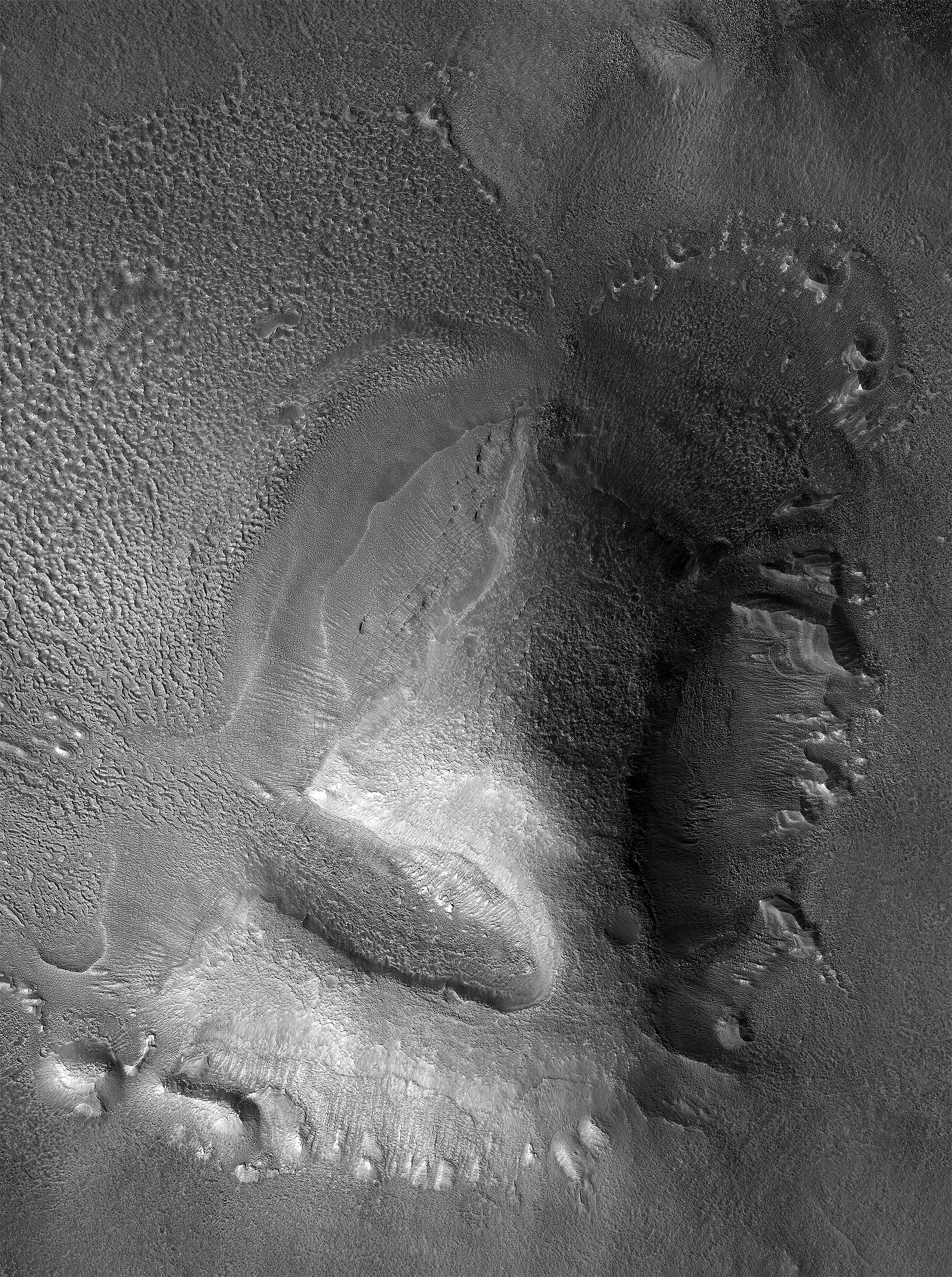
Eroded mound in Mars’ glacier country
Click for full image.
Cool image time! The image to the right, reduced to post here, was a captioned release today by the science team of the high resolution camera on Mars Reconnaissance Orbiter (MRO). It is located in Deuteronilus Mensae, a region of chaos terrain in the transition zone between the northern lowland plains and the southern cratered highlands that is also part of a 2,000 mile-long band that I call Mars’ glacier country. From the caption, written by Dan Berman, senior scientist at the Planetary Science Institute in Arizona:
Lobate debris aprons are commonly found surrounding dissected plateaus in the Deuteronilus Mensae region of Mars. They have been interpreted as debris-covered glaciers and radar data have shown their interiors to be composed of pure ice.
The mound in this image is slightly removed from most of the other plateaus, and the [debris apron] surrounding it is highly degraded. The sharp scarps on the western and eastern sides of the mound indicate that a great deal of the ice once found in these landforms has since sublimated away, leaving behind these collapsed debris cliffs.
I wonder if further research might find an ice layer in those cliff walls, especially because this photo strongly suggests that much of this mound is made of ice that is sublimating away or has flowed downward to form the debris aprons as well as that central gully.
The overview map below shows its location in Deuteronilus Mensae as well as showing almost all of the entire band of Mars’ glacier country.
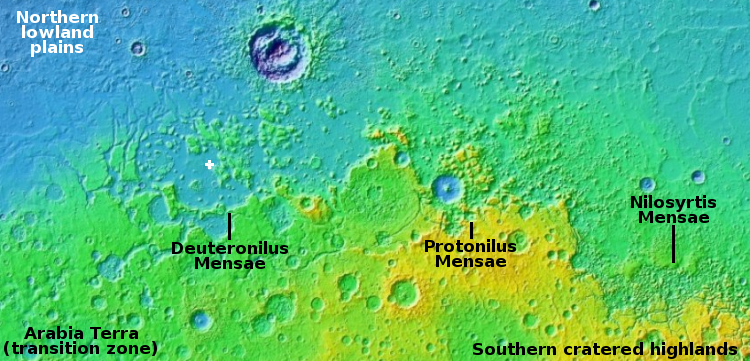
The band that runs through the three mensae regions covers the latitudes from 30 to 47 degrees, dead center in the mid-latitude band where scientists have detected numerous features suggestive of buried glaciers. In these mensae however the detections are pervasive. Almost any image of any mesa shows features similar to what is seen in the photo above.

On Christmas Eve 1968 three Americans became the first humans to visit another world. What they did to celebrate was unexpected and profound, and will be remembered throughout all human history. Genesis: the Story of Apollo 8, Robert Zimmerman's classic history of humanity's first journey to another world, tells that story, and it is now available as both an ebook and an audiobook, both with a foreword by Valerie Anders and a new introduction by Robert Zimmerman.
The print edition can be purchased at Amazon or from any other book seller. If you want an autographed copy the price is $60 for the hardback and $45 for the paperback, plus $8 shipping for each. Go here for purchasing details. The ebook is available everywhere for $5.99 (before discount) at amazon, or direct from my ebook publisher, ebookit. If you buy it from ebookit you don't support the big tech companies and the author gets a bigger cut much sooner.
The audiobook is also available at all these vendors, and is also free with a 30-day trial membership to Audible.
"Not simply about one mission, [Genesis] is also the history of America's quest for the moon... Zimmerman has done a masterful job of tying disparate events together into a solid account of one of America's greatest human triumphs."--San Antonio Express-News
The melting appears to be uniform around the Mesa, my imagination suggest that this was caused by a meteor impact at the center of the glacier blowing out one side, creating enough heat to melt the Mesa like an ice cream cone, refreezing a short distance away.