
InSight still going, but barely
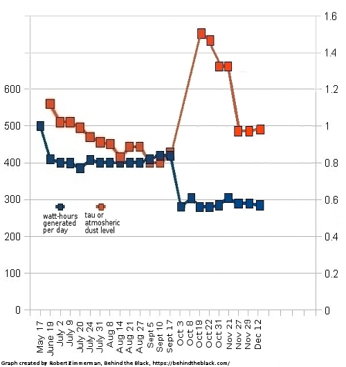
The InSight science team issued another update today, outlining the continuing low power levels produced by the Mars lander, barely enough to keep its seismometer, and nothing else, running.
As of Dec. 12, 2022, InSight is generating an average of ~285 watt-hours of energy per Martian day, or sol. The tau, or level of dust cover in the atmosphere, was estimated at .96 (typical tau levels outside of dust season range from 0.6-0.7).
I have added these numbers to the graph at right in order to show their context over time. Since the October dust storm the levels have held steady, even as the dust in the atmosphere has cleared somewhat.
Nonetheless, InSight’s future continues to be day-to-day. Should it fail to respond to two consecutive scheduled communications sessions, the team will declare it dead, and make no effort at recovery. Though they have been expecting this to happen since the end of October, the lander continues to hang on.


