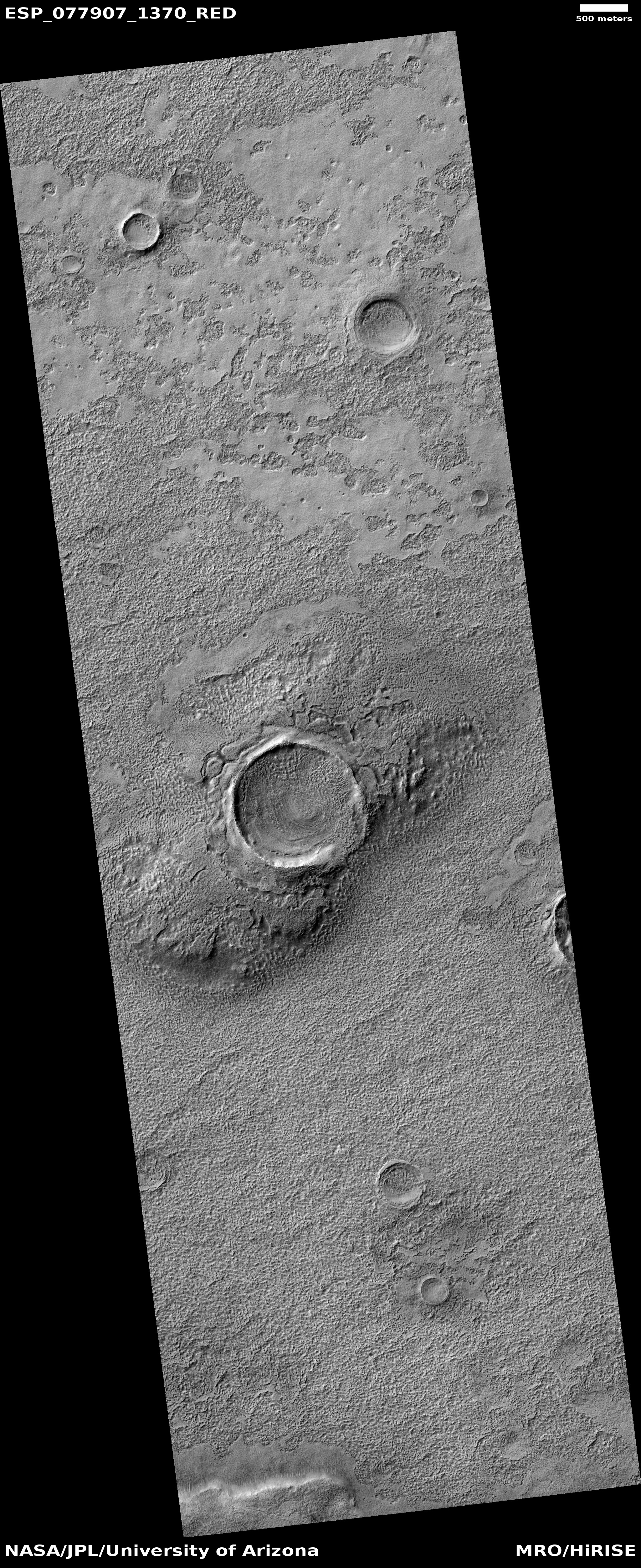
Brain terrain in and around pedestal crater on Mars

Click for original image.
Cool image time! The picture to the right, cropped, reduced, and sharpened to post here, was taken on March 10, 2023 by the high resolution camera on Mars Reconnaissance Orbiter (MRO).
As I noted in a cool image only two weeks ago, brain terrain is a geological feature wholly unique to Mars that planetary geologists still do not understand or can explain. They know its knobby interweaving nodules (resembling the convolutions of the human brain) are related to near surface ice and its sublimation into gas, but no one has much confidence in any of the theories that posit the process that forms it.
In this case the brain terrain not only fills the crater, it appears to surround it as well, but only appearing at spots where a smooth top layer has begun to break apart. Moreover, the crater appears to be a pedestal crater, whereby much of the less dense surrounding terrain has vanished, leaving the compacted crater sitting higher.
» Read more
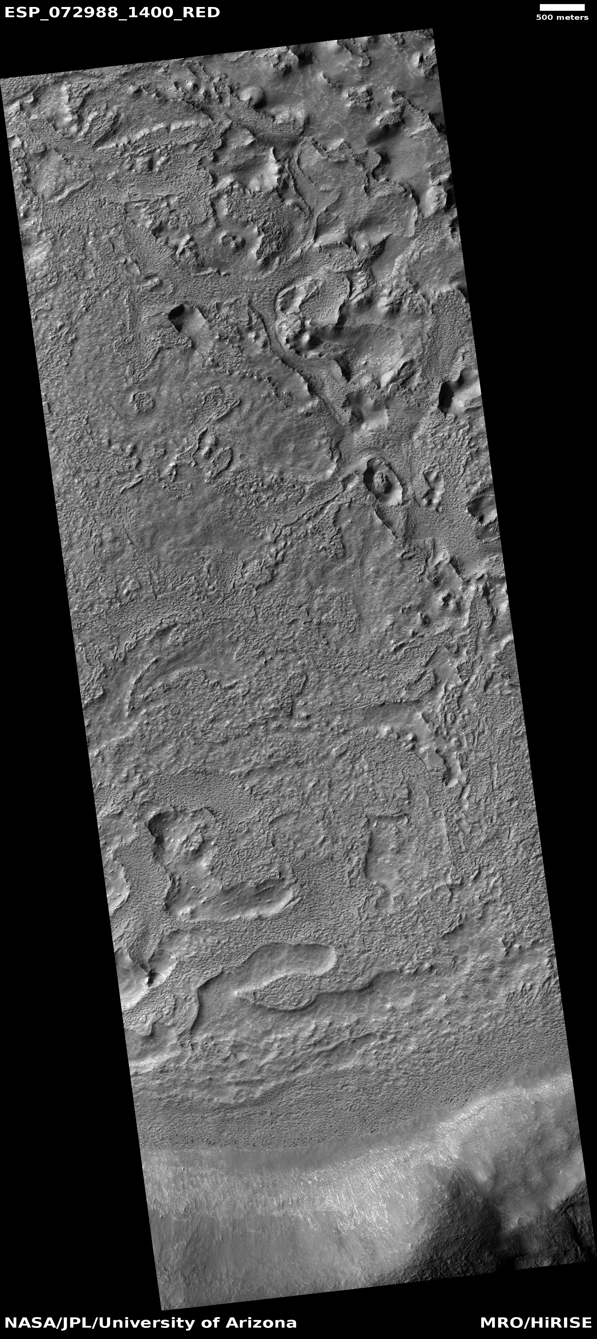