Perseverance’s first climb

Perseverance's first climb
Click for full image.

Cool image time! The photo to the right, rotated, cropped, and reduced to post here, was taken by the high resolution camera on the Mars rover Perseverance on June 16, 2022, shortly after it began its first climb up from the generally flat floor of Jezero crater and onto the delta that once in the far past flowed through a gap into that crater.

I have rotated the image about 8.5 degrees to make horizontal the crater floor and the distant rim of the crater (barely visible through the atmosphere’s thick winter dust). This shows that the rover was then climbing what appears to be a relative low angle grade, hardly as challenging as the serious grades that Curiosity has been dealing with now for the past two years in the foothills of Mount Sharp. Nonetheless, Perseverance has begun climbing.

To see where the rover is see the overview map from the start of this week. Unfortunately, I have been unable to determine the direction of this photo. It could be looking west, south, or east, based on features inside Jezero Crater. I therefore cannot tell you the distance to the rim, which depending on the direction, could be from five to twenty-five miles away.

3 comments

A major update from Curiosity’s science team

Panorama of Mars
Click for full image.

layered flaky rocks
Click for full image.

In a press release today, the Curiosity science team provided a major update on the rover’s recent travels in the mountain foothills of Gale Crater.

First and foremost was the new information about the rover’s wheels, which was buried near the bottom of the release:

The rover’s aluminum wheels are … showing signs of wear. On June 4, the engineering team commanded Curiosity to take new pictures of its wheels – something it had been doing every 3,281 feet (1,000 meters) to check their overall health. The team discovered that the left middle wheel had damaged one of its grousers, the zig-zagging treads along Curiosity’s wheels. This particular wheel already had four broken grousers, so now five of its 19 grousers are broken.

The previously damaged grousers attracted attention online recently because some of the metal “skin” between them appears to have fallen out of the wheel in the past few months, leaving a gap.

The team has decided to increase its wheel imaging to every 1,640 feet (500 meters) – a return to the original cadence. A traction control algorithm had slowed wheel wear enough to justify increasing the distance between imaging.

» Read more

0 comments

A snakelike Martian ridge

A snakelike Martian ridge
Click for full image.

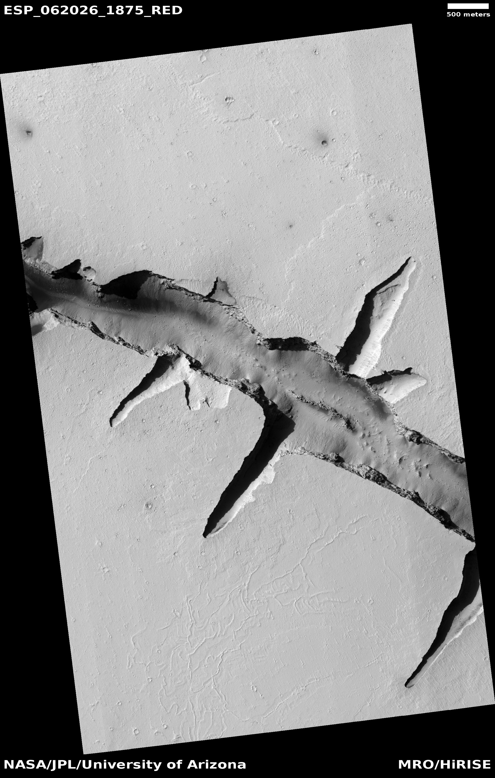
Cool image time! The photo to the right, rotated, cropped, and reduced to post here, was taken on November 22, 2021 by the high resolution camera on Mars Reconnaissance Orbiter (MRO). It shows what the science team labeled a sinuous ridge. Make sure you also look at the full image. The ridge goes on to the south, but then fades way as an almost perfect ramp, only to have another even more wiggly but thinner north-south ridge begin only a few feet to the west.

Sinuous ridges like this are found in many places on Mars. Almost always their origin is thought the result of a former river channel that became a ridge when the surrounding softer material eroded away.

That explanation however does not seem to work for this ridge. It has too many other inexplicable features. For example, note how the peak of the ridge smoothly transitions from sharp to flat-topped. It has a soft appearance that is strengthened by the gap near the top.

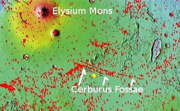
It is almost as if this ridge is a kind of elongated sand dune! And guess what: The overview map below gives that explanation some believability.
» Read more

1 comment

A telescope using a liquid mirror about to become operational

Link here. The telescope, located in the Himalayas, is “an international collaboration between institutions in India, Belgium, Poland, Uzbekistan and Canada.”

The mirror works by rotating it so that its thin layer of liquid mercury forms a parabola.

The tradeoff is that the [telescope]is fixed in a single position, so it only observes one strip of the night sky as the Earth rotates below it. But since the telescope will be hyper-focused on just one area, it’s well-suited for spotting transient objects like supernovas and asteroids.

It appears the scientists will use it to study this same strip of sky over five years, hoping to detect changes in that time period.

This telescope is more a technology test than an actual observatory. Eventually the best place to put such a telescope — and much larger — will be on the Moon, and to do that requires some construction and testing beforehand.

6 comments

InSight team decides to shorten lander’s life to operate seismometer longer

The InSight science team has decided to continue to operate the lander’s seismometer through August rather than turning it off at the end of June, even though that longer use will drain InSight’s batteries sooner and kill the lander shortly thereafter.

The previous plan would have allowed the lander to survive through the end of the year, but would have meant no earthquake data would have been gathered after June.

To enable the seismometer to continue to run for as long as possible, the mission team is turning off InSight’s fault protection system. While this will enable the instrument to operate longer, it leaves the lander unprotected from sudden, unexpected events that ground controllers wouldn’t have time to respond to.

“The goal is to get scientific data all the way to the point where InSight can’t operate at all, rather than conserve energy and operate the lander with no science benefit,” said Chuck Scott, InSight’s project manager at NASA’s Jet Propulsion Laboratory in Southern California.

Apparently they have realized that it is now very unlikely that a dust devil will come by and clear the dust from InSight’s solar panels, so keeping the spacecraft alive longer — but getting no data — does not make sense.

0 comments

Has work begun on a dedicated helicopter mission to Mars?

Overview map

The easternmost point in the Mars Helicopter traverse
Click for full image.

In my routine searches through the image archive for the high resolution camera on Mars Reconnaissance Orbiter, I recently came upon several images labeled “Candidate Mars Science Helicopter Traverse” that I at first thought referred to Ingenuity’s extended mission in Jezero Crater.

A closer look however revealed these photos have nothing to do with Ingenuity or Jezero Crater. Taken in November ’21, January ’22, and March ’22, the images instead cover parts of the south rim of Valles Marineris, the solar system’s largest canyon, and appear to be research for a future dedicated Mars helicopter mission. The overview map above shows the location of these photos by the black dots. Three locations have each been imaged twice to produce a stereoscopic view that can precisely measure the topography.

The photo to the right, cropped and reduced to post here, shows the easternmost image, taken November 3, 2021. Not only does it show ample flat areas, the picture captures an impressive avalanche flow coming down from that southern interior canyon slope.

All the images were requested by planetary scientist Edwin Kite of the University of Chicago. Though I tried several times to contact Dr. Kite to get more information, he unfortunately did not respond. It could be this work is still too preliminary and thus he does not wish to comment.

Nonetheless, the extent of the three sets of images give us a fair idea of the kind of missions Kite and others might be considering. From east to west the distance between the images is about four hundred miles, and covers a traverse of the southern interior slopes of Valles Marineris along that entire length. The photos look mostly at the base of the canyon’s slope, each showing clearly that a helicopter flying there would have plenty of landing spots.

Obviously this first dedicated Mars helicopter mission might not cover this entire distance. Right now these images could simply be the first tentative research on choosing potential landing areas. Regardless, it appears that at least one scientist has already concluded that Ingenuity has proven such helicopter missions make sense, and is beginning to target one of Mars’s most spectacular locations, Valles Marineris, for that mission.

6 comments

Water and dry ice at the Martian north polar ice cap

water and dry ice at the Martian north pole
Click for original image. Click here for full image.

In our third Martian cool image of the day, we go to the north pole of Mars, as seen from orbit by the high resolution camera of Mars Reconnaissance Orbiter (MRO). Taken on March 30, 2022 and cropped and reduced to post here, this picture shows some of the distinct and unique geological features found only on the polar caps of Mars. From the caption by Candy Hansen of the Planetary Science Institute in Tucson, Arizona:

Both water and dry ice have a major role in sculpting Mars’ surface at high latitudes. Water ice frozen in the soil splits the ground into polygons. Erosion of the channels forming the boundaries of the polygons by dry ice sublimating in the spring adds plenty of twists and turns to them.

Spring activity is visible as the layer of translucent dry ice coating the surface develops vents that allow gas to escape. The gas carries along fine particles of material from the surface further eroding the channels. The particles drop to the surface in dark fan-shaped deposits. Sometimes the dark particles sink into the dry ice, leaving bright marks where the fans were originally deposited. Often the vent closes, then opens again, so we see two or more fans originating from the same spot but oriented in different directions as the wind changes.

The top layer of translucent dry ice falls as dry ice snow during the winter, than sublimates away with the arrival of spring. Since this photo was taken in autumn, we are looking at features left over from the activity from the spring and summer.

1 comment

Perseverance peers towards the rim of Jezero Crater

Perseverance peers through winter haze
Click for full image.

Overview map
Click for interactive map.

In our second cool image from Mars today, the Mars rover Perseverance gives us its own long distance view of the dusty winter air inside Jezero Crater. The photo above, cropped and reduced to post here, was taken on June 16, 2022 by the rover’s left high resolution camera, and looks to the southwest towards the crater’s western rim.

As with today’s previous cool image from Curiosity, we can see several ranges, each with distance faded more by the dust that hangs in the air during the winter on Mars. In the foreground right is the nearest cliff of the delta that flowed into Jezero over time in the past. Next is a knob and ridge line, also part of that delta flow but farther away. Third are some farther ridges that might have been part of that flow but maybe not.

Faintest of all are the highest mountains that form the western ridge of Jezero Crater, barely visible in the haze.

The blue dot in the overview map to the right marks Perseverance’s approximate position when the photo was taken. The yellow lines my guess as to the area covered by the photo. The green dot marks Ingenuity’s present position after its last flight, much closer to the delta that I had predicted.

3 comments

Martian mountains, near and far

Navigation image
Click for full image.

Martian mountains, near and far
Click for full image.

Cool image time! The photo to the right, taken on June 18, 2022 by high resolution camera on the Mars rover Curiosity, provides a close-up of the area indicated by the arrow in the navigation camera image above taken three days earlier.

Because the rover had moved uphill slightly during those three days, the close-up can peek over what was the most distant ridge to see farther up Mount Sharp. (For context take a look at the overview map here.) All told, this close-up to the right shows four mountain ridges/ranges. First we have the ridgeline to the right, partly in shadow, which forms the right wall of the saddle that Curiosity appears heading for. Next we can see to the left the top section of the large 1,500 foot high mesa on the other side of the canyon Gediz Vallis. Note its many layers, all of which are going to become a major item of study as Curiosity gets closer.

Third we have a very rough and tumbled ridgeline, formed in a layer the geologists have dubbed the sulfate bearing unit. This layer tends to be very light in color, and more easily eroded. Curiosity is presently beginning to move into this layer as it climbs.

Finally there is the most distant ridge, which is simply the higher reaches of Mount Sharp though not its peak by a long shot.

The dusty winter air is quite evident by the chariscuro effect, causing the more distant ridges to appear more faded.

Note: This will be the first of three cool Martian images today. Stay tuned.

0 comments

NIH to discriminate against whites in awarding research grants

Federal government: dedicated to segregation!
NIH: dedicated to racial discrimination

“Segregation today, segregation tomorrow, segregation forever!” The National Institutes of Health (NIH) has now created a program to award about $20 million in grant money exclusively to black researchers, thus favoring research not because of its merit but solely because of the skin color of the grantee.

The program will create a new class of NIH’s standard R01 research grant designed to “encourage a more diverse pool of PIs [principal investigators],” said Walter Koroshetz, director of the National Institute of Neurological Disorders and Stroke (NINDS), at a recent meeting. NINDS is launching the program, aimed at new PIs and those whose labs are at risk of folding, together with the National Institute of Mental Health (NIMH) and National Institute on Drug Abuse (NIDA). In 2021, the three institutes partnered on a policy with similar aims that NIH later pulled because of concerns it would violate federal antidiscrimination laws.

The NIH attempted to create a similar bigoted grant program last year, but had to back off when critics pointed out its obvious illegality. Agency officials now claim this new program passes muster, because

…it aims to enhance diversity “in a very broad sense,” [NIH extramural chief Michael] Lauer says. An NIH spokesperson notes that although the program “encourages” applications from researchers in underrepresented groups, “it is not exclusive—all new investigators and at-risk investigators are eligible to apply.” (NIH defines “at-risk” as a PI who will have no NIH grants if their high-quality proposal isn’t funded.)

What a lie. We all know that the grant application will require each applicant to state their race, and the NIH will then automatically disqualify anyone who isn’t black. It will also conveniently never make public the actual racial breakdown of those who win grants from this program, in order to hide its bigotry.

6 comments

Wavy crescent ridges on Mars

Wavy crescents on Mars
Click for full image.

Cool image time! The photo to the right, cropped and reduced to post here, was taken on November 19, 2021 by the high resolution camera on Mars Reconnaissance Orbiter (MRO). It shows what the science team has labeled “Crescentic forms,” which in some ways resemble crescents that I featured in a cool image back in November 2020.

Unlike those earlier crescents, today’s are linked together to form a longer wavy line. Furthermore, today’s crescents include some positive relief, with some parts standing above the surrounding terrain. The earlier crescents were entirely carved out of the ground, forming depressions.

And yet, the method of formation for both must be somewhat similar. I say this based on their location, as shown in the overview map below.
» Read more

0 comments

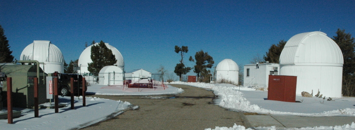
Wildfire reaches Kitt Peak National Observatory

A wildfire has crested the peak and reached the Kitt Peak National Observatory, threatening a number of telescopes there.

Around 2:00 a.m. MST Friday morning the fire, contrary to the expectations of the firecrews, crested the southwest ridge where the Hiltner 2.4-meter Telescope, McGraw-Hill 1.3-meter Telescope, Very Long Baseline Array Dish and UArizona 12-meter Telescope are located. Because of the ongoing nature of the situation, it is currently not possible to assess whether any damage to the structures has occurred. We will report any damage as soon as possible.

Based on this report, however, it does appear that officials expect several of these telescopes to be damaged by the fire.

2 comments
1 181 182 183 184 185 729