Martian rootless cones

Rootless cones
Click for original image.

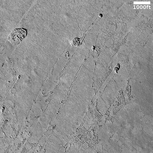
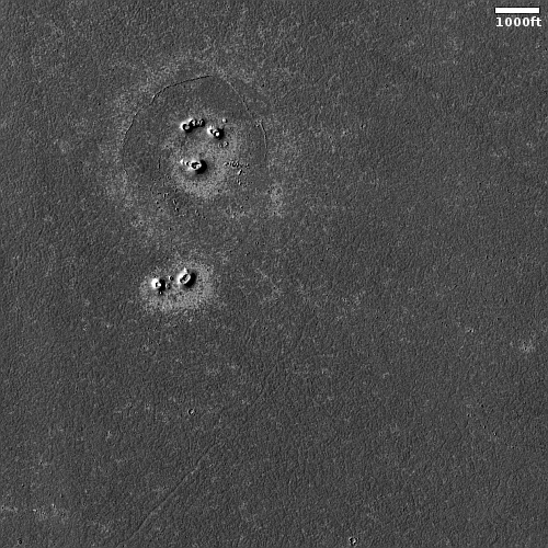
Cool image time! The picture to the right, cropped, reduced, and sharpened to post here, was taken on March 8, 2023 by the high resolution camera on Mars Reconnaissance Orbiter (MRO).

The camera team labeled this picture simply “Rootless Cones,” which is a feature that is created when the lava that covers the surface is thin, allowing the heated material below (which is not lava) to burst upward, producing the cone and caldera. If you look at the full image you will see other similar clusters of cones scattered about on this very flat and featureless plain. Apparently, the material that this lava plain covered had several similar bursts in a number of areas.

Such cones in this particular lava field are not rare, and in fact are evidence that this particular field is young.
» Read more

The youngest flood lava on Mars, flowing past a crater

Crater with lava flow
Click for full image.

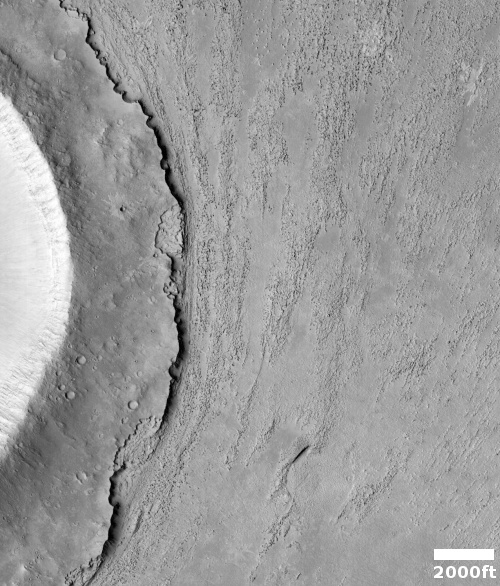
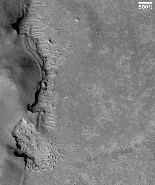
Cool image time! The photo to the right, rotated, cropped, reduced to post here, was taken on December 3, 2022 by the high resolution camera on Mars Reconnaissance Orbiter (MRO).

The title given to this image by the MRO science team is “Upstream Edge of Crater in Athabasca Valles.” The crater itself is a pedestal crater, uplifted from the surrounding terrain because it was more resistant to erosion.

The material to the east of the crater’s rim definitely appears to have flow characteristics, but is it wet mud, glacial ice, or lava?

To figure this out we need as always some context. The latitude, 8 degrees north, immediately eliminates mud or glacial material. This location is in the dry equatorial regions of Mars, where no near surface ice has yet been found. Thus, the flow features are likely hardened lava.

What direction however was the flow? Was it flowing to the north, widening as it moved past the pedestal crater? Or was it to the south, narrowing as it pushed past that crater? To answer this question we need to widen our view.
» Read more

Frozen lava flows around Martian hills

Martian lava flowing around hills
Click for full image.

Cool image time! The photo to the right, rotated, cropped, reduced, and enhanced to post here, was taken on August 24, 2022 by the high resolution camera on Mars Reconnaissance Orbiter (MRO). It shows the westernmost edge of the Athabasca flood lava plain, thought to be the youngest lava flow on Mars, having covered the area of Great Britain in a matter of weeks 600 million years ago.

This image was a captioned feature yesterday by the MRO science team. As they note:

Although you can’t sail a boat on a sea of lava, hills and craters that stick up higher than the lava flow act like barriers. When a boat is driven through the water, there is a bow wave at the front of the boat, and a wake that trails off behind that indicates which way the boat is moving. In a lava flow, when a hill sticks up, the lava piles up on the upstream side (just like a bow wave) and can leave a wake on the downstream side, so we can tell which way the lava was moving against the stationary hill.

As you can see, every hill has a pile of lava on its northeast slopes, and a wake to its southeast. As the main vent of the Athabasca eruption is to the northeast, about 500 miles away (as shown on the overview map below), the flow direction suggested by the wakes fit the general geography.
» Read more

Deep inside the youngest flood lava event on Mars

Deep inside the youngest flood lava event on Mars
Click for full image.

Cool image time! Today we return to the Athabasca Valles flood lava event, believed to be the youngest major lava event on Mars that I highlighted in a cool image last week.

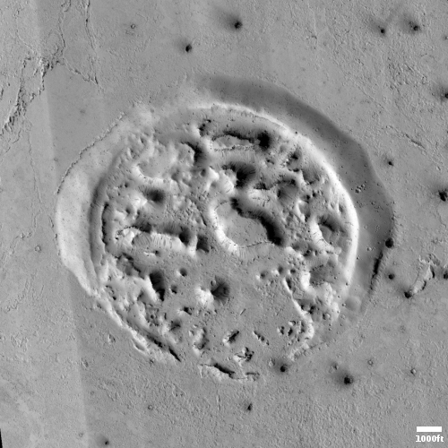
Then, I showed two meandering lava flows near the edge of this Great Britain-sized flood lava plain, produced 600 million years ago in only a matter of weeks. Today, we take a look deep within the lava plain. The photo to the right, rotated, cropped, and reduced to post here, was taken on May 6, 2022 by the high resolution camera on Mars Reconnaissance Orbiter (MRO). It shows what the scientists label “a lava-crater interaction.”

In plain English, we are looking at a crater that has been inundated by the flood lava, filling it.
» Read more

A “What the heck!?” crater on Mars

A
Click for full image.

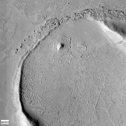
Today’s cool image falls into what I call my “What the heck?” category. The photo to the right, cropped and reduced to post here, was taken on May 31, 2022 by the high resolution camera on Mars Reconnaissance Orbiter. It was also picked by the science team as that camera’s picture of the day on July 12, 2022. From the caption:

This seems to belong to a class of craters in the Cerberus Plains that was flooded by lava, which was subsequently uplifted and fractured by an unknown process. This class of filled, uplifted and fractured craters is informally called “the waffle.” A combination of volcanic and periglacial processes seems possible.

In other words, the scientists only have a vague idea what created the broken up floor of this crater. For example, why did only the material in the interior of the crater get uplifted and fractured? Did this uplift occur before, during, or after the lava event?

The overview map below tells us a little about where that lava came from, and when.
» Read more

Stucco on Mars!

Stucco on Mars
Click for full image.

Cool image time! The picture to the right, cropped to post here, was taken on June 8, 2021 by the high resolution camera on Mars Reconnaissance Orbiter (MRO). It shows a strangely flat plain with a complex stucco-type surface of ridges and depressions. The sunlight is coming from the west, which makes the smoother flat areas depressions.

What are we looking at? What causes this strange surface? Make sure you look at the full image, because the section I cropped out doesn’t give a true sense of the terrain’s vastness.

The MRO science team labeled the photo “volcanic terrain,” but that tells only part of the story, since this volcanic terrain is actually part of Mars’ most interesting lava plains, as the overview map below shows.
» Read more

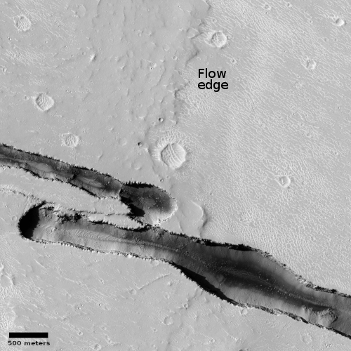
New cracks across old Martian lava flows

New cracks across an old lava flow
Click for full image.

Cool image time! The photo to the right, cropped and reduced to post here, was taken on June 4, 2021 by the high resolution camera on Mars Reconnaissance Orbiter (MRO). It captures one of the many deep straight fissure canyons that make up the feature dubbed Cerberus Fossae in the center of Mars’ volcano country.

The crack is called a graben, and happens when the ground is either stretched from pressure from below, or when two adjacent large blocks of material move sideways relative to each other.

What makes this particular graben interesting are two features. First, the overlapping break suggests something complex took place at this spot when the crack separated. Second, the crack cut across the foot of an older frozen lava flow, meaning it has to be younger than that flow.

The overview map below provides a clue when that lava flow might have occurred, while also suggesting this crack in Cerberus Fossae might be much younger than expected.
» Read more

Landslides on the edge of Mars’ youngest lava field

Landslides on the edge of Mars' youngest lava field
Click for full image.

Cool image time! The photo to the right, cropped to post here, was taken by the high resolution camera on Mars Reconnaissance Orbiter (MRO) on September 28, 2020. It shows several indentations in a north-south cliff face, with debris apparently falling down into a flat plain to the east.

The scientific history of this picture is very interesting. The first photo of these landslides was taken in 2006 and was titled, “Landslides on Flat Topography in Elysium Planitia”. The second, taken a few months later in 2007 to produce a stereoscopic view, was labeled “Landslides Along Shoreline in Elysium Planitia.” This most recent 2020 image is merely labeled “Landslides in Elysium Planitia.”

Is the flat terrain to the west a seabed to an ancient ocean, as suggested by the title for the 2007 image, with these landslides erosion caused in the far past by water lapping up against these cliffs?
» Read more