
Two lunar orbiters spot the crash site of Ispace’s Resilience lander
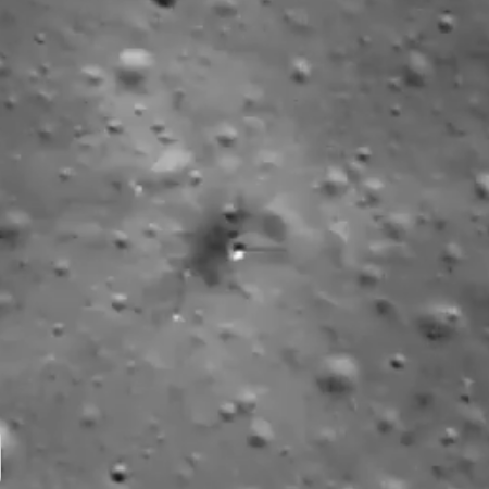
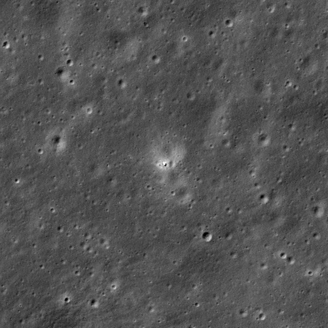
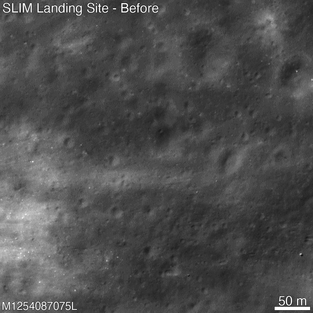
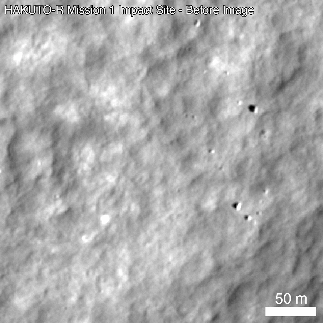
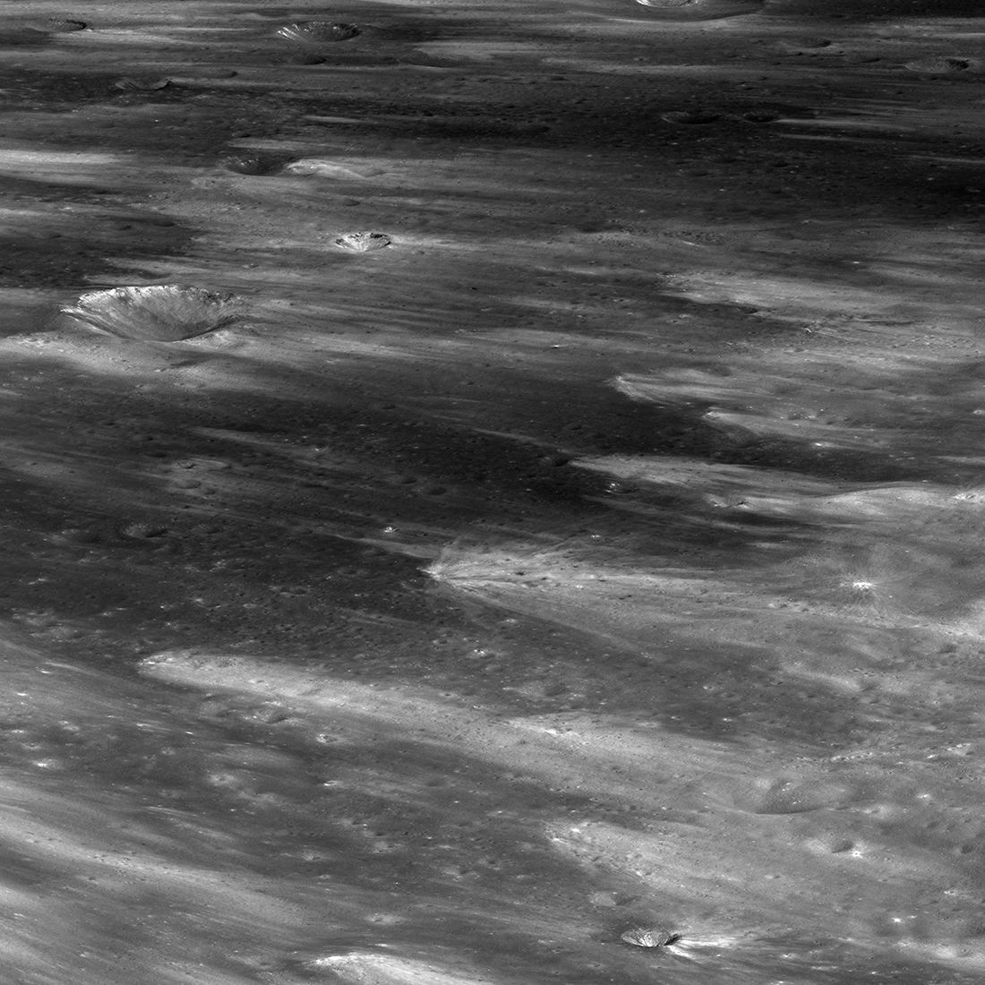
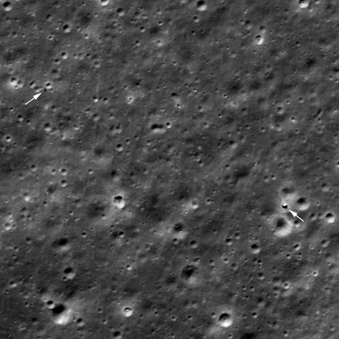
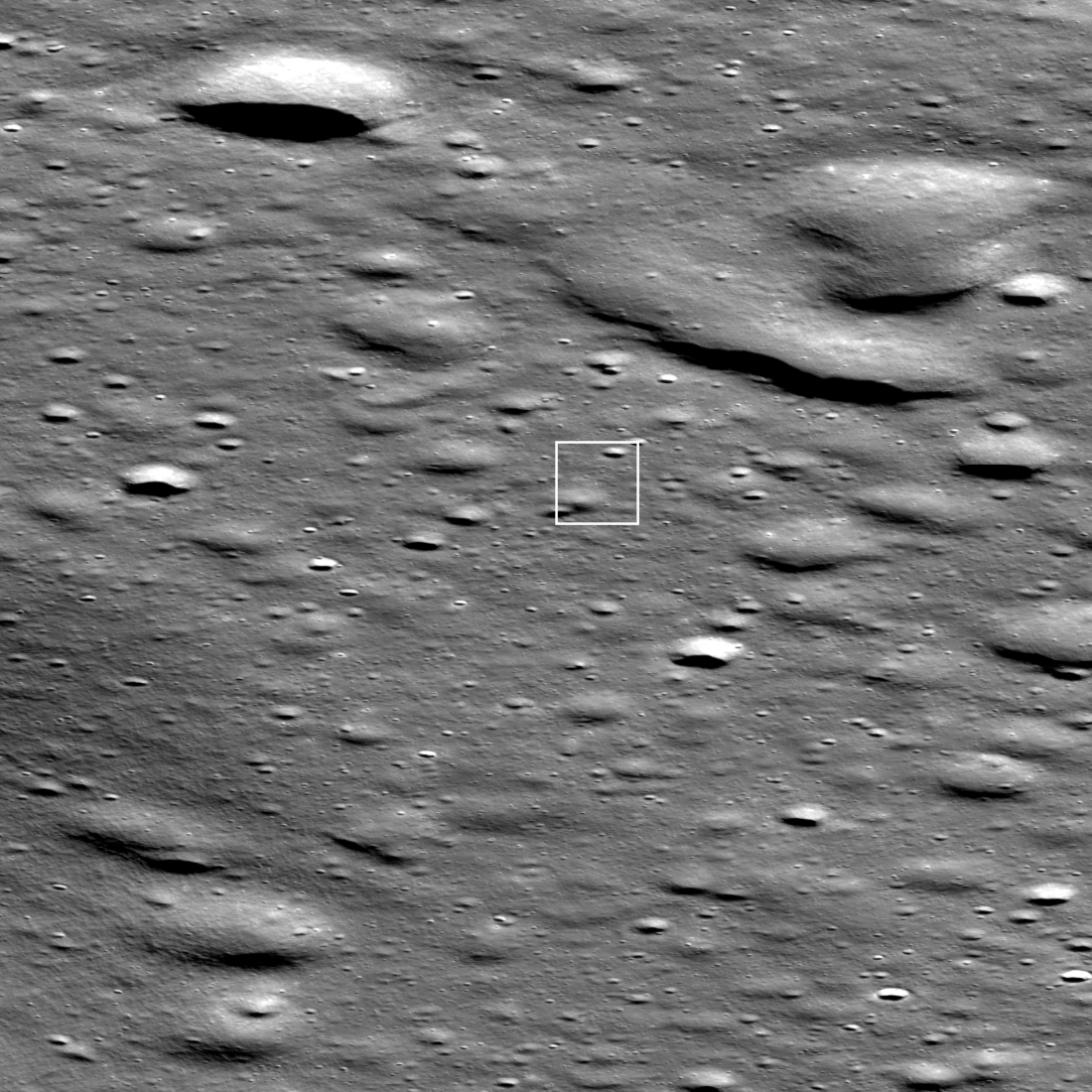
Scientists using both NASA’s Lunar Reconnaissance Orbiter (LRO) and India’s Chandrayaan-2 lunar orbiter have spotted the crash site for the private commercial lunar lander Resilience, built and launched by the Japanese startup Ispace.
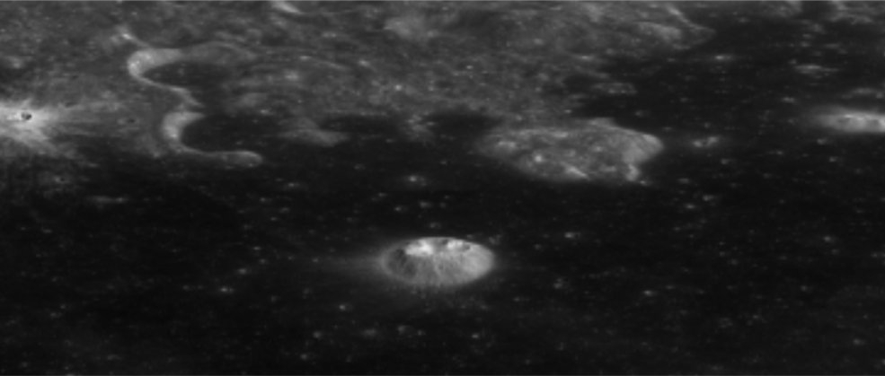
The picture to the right was taken by Chandrayaan-2. As noted at the LRO website showing its photo:
The dark smudge (60.4445°N, 355.4120°E, -2431.6 m elevation ) formed as the vehicle excavated and redistributed shallow regolith (soil); the faint bright halo resulted from low-angle regolith particles scouring the delicate surface.
The lander attempted a soft landing on June 5, 2025, but because its laser rangefinder was unable to gather good data as to its elevation, it did not decelerate properly and was going too fast when its engines tried for a soft landing. It instead crashed.
Scientists using both NASA’s Lunar Reconnaissance Orbiter (LRO) and India’s Chandrayaan-2 lunar orbiter have spotted the crash site for the private commercial lunar lander Resilience, built and launched by the Japanese startup Ispace.
The picture to the right was taken by Chandrayaan-2. As noted at the LRO website showing its photo:
The dark smudge (60.4445°N, 355.4120°E, -2431.6 m elevation ) formed as the vehicle excavated and redistributed shallow regolith (soil); the faint bright halo resulted from low-angle regolith particles scouring the delicate surface.
The lander attempted a soft landing on June 5, 2025, but because its laser rangefinder was unable to gather good data as to its elevation, it did not decelerate properly and was going too fast when its engines tried for a soft landing. It instead crashed.


