
The strange terrain of the Martian southern ice cap

Click for original image.
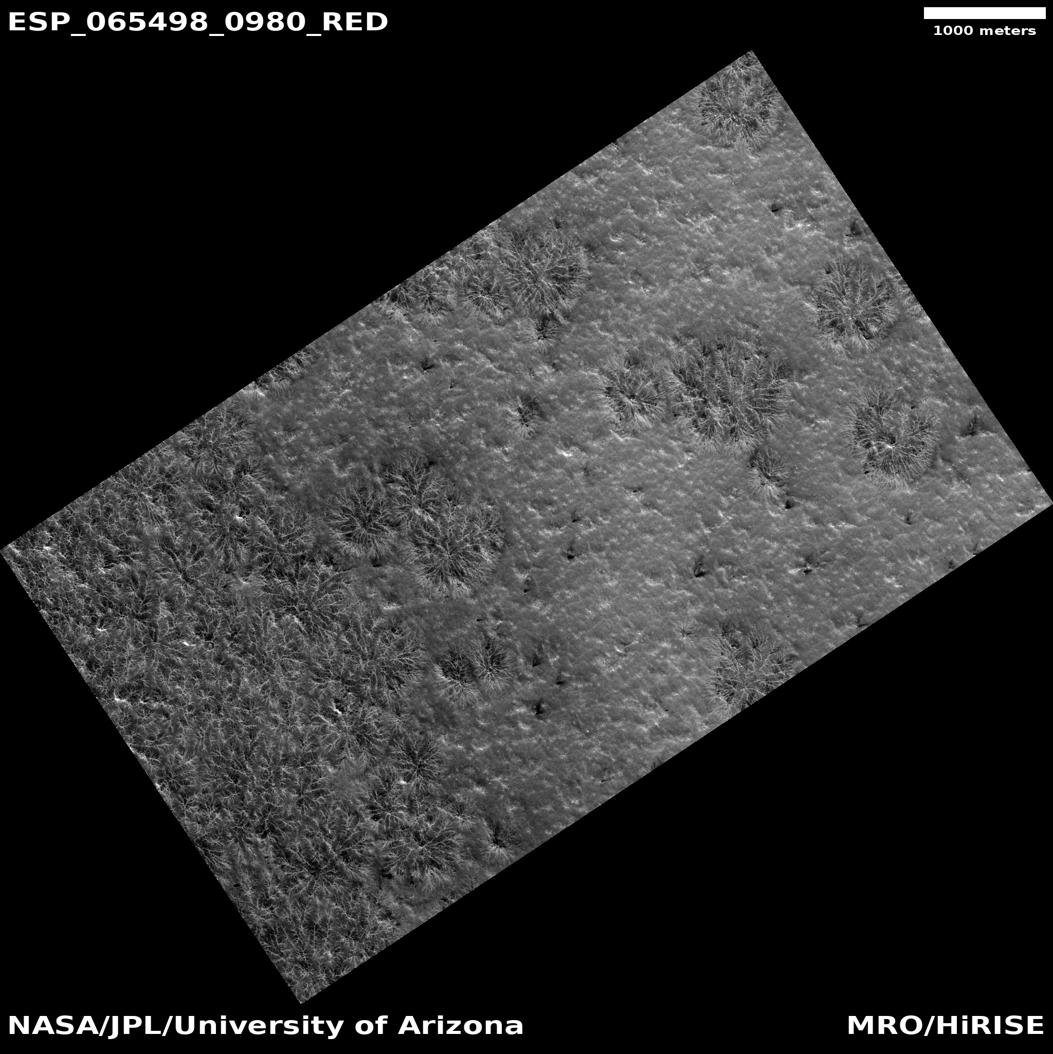
Cool image time! The picture to the right, rotated, cropped, and sharpened to post here, was taken on July 29, 2024 by the high resolution camera on Mars Reconnaissance Orbiter (MRO). It shows a section at the Martian south pole at the very high latitude of 87 degrees south, only about 100 miles from the pole itself.
The label for this picture is “possible water ice and mesas,” suggesting we are looking at an ice cap of water that is partly sublimated away.
In truth, things are much more complicated. It was summer when this photo was taken. Note the drainage in the lower right and the dark spidery lines there. In the winter on Mars atmospheric carbon dioxide falls as snow and coats the poles to about 60 degrees latitude with a thin mantle of dry ice. In the spring this mantle sublimates away, but does so in an counter-intuitive manner. The sublimation first occurs at the mantle’s base, and the trapped gas flows up until it finds a weak spot in the mantle and cracks through, spewing out and deposting dark splotches of dust.
At the south pole this upward flow always follows the same paths, producing the dark spidery patterns we see here. In the case of the drainage in the lower right, this is a drainage of gas eastward until it pops out at the slope, causing that depression to become darkly stained.
This is only part of the story of this complex geology, however.
» Read more

Click for original image.
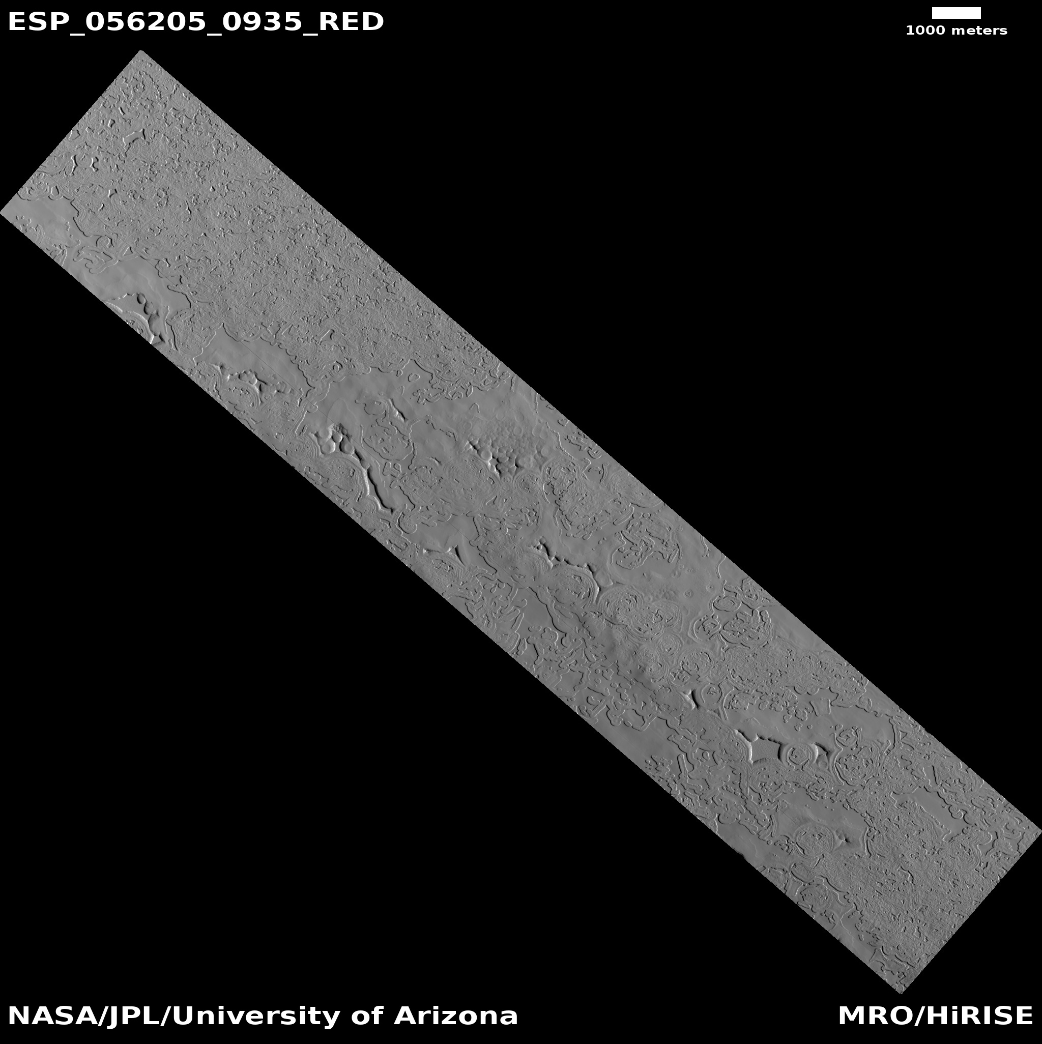
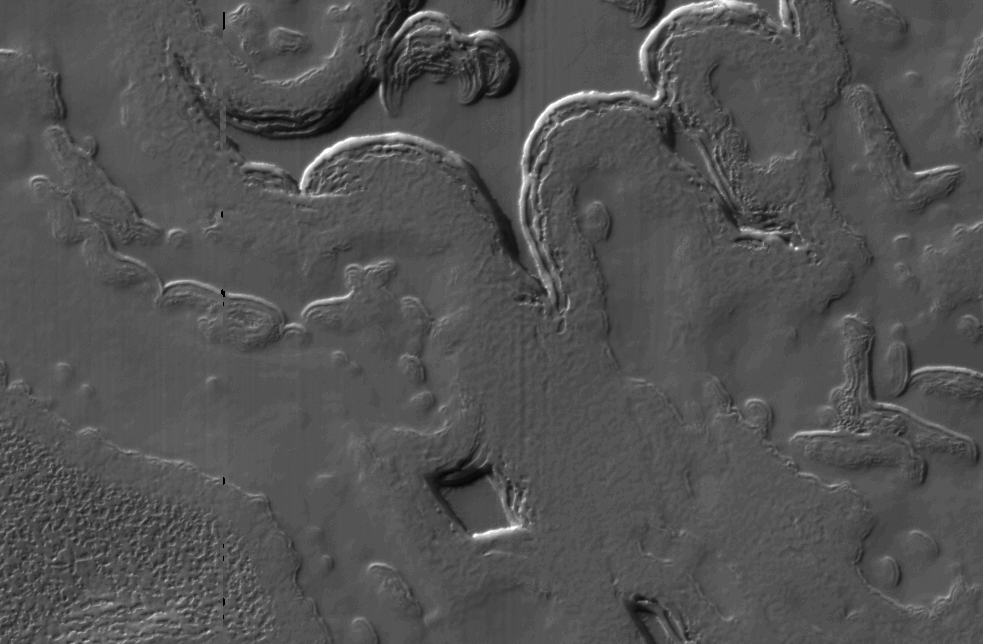
Cool image time! The picture to the right, rotated, cropped, and sharpened to post here, was taken on July 29, 2024 by the high resolution camera on Mars Reconnaissance Orbiter (MRO). It shows a section at the Martian south pole at the very high latitude of 87 degrees south, only about 100 miles from the pole itself.
The label for this picture is “possible water ice and mesas,” suggesting we are looking at an ice cap of water that is partly sublimated away.
In truth, things are much more complicated. It was summer when this photo was taken. Note the drainage in the lower right and the dark spidery lines there. In the winter on Mars atmospheric carbon dioxide falls as snow and coats the poles to about 60 degrees latitude with a thin mantle of dry ice. In the spring this mantle sublimates away, but does so in an counter-intuitive manner. The sublimation first occurs at the mantle’s base, and the trapped gas flows up until it finds a weak spot in the mantle and cracks through, spewing out and deposting dark splotches of dust.
At the south pole this upward flow always follows the same paths, producing the dark spidery patterns we see here. In the case of the drainage in the lower right, this is a drainage of gas eastward until it pops out at the slope, causing that depression to become darkly stained.
This is only part of the story of this complex geology, however.
» Read more