Czech Republic buys seat on Vast mission to ISS
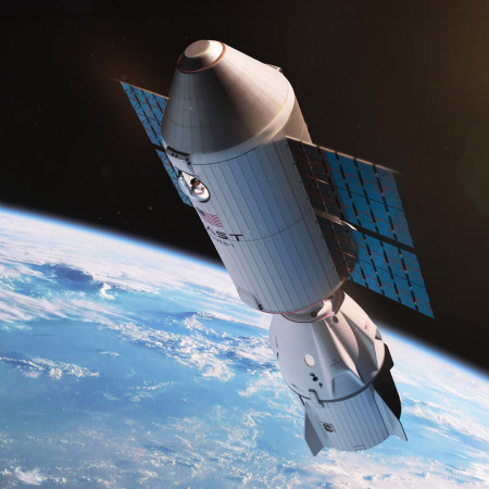
Artist rendering of Haven-1 with docked
Dragon capsule
In its continuing effort to sign customers (and earn income) outside of NASA funding, the space station startup Vast today announced it has signed a deal with the Czech Republic to fly one of its astronauts to ISS on its planned mission there in 2027.
This agreement builds on the memorandum of understanding that Vast, and the Czech Republic signed in 2024. Subject to Multilateral Crew Operations Panel (MCOP) review and approval, Aleš Svoboda, one of the 12 members of the astronaut reserve selected by ESA in November 2022, will serve as the mission pilot. The MCOP’s decisions are reached through a consensus among representatives from all five space station partners: NASA, ESA, Roscosmos, the Japan Aerospace Exploration Agency, and the Canadian Space Agency. Pending approval, Aleš Svoboda will become the first Czech astronaut to visit the International Space Station. Svoboda is planned to join ESA Astronaut Thomas Pesquet who is the named Commander for the mission.
Pesquet is a French astronaut flying under the deal France signed with Vast only two weeks ago.
Unlike the Starlab and Axiom stations, Vast is building its single module demo station, Haven-1, with no government funds. It is not only flying this private two-week mission to ISS, it is also planning four two-week missions to Haven-1 during if three year mission, once it launches next year. All will use SpaceX’s Falcon 9 as a launch provider, with one of its Dragon capsules for crew transport.
Below is my updated ranking of the five American space stations presently under development:
» Read more