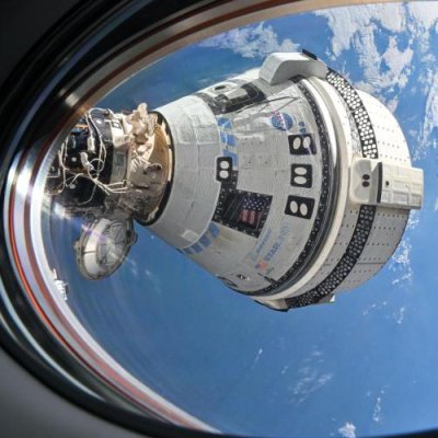
Starliner docked to ISS in 2024.
In a procurement announcement on May 18, 2026, NASA added another three to six crewed flights to ISS to its contract with SpaceX, covering all missions possible through 2030, which in turn practically eliminates the possibility it will buy any manned flights on Boeing’s Starliner capsule.
In a May 18 procurement filing, NASA announced its intent to add six post-certification missions, or PCMs, to SpaceX’s commercial crew contract on a sole-source basis. The agency would order up to three of those missions at the time it added them, formally starting preparations for them.
…Adding six missions to the contract would cover three years of ISS operations, at a rate of one mission every six months. With the currently contracted missions, running through Crew-14, flying through the fall of 2027, the extension would provide coverage through late 2030, when the ISS is slated for retirement. NASA has previously stated the last crewed mission would likely spend a year at the station.
Though it is not stated yet exactly how much SpaceX will earn with these additional missions, based on previous contracts the revenue will likely range from $1 to $2 billion. Overall, SpaceX has probably received somewhere between $4 to $6 billion additional earnings that was supposed to go to Boeing.
Instead, Boeing is now out of the picture entirely, though NASA is being very coy about saying so. It will earn nothing from Starliner, at least in connection with hauling crews or cargo to ISS. And because its contract with NASA was fixed price and the company could not meet its final milestones to get the bulk of its payments, it will have cost the company about $2 billion beyond what NASA had paid it.
It remains unknown whether Boeing wishes to continue the project. NASA officials had suggested earlier this year that it would buy an unmanned cargo mission to ISS to give the company a chance to prove the capsule and get it certified for manned missions. They have since backed off from that plan, scheduling no Boeing missions through the rest of this year.
Though things could still change, it appears Starliner is dead. In history books this Boeing project I think will become the poster boy for the failures of the older big space companies that used to dominate America’s aerospace industry. By the 21st century they didn’t know how to budget, had poor quality control resulting in unreliable products, and designed things that were badly conceived. The result was a bankrupt space industry that was only saved when new companies appeared willing to fill a need these older companies could not.