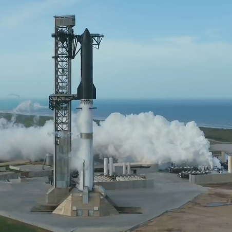
Starship/Superheavy, shortly after launch and looking
down at Boca Chica
SpaceX today successfully launched its Starship/Superheavy rocket on its 13th orbital test flight, during which the company was able to complete almost all of its planned tasks, as intended.
The only issue occurred when Superheavy ignited its engines for its landing burn a couple of miles off the coast of Texas. The plan was to fire 13 Raptor-3 engines. Instead, only ten lit initially. Almost immediately another two engines cut out, leaving eight firing, only for three more to shut down a few seconds later. The five working engines however were not enough to slow the booster enough for a soft splashdown. It instead continued to fire until the rocket hit the water hard.
In orbit, Starship successfully deployed 20 version-3 Starlink satellites, with the last two using cameras to photograph the ship’s exterior, as was done on the previous flight with the dummy satellites. Engineers were able to activate and communicate with all 20, and also link the satellites using communication lasers, before the satellites began breaking up in the atmosphere as their orbits decayed.
The ship then did a 14-second engine firing of one Raptor-3 engine, proving again that the engines can relight reliably once in orbit to accurately de-orbit Starship.

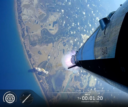
Starship afloat and intact after the flight
Finally, Starship completed a soft splashdown in the Indian Ocean, once again proving that its thermal system works as planned. In fact, the splashdown was so soft and perfect that Starship fell sideways and then floated serenely on the ocean. On previous landings after splashing down vertically, the ship fell over hard and exploded. This time it remained afloat long enough for drones to get great imagery of the thermal tile system post landing. Even cameras inside the ship beamed back images. As noted by one announcer, the heat shield seemed “pretty intact. … You could count the number of missing tiles on one hand.” I would not be surprised if SpaceX manages to salvage the ship and bring it back to Boca Chica.
This success makes it very likely that the 14th test flight will be a full orbital test, lasting several orbits at least but more likely a full day.
The failure of several of Superheavy’s Raptor-3 three engines during the landing burn needs to be addressed, but this flight showed a significant improvement over the last flight, where multiple engines failed to light on both Superheavy and Starship after stage separation. The improvement suggests SpaceX’s engineers have a handle on this issue, and are making progress in fixing it. Based on the company’s multi-decade track record, once fixed it will not reappear ever again.
I predict that the next flight will take place no more then six weeks from now.
Though this flight did not complete a full orbit, I consider this an orbital success, because that low orbit was intentional. The rocket demonstrated the ability to reach orbit, and did so successfully. I thus add it to my launch count. The leaders in the 2026 launch race:
89 SpaceX
48 China
10 Rocket Lab (plus two suborbital HASTE launches)
10 Russia
For the third straight year SpaceX leads the entire world combined in total launches, 89 to 83.