
Curiosity sees smooth ground for the first time in years
Click for full resolution version. Click here, here, and here for original images.
 d
d
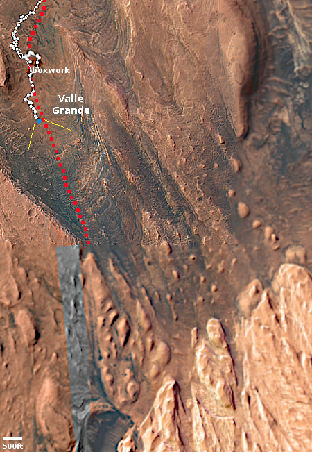
Click for interactive map.
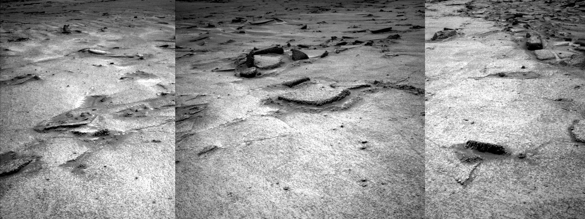
Cool image time! The panorama above was created from three pictures taken on June 12, 2026 by the left navigation camera on the Mars rover Curiosity (see here, here, and here). It shows the immediate ground uphill in front of the rover, which appears to be the smoothest ground that Curiosity has seen in about five years, since it entered the foothills at the base of Mount Sharp in 2021.
Since then the terrain has been routinely boulder strewn. In one case, the ground was so rocky and rough that the science team had to back off from their original plans and find a different route.
The panorama above shows something wholly different, a patch of relatively smooth ground with only a scattering of sharp rocks protruding periodically from below. This ground is likely the rover’s first taste of what the science team calls the “yardang unit”, the light colored hills in the lower right of the overview map to the right. For years that team has looked at those hills, wondering what it would be like to drive Curiosity on them. Their geology suggests a much softer terrain, sand shaped into dunes (yardangs) by the wind. The unknown was always whether the ground was structurally strong enough for the rover to traverse it.
It looks like they are about to get their first clue. Based on the panorama above, the ground appears very promising.
On the overview map, the blue dot marks Curiosity’s present position, with the red-dotted line is planned route and white-dotted line its actual travels. The yellow lines indicate approximately the area covered by the panorama.


