
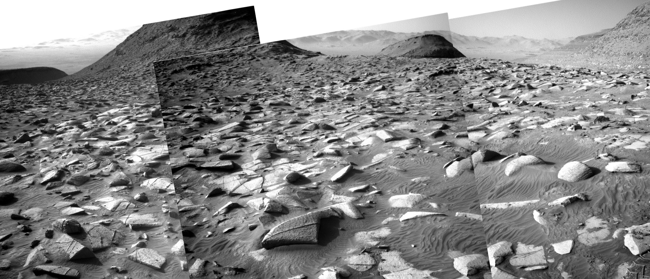
First images from Lucy’s fly-by of asteroid Donaldjohanson
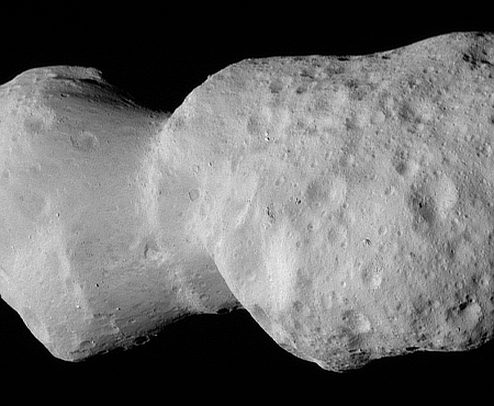
Closest view of asteroid DonaldJohanson.
Click for movie.
The science team for the asteroid probe Lucy today released the pictures taken by the spacecraft as it approached the asteroid Donaldjohanson on April 20, 2025, compiled into a short movie.
The asteroid was previously observed to have large brightness variations over a 10-day period, so some of Lucy team members’ expectations were confirmed when the first images showed what appeared to be an elongated contact binary (an object formed when two smaller bodies collide). However, the team was surprised by the odd shape of the narrow neck connecting the two lobes, which looks like two nested ice cream cones.
…From a preliminary analysis of the first available images collected by the spacecraft’s L’LORRI imager, the asteroid appears to be larger than originally estimated, about 5 miles (8 km) long and 2 miles (3.5 km) wide at the widest point. In this first set of high-resolution images returned from the spacecraft, the full asteroid is not visible as the asteroid is larger than the imager’s field of view. It will take up to a week for the team to downlink the remainder of the encounter data from the spacecraft; this dataset will give a more complete picture of the asteroid’s overall shape.
Lucy is now on its way to the orbit of Jupiter, where it will get close-up views of five different Trojan asteroids in 2027, followed by a later visit to another group of Trojans in 2033.
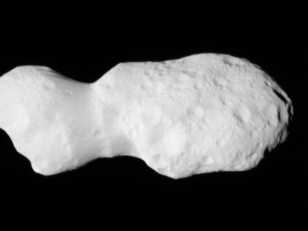


