Click for full image.
No, today’s cool image is not a variation of the absurd “face on Mars” that our alien-obssessed fantasy culture focused on for more than twenty years that turned out to be nothing more than a mesa whose shadows in one image made it look very vaguely like a face.
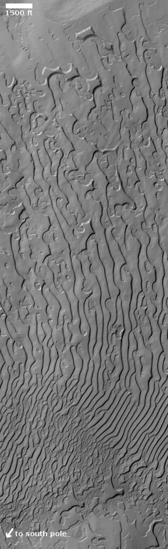
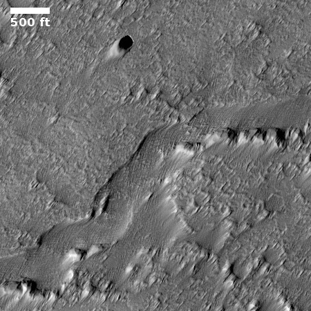
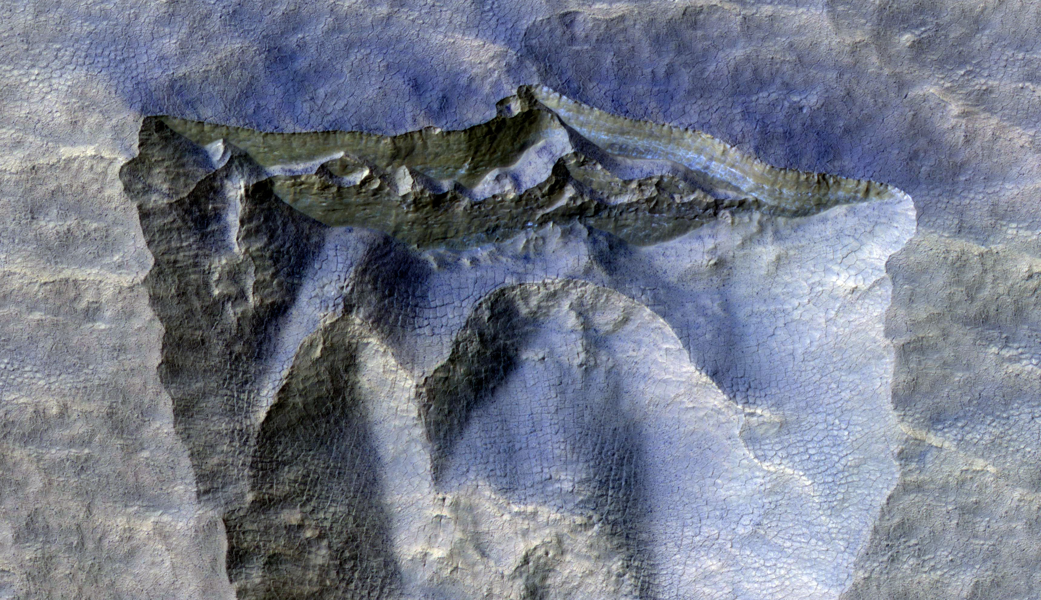
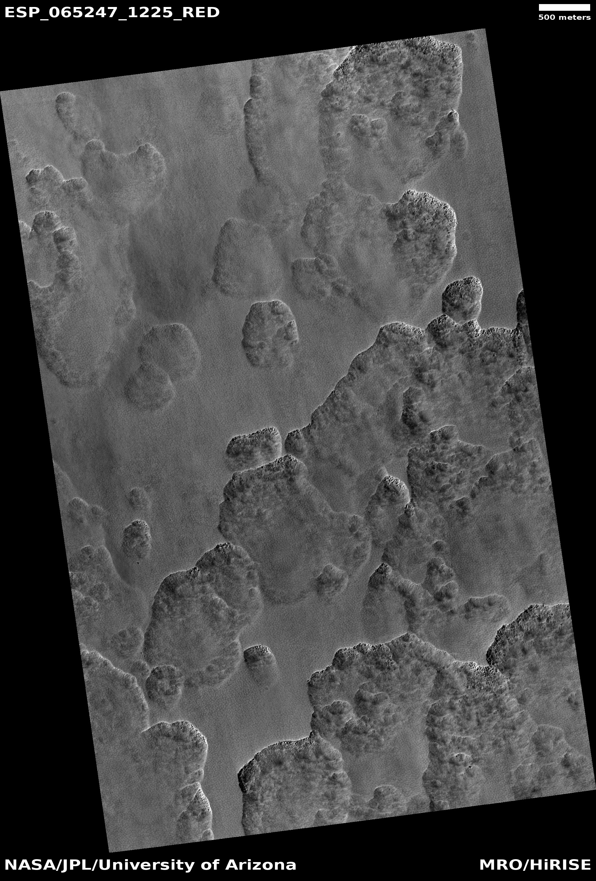
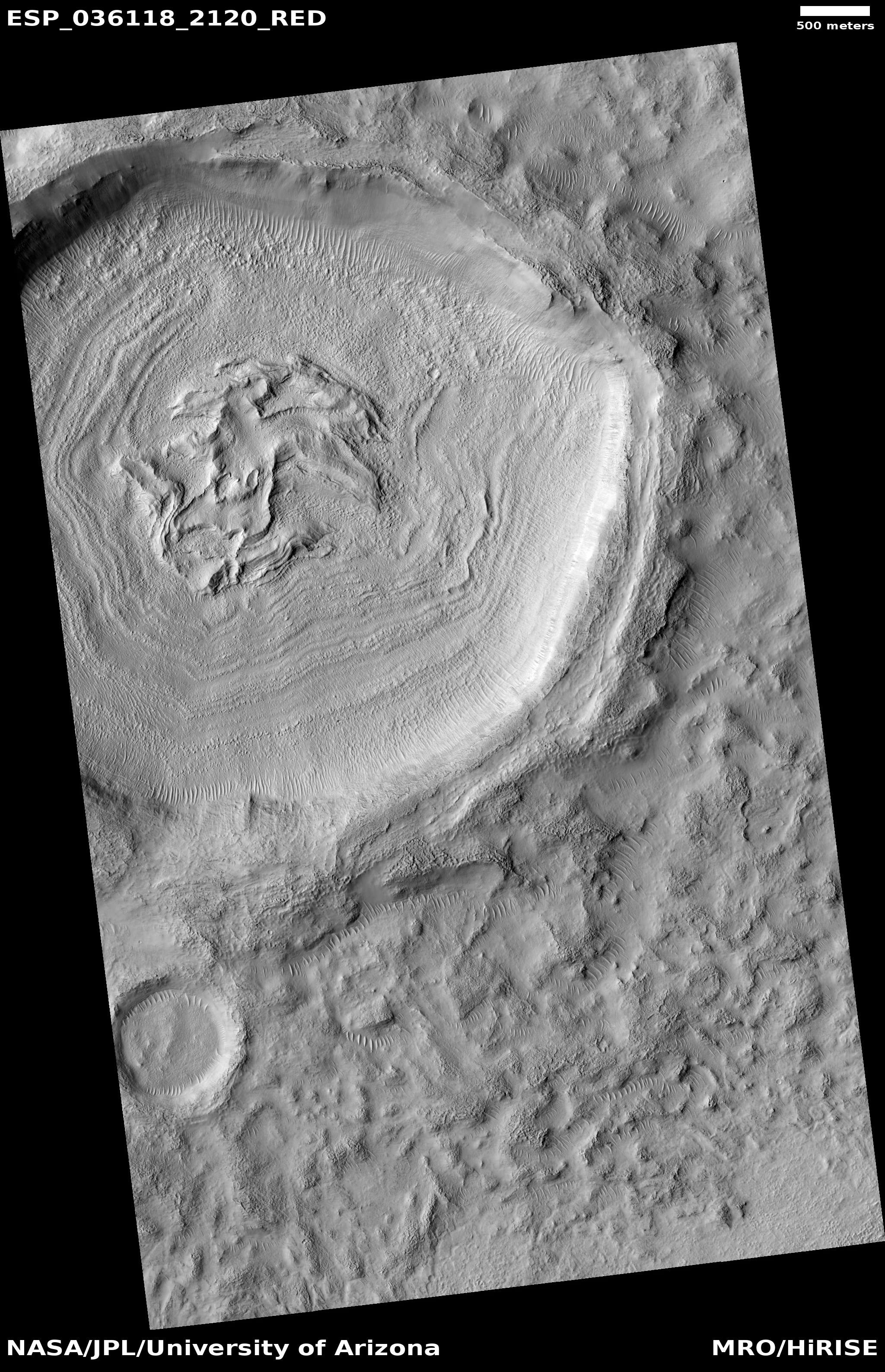
Instead, today’s cool image is of a very weird Martian geological feature that strongly resembles the whorls and curls seen in all fingerprints, and is thus apply named “Fingerprint Terrain.”
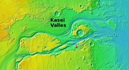
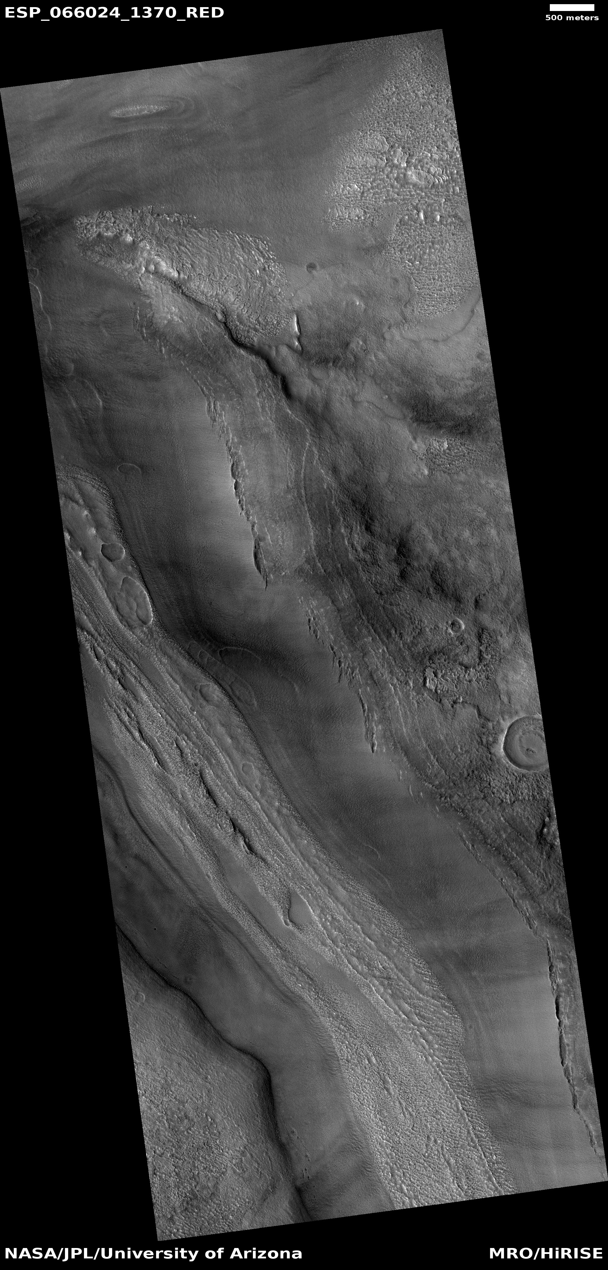
The photo to the right, rotated, cropped, reduced, and annotated to post here, was taken by the high resolution camera on Mars Reconnaissance Orbiter on August 26, 2020. It shows part of the surface of Mars’ south pole residual icecap, about 130 miles from the south pole, at a place where the temporary thin dry ice mantle that arrives every winter with the bulk of it sublimating away with the coming of spring.
The fingerprint in this image shows that sublimation process, with the gaps in dry ice mantle getting wider and larger as you move north, until the ridges between disappear altogether.
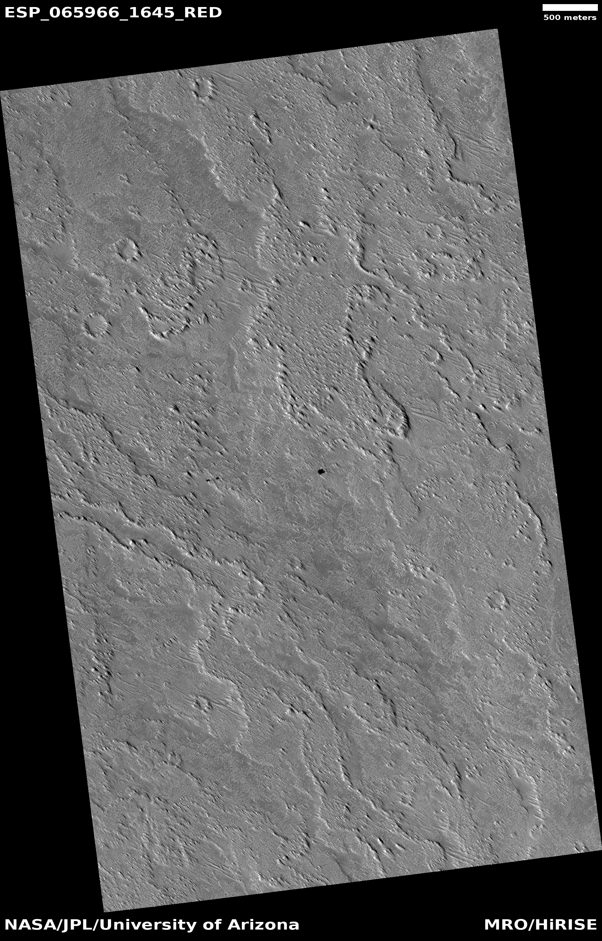
But why does it look as it does, like a fingerprint? In other places this sublimation process does not look like this at all. Sometimes we get spiderlike formations. Sometimes we get splatters that suggest geysers. Sometimes the surface sublimates to produce swiss cheese shapes. But why a fingerprint here?
I asked this question of Shane Byrne of the Lunar and Planetary Lab University of Arizona, who had requested this particular image, hoping he and other planetary scientists had investigated this geology and come up with an explanation. His answer illustrates how little we yet know about Mars.
It’s almost definitely some sort of sublimation process, but it hasn’t been well investigated. There are some papers that talk about sublimation landforms on the cap in general and map out where different types are, but nothing that I know that’s specific to the fingerprint terrain.
In other words, why the dry ice cap sublimates away in this manner, at this and other locations, remains unexplained.
I’ll say it again: Mars is strange, Mars is alien, and Mars is therefore a place humans must go.


