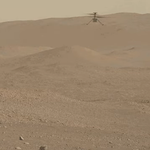
Ingenuity flies on, completing its 57th flight
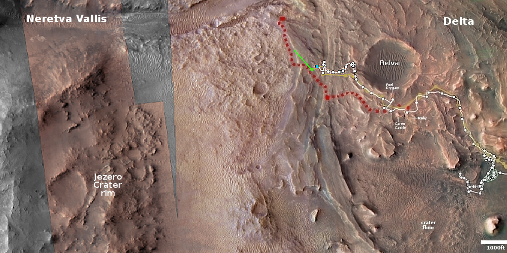
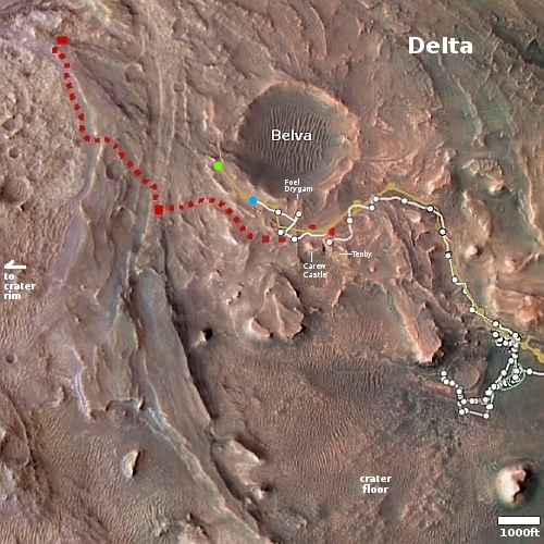
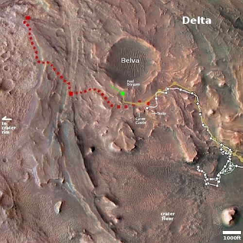
Click for interactive map
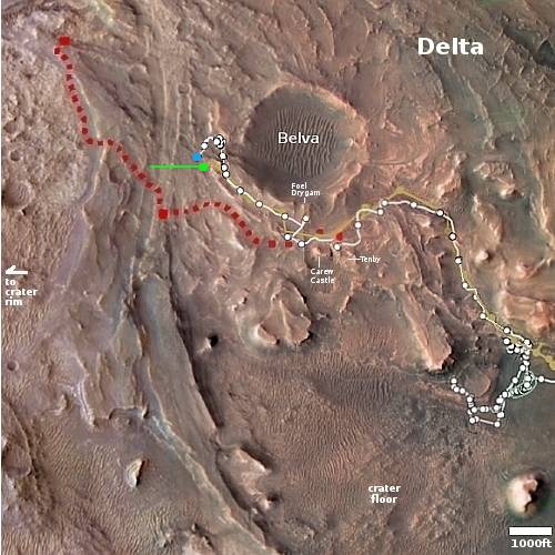
On September 3, 2023 Ingenuity successfully completed its 57th flight on Mars, traveling 713 feet for two minutes and nine seconds. As noted at the tweet at the link, the helicopter has now accumulated more than 100 minutes of flight time.
As it has on almost all its recent flights, the helicopter flew a slightly longer distance for slightly longer that its flight plan, probably because it was taking time to find a safe landing spot.
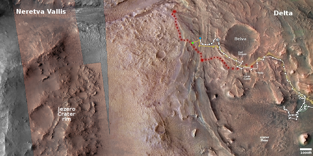
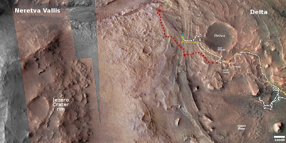
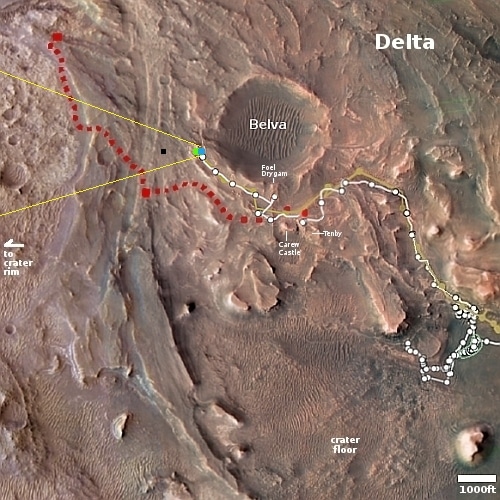
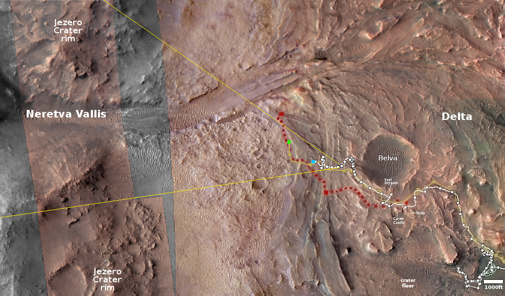
The green dot on the overview map above shows Ingenuity’s new location. It has moved west and north of Perseverance, following the rover’s planned route as indicated by the red dotted line. The blue dot marks Perseverance’s present location. The yellow lines indicate the approximate area of the mosaic below, just released by the Perseverance science team, taken on July 8, 2023 by the rover’s high resolution camera and cropped and reduced to post here. It shows us the rover’s eventual path forward, into that mountain gap.

Click for original, full resolution image (a large file).