
Chinese scientists pinpoint a prime landing site for its manned lunar mission
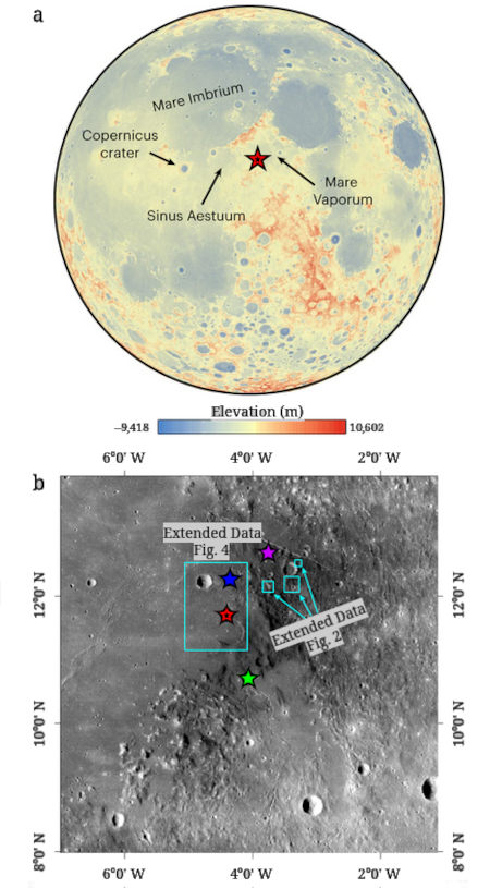
Though no final decision has apparently been made, a just published research paper suggests that China is considering a location almost dead center on the Moon’s near side, on the edge of a mare region dubbed Sinus Aestruum, for its first manned lunar landing, presently targeting a 2030 launch date. From the abstract:
We propose four prospective landing sites in the traversable areas, which provide a range of diverse geological samples, including volcanic debris, mare basalts, Copernicus crater ejecta and high-Th materials. Such a collection may provide insights into the geological evolution of the region and enhance our understanding of the lunar mantle composition and volcanic processes.
The red star on global lunar map to the right, taken from figure 1 of the paper, shows the location of this region. The lower map zooms into the region, with the four stars indicating the four prospective landing sites. The region has several rilles, long meandering channels thought to have formed from lava flow, that could be reached during an EVA.
Though it appears the scientists of this paper are lobbying for this landing region and no final decision has been reached, its location and wide variety of geology strongly suggests this will be the final choice. If so, of the four landing sites outlined two are in the smoother mare regions, and two are off the edge, in rougher terrain. For safety considerations, it is likely the final landing site will be in one of the former.


