
Tantalizing Titania, Uranus’s largest moon
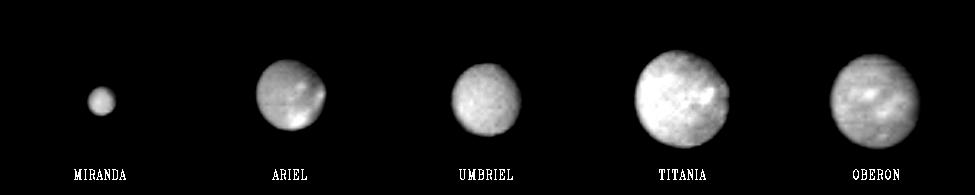 The historically known moons of Uranus. Click for original NASA press release.

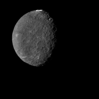
Click for original image.
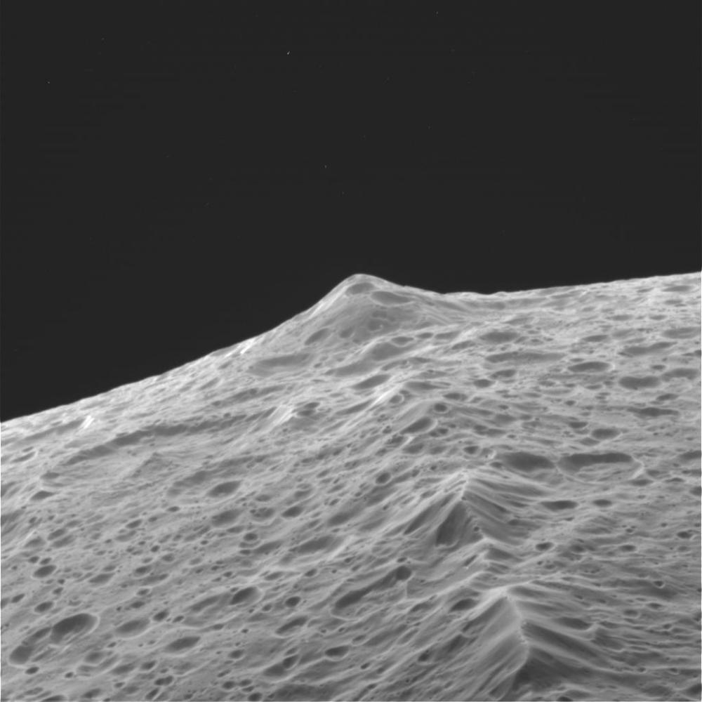
This week’s tour of the five largest moons of Uranus continues today with a look at the highest resolution picture taken Uranus’s largest moon, Titania, when Voyager-2 did its fly-by of the solar system’s seventh planet on January 24, 1986. The image to the right, cropped and reduced to post here, was taken from about 229,000 miles, and can only resolve objects bigger than eight miles across. From the press release:
Titania is the largest satellite of Uranus, with a diameter of a little more than 1,000 miles. Abundant impact craters of many sizes pockmark the ancient surface. The most prominent features are fault valleys that stretch across Titania. They are up to 1,000 miles long and as much as 45 miles wide. In valleys seen at right-center, the sunward-facing walls are very bright. While this is due partly to the lighting angle, the brightness also indicates the presence of a lighter material, possibly young frost deposits. An impact crater more than 125 miles in diameter distinguishes the very bottom of the disk; the crater is cut by a younger fault valley more than 60 miles wide. An even larger impact crater, perhaps 180 miles across, is visible at top.
Two or three other images were taken by Voyager-2, but they don’t provide any significant additional information. All told the spacecraft was only able to see about 40% of Titania’s surface.
Subsequent research using a variety of orbiting telescopes have suggested there is water ice and carbon dioxide on the surface. This data also hints of the presence of a very very thin atmosphere. These results however are quite uncertain.
As with Uranus’s other moons Miranda, Ariel, and Umbriel that I highlighted earlier this week, the Voyager-2 data merely gives us a taste of what’s there. Forty years later we have learned almost nothing more about these distant worlds.
Tomorrow we look at Oberon. I will then follow-up the next day with a look at what we don’t know about Uranus and its moons.


