
The very icy high northern latitudes of Mars
Click for full image.
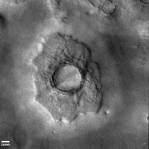
Today’s cool image to me illustrates how the presence of near surface ice in the high latitudes of the northern lowland plains of Mars helps to produce a very strange and alien terrain.
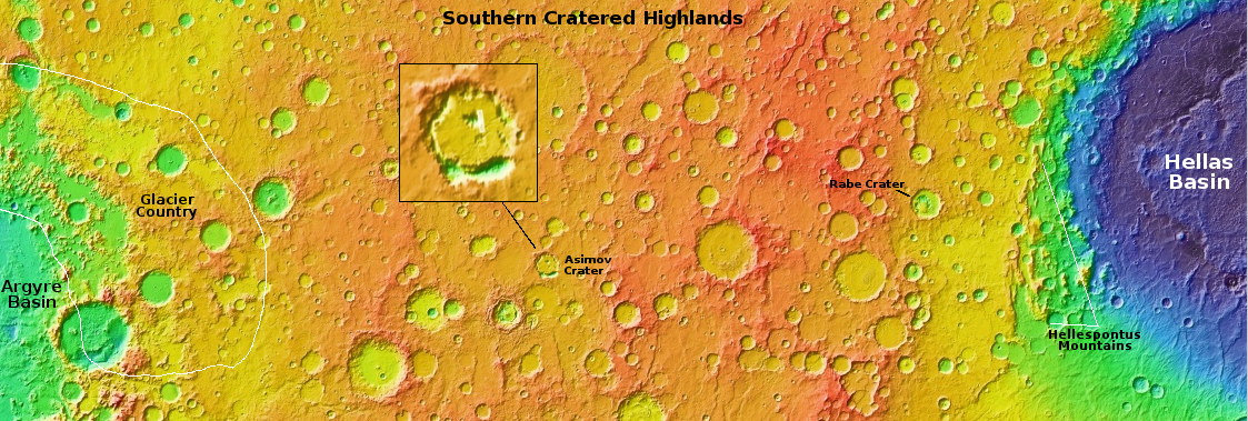
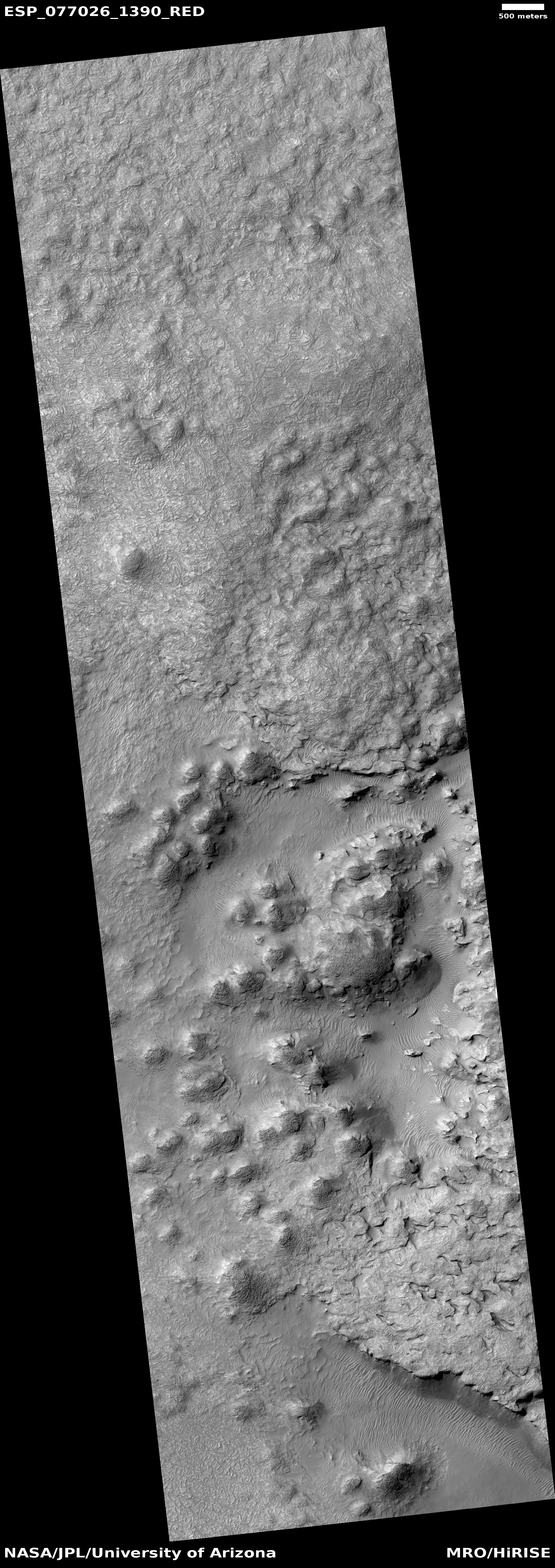
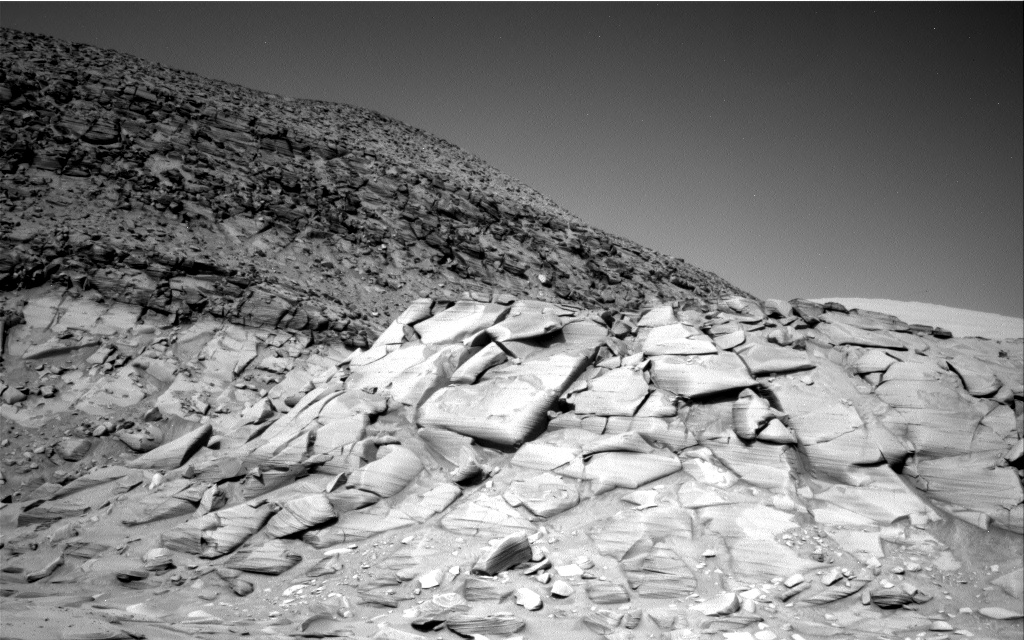
The picture to the right, rotated, cropped, reduced, and sharpened to post here, was taken on January 31, 2023 by the high resolution camera on Mars Reconnaissance Orbiter (MRO). It shows a typical example of what the scientists have dubbed a “pedestal crater,” where the crater ends up higher than the surrounding terrain because the impact had packed the ground and made it more resistant to erosion.
This theory however does not explain entirely what we see here. That apron mesa surrounding the crater also resembles the kind of splash field that is created when an impact occurs in less dense ice-rich ground. Note too the soft stippled nature of the ground. Wind erosion is not the sole cause of change here.
» Read more

Click for full image.
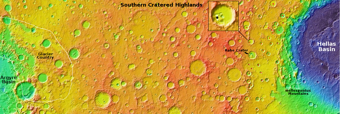
Today’s cool image to me illustrates how the presence of near surface ice in the high latitudes of the northern lowland plains of Mars helps to produce a very strange and alien terrain.
The picture to the right, rotated, cropped, reduced, and sharpened to post here, was taken on January 31, 2023 by the high resolution camera on Mars Reconnaissance Orbiter (MRO). It shows a typical example of what the scientists have dubbed a “pedestal crater,” where the crater ends up higher than the surrounding terrain because the impact had packed the ground and made it more resistant to erosion.
This theory however does not explain entirely what we see here. That apron mesa surrounding the crater also resembles the kind of splash field that is created when an impact occurs in less dense ice-rich ground. Note too the soft stippled nature of the ground. Wind erosion is not the sole cause of change here.
» Read more


