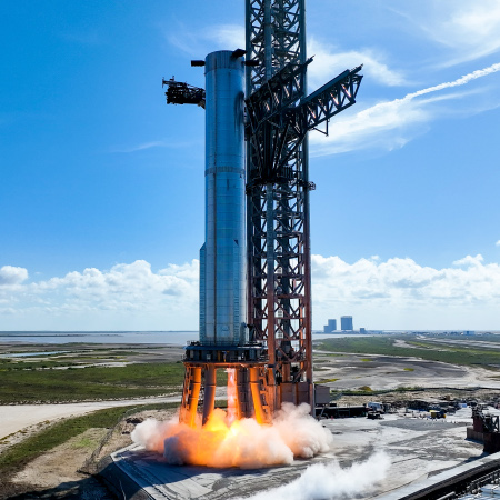
Superheavy prototype #7 and Starship prototype #24 undergo static fire tests
Capitalism in space: SpaceX engineers yesterday performed static fire tests of both its Superheavy prototype #7 and its Starship prototype #24.
The Superheavy prototype fired one engine, and did so only a few weeks after that prototype experienced an explosive event the launchpad during earlier fueling/engine tests. Yesterday’s engine test was the first time any Superheavy prototype had fired its engines on the launchpad.
The Starship prototype meanwhile fired two engines on a nearby vertical test stand.
SpaceX’s plan is to stack #24 on top of #7 and attempt an orbital launch test that will have the Superheavy prototype land in the Gulf of Mexico while the Starship prototype reaches orbit and then returns to Earth in the Pacific northeast of Hawaii. Based on the company’s normal pace of operations, that flight is probably only weeks away. However, before that flight engineers will have to do a full static fire test of all 33 of #7 engines, and then like do it again with Starship #24 stacked on top.

