
A graceful spiral galaxy

Click for original image.
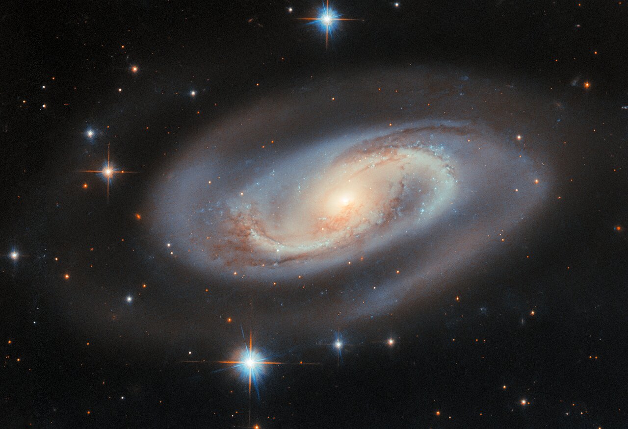
Cool image time! The picture to the right, cropped, reduced, and sharpened to post here, was taken by the Hubble Space Telescope as part of a project to study galaxies with very active central supermassive black holes.
What sets UGC 11397 apart from a typical spiral lies at its centre, where a supermassive black hole containing 174 million times the mass of the Sun is growing. As a black hole ensnares gas, dust, and even entire stars from its vicinity, this doomed matter heats up and puts on a fantastic cosmic light show. Material trapped by the black hole emits light from gamma rays to radio waves and can brighten and fade without warning. But in some galaxies, including UGC 11397, thick clouds of dust hide much of this energetic activity from view in optical light. Despite this, UGC 11397’s actively growing black hole was revealed through its bright X-ray emission — high-energy light that can pierce the surrounding dust. This led astronomers to classify it as a Type 2 Seyfert galaxy, a category used for active galaxies whose central regions are hidden from view in visible light by a doughnut-shaped cloud of dust and gas.
To me what sets this galaxy apart is its natural beauty. It also reminds me of the universe’s vastness. Located about 250 million light years away, those hazy spiral arms represent millions of stars, many of which likely harbor planets and maybe even life.
Click for original image.
Cool image time! The picture to the right, cropped, reduced, and sharpened to post here, was taken by the Hubble Space Telescope as part of a project to study galaxies with very active central supermassive black holes.
What sets UGC 11397 apart from a typical spiral lies at its centre, where a supermassive black hole containing 174 million times the mass of the Sun is growing. As a black hole ensnares gas, dust, and even entire stars from its vicinity, this doomed matter heats up and puts on a fantastic cosmic light show. Material trapped by the black hole emits light from gamma rays to radio waves and can brighten and fade without warning. But in some galaxies, including UGC 11397, thick clouds of dust hide much of this energetic activity from view in optical light. Despite this, UGC 11397’s actively growing black hole was revealed through its bright X-ray emission — high-energy light that can pierce the surrounding dust. This led astronomers to classify it as a Type 2 Seyfert galaxy, a category used for active galaxies whose central regions are hidden from view in visible light by a doughnut-shaped cloud of dust and gas.
To me what sets this galaxy apart is its natural beauty. It also reminds me of the universe’s vastness. Located about 250 million light years away, those hazy spiral arms represent millions of stars, many of which likely harbor planets and maybe even life.


