
The strange flows in Shalbatana Vallis on Mars
Click for full image.
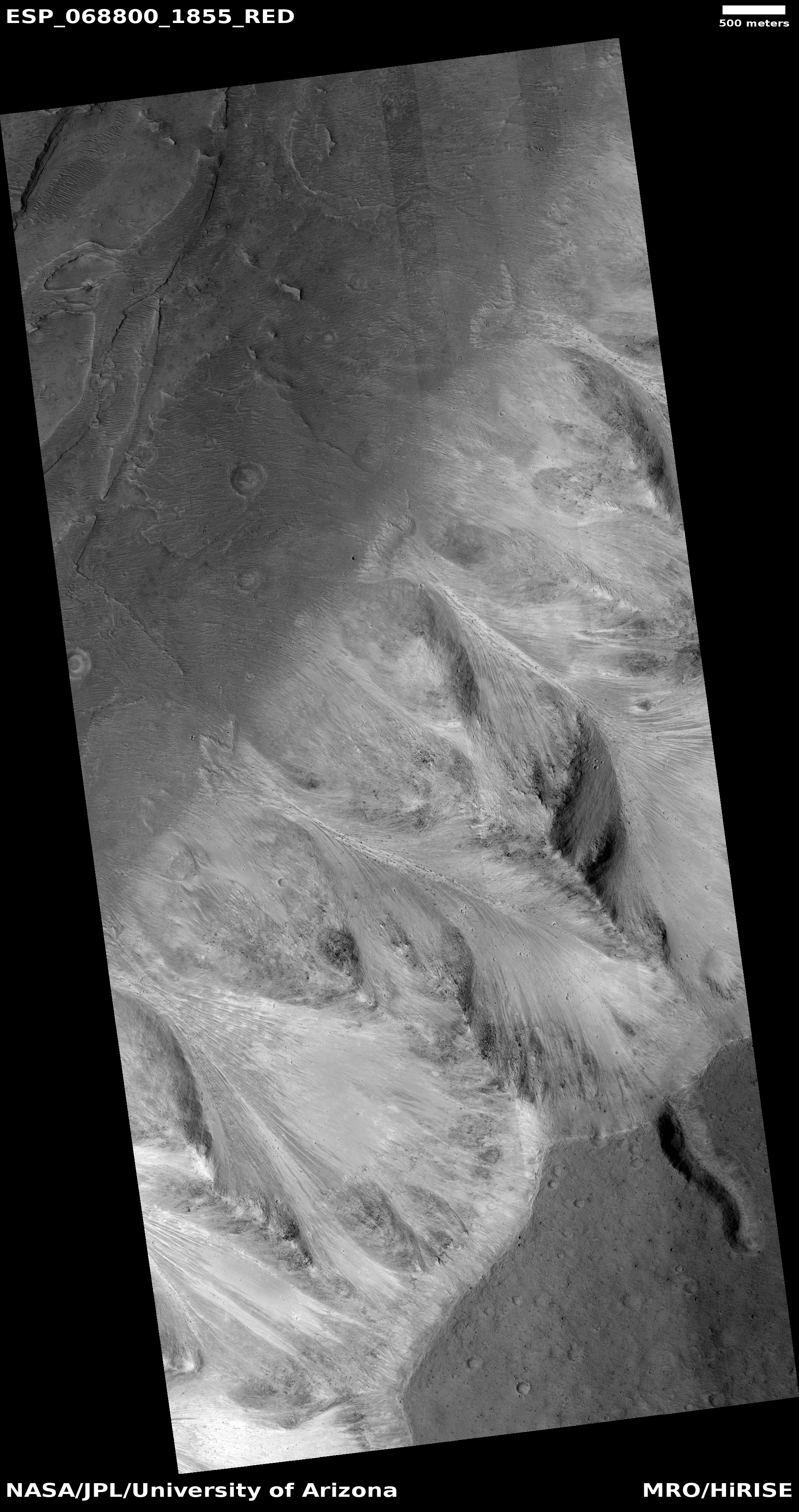
Cool image time! The photo to the right, rotated, cropped, and reduced to post here, was taken by the high resolution camera on Mars Reconnaissance Orbiter (MRO) on March 31, 2021, and shows a series of very distinct arrowhead-shaped sloping ridges interspersed with hollows flowing down from the southern cliff face of Shalbatana Vallis, one of the larger long meandering drainages flowing into the northern lowlands of Chryse Planitia and north of Valles Marineris.
This location is at 5 degrees north latitude, so nothing we see in the picture is likely glacial or evidence of ice.
So what are we looking at? My guess is that the parallel ridges show us a hint of the original slope of alluvial fill. In the past canyon’s south rim or cliff either did not exist, or was much smaller. Instead the ground mostly sloped gently downhill from the plateau to the canyon floor.
Scientists believe that in the far past catastrophic floods of water flowed through Shalbatana. If a massive flood of water off that rim came down that slope of alluvial fill, it could have pushed into that fill and created the hollows, washing the fill down into the canyon floor and leaving behind the ridges in between.
The overview maps below provide the geographical context.
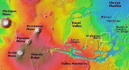
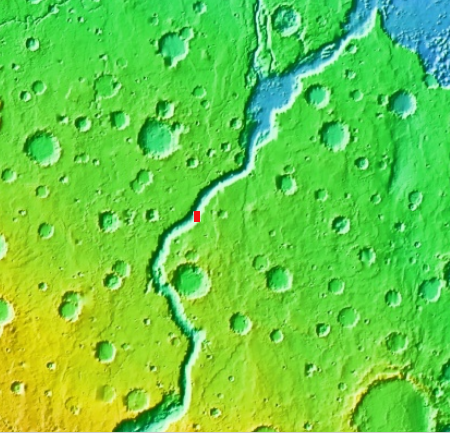
The first map shows a wide view of this region. Shalbaltana Vallis is the smaller snaking canyon just north of Valles Marineris on its eastern end. The white box indicates the area covered by the second map.
The red box marks the location of today’s image.
What the image implies is that not only did those theorized catastrophic floods flow down the canyon, but there was a lot of liquid that flowed suddenly from the plateau above. I can’t imagine the scenario that would make that possible, but I am sure some scientist will figure it out.
Note two that back in 2009 scientists found evidence [pdf] in Shalbaltana of what they thought was sedimentary material and a shoreline that suggested a lake once existed inside the canyon. That location was far to the south and farther upstream that the image above, but it reinforces the possibility that a lot of liquid water was once flowing within and into this canyon.
There is still some uncertainty about all these theories. Both volcanic and glacial processes might have been involved. If fluvial the erosion could have been slow over a long time rather than catastrophic. We also do not yet have a good understanding of the past Martian climate. Nonetheless, this image tells us that something once happened here that produced very spectacular geography.

On Christmas Eve 1968 three Americans became the first humans to visit another world. What they did to celebrate was unexpected and profound, and will be remembered throughout all human history. Genesis: the Story of Apollo 8, Robert Zimmerman's classic history of humanity's first journey to another world, tells that story, and it is now available as both an ebook and an audiobook, both with a foreword by Valerie Anders and a new introduction by Robert Zimmerman.
The print edition can be purchased at Amazon or from any other book seller. If you want an autographed copy the price is $60 for the hardback and $45 for the paperback, plus $8 shipping for each. Go here for purchasing details. The ebook is available everywhere for $5.99 (before discount) at amazon, or direct from my ebook publisher, ebookit. If you buy it from ebookit you don't support the big tech companies and the author gets a bigger cut much sooner.
The audiobook is also available at all these vendors, and is also free with a 30-day trial membership to Audible.
"Not simply about one mission, [Genesis] is also the history of America's quest for the moon... Zimmerman has done a masterful job of tying disparate events together into a solid account of one of America's greatest human triumphs."--San Antonio Express-News
My initial view of this made me think the lines were very straight and not flows but growths.
This makes me wonder if crystals form on Mars as they do on Earth as shown in this Wiki article:
https://en.wikipedia.org/wiki/Cave_of_the_Crystals
Do/would the conditions on Mars (low gravity, very small liquid water…et alia) promote the formation of very large crystals?