
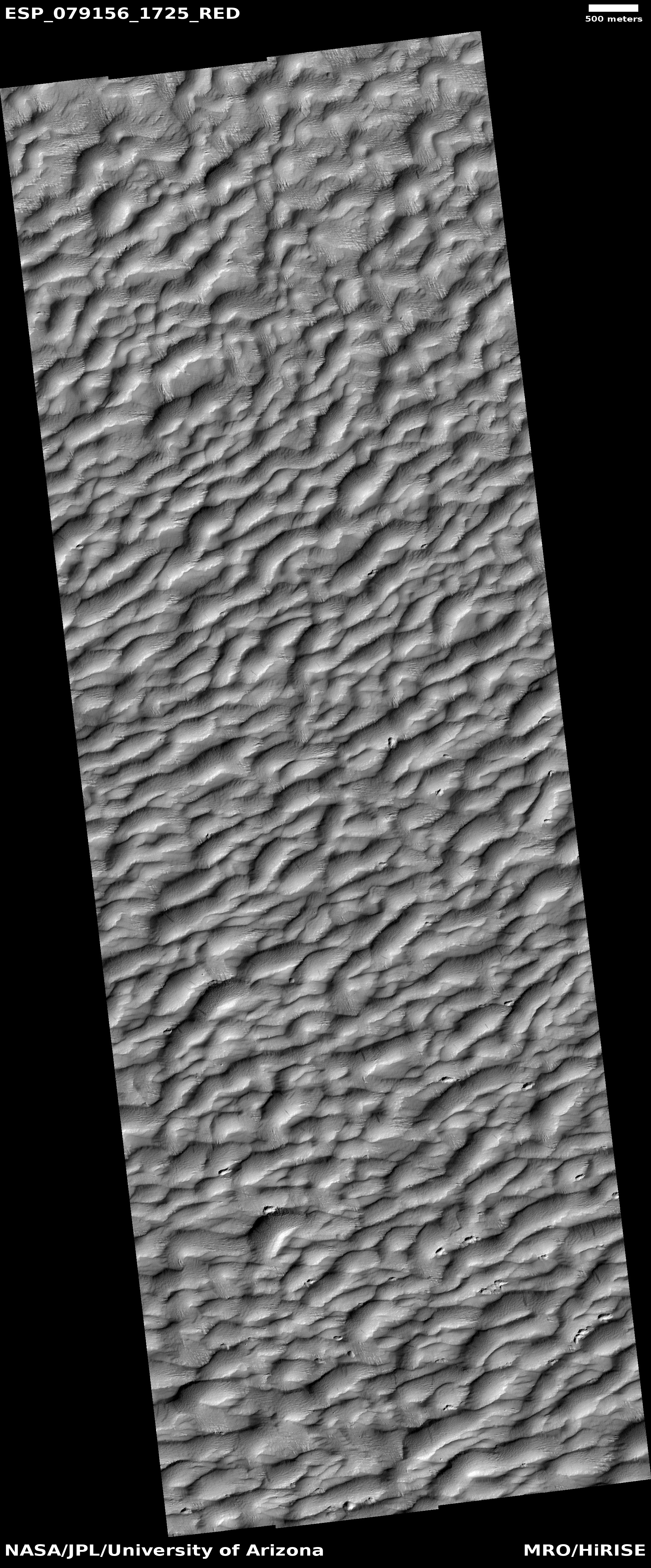
Martian lava that buried a crater
Click for original image.
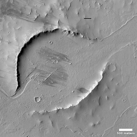
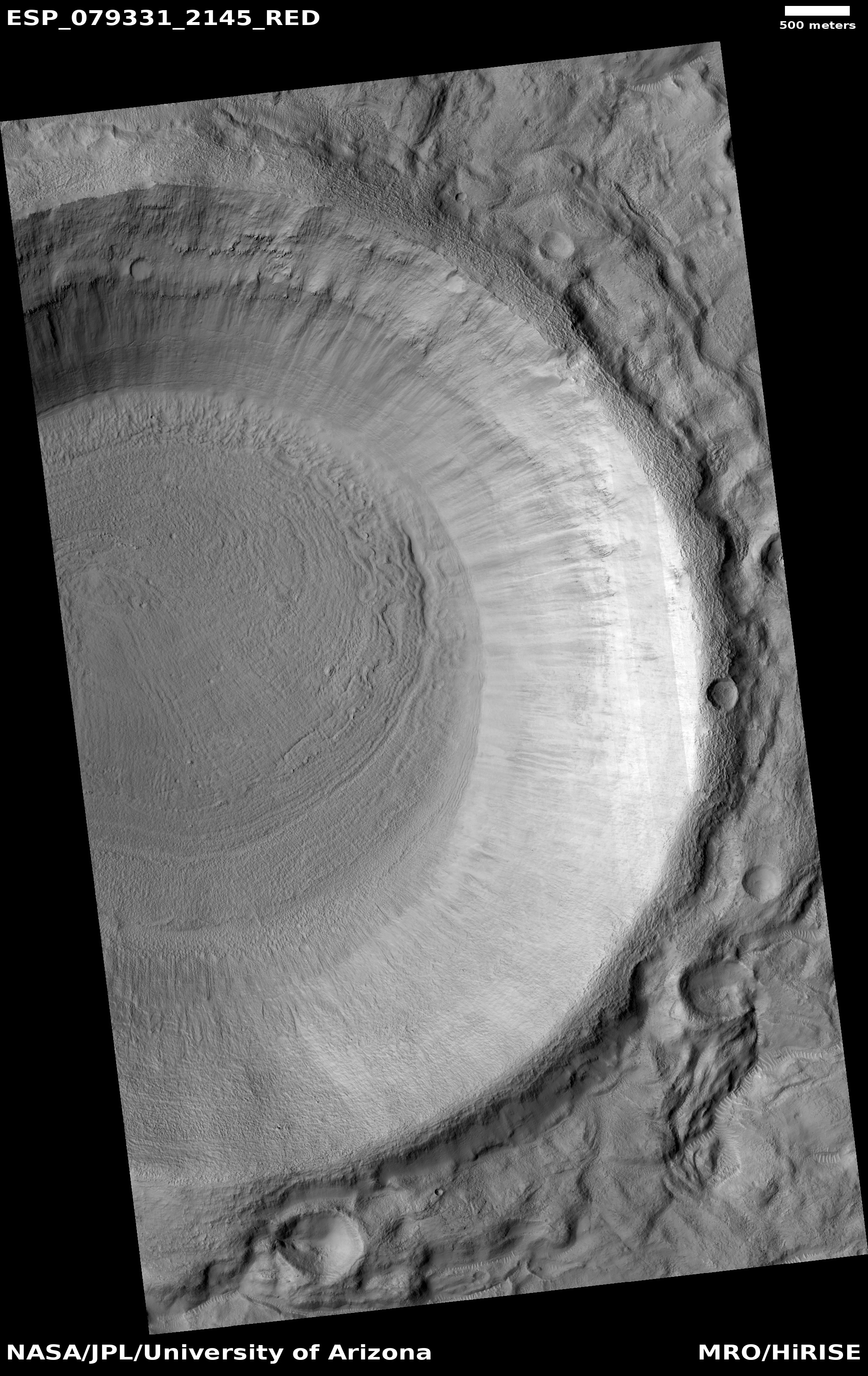
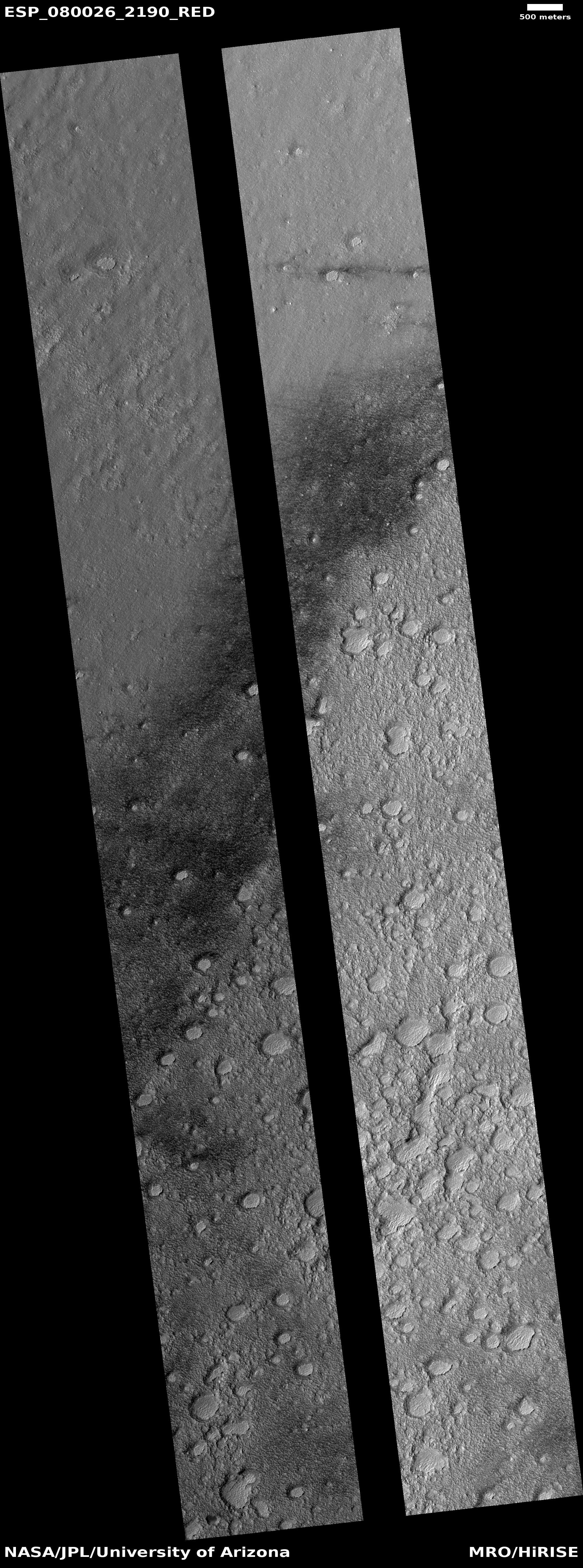
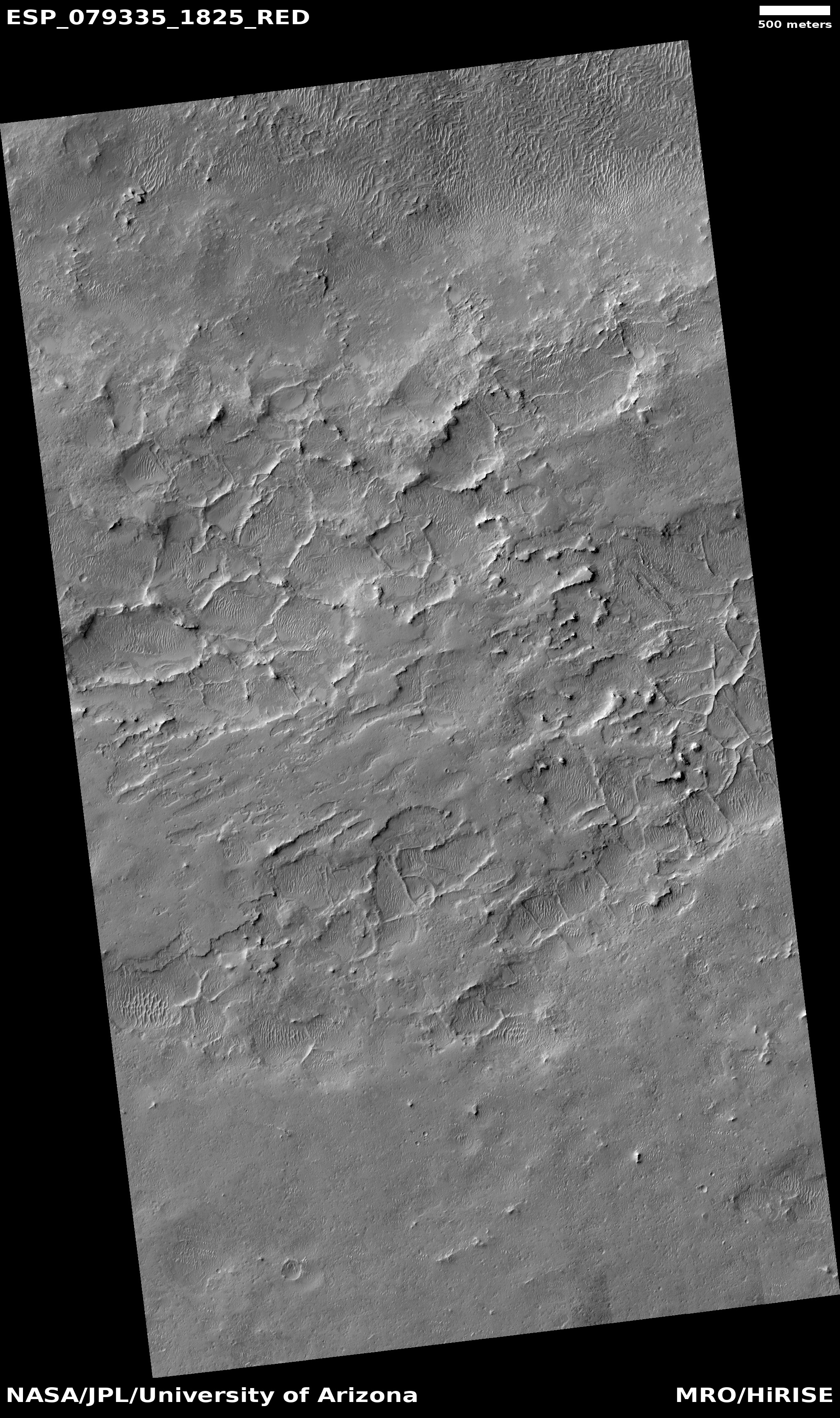
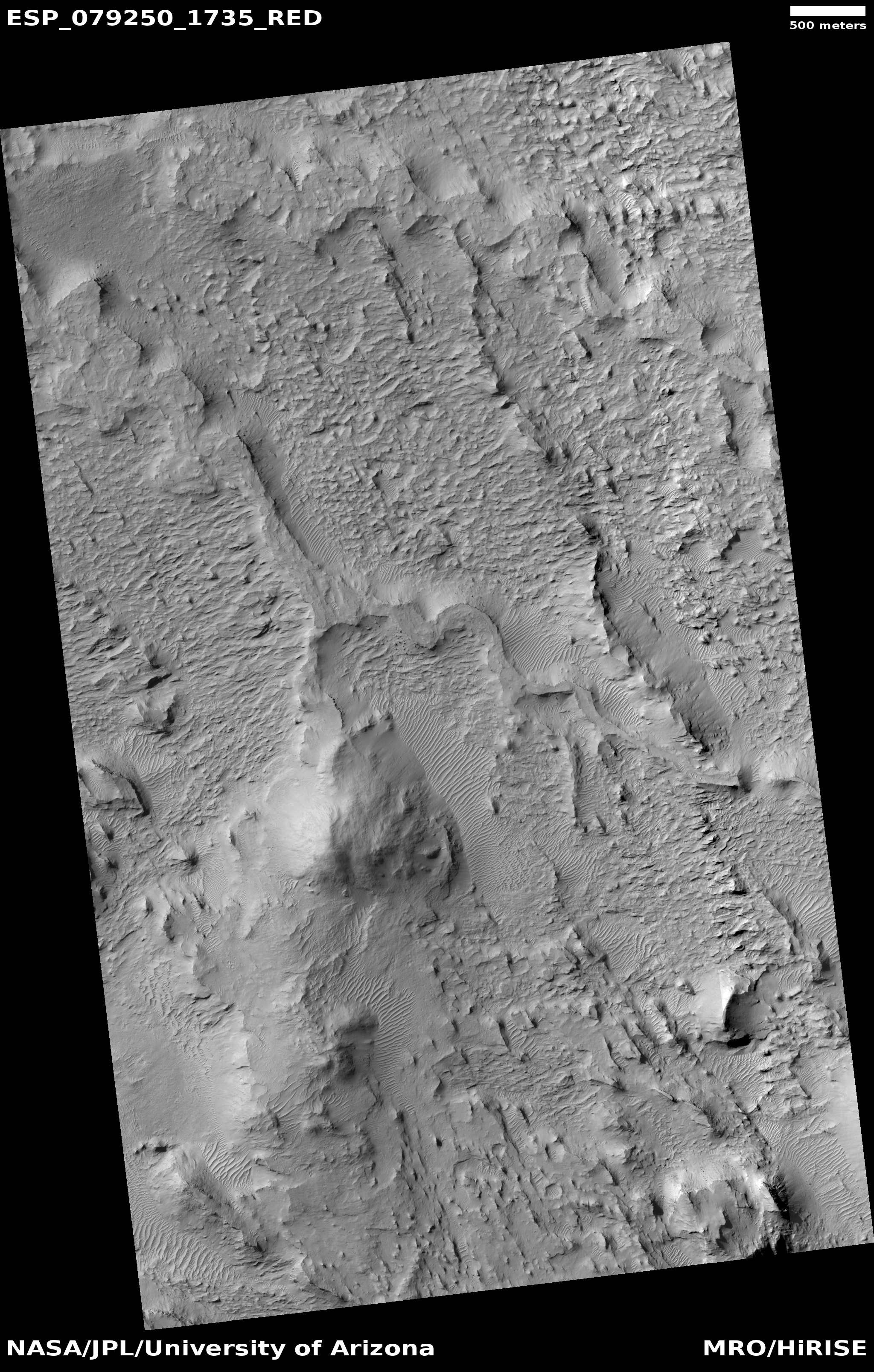
Cool image time! The picture to the right, rotated, cropped, reduced, and sharpened to post here, was taken on June 24, 2023 by the high resolution camera on Mars Reconnaissance Orbiter (MRO). It shows a lava flow that cut through an older 2-mile-wide crater, mostly burying it as it burst through the crater’s southwest and northeast rims. From the caption:
A lava channel extends from the feature and continues 60 kilometers to the northeast, growing deeper along its path. The circular formation is likely an eroded impact crater whose walls have been breached by the lava as it surrounded the rim and then infilled the crater. Alternatively, it could represent the location of a volcanic vent that sourced some of the lavas that formed the channel.
Click for original image.
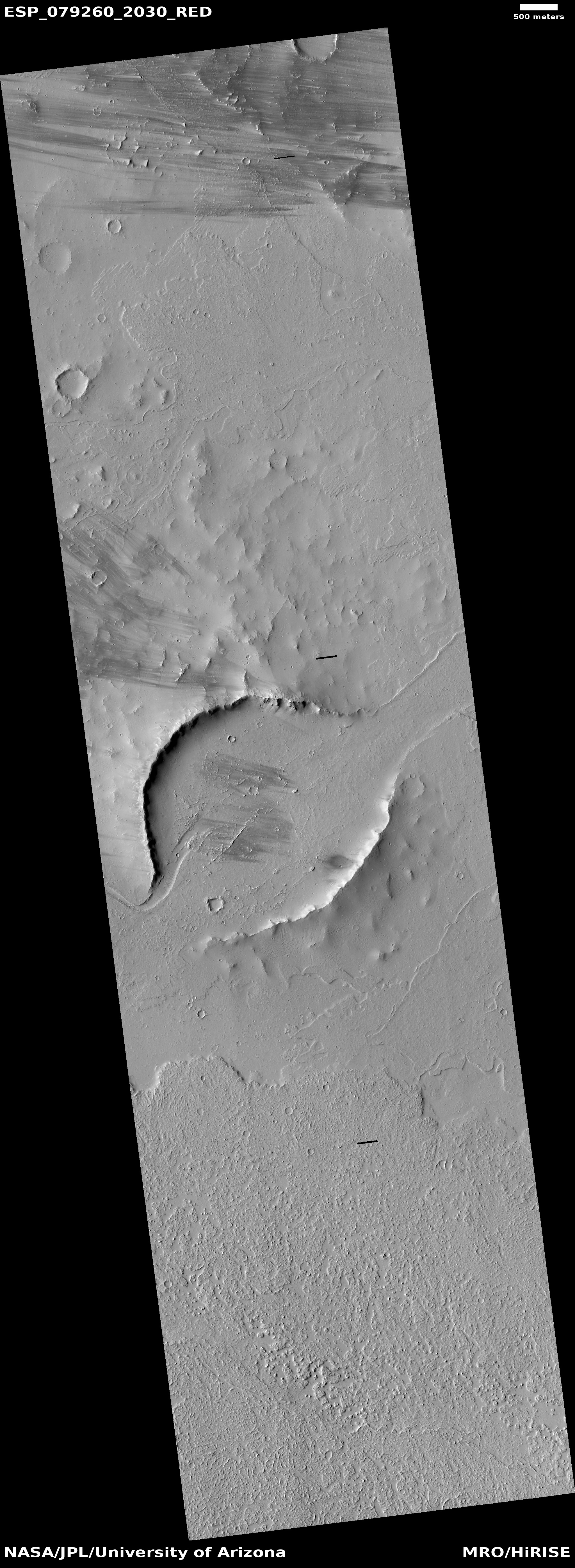
Cool image time! The picture to the right, rotated, cropped, reduced, and sharpened to post here, was taken on June 24, 2023 by the high resolution camera on Mars Reconnaissance Orbiter (MRO). It shows a lava flow that cut through an older 2-mile-wide crater, mostly burying it as it burst through the crater’s southwest and northeast rims. From the caption:
A lava channel extends from the feature and continues 60 kilometers to the northeast, growing deeper along its path. The circular formation is likely an eroded impact crater whose walls have been breached by the lava as it surrounded the rim and then infilled the crater. Alternatively, it could represent the location of a volcanic vent that sourced some of the lavas that formed the channel.


