
The Insight lander on Mars as seen from orbit over six years
Click for movie.
Using photos taken by Mars Reconnaissance Orbiter (MRO) from 2018 to 2024, researchers have compiled a short movie showing how the dust around the Mars lander Insight changed over time.
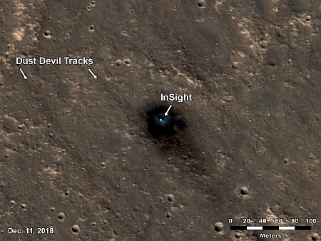
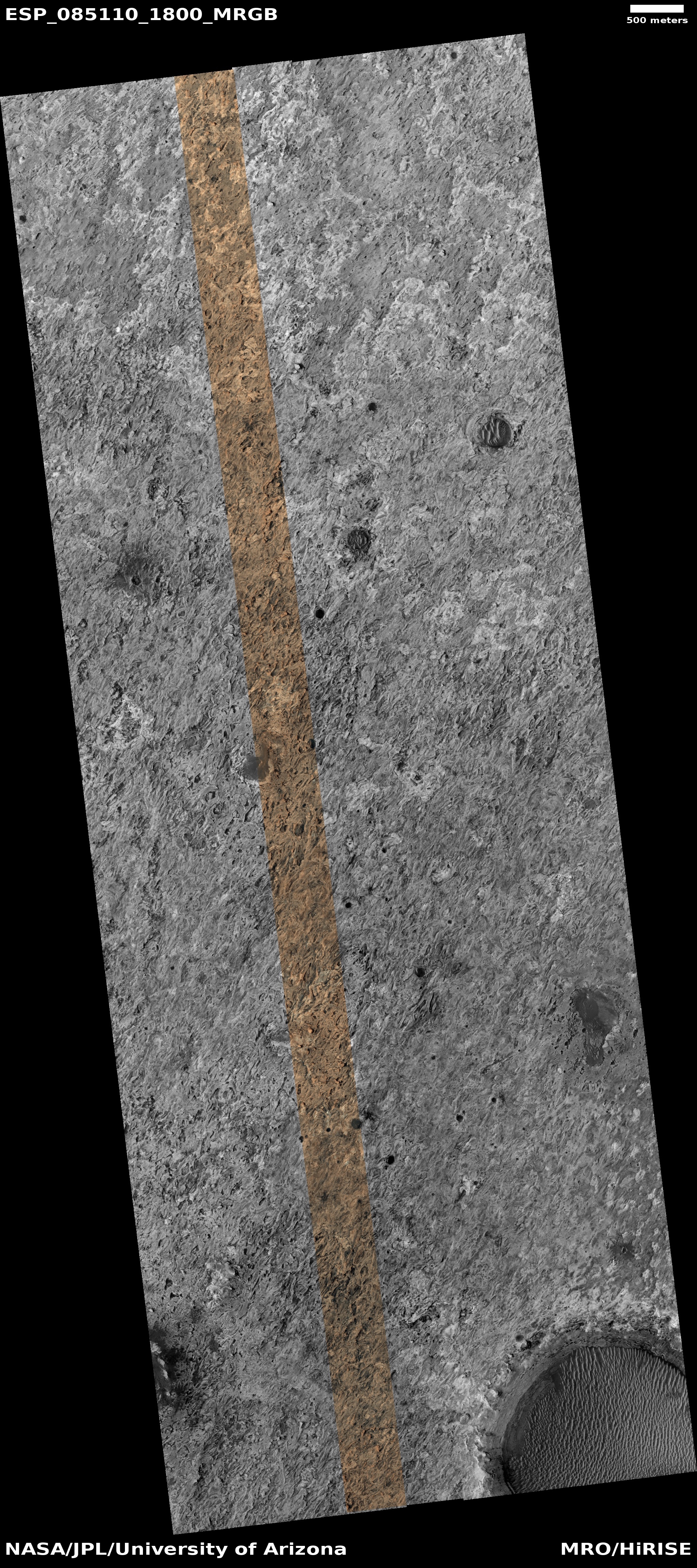
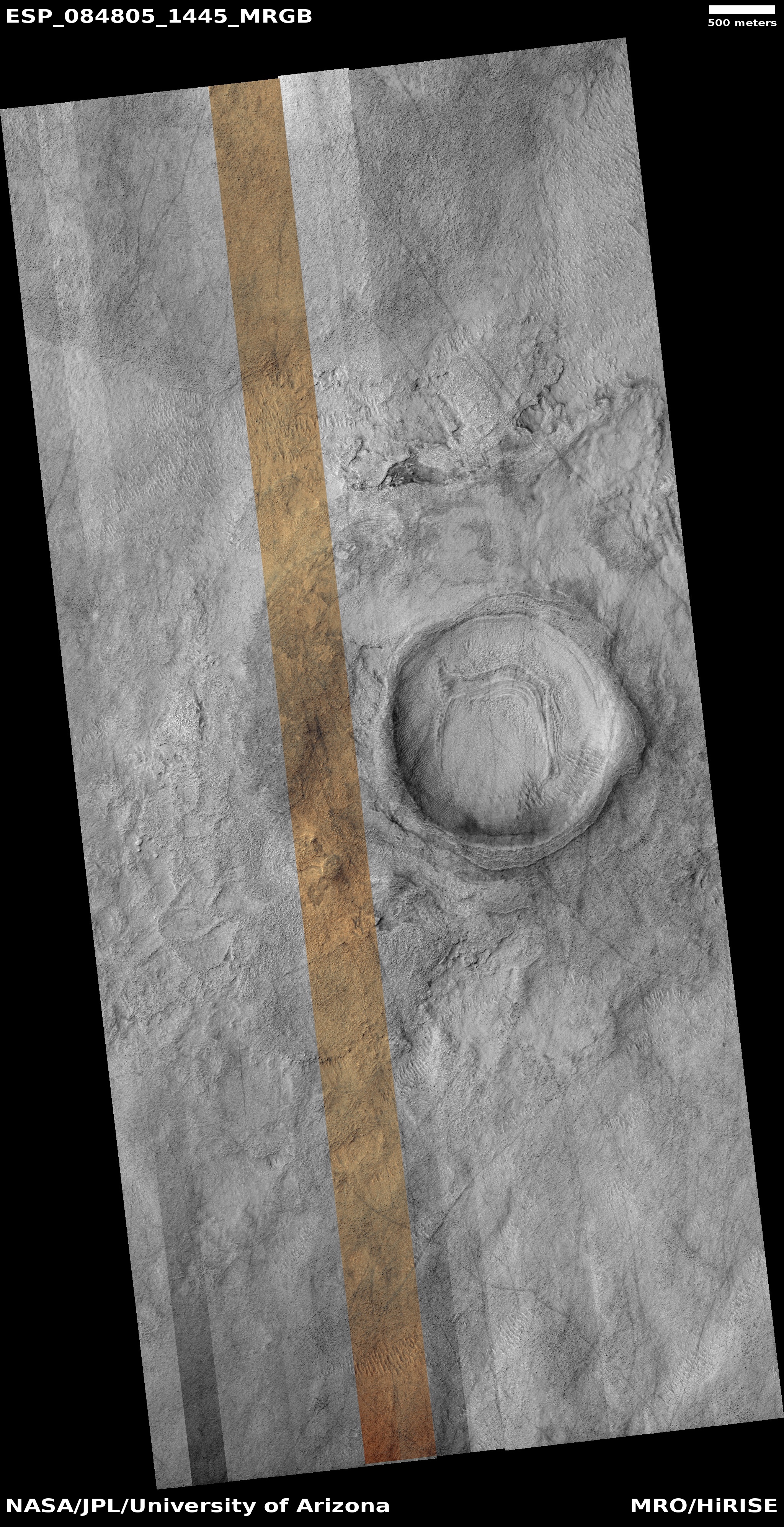
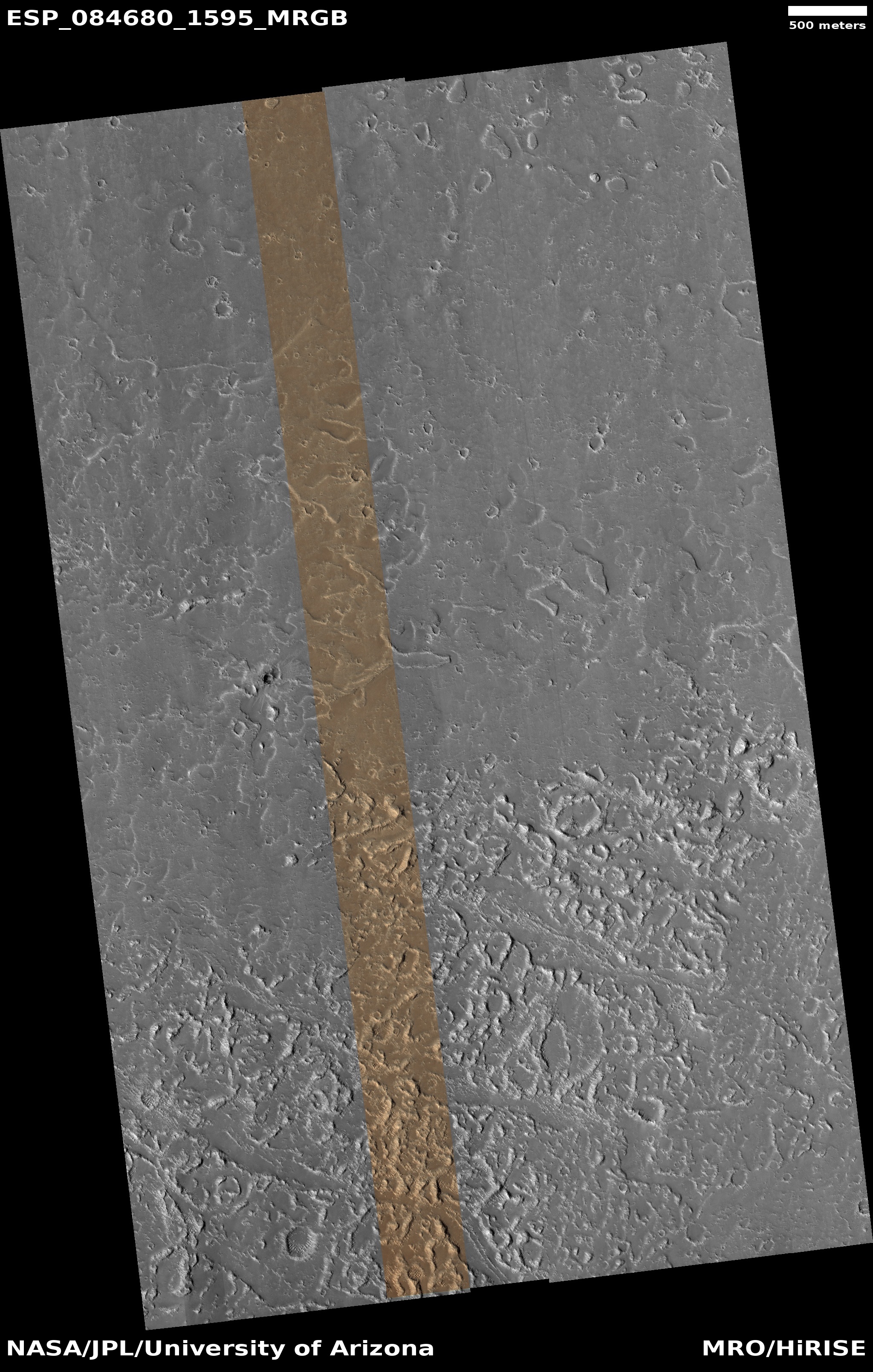
This video shows images taken by HiRISE between Dec. 11, 2018, just a couple weeks after InSight landed on Mars, and Oct. 23, 2024. In the images, InSight often appears as a bright, blue dot due to its reflection of sunlight. A dark halo was scorched into the ground by the spacecraft’s retrorocket thrusters; this halo fades away over time. Dark stripes that can be seen on the surface are tracks left by passing dust devils. [emphasis mine]
You can see the movie here. The image to the right was the first picture taken by MRO only three weeks after landing.
Insight eventually shut down because this dust accumulated on its solar panels, and the lander never was blessed with having a dust devil cross over it to blow that dust away. This video illustrates why. Out of the seven images making up the short movie, only three show dust devil tracks, and in each case only a few tracks are seen. No other tracks are detected.
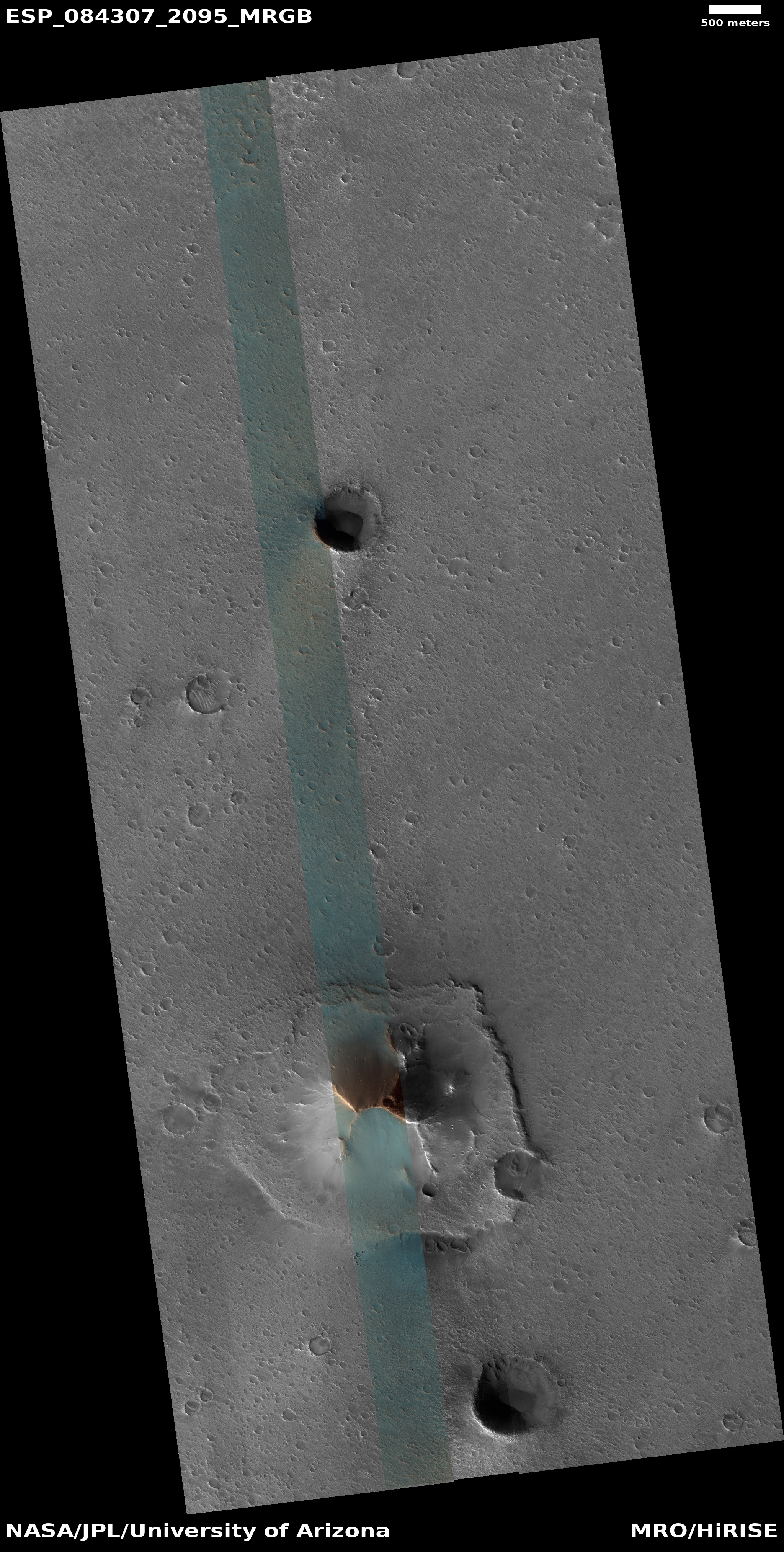
In other words, over six years this region simply did not get a lot of dust devils. The odds of one crossing over InSight was thus quite low. Ironically, the image to the right shows that a dust devil crossed very close to the lander about the time it landed in 2018, probably just beforehand since the dark scorch created by the lander’s thrusters cover the track. No dust devil ever got that close again.
Click for movie.
Using photos taken by Mars Reconnaissance Orbiter (MRO) from 2018 to 2024, researchers have compiled a short movie showing how the dust around the Mars lander Insight changed over time.
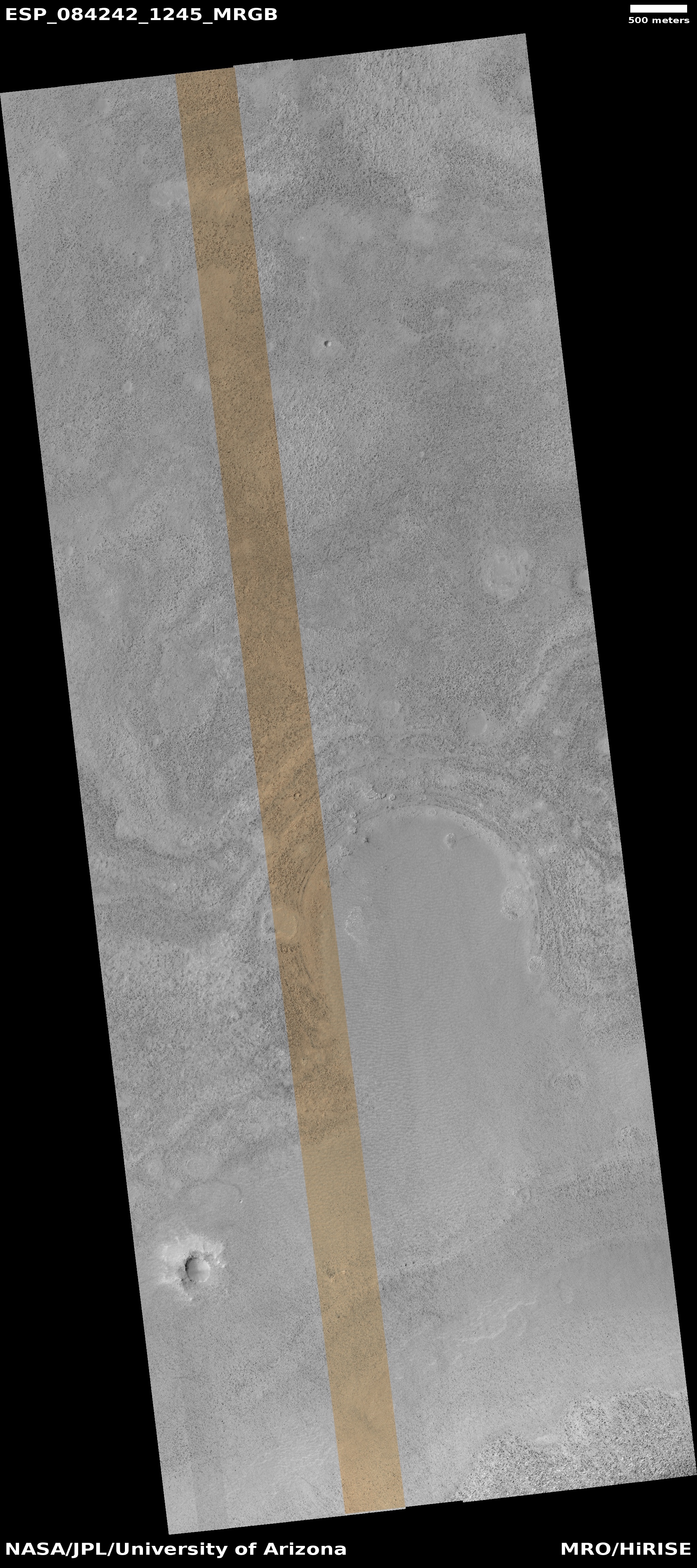
This video shows images taken by HiRISE between Dec. 11, 2018, just a couple weeks after InSight landed on Mars, and Oct. 23, 2024. In the images, InSight often appears as a bright, blue dot due to its reflection of sunlight. A dark halo was scorched into the ground by the spacecraft’s retrorocket thrusters; this halo fades away over time. Dark stripes that can be seen on the surface are tracks left by passing dust devils. [emphasis mine]
You can see the movie here. The image to the right was the first picture taken by MRO only three weeks after landing.
Insight eventually shut down because this dust accumulated on its solar panels, and the lander never was blessed with having a dust devil cross over it to blow that dust away. This video illustrates why. Out of the seven images making up the short movie, only three show dust devil tracks, and in each case only a few tracks are seen. No other tracks are detected.
In other words, over six years this region simply did not get a lot of dust devils. The odds of one crossing over InSight was thus quite low. Ironically, the image to the right shows that a dust devil crossed very close to the lander about the time it landed in 2018, probably just beforehand since the dark scorch created by the lander’s thrusters cover the track. No dust devil ever got that close again.


