Part 1: The ugly corrupt lie of the experimental COVID jab

Joe Biden: dictator
Joe Biden: claiming the power to tell us what medicines we must take

On September 9, 2021, President Joe Biden announced harsh mandates nationwide that forced millions to get COVID shots. You had no choice. If you refused, you would be fired from your job and made a non-person, forbidden in all ways from participating normally in society.

“We’ve been patient, but our patience is wearing thin,” Biden said, making a direct appeal to the 80 million people who he said were still unvaccinated. “Your refusal has cost all of us.”

…”It’s simple [said an official]: If you want to work for the federal government, you must be vaccinated. If you want to do business with the government, you must vaccinate your workforce.”

Those mandates — unreasonably based on very uncertain knowledge at the time — have now been found to have killed thousands of people who did not need to die.

And worst of all, the people imposing those mandates were lying, and knew they were lying.

Killing young adults

For a large majority of the population that either voluntarily chose to get the COVID jab or were forced to submit under duress, the shots and boosters at this point appear to have been harmless. Most people have exhibited no negative symptoms once jabbed, and have so far been able to go on with their lives as if nothing had changed.

The problem is that for many, that jab was a death sentence, with the executioner often arriving unexpectedly but quickly, and completely unnecessarily.
» Read more

14 comments

Celestron to modify commercial amateur telescope for space use

Capitalism in space: Amateur telescope manufacturer Celestron has signed a deal to adapt one of its more expensive ground-based telescopes for use in space.

Trans Astronautica Corp. announced an agreement Sept. 27 with telescope manufacturer Celestron to develop a space-qualified version of the company’s Rowe-Ackermann Schmidt Astrograph (RASA) ground-based telescope. “We’ve been using Celestron’s RASA telescopes in our space domain awareness and asteroid prospecting systems, and we found them to be very affordable, high-quality optical systems,” Joel Sercel, TransAstra founder and CEO, told SpaceNews. “We looked at the designs and we realized it would not be that hard to adapt them for space use.”

Over the next year, TransAstra plans to modify the RASA telescope design and substitute materials to produce a telescope that can withstand radiation exposure, temperature swings, and the vibration and shock loads of space launch.

TransAstra provides tracking data on space junk to both the commercial and defense industry. It also has a new deal to use its telescopes to provide schools use of these telescopes for educational purposes. The goal is to put this capability into orbit.

The future ramifications however are profound. Once Celestron has a commercial relatively inexpensive telescope capable of operating in space (or on the Moon), it will not take long before customers begin lining up eager to buy and launch it. Think about it: though there will be engineering issues to overcome, the cost of placing one of these telescopes on one of the new commercial lunar landers for operation on the Moon will not be far beyond the budgets of many amateur astronomers, some of whom spend hundreds of thousands of dollars on their own ground-based observatories.

9 comments

More glaciers in Mars’ glacier country

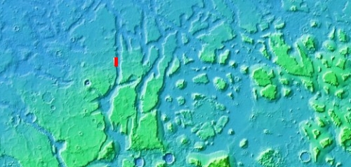
Overview map

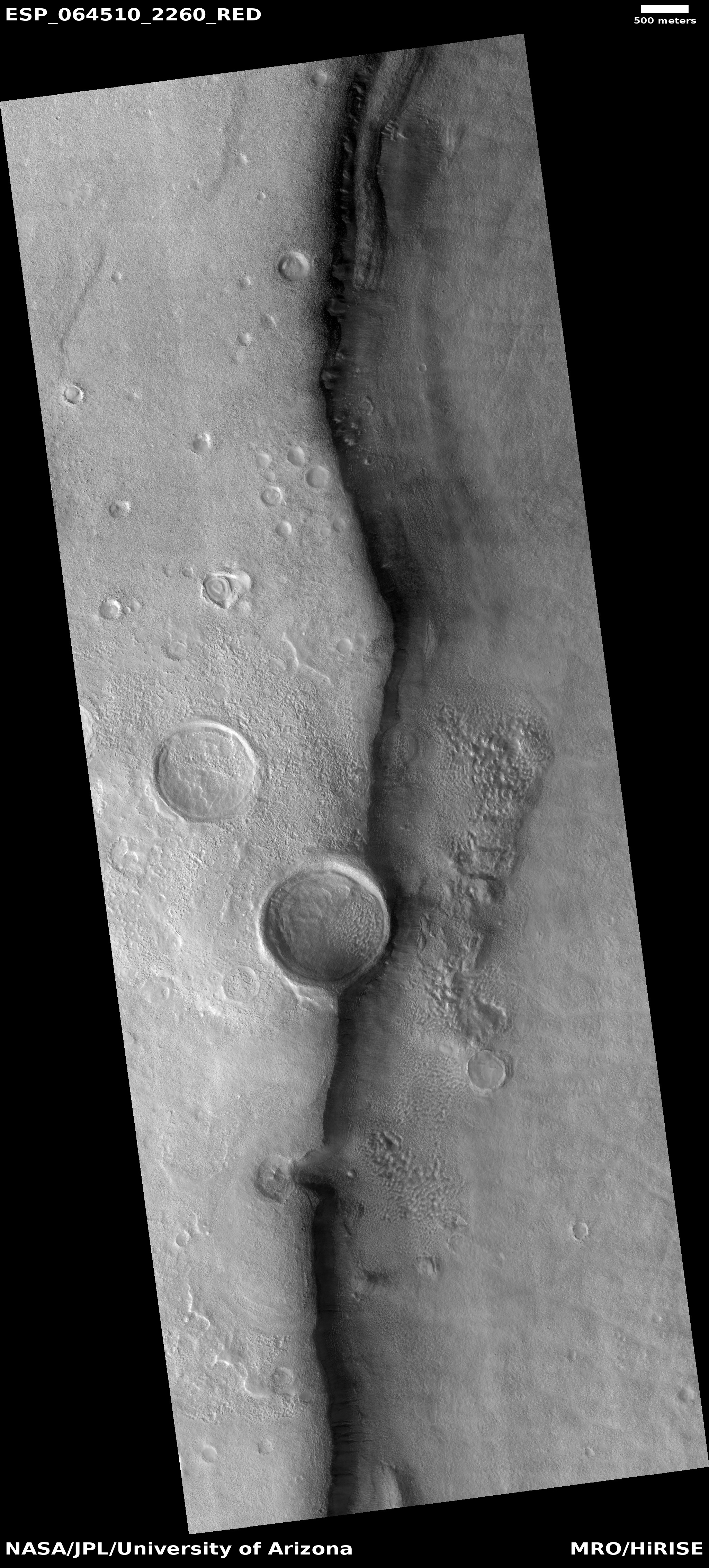
glacial layering in Clasia Vallis
Click for full image.

Cool image time! The photo to the right, rotated, cropped, and reduced to post here, was taken on June 18, 2022 by the high resolution camera on Mars Reconnaissance Orbiter (MRO). It shows what appear to be layered glacial features on the floor of what at first glance appears to be a crater.

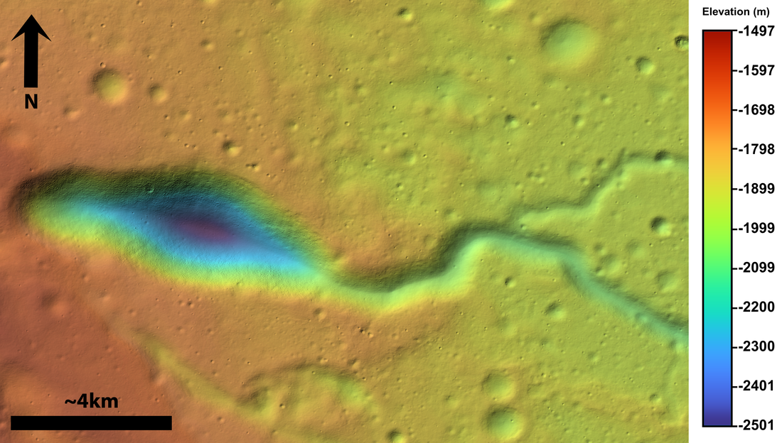
It is not a crater however. The depression in the lower right of this image is the rim and floor of a 77-mile-long meandering canyon on Mars dubbed Clasia Vallis. The red cross in the overview map above marks its location, at 34 degrees north latitude. This channel drains downward from the southern cratered highlands into the 2,000-mile-long mid-latitude strip of mensae terrain that I dub glacier country because almost every hi-res image from this region shows glacial features.

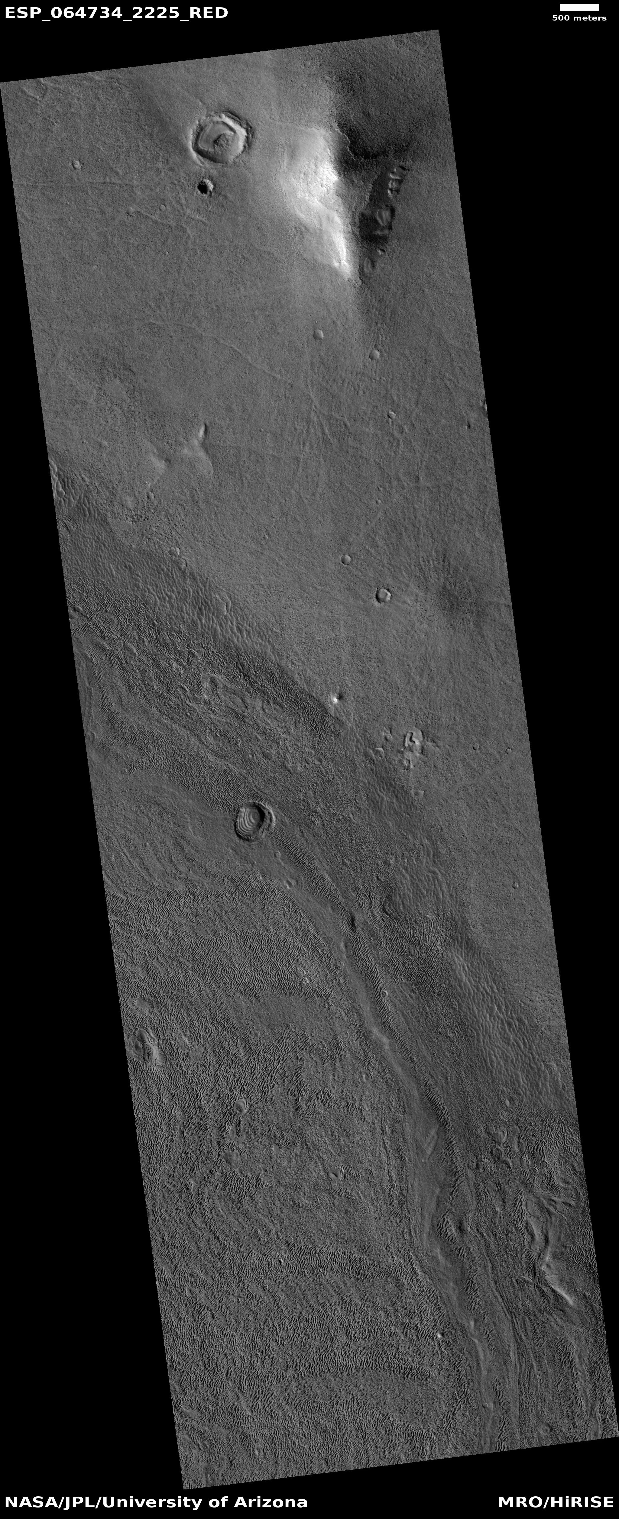
Below is a wider view of Clasia Vallis, taken by the context camera on MRO on March 19, 2014.
» Read more

0 comments

First ground-based telescope view of DART impact on Dimorphus

LICIACube Explorer image of DART impact

We now have the first ground-based images of the DART impact on the 525-foot-wide asteroid Dimorphus yesterday, captured by the Hawaiian telescope ATLAS.

You need to watch the video of the full sequence of images, available here, to get a true sense of the impact. The cloud of material quickly expands to about twice the asteroid’s size, then dissipates away, with the remaining asteroid now appearing larger (?). That larger size could be caused by a remaining cloud of material that still needs to settle back to the surface.

More images have been released by a Chinese telescope. Also, the first images from the Italian cubesat LICIACube Explorer, flying in parallel with DART, have been released. I have posted one to the right. The large blob near the center is the parent half-mile-wide asteroid, Didymos. Dimorphus is buried in the debris cloud above and slightly to the right.

Hat tip stringer Jay for the links to these images.

1 comment

Radar data from Zhurong finds no ice to a depth of 260 feet

Zhurong's ground-penetrating radar data

Overview map

Chinese scientists today finally published their results from the ground-penetrating radar instrument on their Mars rover Zhurong, revealing that to a depth of 260 feet (80 meters), it detected no clear signal of water ice.

Figure 2 of their paper, posted above, summarizes their results. It shows the radar profile to 328 feet (100 meters) depth along Zhurong’s route, as shown in the map to the right, with the last bit of its recent travels ending somewhere in the blue circle. From the paper:

Our low-frequency radar imaging profile shows radar signals within the depth range of 0–80 m (Fig. 2a), precluding the existence of a water-rich layer within this depth range as the existence of water would strongly attenuate the radar signals and diminish the visibility of deeper reflections. The estimated low (less than 9) dielectric permittivity (Fig. 2c) further supports the absence of a water-rich layer as water-bearing materials typically have high (greater than 15) dielectric permittivity.

We further tested this assessment with thermal considerations by conducting a heat conduction simulation based on available thermal parameters estimated from previous studies (Methods). Our thermal simulation results … show that the Zhurong landing area has an annual average temperature of around 220K in the RoPeR detection depth range, which is much lower than the freezing point of pure water (273K), and also lower than the eutectic temperatures of typical sulfate and carbonate brines, but slightly above those of perchlorate brine systems. This observation suggests that the shallow subsurface of the Zhurong landing area could not stably contain liquid water nor sulfate or carbonate brines, consistent with the radar imaging result.

The data suggests that below the surface topsoil layer, the regolith, there are two distinct layers of material that the scientists interpret as possible evidence of past catastrophic floods. That conclusion however is very very uncertain. The main take-away is that in the northern lowland plains of Utopia Planitia at 25 degrees north latitude, where Zhurong landed, Mars is definitely a dry desert, with no water close to the surface.

This data also suggests that if you establish a colony anywhere in Mars’ dry equatorial regions within 30 degrees latitude of the equator, you will likely have to travel north or south a considerable distance to get to easily accessible ice. The global map of Mars below shows the regions where ice is most evident, north and south of 30 degrees latitude.
» Read more

2 comments

DART hits Dimorphus

Didymos and Dimorphus

Dimorphus

The surface of Dimorphus

The probe DART today successfully impacted the small 525-foot-wide asteroid Dimorphus. From the data produced engineers will calculate how much that impact changed Dimorphus’ orbit around it parent asteroid, half-mile-wide Didymos.

The three images to the right give a sense of the approach and impact.

The first, at 2 minutes and 30 seconds from impact, shows Didymos in the left bottom corner. You can actually see individual boulders on its surface. At this distance and resolution is is unclear whether it is a rubble pile or a more solid body. Dimorphus is no longer a mere dot, but no surface features can yet be discerned.

The second image, only seventeen seconds before DART crashed into Dimorphus, shows us the entire asteroid. Though it appears to be a pile of rocks, it also appears less of a rubble pile than both Ryugu and Bennu, visited by probes in 2019 and 2020. Those rubble-piles had almost no smooth surface areas. Dimorphus however at this distance and resolution does appear to have a lot of areas where the surface is relatively smooth, suggesting its structure is more solid than a rubble pile.

At only 525 feet across, some of those bigger boulders are about 50 to 60 feet in diameter.

The white dot in the center of Dimorphus marks the rocks seen in the third image, taken about five seconds before impact. At this resolution so close to the surface, it appears the smooth areas are actually made up of many tiny pebbles and dust.

The biggest rock in the center of the picture is probably between ten to twenty feet in diameter.

The primary data from this mission will not be available for a few weeks. Scientists have to observe both asteroids to see how much, if at all, Dimorphus’s orbit was shifted by the impact. Also, the images from the Italian cubesat, LICIACube Explorer, which was flying parallel to DART and taking pictures of the impact, plume, and back side of Dimorphus, won’t be available until later this week. Those images should give us a measure of the spacecraft’s effect on the asteroid. They will also reveal a lot more about the asteroid’s geology.

12 comments

Zig-zag ridges on Mars

Zig-zag ridges on Mars
Click for full image.

Cool image time! The photo to the right, cropped and reduced to post here, was taken on April 9, 2022v by the high resolution camera on Mars Reconnaissance Orbiter (MRO). It shows a series of parallel zig-zag ridges in a flat, knobby terrain.

I don’t presume to explain this at all. According to one research paper,

This interplana region consists of extensive networks of ridges—the eponymous Aeolis Dorsa—and is interpreted as having formed by topographic inversion of fluvial and alluvial deposits.

Why these ridges zig-zag however does not seem to fit into either a fluvial or alluvial explanation, both of which involve the flow of water. The quote implies these could be inverted stream channels (where the compacted streambed becomes a ridge when the surrounding terrain erodes away), but once again, the distinct zig-zag pattern seems wrong. Rivers meander, but they don’t generally turn right and left so sharply. And why should we see parallel zig-zags? This doesn’t seem to fit with a river channel origin.

The particular location, as shown on the overview map below, is close to the dry Martian equator, on the edge of Medusae Fossae Formation, the largest field of volcanic ash dust on Mars.
» Read more

1 comment

A galaxy slowly being eaten by its black hole

Spiral galaxy
Click for full image.

Cool image time! The photo to the right, rotated and reduced to post here, was taken by the Hubble Space Telescope. From the caption:

NGC 5495, which lies around 300 million light-years from Earth in the constellation Hydra, is a Seyfert galaxy, a type of galaxy with a particularly bright central region. These luminous cores — known to astronomers as active galactic nuclei — are dominated by the light emitted by dust and gas falling into a supermassive black hole. This image is drawn from a series of observations captured by astronomers studying supermassive black holes lurking in the hearts of other galaxies.

Essentially Seyfert galaxies are galaxies whose central supermassive black hole has become dominant, large enough that its gravity is slowly eating up the rest of the galaxy. As it increasingly swallows stars and gas, the black hole emits more and more energy, thus becoming an active galactic nuclei.

Two stars from our own galaxy also dominate this picture, one inside and to the right of the galaxy’s center, and the other the bright star at the bottom of the picture, both identified by the diffraction spikes.

1 comment

Watch DART smash into asteroid today

At 7:14 pm (Eastern) the NASA’s Double Asteroid Redirection Test (DART) spacecraft will crash into the small and harmless asteroid Dimorphus to see if such an impact could be used in the future to change the path of another asteroid aimed at Earth.

Dimorphus is 525 feet in diameter, and is a small moon of the larger half-mile-wide asteroid Didymos. Both are presently about 7 million miles away from Earth.

I have embedded the live streams below, one from a DART camera, dubbed DRACO, that will view the asteroid as the spacecraft approaches, and the other from NASA’s official live stream. From the DRACO live stream webpage:
» Read more

1 comment

Ganymede as seen by Juno

Ganymede as seen by Juno
Click to see full image.

Cool image time! The picture to the right, cropped and reduced to post here, was taken on June 7, 2021 when Juno made a close fly-by of Jupiter’s moon Ganymede. It has been reprocessed to bring out the details by citizen scientist Brian Swift.

Note the bands and parallel light and dark ridges that criss-cross the planet. Scientist as yet do not understand what caused them. Note also the bright impact craters, suggesting the release of water ice from below.

This image anticipates Juno’s upcoming September 29, 2022 fly-by of Europa, one of Jupiter’s other Galilean moons. The orbiter will pass only 221 miles above its surface, and get the best images in decades, since the Galileo mission in the 1990s.

3 comments

Above ground and underground Martian drainages

Overview map

Cool image time! Today we are going to zoom into our cool image. The overview map to the right provides us the context. Our target is the small white rectangle inside the small box just below the north rim of 185-mile-wide Newton Crater, located 200 to 800 miles from the southwest edge of the lava plains dubbed Daedalia Planum that flowed down from Mars’s biggest volcanoes.

Newton Crater has a number of interesting features. Only two weeks ago I featured 4-mile-wide Avire Crater in Newton’s western quadrant, long known to have many gullies on its interior slopes as well as glacier features on its floor. Scientists have been monitoring those gullies now for more than a decade to see if they change seasonally, in a attempt to figure out their cause.

Today’s cool image looks at the very intriguing meandering canyons that appear to flow south from Newton’s north rim.
» Read more

0 comments

A hot wave in Jupiter’s upper atmosphere has been discovered, flowing away from the pole

Jupiter heat wave

Using data obtained by ground-based telescopes, scientists have discovered a hot wave, with temperatures in the range of 700 degrees Celsius (about 1,300 degrees Fahrenheit), rolling outward from Jupiter’s hot polar atmospheric regions, believed caused by the gas giant’s intense aurora.

Jupiter’s atmosphere, famous for its characteristic multicoloured vortices, is also unexpectedly hot: in fact, it is hundreds of degrees hotter than models predict. Due to its orbital distance millions of kilometres from the Sun, the giant planet receives under 4% of the amount of sunlight compared to Earth, and its upper atmosphere should theoretically be a frigid -70 degrees Celsius. Instead, its cloud tops are measured everywhere at over 400 degrees Celsius.

…Just like the Earth, Jupiter experiences auroras around its poles as an effect of the solar wind. However, while Earth’s auroras are transient and only occur when solar activity is intense, auroras at Jupiter are permanent and have a variable intensity. The powerful auroras can heat the region around the poles to over 700 degrees Celsius, and global winds can redistribute the heat globally around Jupiter.

The graphic above, adapted from the research presentation [pdf], shows that wave propagating away from the pole. The wave’s width is about the size of the Earth, with different sections moving from about 1,000 feet per second to 8,000 feet per second.

1 comment
1 166 167 168 169 170 729