
The source of a Martian glacial canyon 750 miles long

Click for original image.
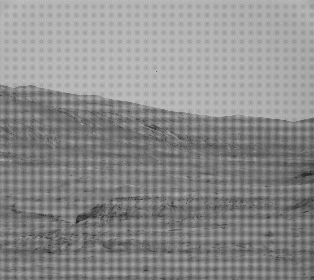
Cool image time! The picture to the right, cropped, reduced, sharpened, and brightened to post here, was taken on May 1, 2025 by the high resolution camera on Mars Reconnaissance Orbiter (MRO).
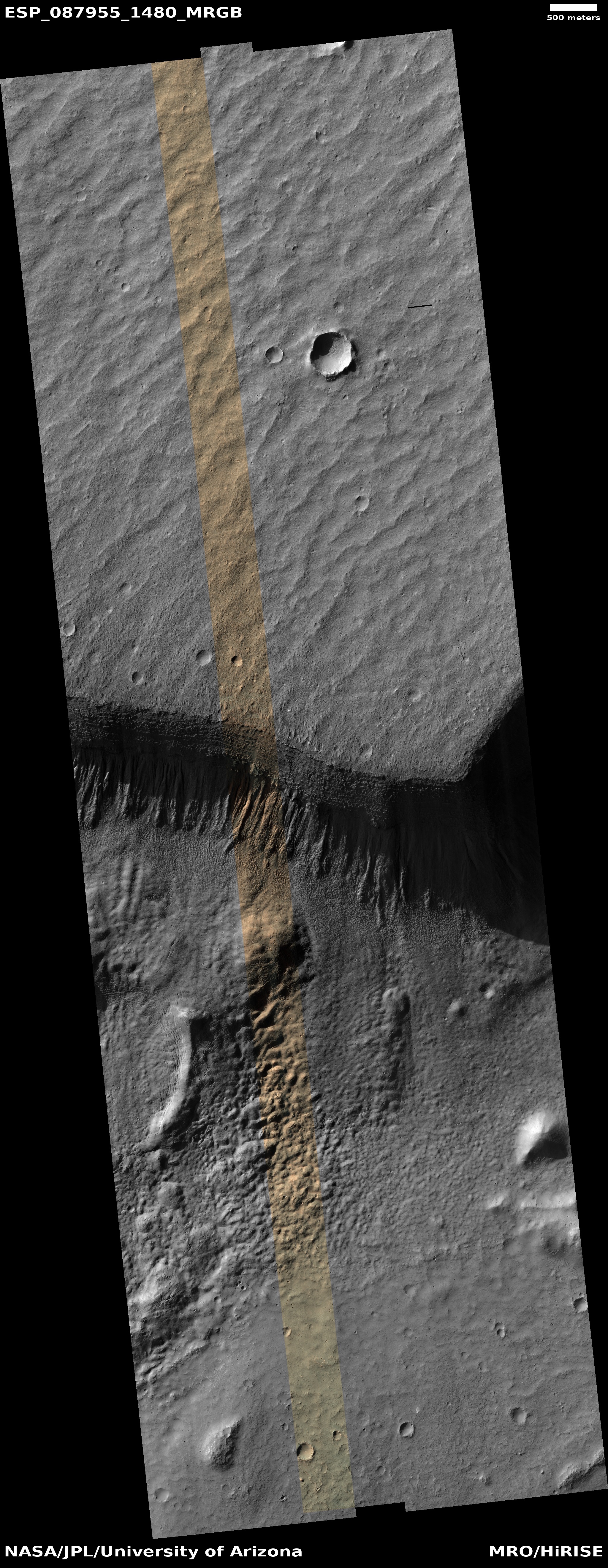
The scientists label this very simply as a “wall on Ausonia Cavis”. Ausonia Cavis — 31 miles long and 20 miles wide at its widest — is one of the many gigantic sinks found in many places on Mars. This particular cliff wall is about 2,000 feet high, though from rim to floor of the sink is closer to 3,000 feet.
The image was likely taken to get a closer look at those gullies flowing down the cliff wall. Previous research of similar cliff walls in this region has found what appears to be seasonal water frost in such gullies, and this image was likely taken to see if more such frost could be spotted here as well.
» Read more
Click for original image.
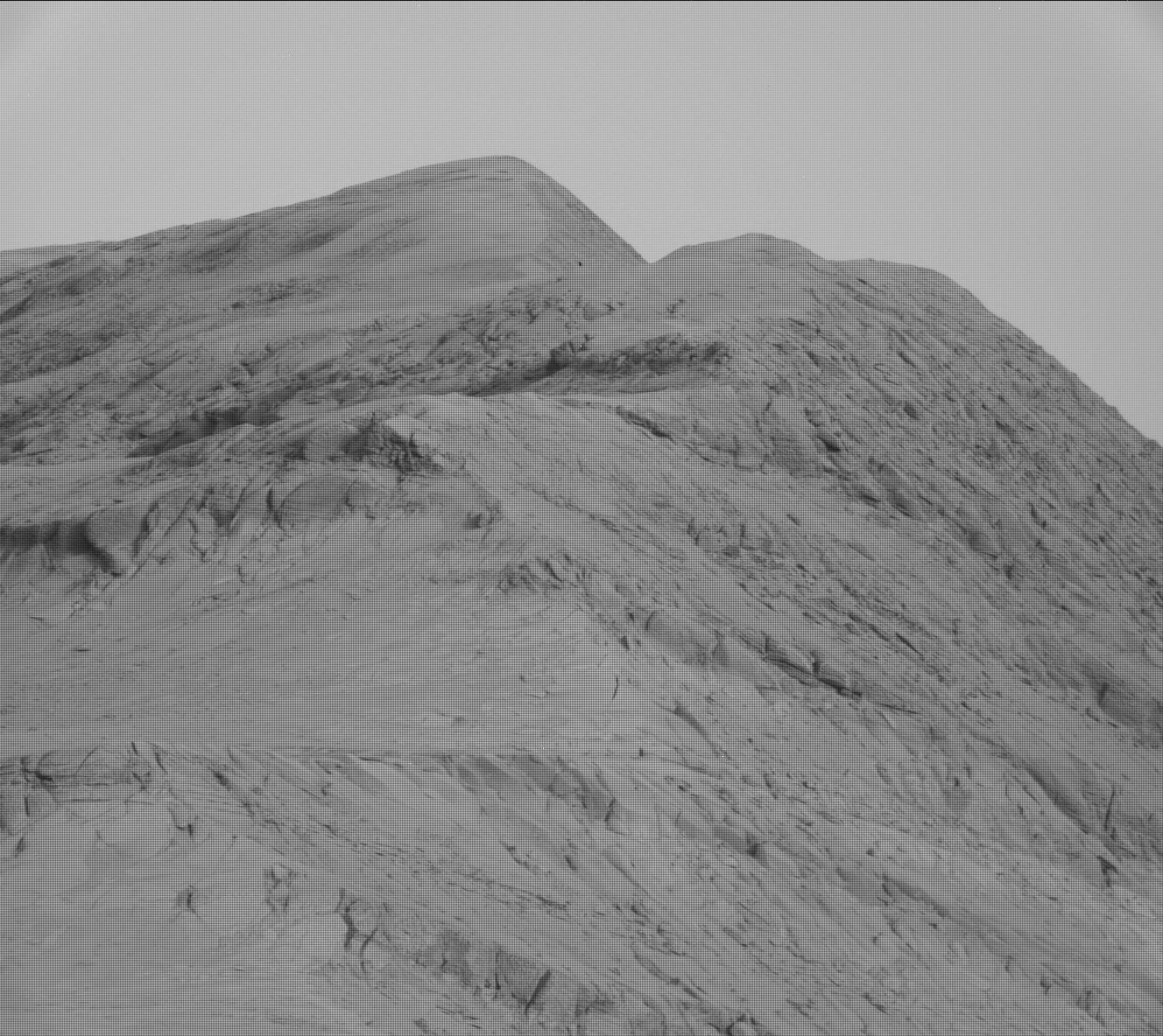
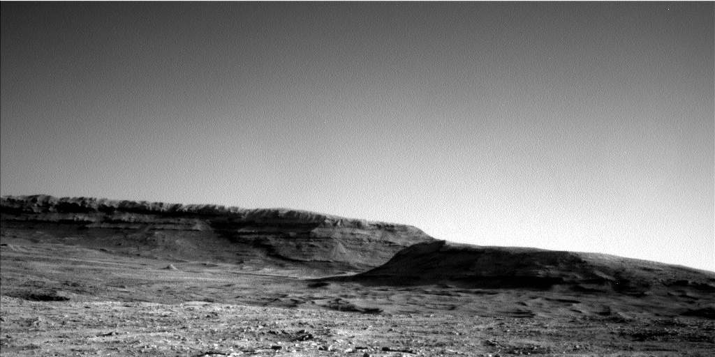
Cool image time! The picture to the right, cropped, reduced, sharpened, and brightened to post here, was taken on May 1, 2025 by the high resolution camera on Mars Reconnaissance Orbiter (MRO).
The scientists label this very simply as a “wall on Ausonia Cavis”. Ausonia Cavis — 31 miles long and 20 miles wide at its widest — is one of the many gigantic sinks found in many places on Mars. This particular cliff wall is about 2,000 feet high, though from rim to floor of the sink is closer to 3,000 feet.
The image was likely taken to get a closer look at those gullies flowing down the cliff wall. Previous research of similar cliff walls in this region has found what appears to be seasonal water frost in such gullies, and this image was likely taken to see if more such frost could be spotted here as well.
» Read more


