
An icy Martian crater filled with brain terrain

Click for original image.
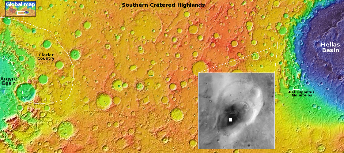
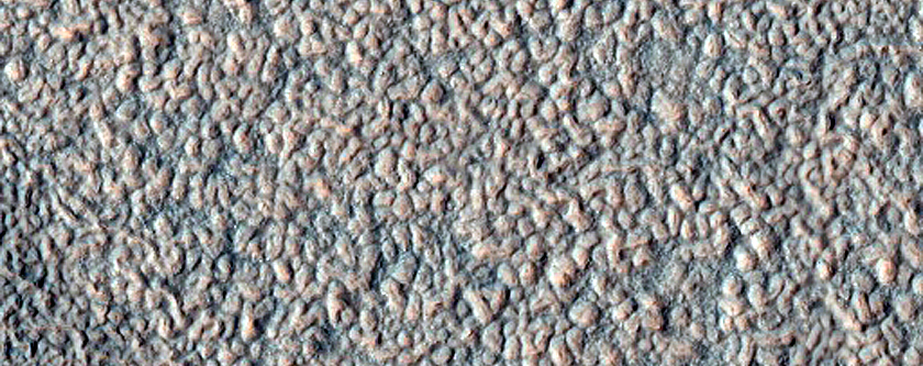
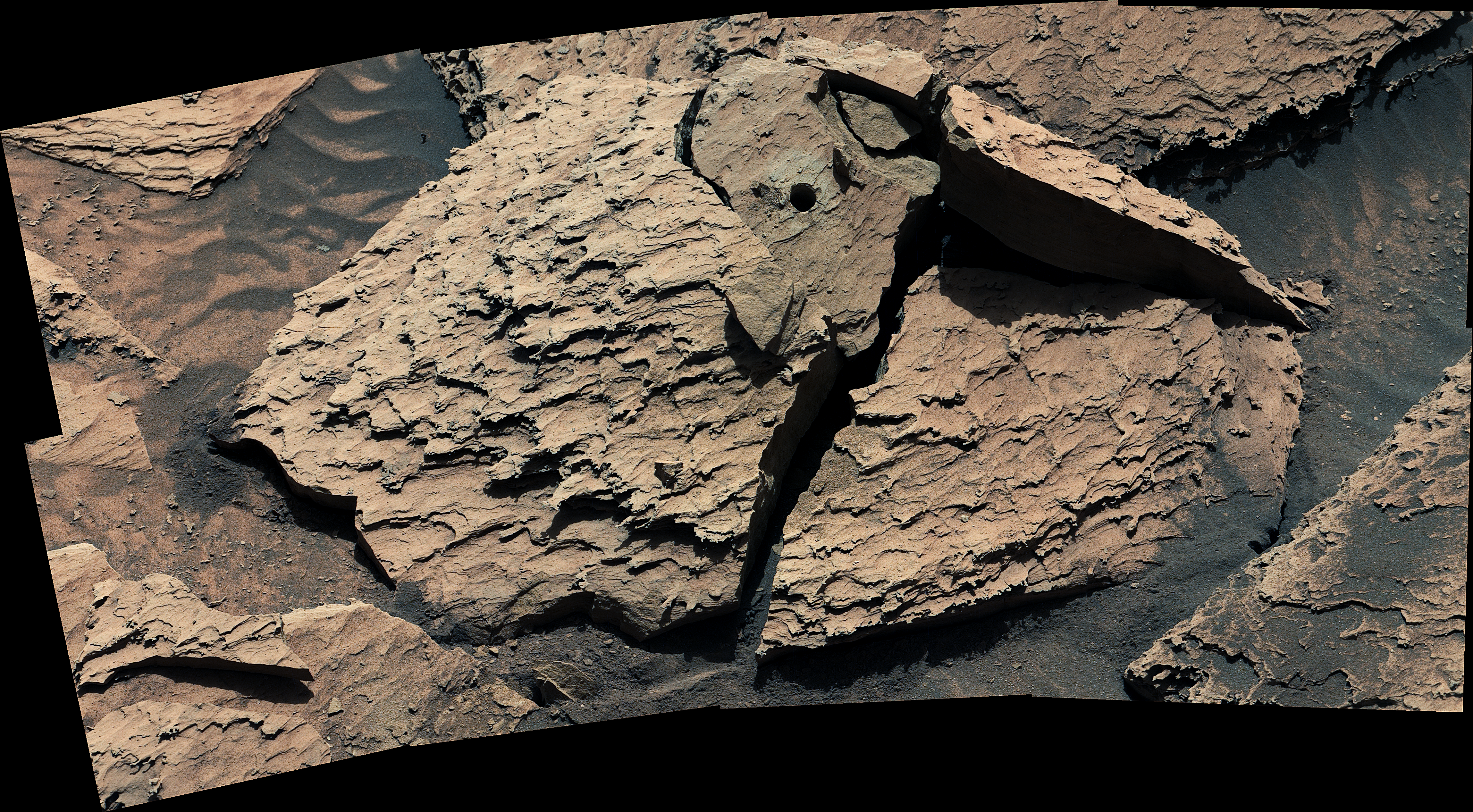
Cool image time! The picture to the right, rotated, cropped, and reduced to post here, was taken on March 26, 2026 by the high resolution camera on Mars Reconnaissance Orbiter (MRO). It shows what the scientists label an “ice-rich crater fill.”
And yup, that’s what we got. The floor of this 2.8-mile-wide unnamed crater is filled with what planetary scientists have labeled brain terrain, a feature found only on Mars that they associate with the sublimation of near surface ice, but as yet do not fully understand its entire formation process. In the upper right is a full resolution inset of that brain terrain, to give a good sense of its strange nature.
On that floor there are also several small fresh impact craters, as well as older small impacts that have faded almost to obscurity due to that mysterious process forming the brain terrain.
Its iciness of the terrain is also indicated by the rim of the crater, which is distorted as well as blobby. At impact or subsequently the ground here was soft like mud, and thus easy to shape into these cushioned features. Thus, though the rim was almost certainly circular after impact, time and the muddy nature of this ground allows it to get bent and warped.
Nor is it surprising there is near surface ice at this location. We are at 41 degrees south latitude, well away from the dry Martian tropics. This picture simply provides more evidence that once you get above 30 degrees latitude, it will not be hard to find water on Mars.
» Read more


.jpg)