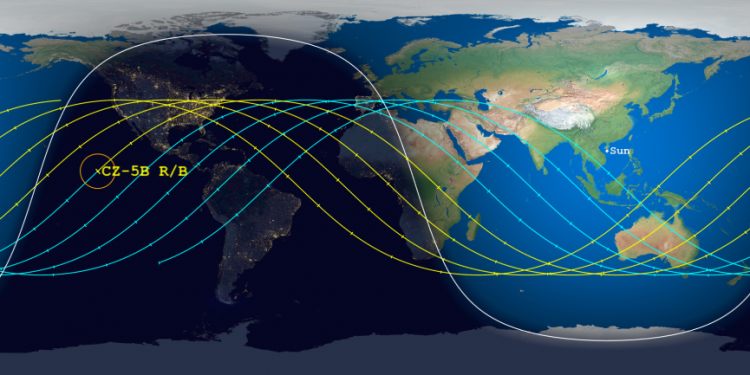

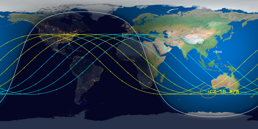
The reentry window of the 21-ton core stage for China’s Long March 5B rocket, launched on April 29th, has now narrowed to only 28 hours, with the centerpoint of that window on May 9th over the Pacific, only about 20 minutes before reaching Mexico and the continental U.S.
The update by the Aerospace Corporation is shown in the maps above and to the right. With the right map I have zoomed into the section over the U.S. to show the potential path of this core stage should it come down a bit later than presently predicted.
The circled point is centerpoint of the reentry window. The yellow orbital tracks are after that point, with the blue tracks previous. The tick marks indicate 15-minute intervals.
As you can see, the centerpoint is only about 20 minutes before the stage crosses Mexico and begins a half hour traverse above the continental United States from Texas to Maryland. If the stage should manage to stay up for another full orbit it will once again traverse the continental U.S., this crossing from San Diego to Cape Cod.
If the stage comes down early instead it could land anywhere from southern Europe to Australia, with the Middle East and India in between.
As I have noted already, China designed and launched this rocket knowing it was creating a giant piece of space junk that was going to fall on someone’s head. Just as that communist government has not cared that it has been dumping first stages on its own people for decades, it apparently does not care that it is dumping even bigger first stages on everyone else. The Long March 5B is the rocket they are using to launch the modules to their space station, as well as many of the future planetary missions to the Moon and Mars. And every time they launch it they will be dumping a core stage on someone, a direct violation of the Outer Space Treaty that China has signed.
The world’s governments should be outraged, and teaming up to demand that either China change this situation or delay future Long March 5B launches, or face serious financial consequences. Sadly, I do not expect this, as our present political class is either incompetent or corrupt and in the deep financial pockets of the Chinese.


