
A chain of Martian sinkholes
Click for full image.
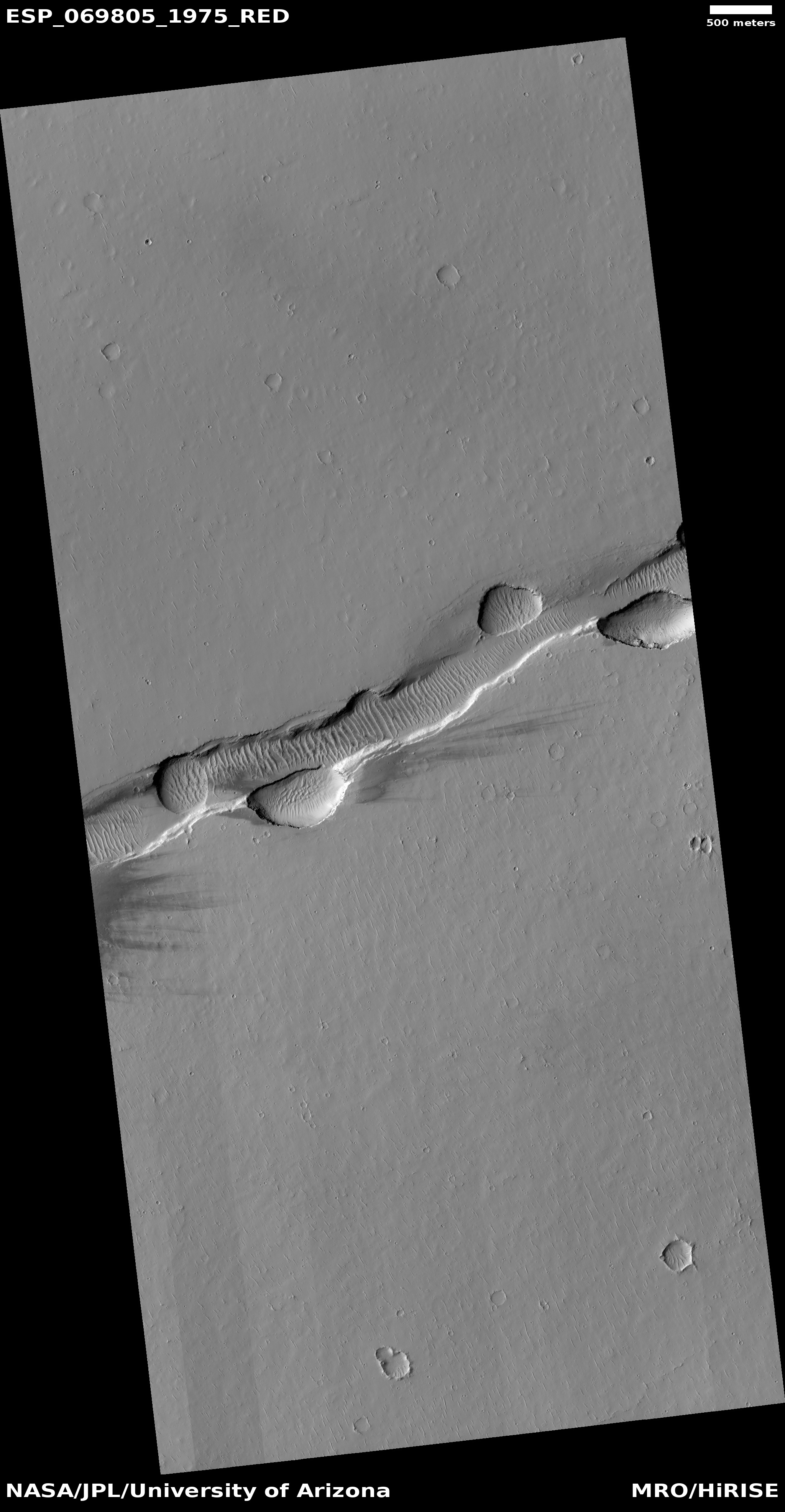
Cool image time! The photo to the right, rotated, cropped, and reduced to post here, was taken on June 17, 2021 by the high resolution camera on Mars Reconnaissance Orbiter (MRO). It shows a somewhat straight depression with several wider and deeper pits along it.
The feature immediately suggests sinkholes that exist because the ground is sagging into voids below ground. Yet, both the straight and circular depressions also appear filled, showing no evidence that they connect to any below ground cavities.
Are the sinks the result of a fissure produced by a graben, when two large blocks shift relative to each other to cause a fissure to appear? Or are they evidence of an underground lava tube? Or maybe they are the filled remains of a now mostly buried canyon carved by water or ice?
As always, a wider view helps clarify things, though whether it answers the question is uncertain.
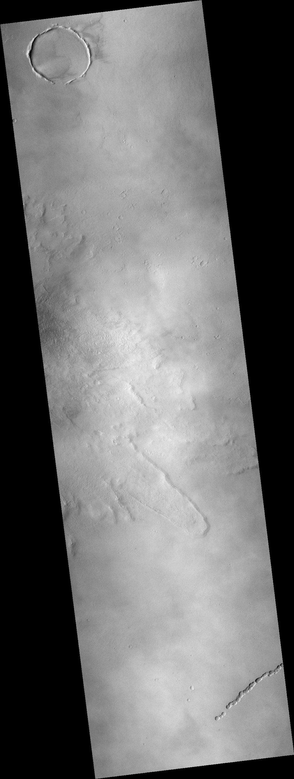
To see full images, go here and here.
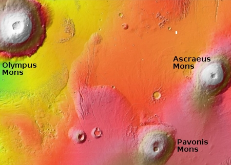
The overview map to the right, with the photo’s location indicated by the white rectangle, shows that this depression is located in the Tharsis Bulge, the region on Mars where its largest volcanoes are found. To the southeast is Ascraeus Mons, Mars second largest volcano, about 600 miles away. To the west about 1,900 miles away is Olympus Mons, Mars’ largest.
Thus, the feature is not likely a flow feature carved by water or ice. The altitude is too high, almost all the geological features here are volcanic, and the latitude, 17 degrees north, is in the Martian dry equatorial regions where little evidence of surface water or ice is found.
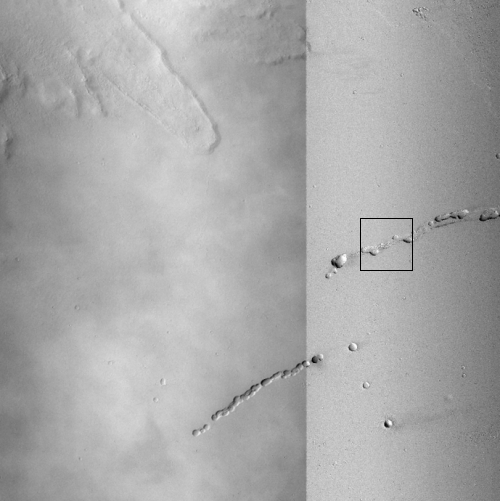
The second image to the right, created by me from two MRO context camera images, shows a wider view of this region. The black rectangular marks the area covered by the photo above.
As you can see, there are two pit chains in this area. They are parallel to each other but also appear have formed separately. Based on the lobate flow to the northwest that resembles very much frozen lava, both chains run in a direction that seems at right angles to the downhill grade.
Based on the wider images and the location, my guess therefore is that these depressions signal a graben, fissures created along a fault. The sinks suggest that the fissures are not entirely filled, but have some voids below in which the surface dust and debris is sinking.
What is most puzzling about these features is their isolation. If formed from faults, you would expect the faults to be more extensive. Instead, the two cracks are relatively small features on a smooth flat lava plain.

On Christmas Eve 1968 three Americans became the first humans to visit another world. What they did to celebrate was unexpected and profound, and will be remembered throughout all human history. Genesis: the Story of Apollo 8, Robert Zimmerman's classic history of humanity's first journey to another world, tells that story, and it is now available as both an ebook and an audiobook, both with a foreword by Valerie Anders and a new introduction by Robert Zimmerman.
The print edition can be purchased at Amazon or from any other book seller. If you want an autographed copy the price is $60 for the hardback and $45 for the paperback, plus $8 shipping for each. Go here for purchasing details. The ebook is available everywhere for $5.99 (before discount) at amazon, or direct from my ebook publisher, ebookit. If you buy it from ebookit you don't support the big tech companies and the author gets a bigger cut much sooner.
The audiobook is also available at all these vendors, and is also free with a 30-day trial membership to Audible.
"Not simply about one mission, [Genesis] is also the history of America's quest for the moon... Zimmerman has done a masterful job of tying disparate events together into a solid account of one of America's greatest human triumphs."--San Antonio Express-News
Cool and very curious for sure! Another puzzling aspect is the clear wind-driven dunes in the depressions (maybe graben), and the streaks on the mesa just south of the linear depression, indicating wind generally west-to-east. Then on the surrounding mesa, the only features that appear wind-shaped are the many very small linear structures oriented north-northeast. Not sure what they could be.