
More Martian pits, filled and unfilled!
Click for full image.
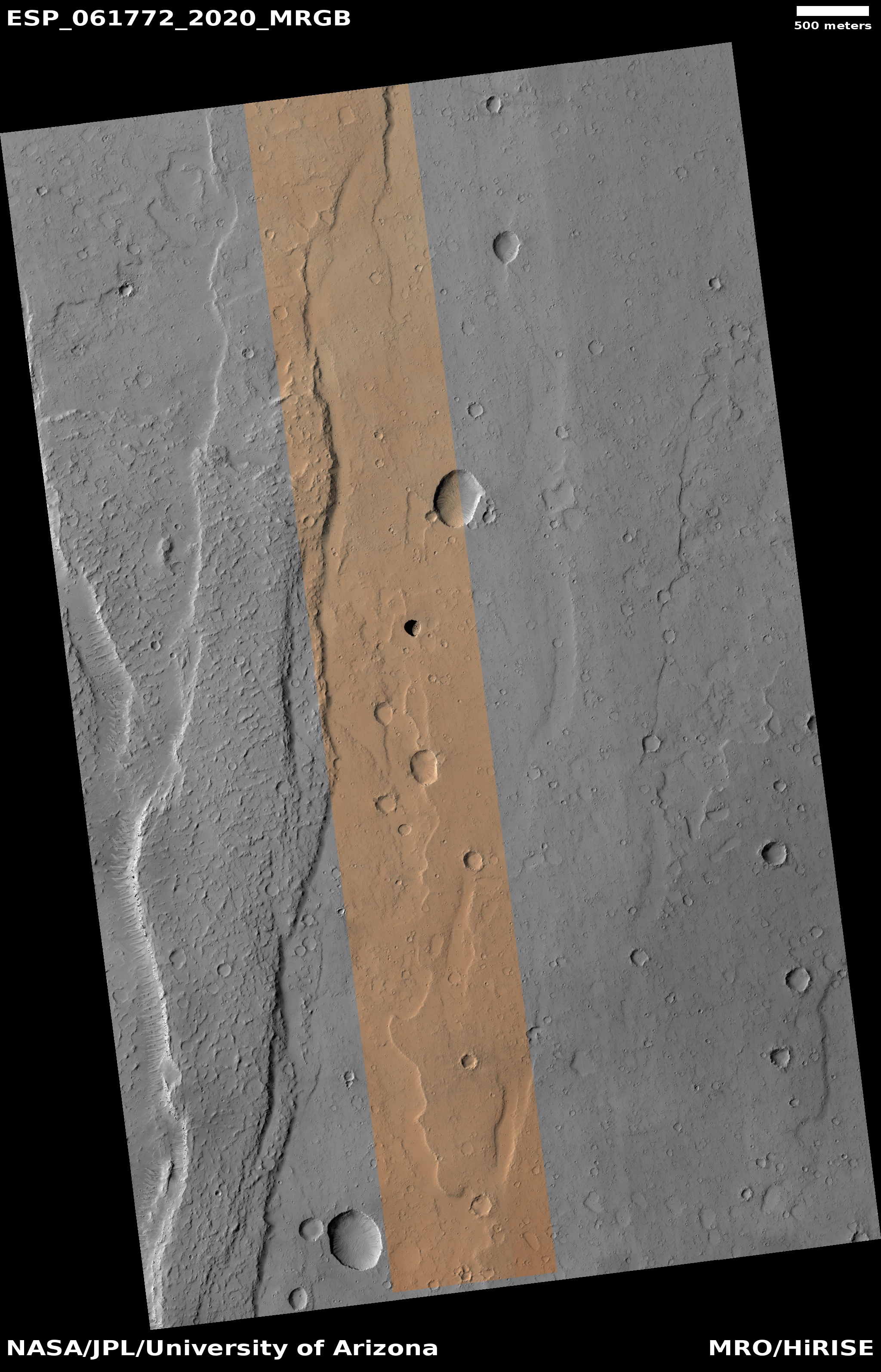
Time for what has almost become a monthly pit report from Mars Reconnaissance Orbiter (MRO). The November image download from the spacecraft’s high resolution camera included two pit-related photographs, both very different. To the right is the first, cropped to focus on the pit and the immediate surrounding terrain. Below that is a wider overview map to provide the context.
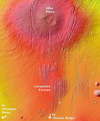
This pit’s location is indicated by the white box at the southern end of a region dubbed Ceraunius Fossae, made of hundreds and hundreds of parallel north-south fissures extending more than seven hundred miles south of the giant volcano Alba Mons and caused when the ground was stretched from below, causing it to crack.
This surrounding terrain helps to explain the pit’s origin. First it is located in a north-south depression with a number of other less pronounced depressions. While these do not line up precisely, they still suggest that they are sinkholes where the surface material is draining downward into voids below. Normally the assumption would be the existence of a lava tube, but here the downward grade is very small. Instead, what is likely happening is that the ground is being stretched, causing cracks to form into which surface material slips downward.
The Ceraunius Fossae fractures are extensional features produced when the crust is stretched apart…. Mechanical studies indicate that a regional pattern of radiating graben and rifts is consistent with stresses caused by loading of the lithosphere by the enormous weight of the Tharsis bulge….Several generations of grabens with slightly different orientations are present in Ceraunius Fossae, indicating that stress fields have changed somewhat over time.
In addition to producing normal faults and graben, extensional stresses can produce dilatant fractures or tension cracks that can open up subsurface voids. When surface material slides into the void, a pit crater may form. Pit craters are distinguishable from impact craters in lacking raised rims and surrounding ejecta blankets. On Mars, individual pit craters can coalesce to form crater chains (catenae) or troughs with scalloped edges.
That’s what we see here. The pit is suggestive of a void below, but it is likely not going to be a long coherent underground passage but a serious of random gaps, aligned roughly along the larger crack and producing the various depressions on the surface.
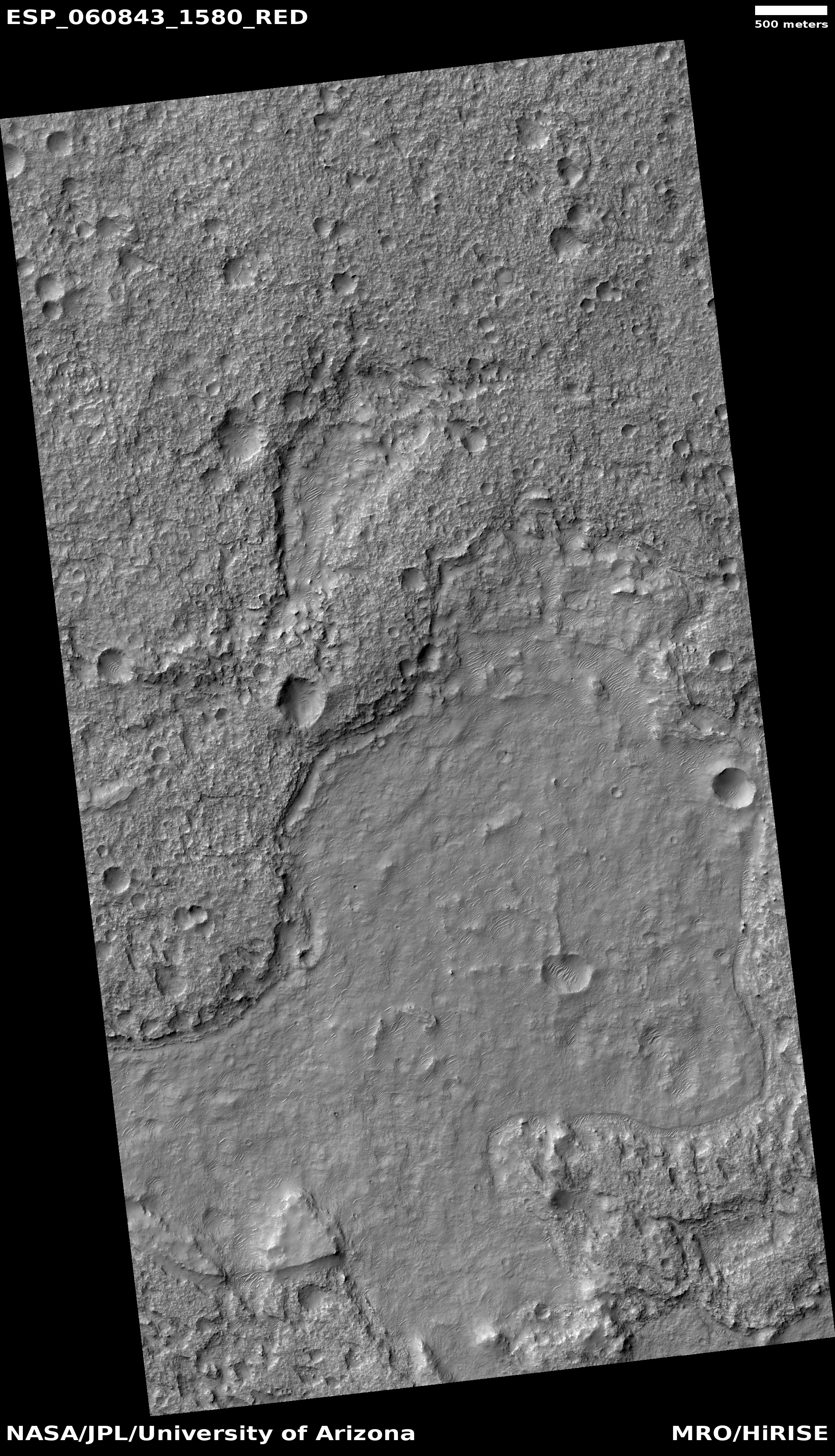
Today’s second pit is of an entire different nature.
Click for full image.
Click for full image.
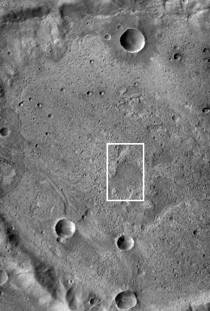
The image to the right, rotated, cropped, and reduced to post here, shows this “pit,” labeled by the MRO science team as “Pit Fill at Terminus of Alluvial Fan.” This feature is located in the cratered southern highlands just north of Hellas Basin, where the ground is just beginning its descent into this lowest point on the Martian surface.
Normally alluvial fill is made up of loose debris, such as avalanche scree, that drops from higher elevations to slowly fill the lower slopes of a mountain or plain. In this case we have an alluvial fan, where the material has been pushed downward by some liquid flow.
[On Earth] alluvial fans form where fast-flowing mountain streams meet the valley floors of basins such as the Wet Mountain and San Luis valleys. Because of reduced gradients of the streams at the base of the mountains, deposition of sediment occurs and alluvial fans are formed.
The wider image, taken by the wide angle context camera on MRO, helps show us what has happened here. I have rotated it to match the first image, with the white rectangle showing the image’s location.
It appears that the pit or depression formed in the far past. Over time, a flow downhill from the higher elevations to the west pushed material down the grade to produce an alluvial fan, which terminated at this pit depression, filling it. Later crater impacts can be seen on top of everything.
What flowed? It could have been lava. It might have been water, but that is more speculative, as this location is at about 22 degrees south latitude, quite close to the equator where not a lot of evidence of subsurface water ice has so far been found.
The image suggests to me lava, but don’t put much money on that guess.
What caused the pit or depression? That involves geological processes partly buried by the flow. Getting a handle on those earlier events probably requires more data from the site that we probably can’t get until we are walking there, with the Martian version of a geologist’s hammer.

On Christmas Eve 1968 three Americans became the first humans to visit another world. What they did to celebrate was unexpected and profound, and will be remembered throughout all human history. Genesis: the Story of Apollo 8, Robert Zimmerman's classic history of humanity's first journey to another world, tells that story, and it is now available as both an ebook and an audiobook, both with a foreword by Valerie Anders and a new introduction by Robert Zimmerman.
The print edition can be purchased at Amazon or from any other book seller. If you want an autographed copy the price is $60 for the hardback and $45 for the paperback, plus $8 shipping for each. Go here for purchasing details. The ebook is available everywhere for $5.99 (before discount) at amazon, or direct from my ebook publisher, ebookit. If you buy it from ebookit you don't support the big tech companies and the author gets a bigger cut much sooner.
The audiobook is also available at all these vendors, and is also free with a 30-day trial membership to Audible.
"Not simply about one mission, [Genesis] is also the history of America's quest for the moon... Zimmerman has done a masterful job of tying disparate events together into a solid account of one of America's greatest human triumphs."--San Antonio Express-News
When I first looked at the lava field around Olympus Mons, I saw the the large low incline lava around the mountain proper. I came the the conclusion that the lava coming out was very hot and that Mars was hot at the time. This explained how the lava could travel so far and still remain liquid.