
The insane terrain inside Mars’ Death Valley

Click for original image.
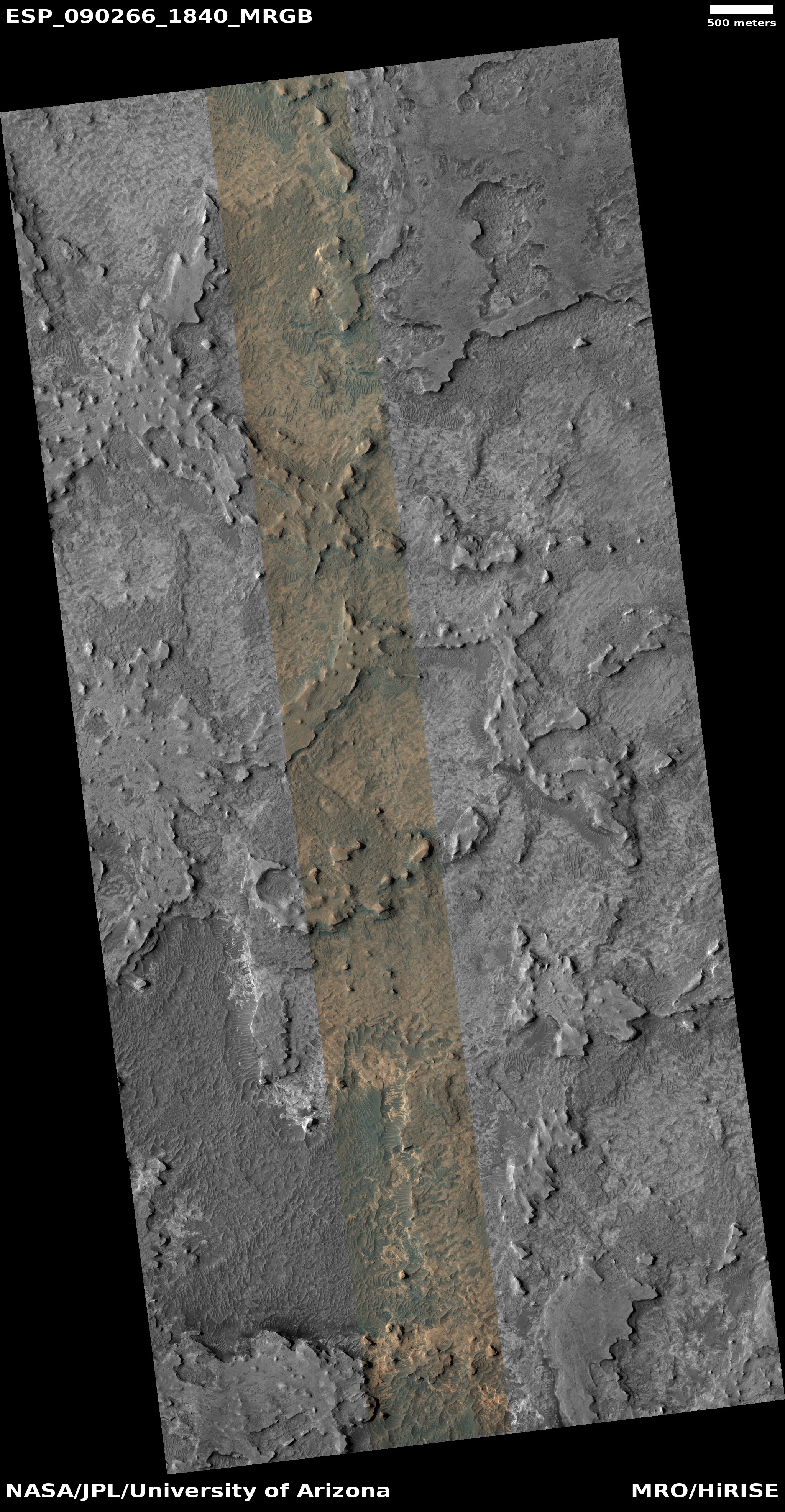
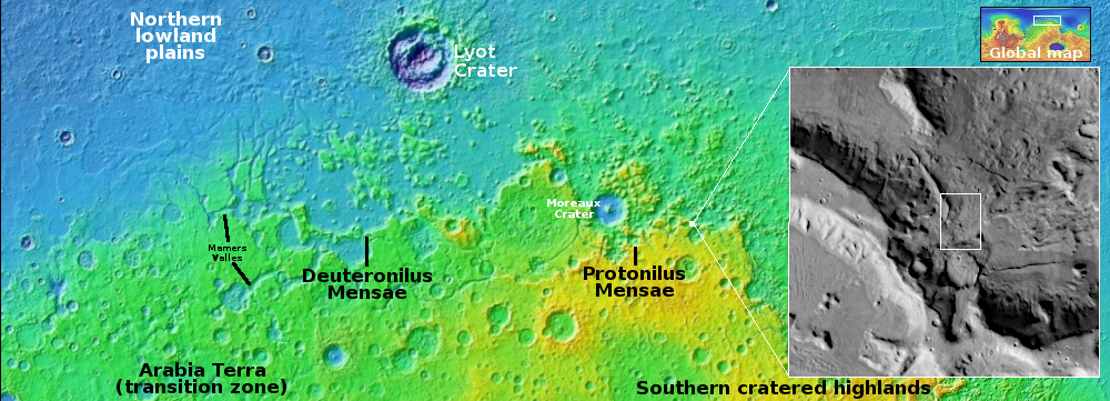
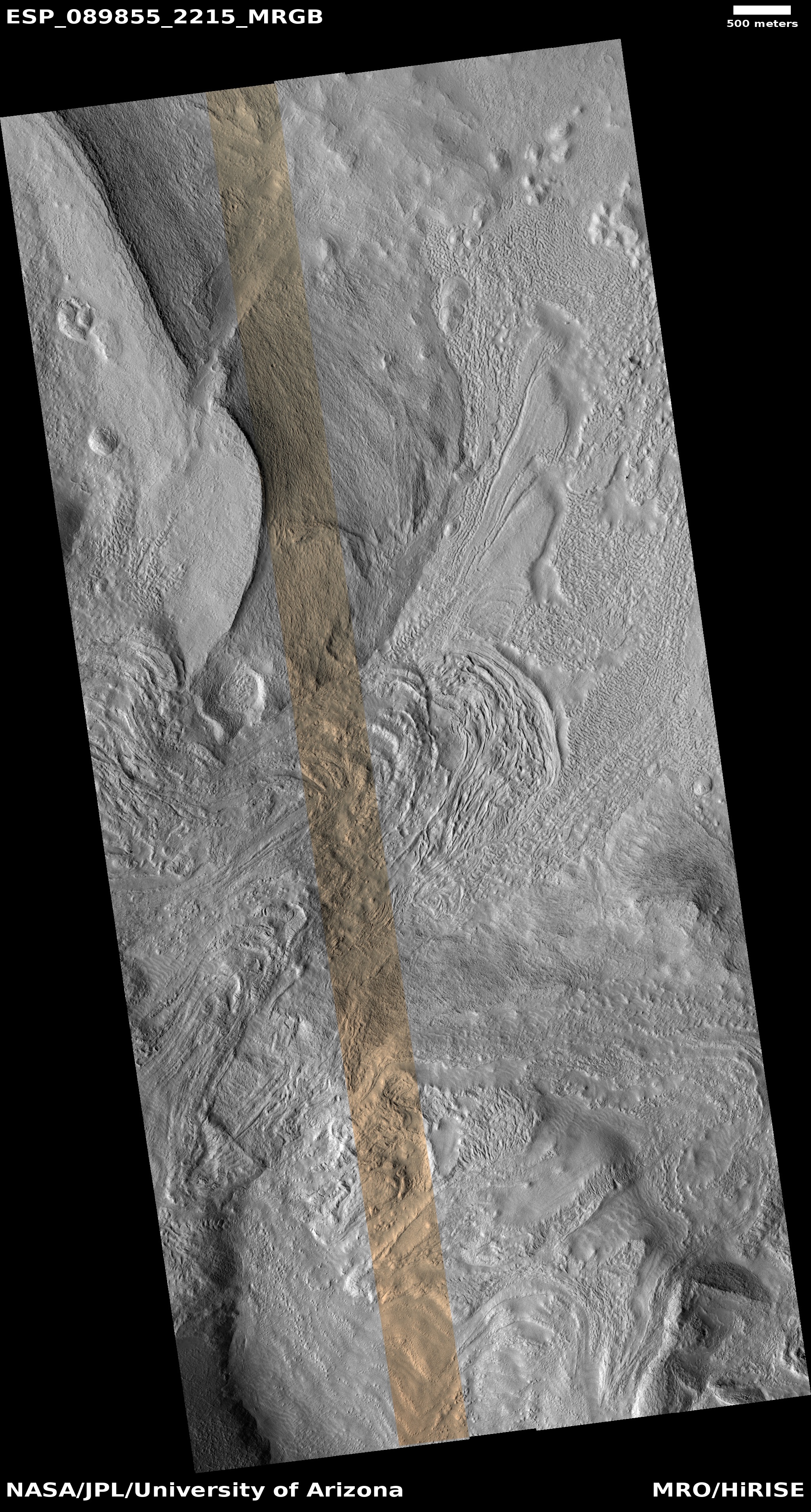
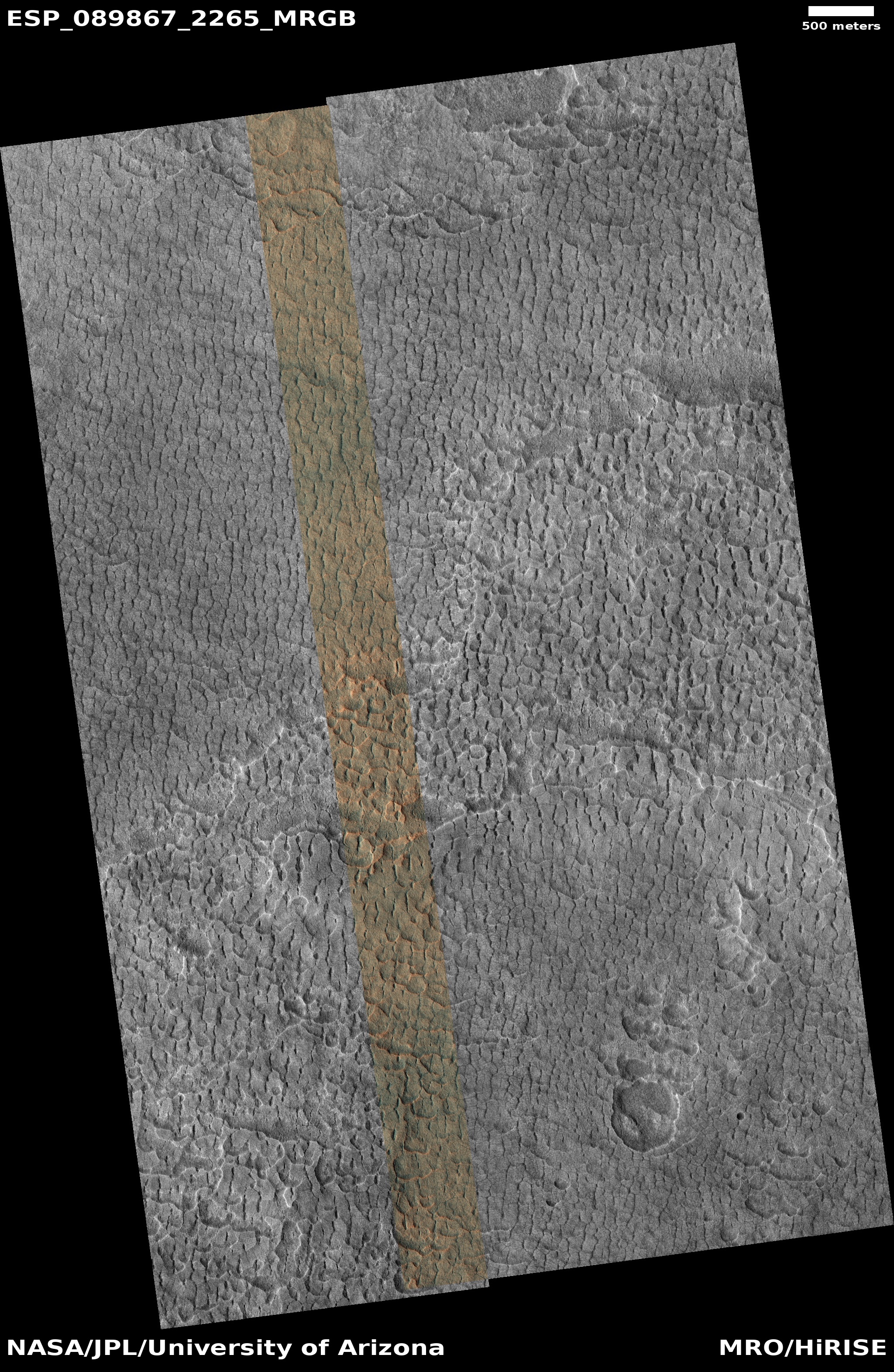
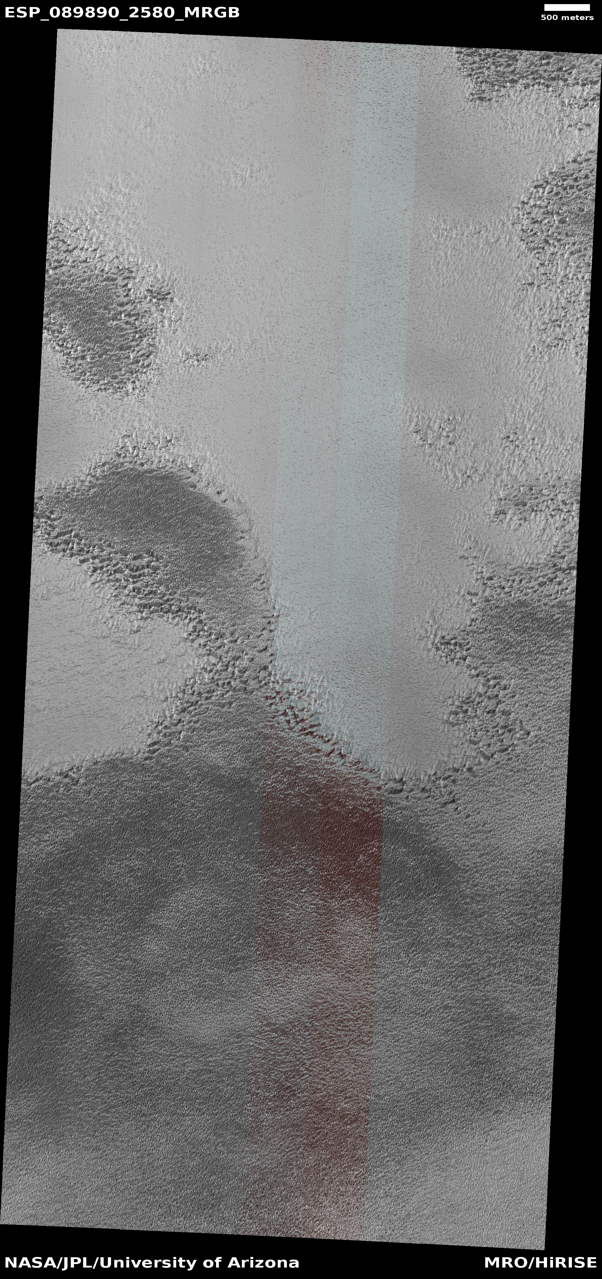
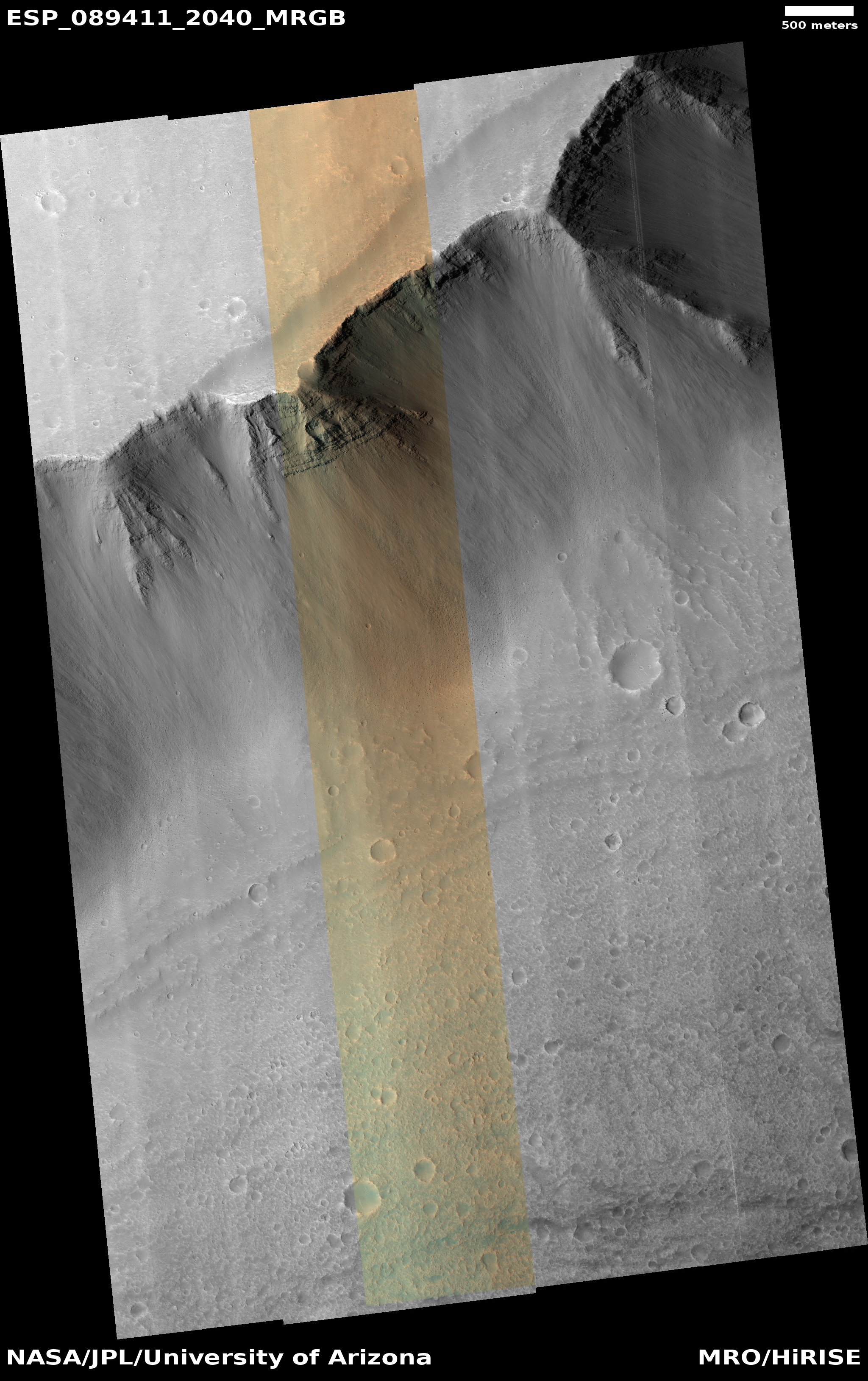
Cool image time! The picture to the right, cropped, reduced, and sharpened to post here, was taken on October 27, 2025 by the high resolution camera on Mars Reconnaissance Orbiter (MRO).
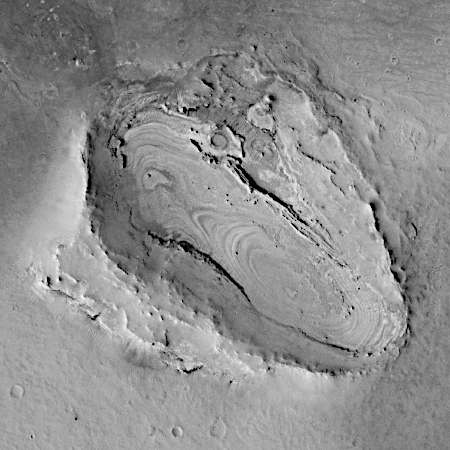
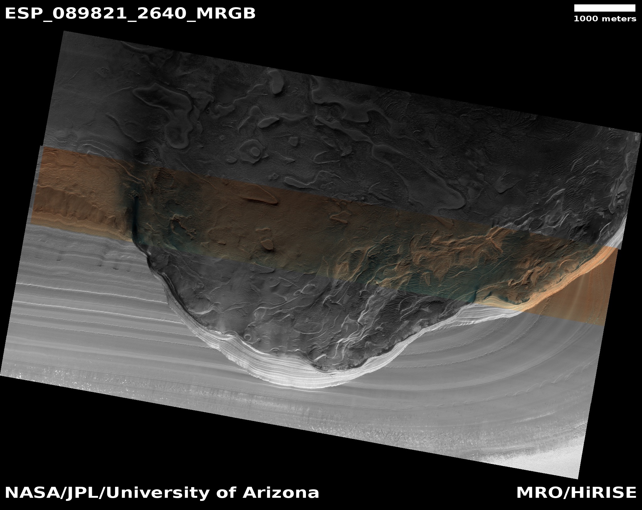
The science team labels this a “twisted surface,” to which I think we all can agree. What we are looking at is a geological feature found only on Mars in only one region that has been labeled “taffy terrain” by scientists. According to a 2014 paper, the scientists posit that this material must be some sort of “a viscous fluid,” naturally flowing downward into “localized depressions.” Because of its weird nature I have posted many cool images of it in the past (see here, here, here, here, here, and here).
In the case of the image to the right, the red dot marks the peak of a small knob, with the green dot on the upper left the low point about 900 feet below. As you can see, the taffy has migrated into the depressions, as some flowing material would.
» Read more

Click for original image.
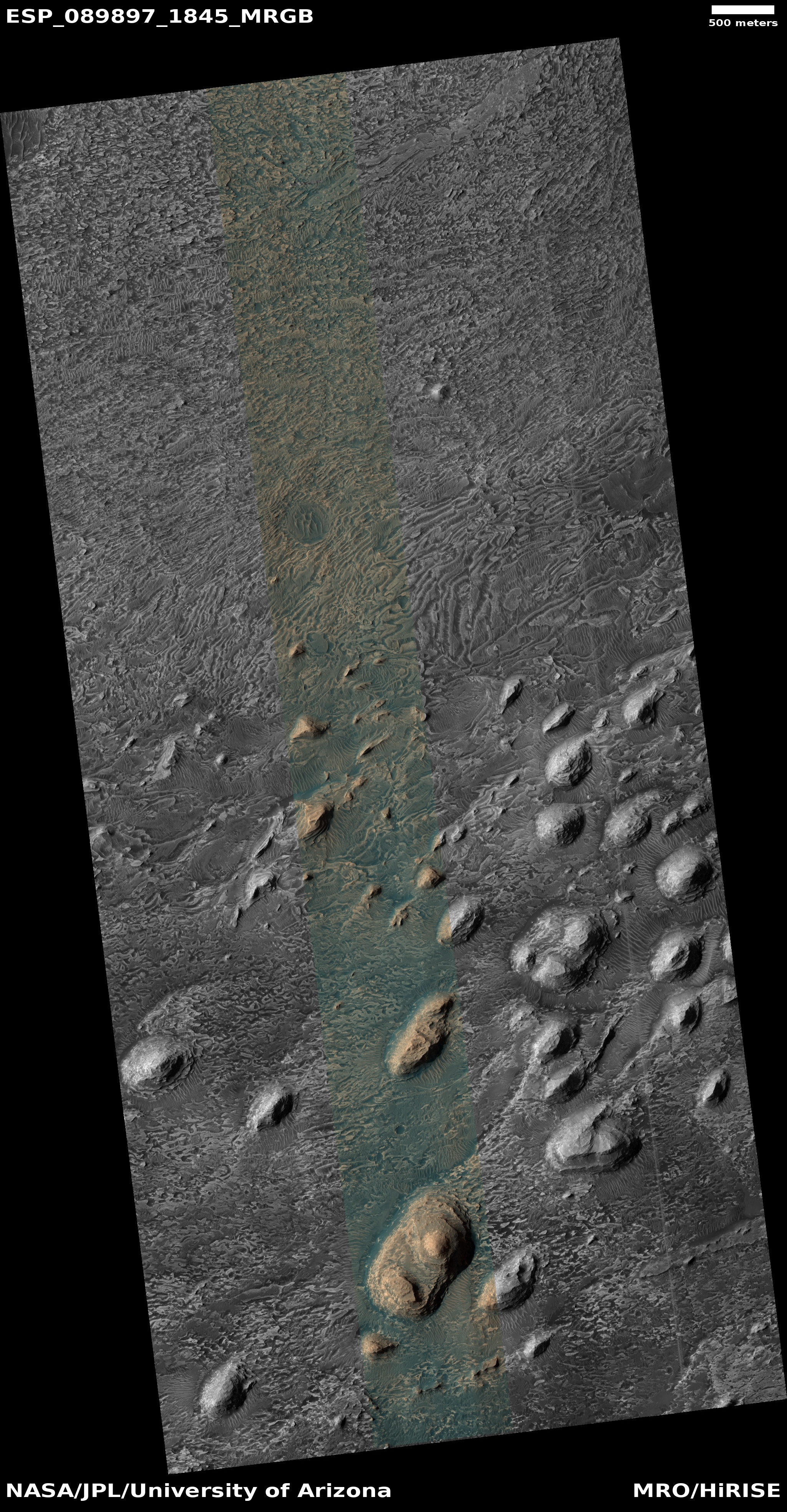
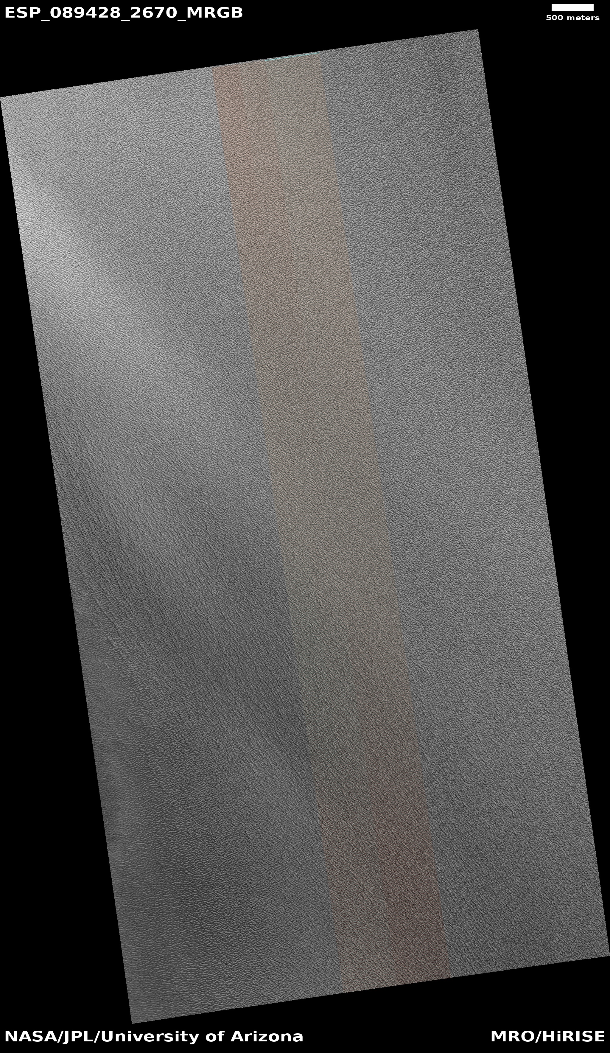
Cool image time! The picture to the right, cropped, reduced, and sharpened to post here, was taken on October 27, 2025 by the high resolution camera on Mars Reconnaissance Orbiter (MRO).
The science team labels this a “twisted surface,” to which I think we all can agree. What we are looking at is a geological feature found only on Mars in only one region that has been labeled “taffy terrain” by scientists. According to a 2014 paper, the scientists posit that this material must be some sort of “a viscous fluid,” naturally flowing downward into “localized depressions.” Because of its weird nature I have posted many cool images of it in the past (see here, here, here, here, here, and here).
In the case of the image to the right, the red dot marks the peak of a small knob, with the green dot on the upper left the low point about 900 feet below. As you can see, the taffy has migrated into the depressions, as some flowing material would.
» Read more


