
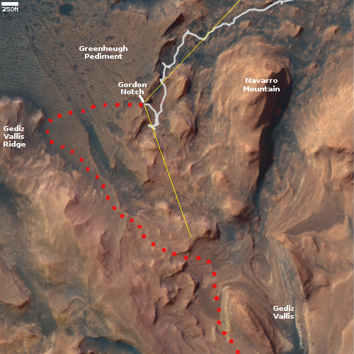
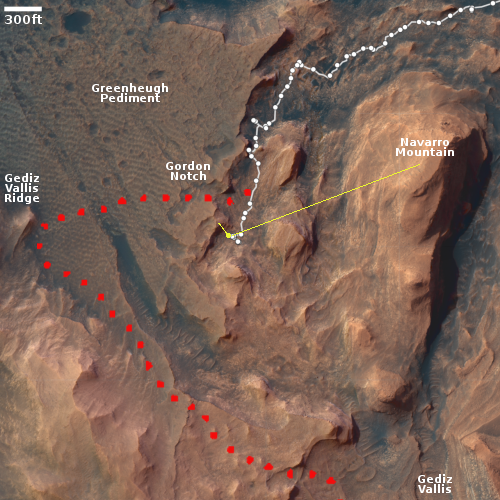
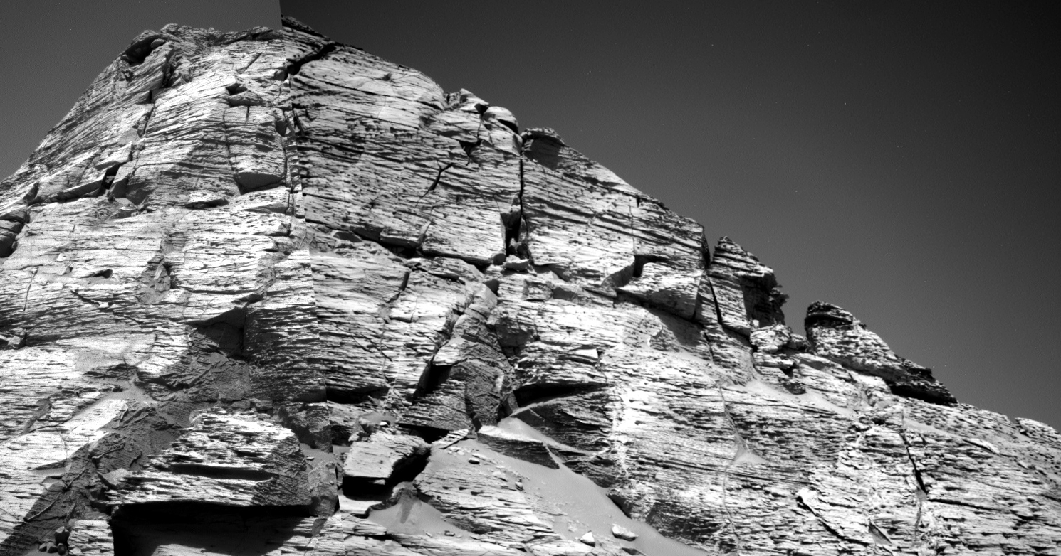
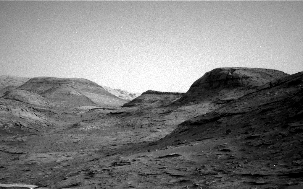
Curiosity’s upcoming rough terrain
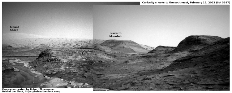
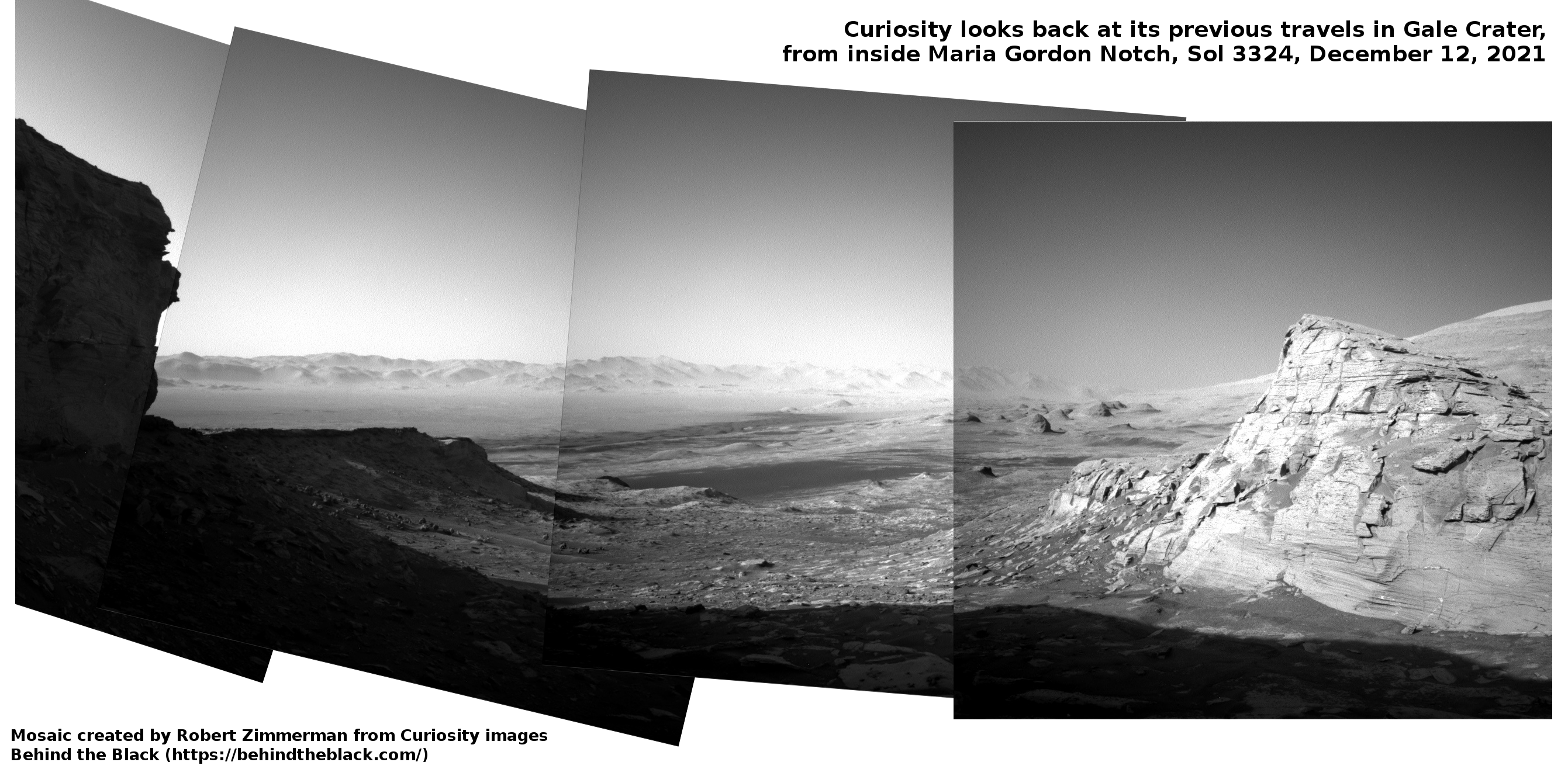
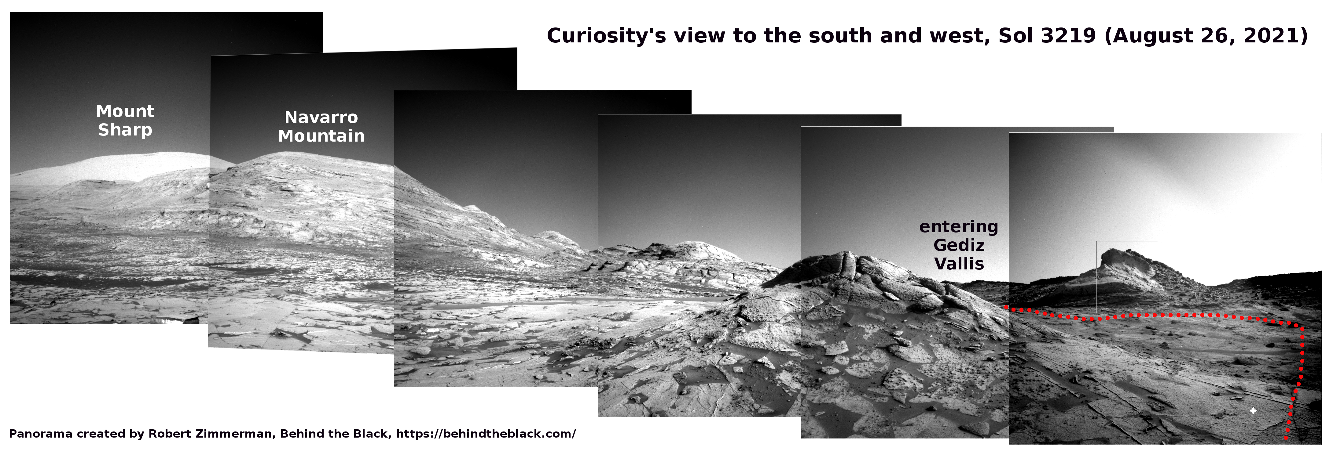
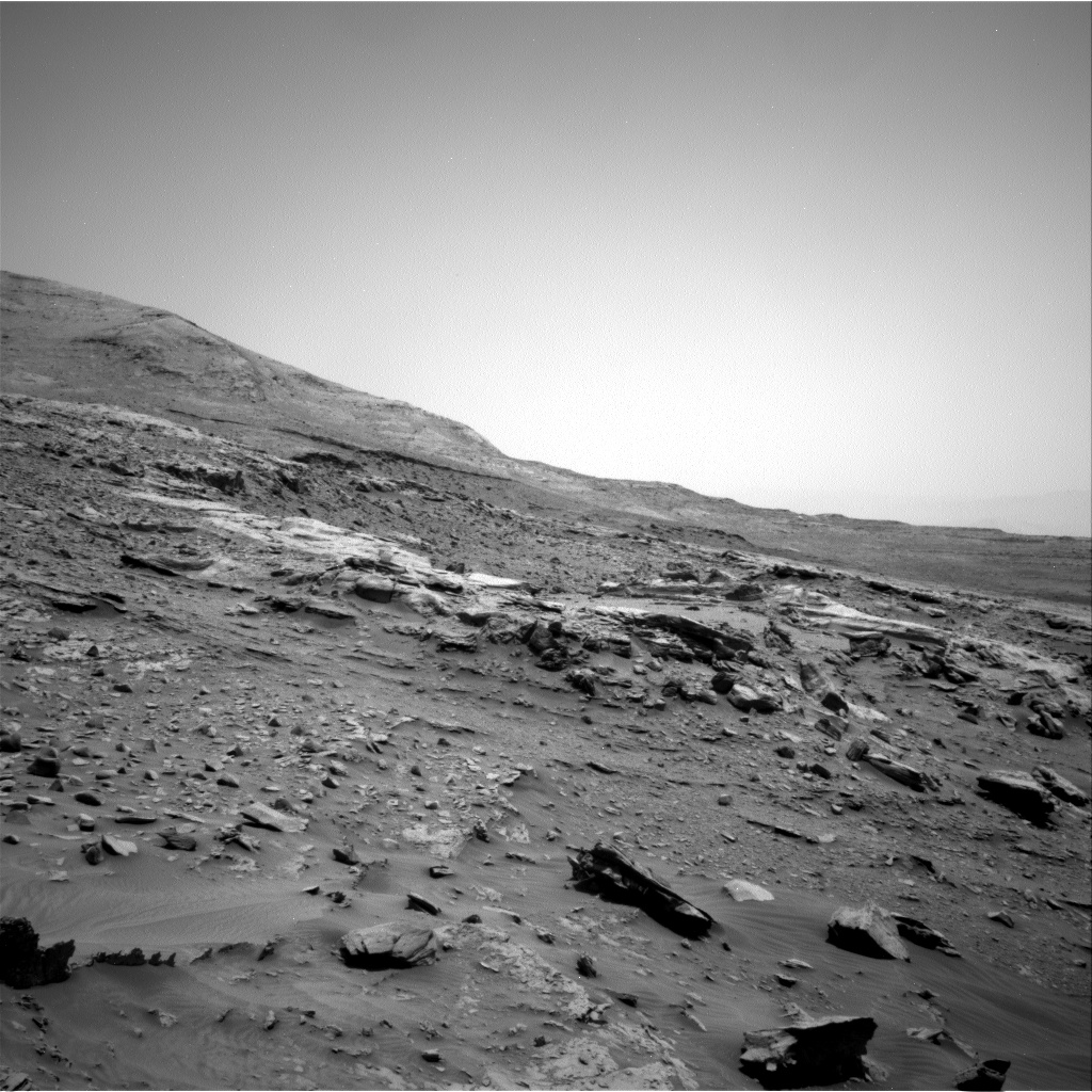
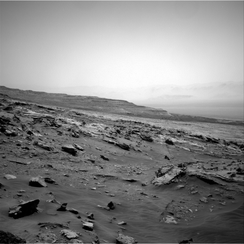
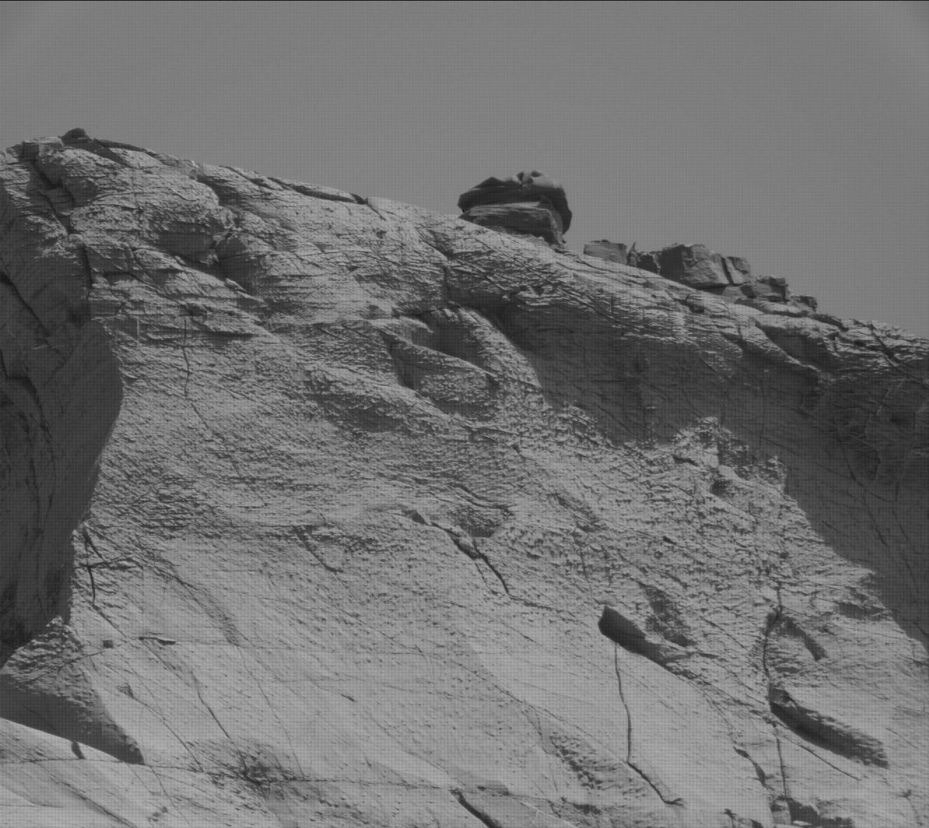
 Click for high resolution. For original images go here, here, here, and here.
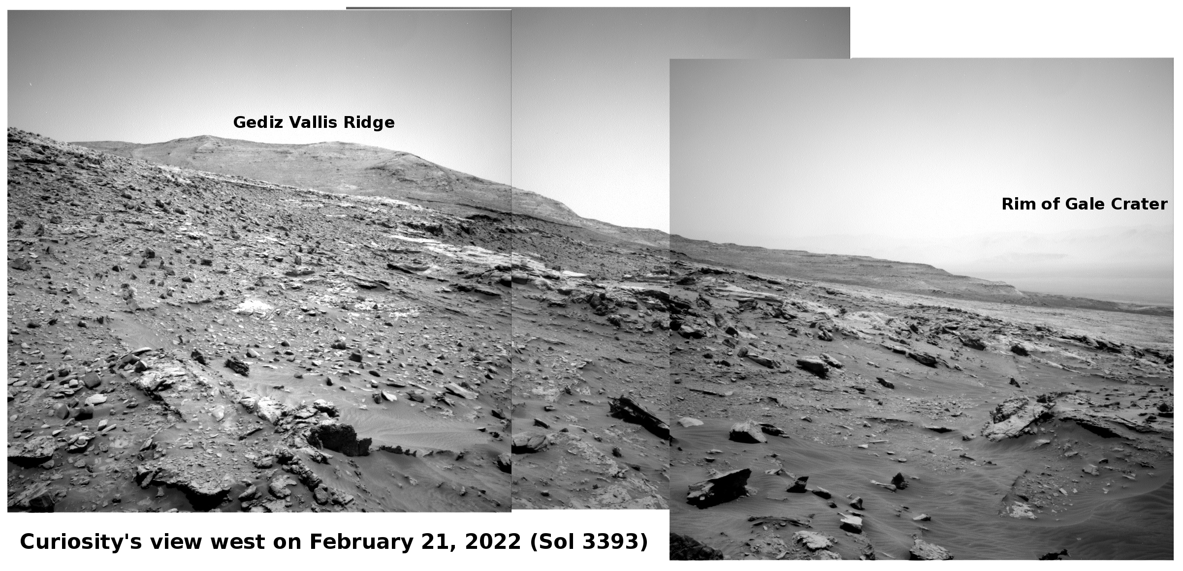
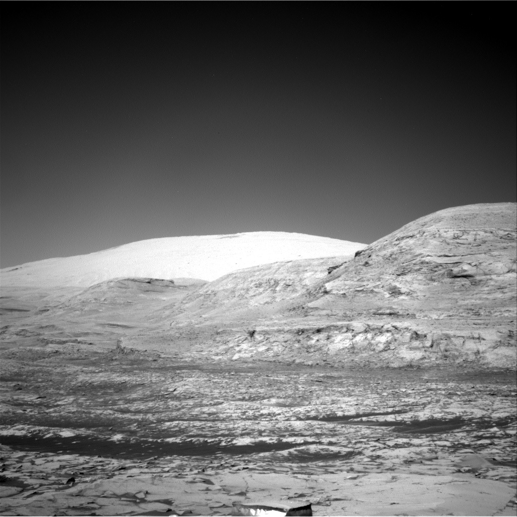
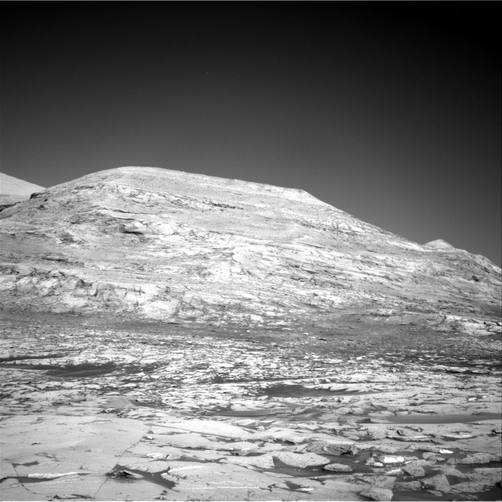
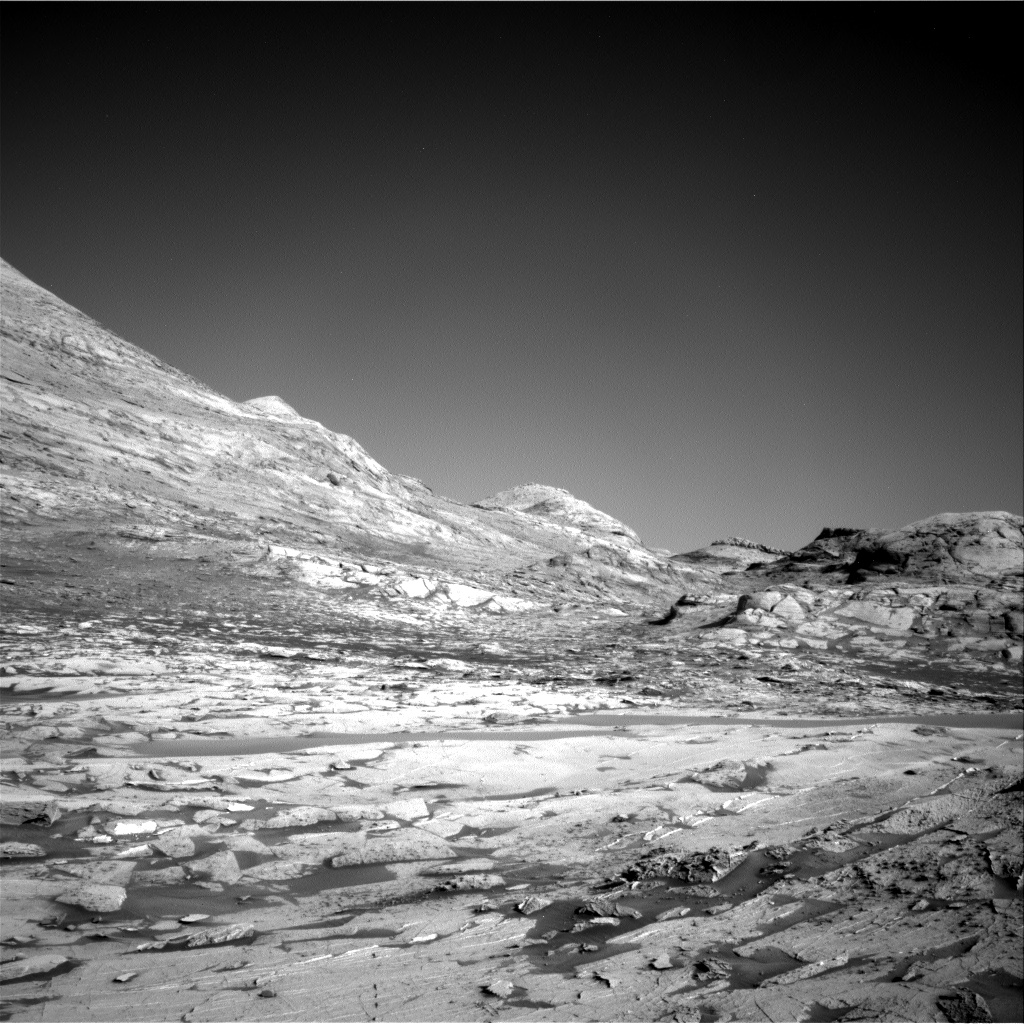
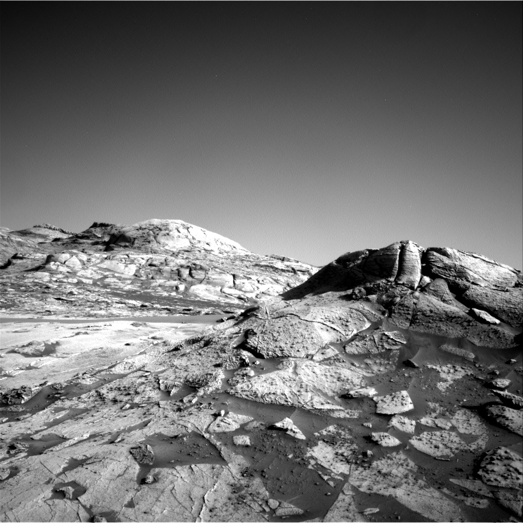
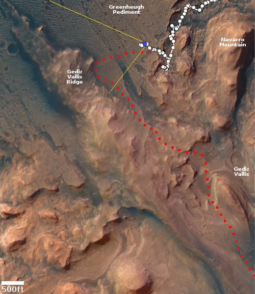
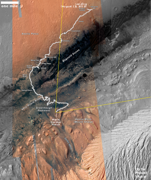
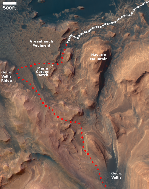
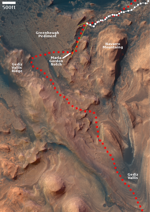
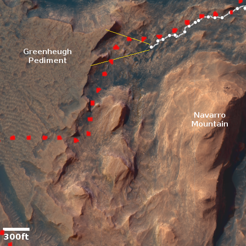
Click for interactive map.
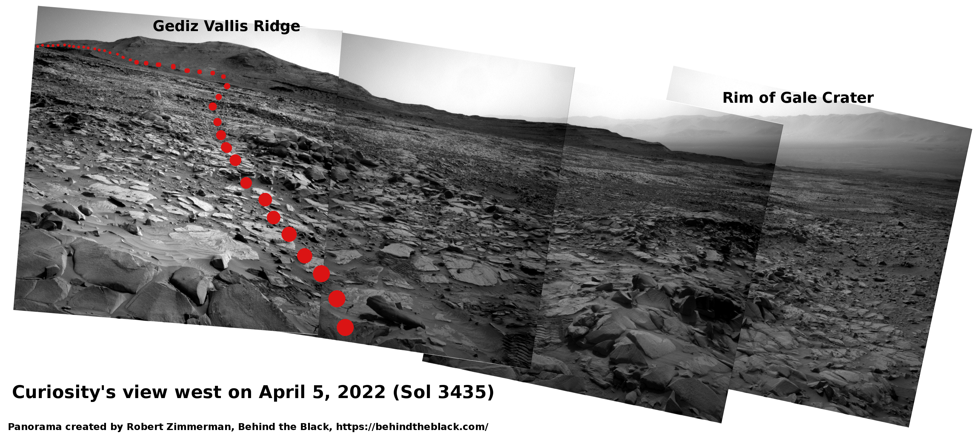
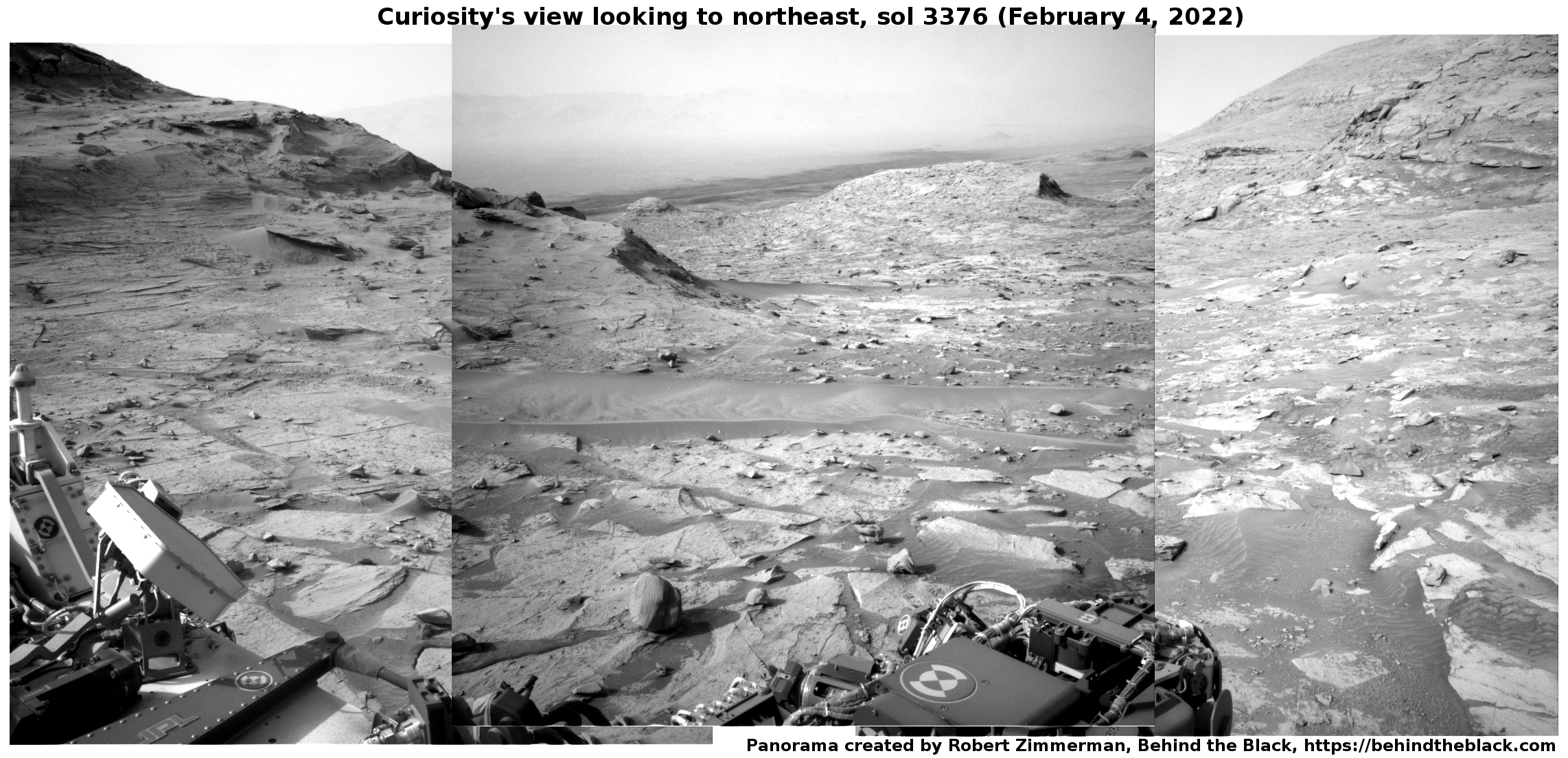
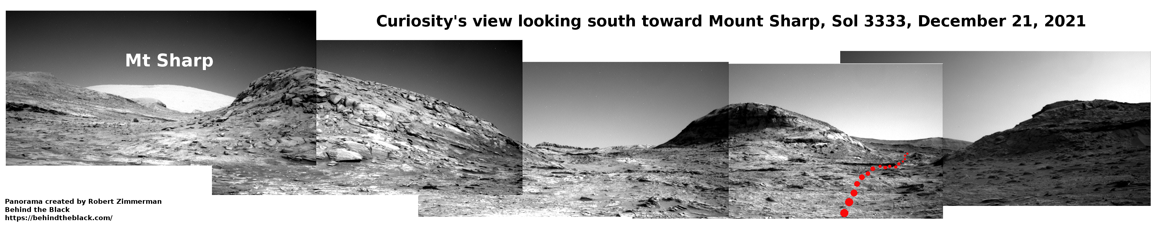
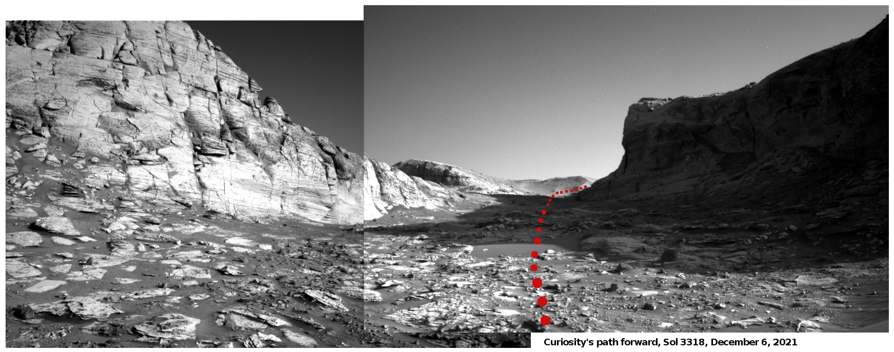
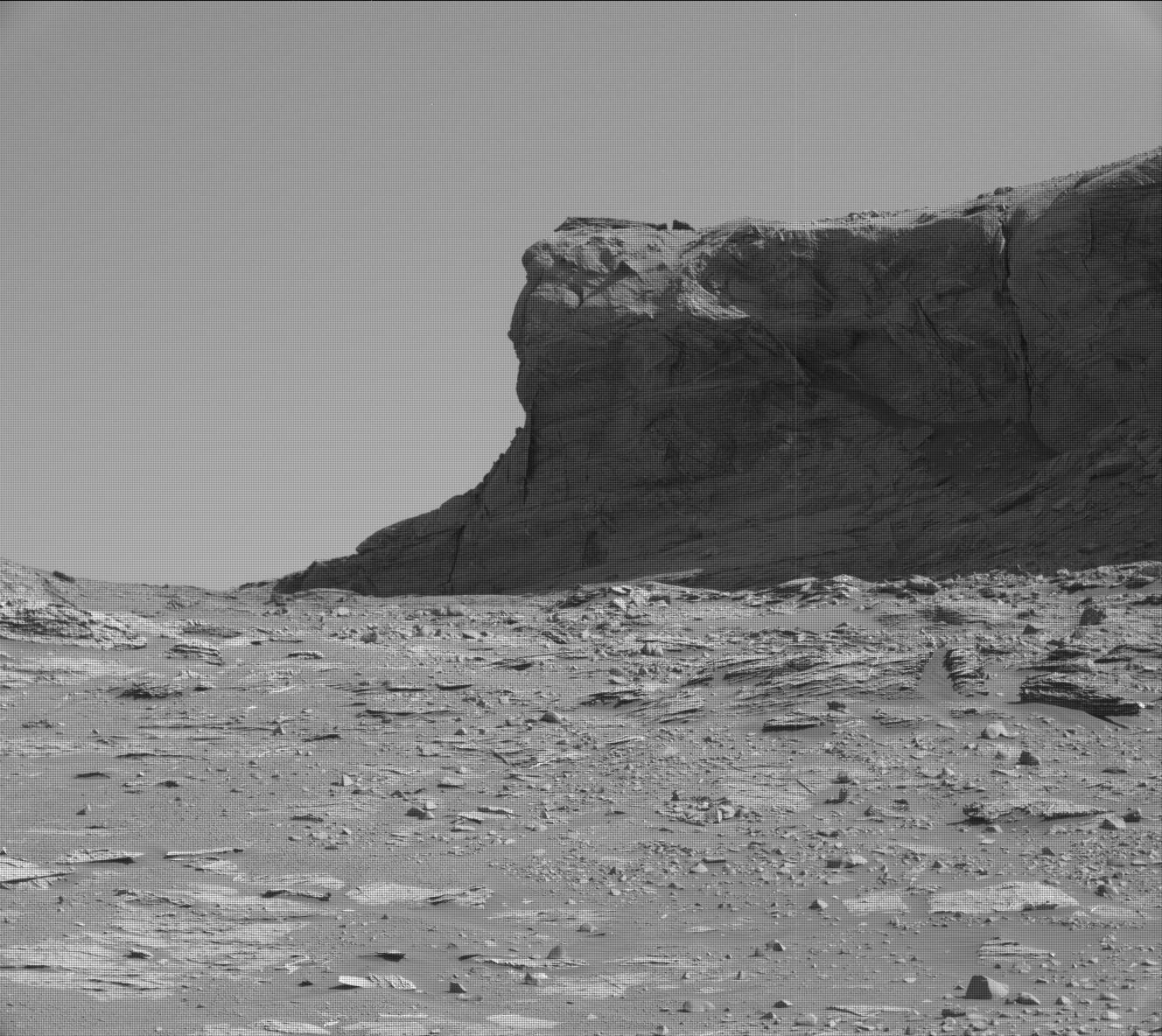
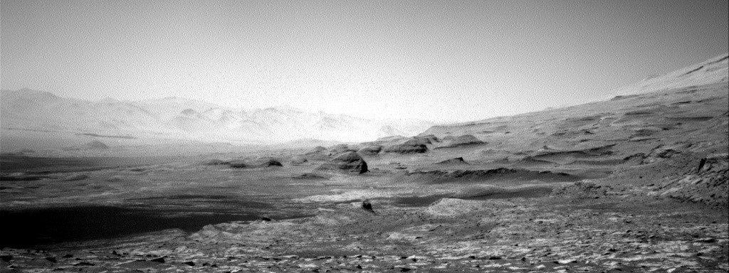
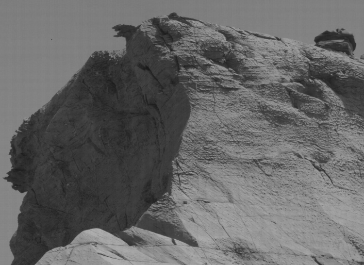
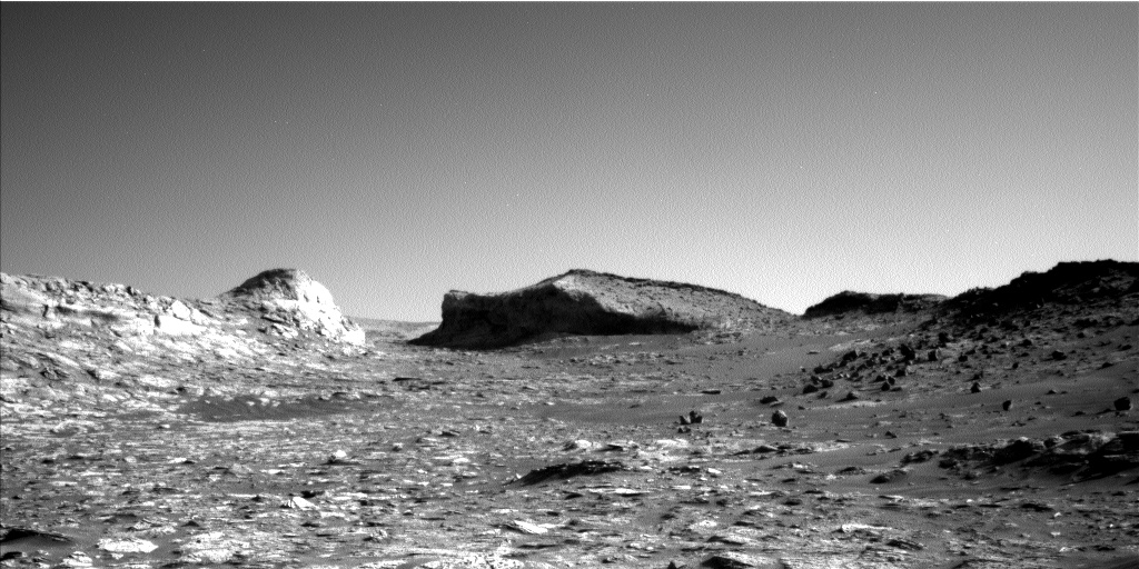
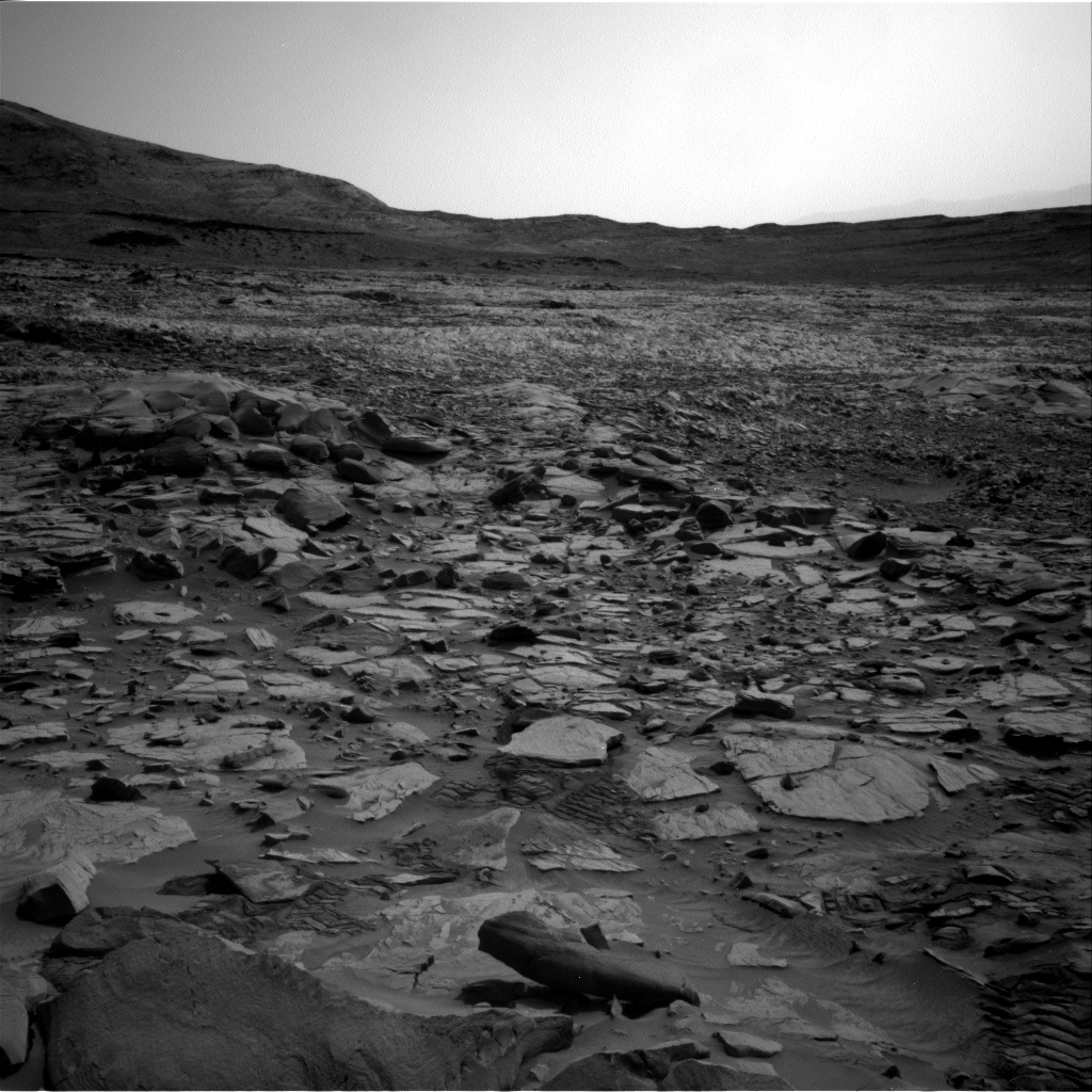
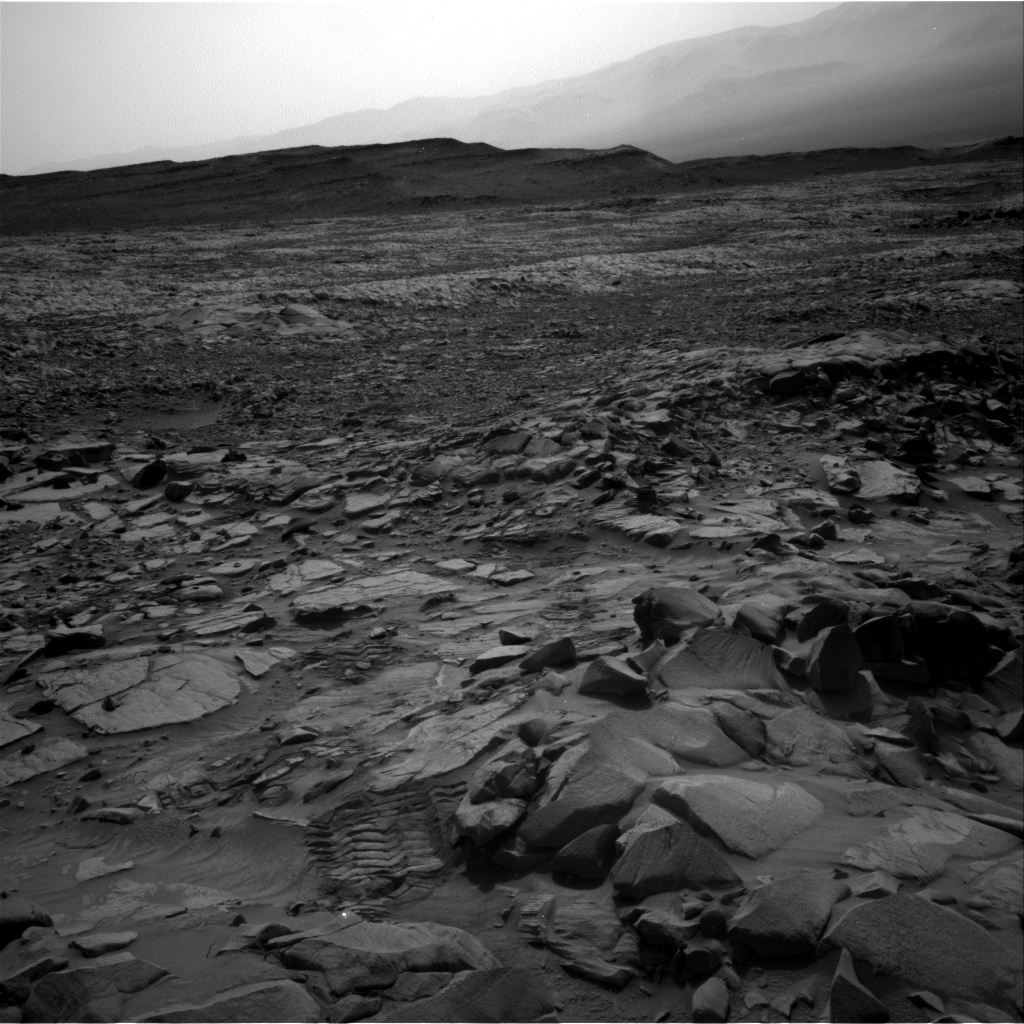
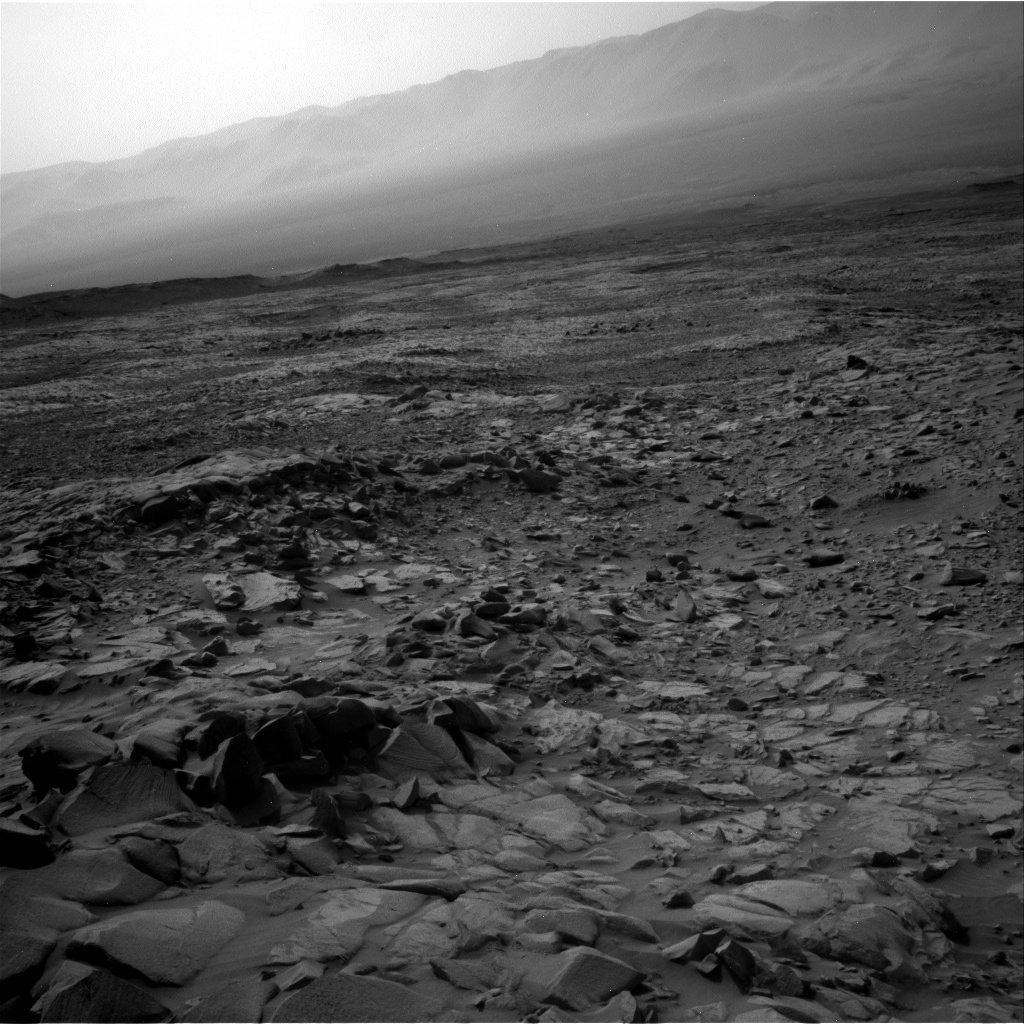
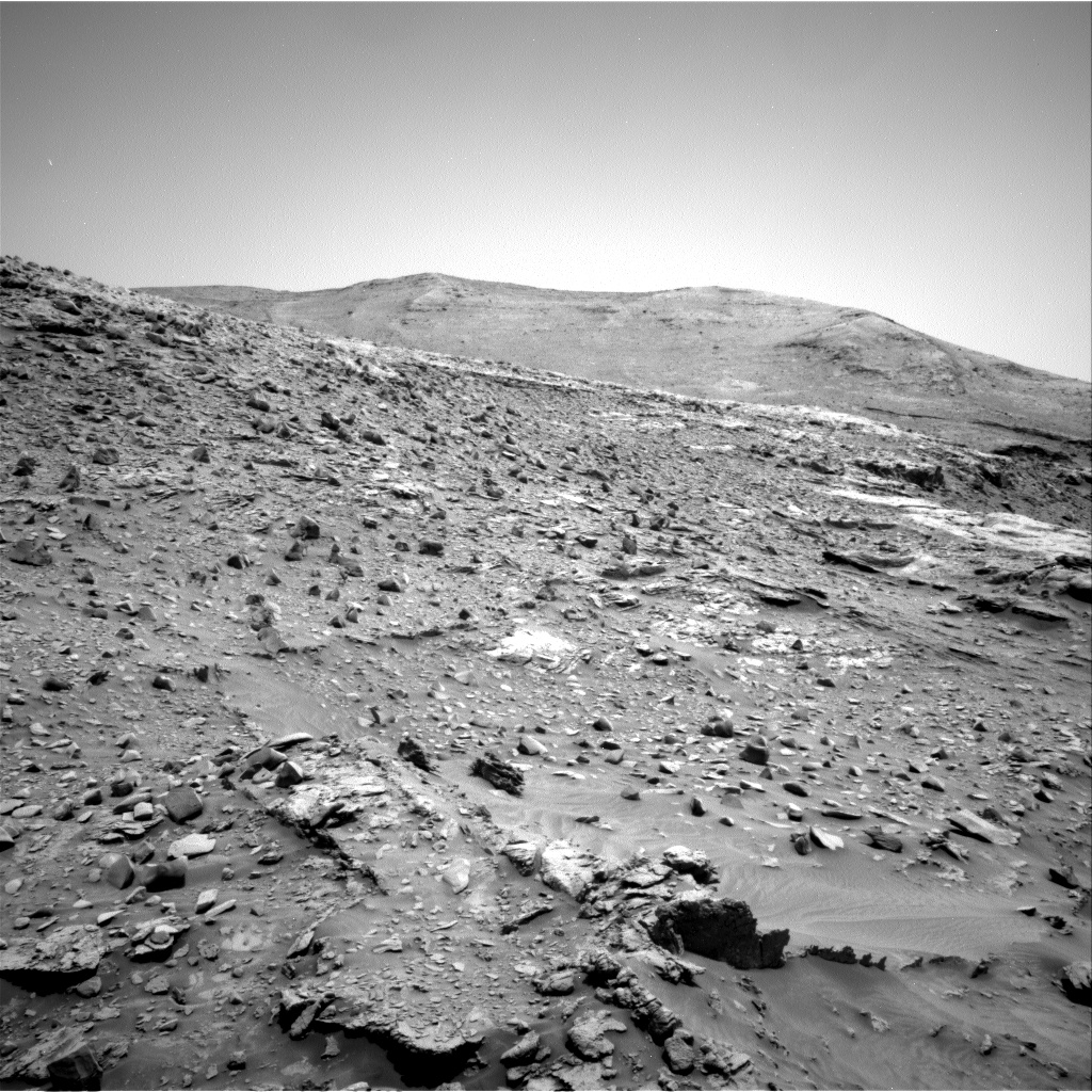
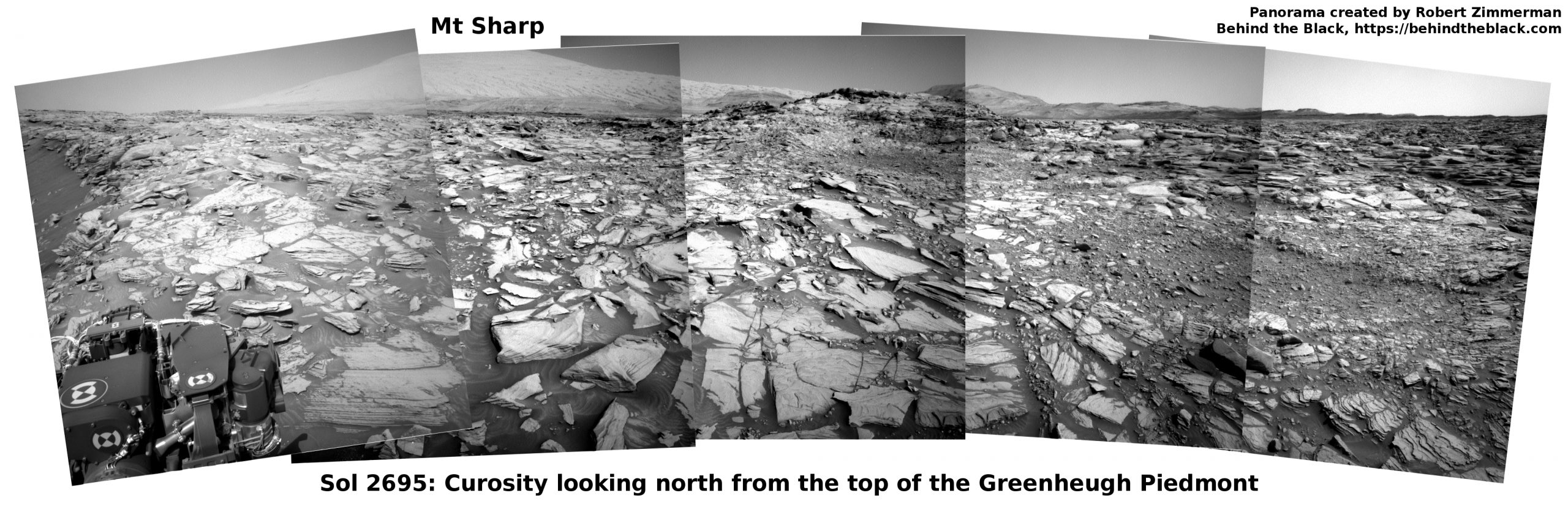
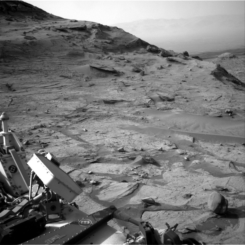
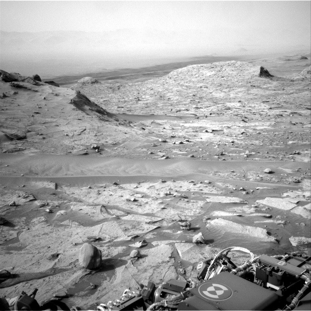
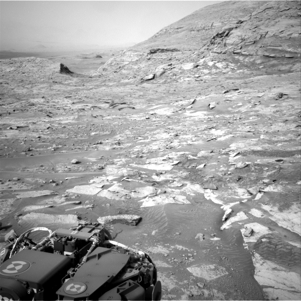
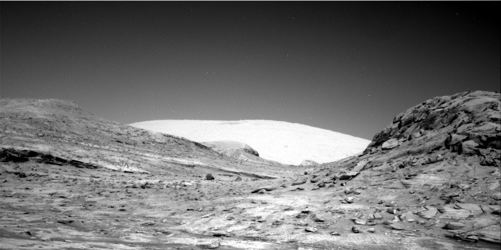
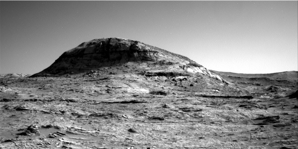
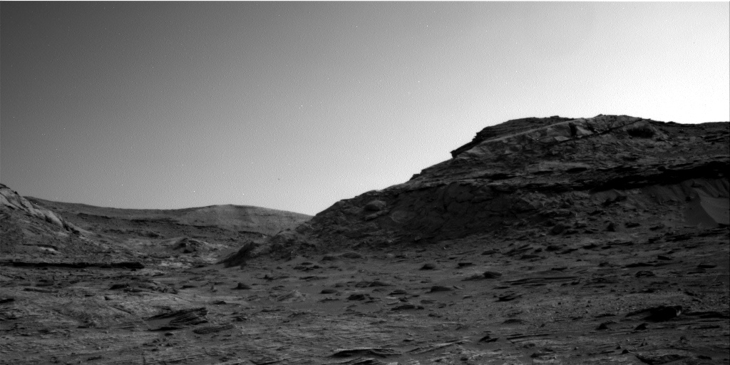
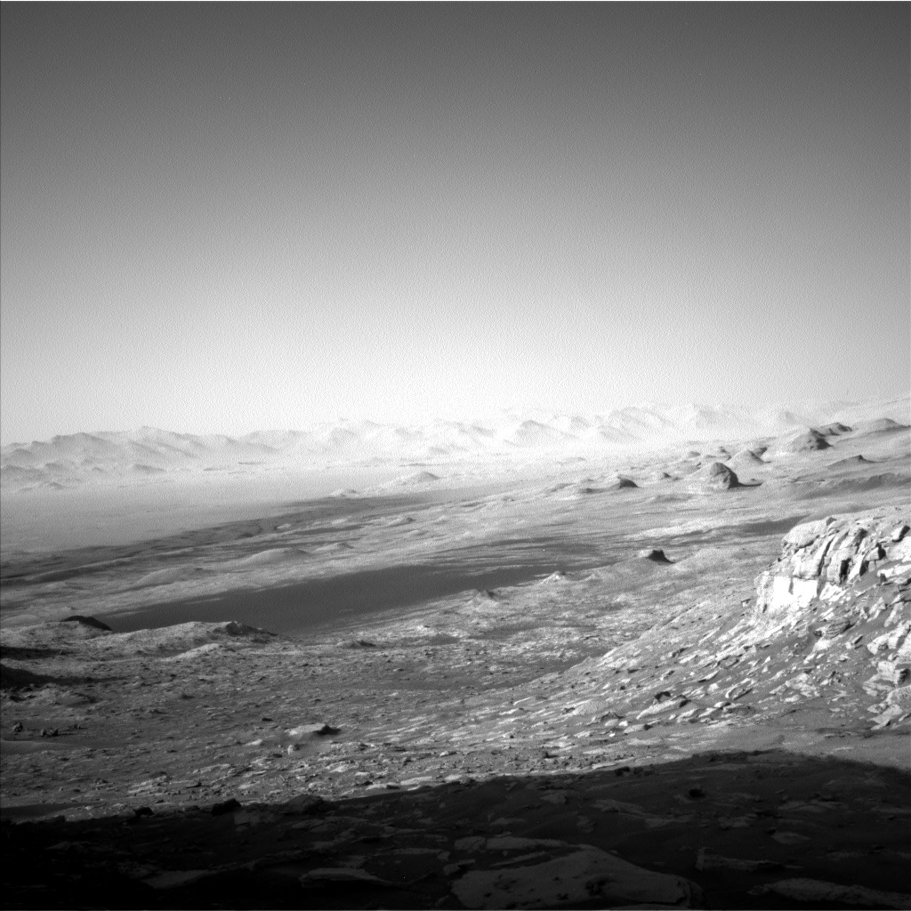
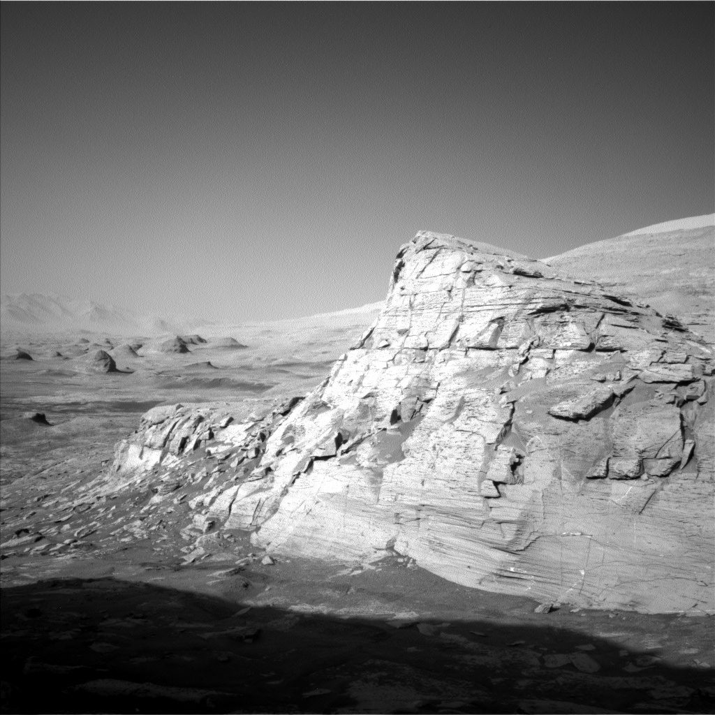
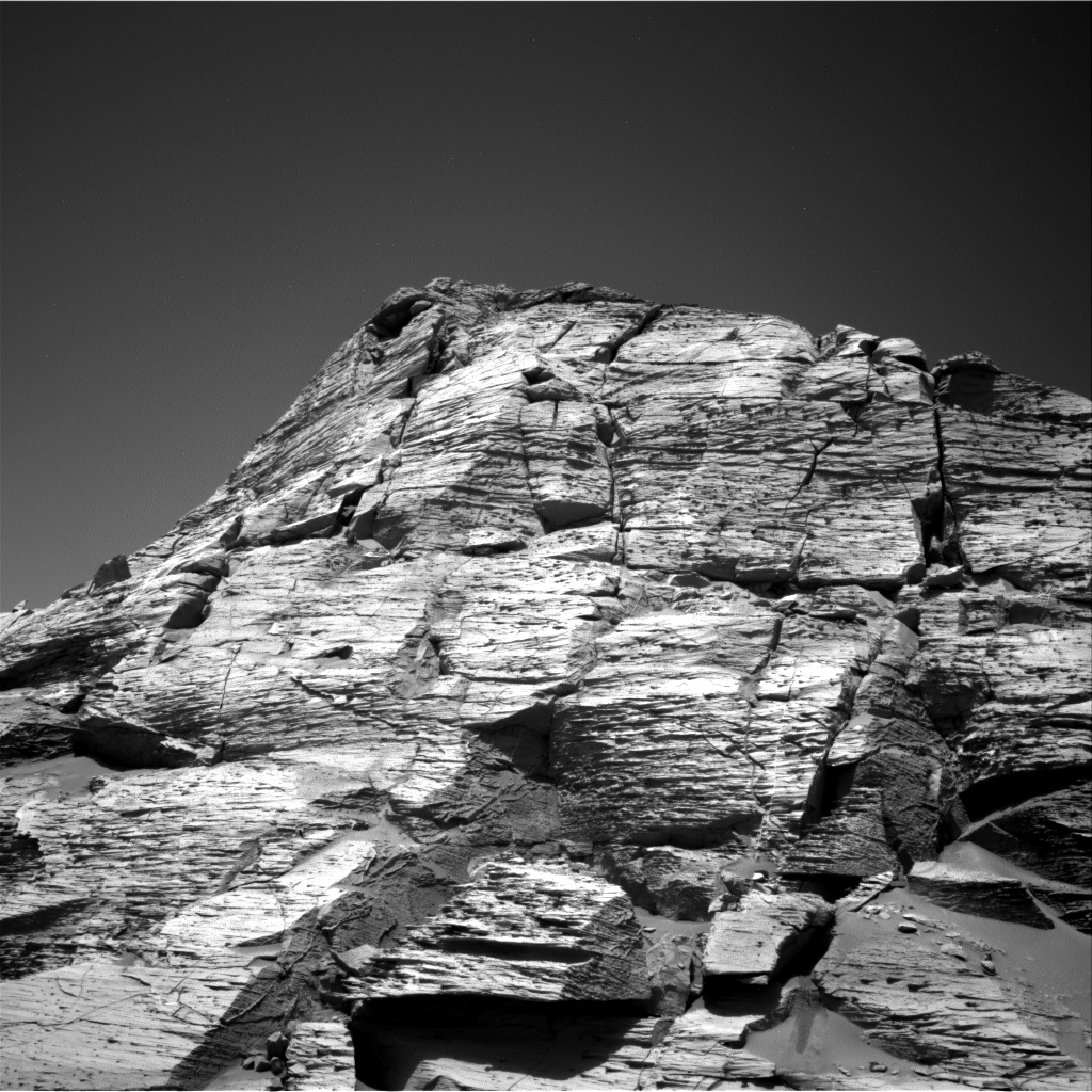
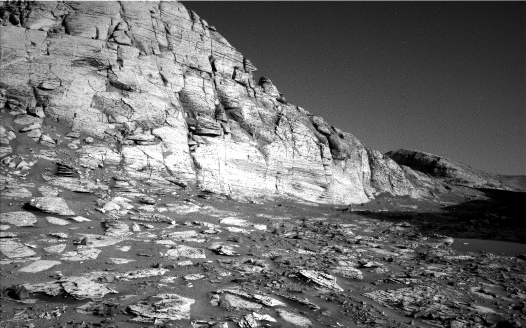
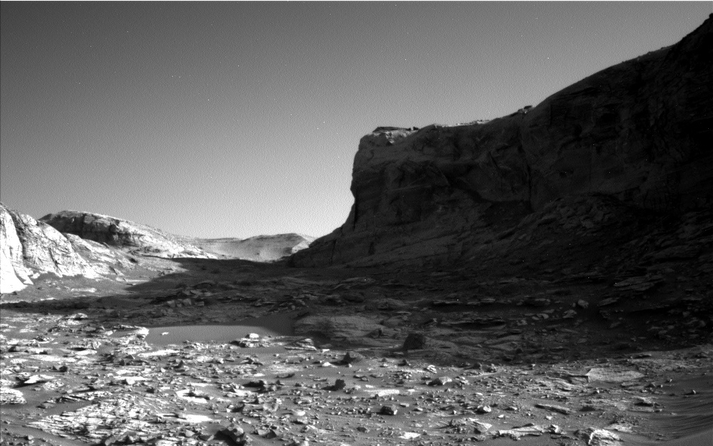
Cool image time! The panorama above, created by me from four photos taken by Curiosity’s right navigation camera on April 5, 2022, reveal much about the alien world of Mars that the rover is exploring. The red dotted line indicates approximately the rover’s upcoming route.
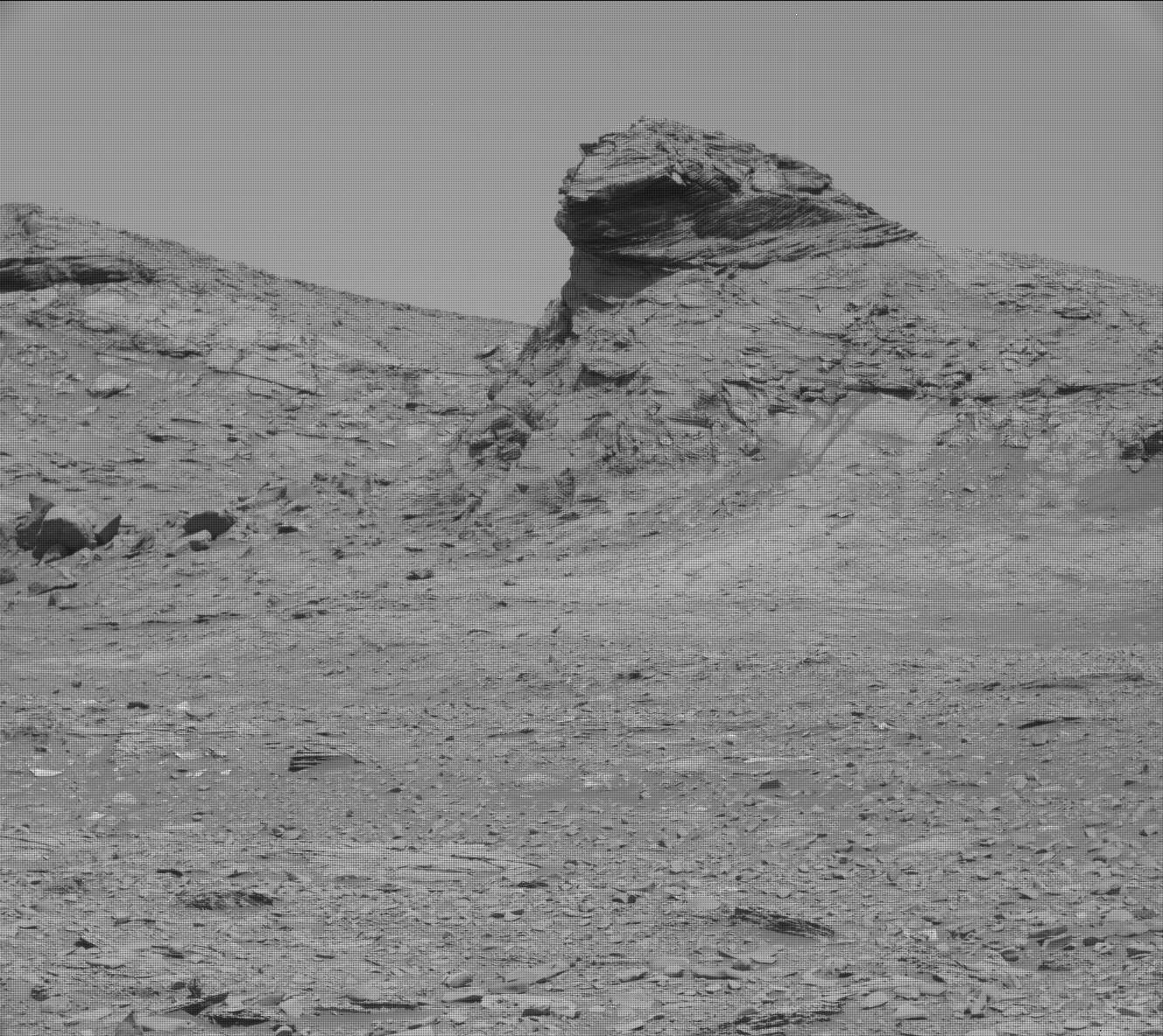
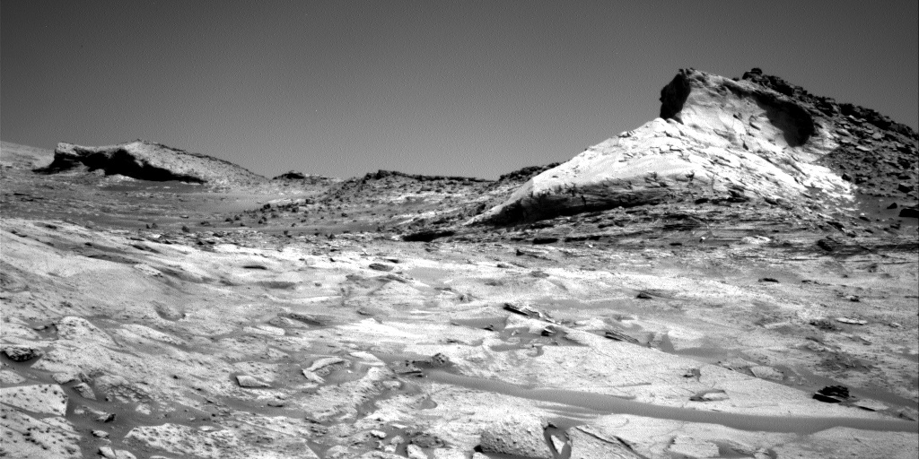
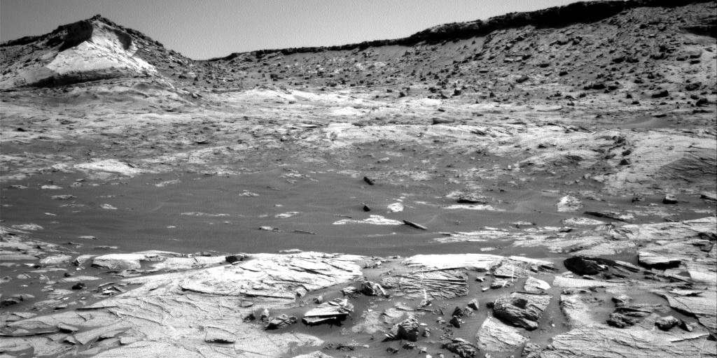
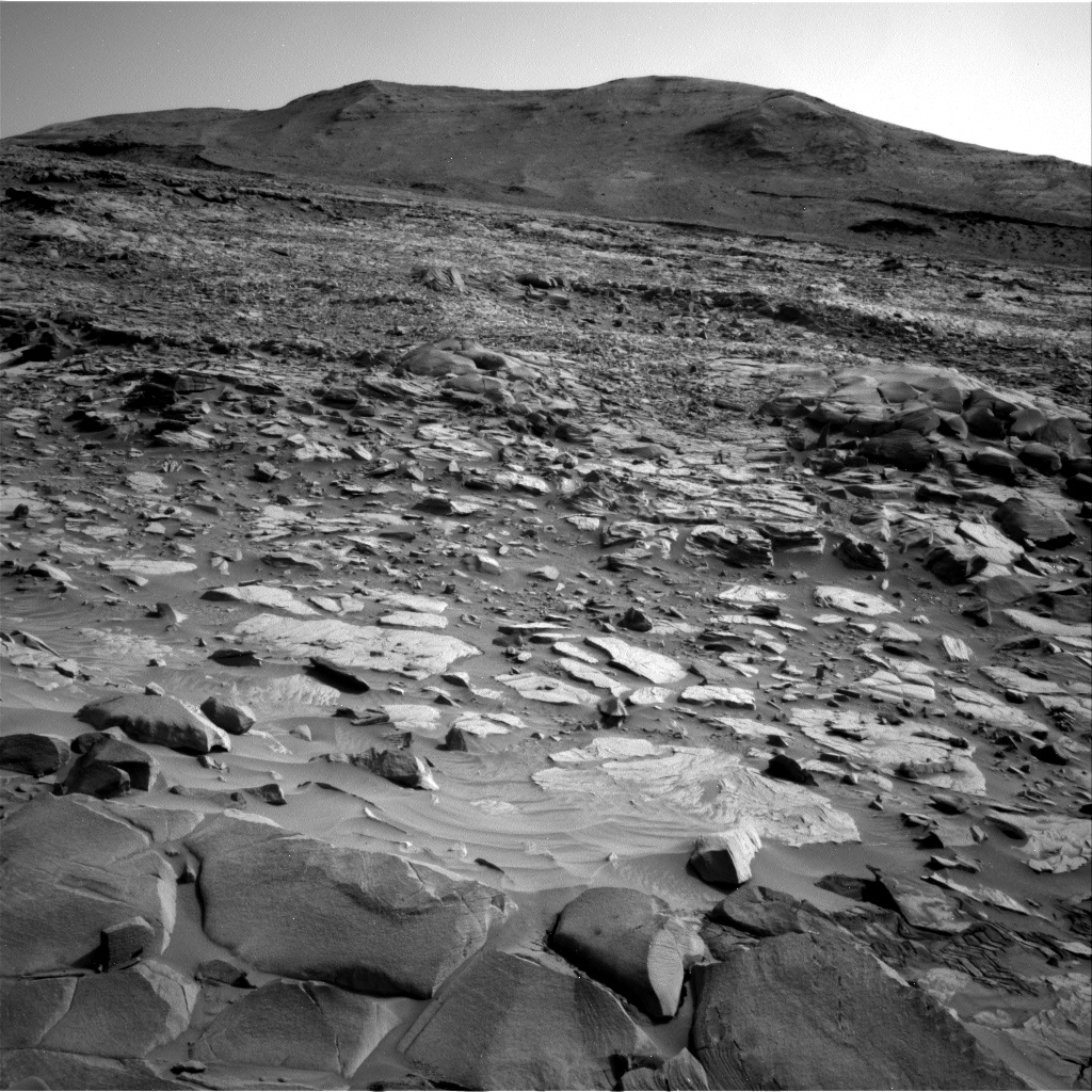
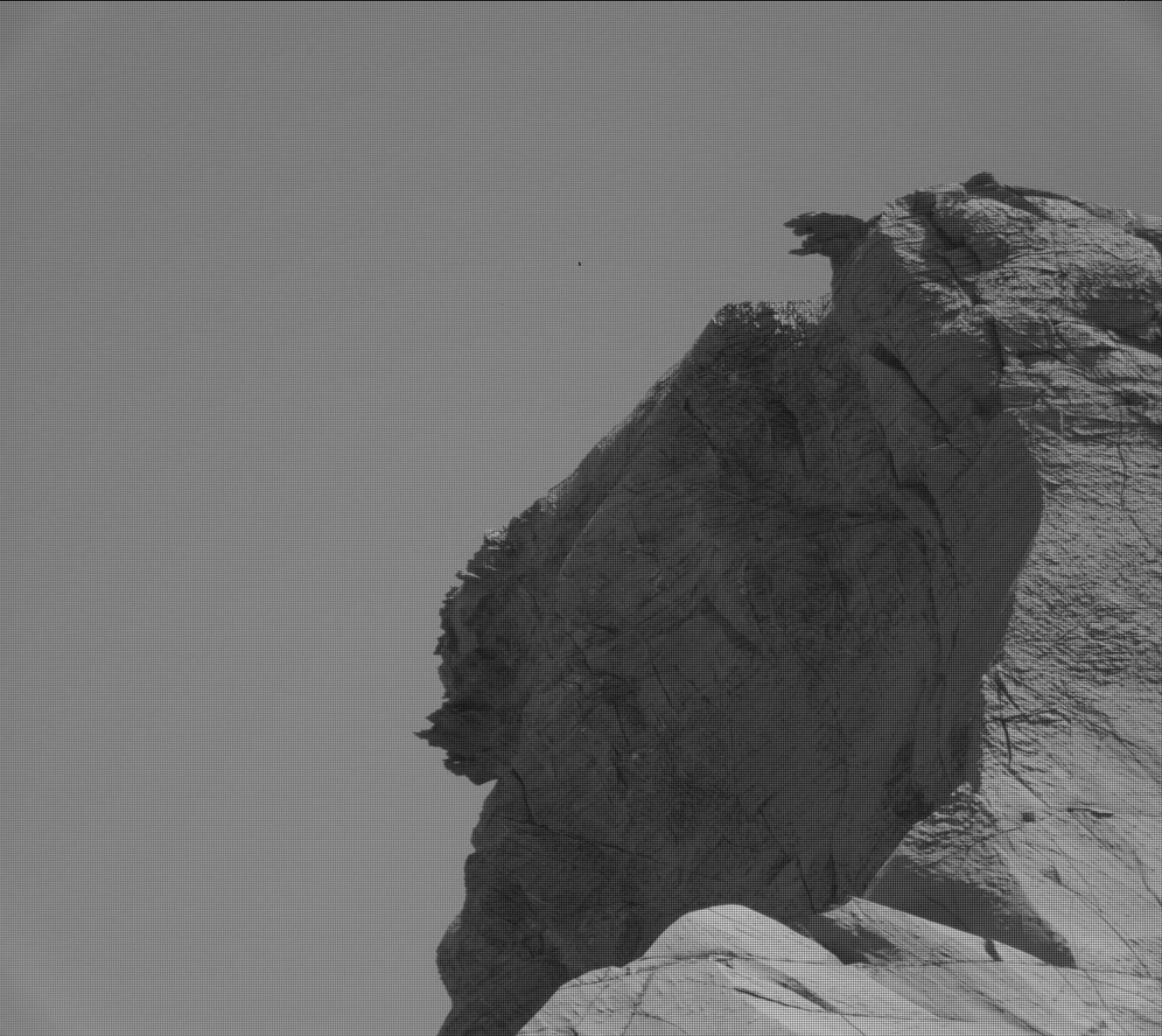
First there is the rough surface of the Greenheugh Pediment, the sloping plateau that Curiosity is presently traversing. Called “gater-back terrain” by the science team, this broken surface apparently is sandstone that was originally a dune field that in the past was periodically washed by water runoff and later hardened into this structurally weak rock.
Second, I have orientated the images so that the rim of Gale Crater, approximately 25 miles away, is horizontal. By doing so, we can see the upward slope of the Greenheugh Pediment. Curiosity is on a tilted surface, and while it will be traversing along a contour line as it heads west towards Gediz Vallis Ridge about 1,000 feet away, when it turns left and heads uphill, the climb will be steady and steep, as it has now been for the past year since the rover entered the mountains at the foot of Mount Sharp.
Taken together, these details indicate why Curiosity has moved very slowly in recent weeks, as shown by the white dots in the overview map to the right. The blue dot marks Curiosity’s present location, with the yellow lines indicate the approximate view in the panorama above.
Traversing the pediment carries real risk to the rover. Though its somewhat dinged wheels have held up well during this last year of traveling in these rough mountains, at any point the severe roughness here could damage one or more wheels significantly, even putting one or more out of commission. The rover team is traveling carefully to avoid this, but these factors illustrate a possible end for the rover, though hopefully still years away.


