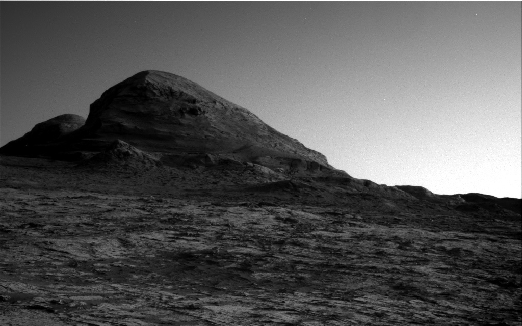
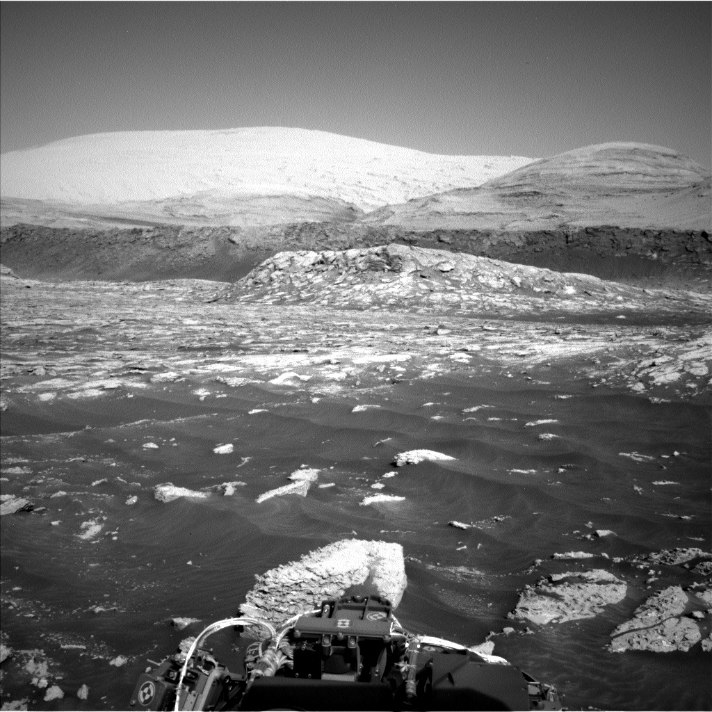
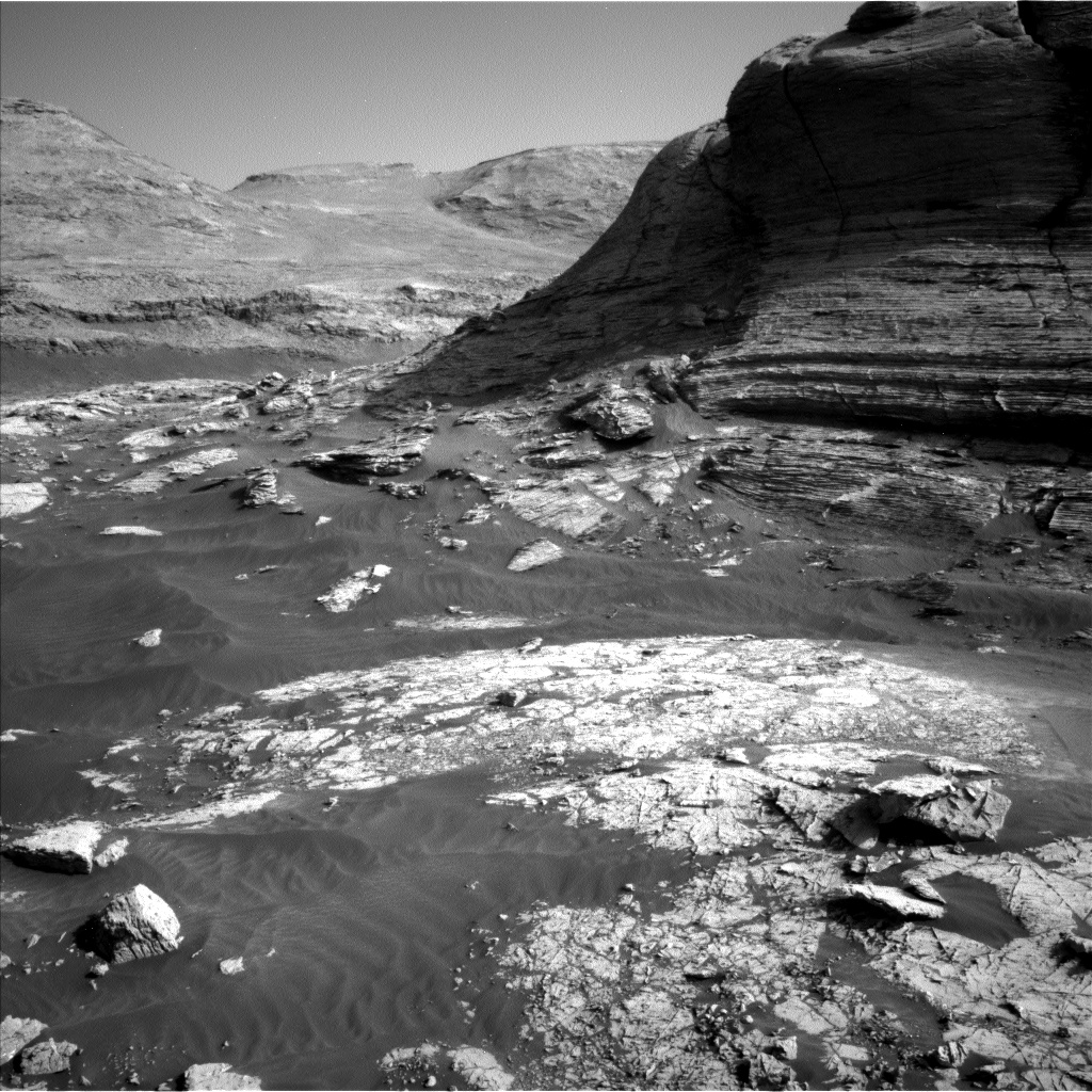
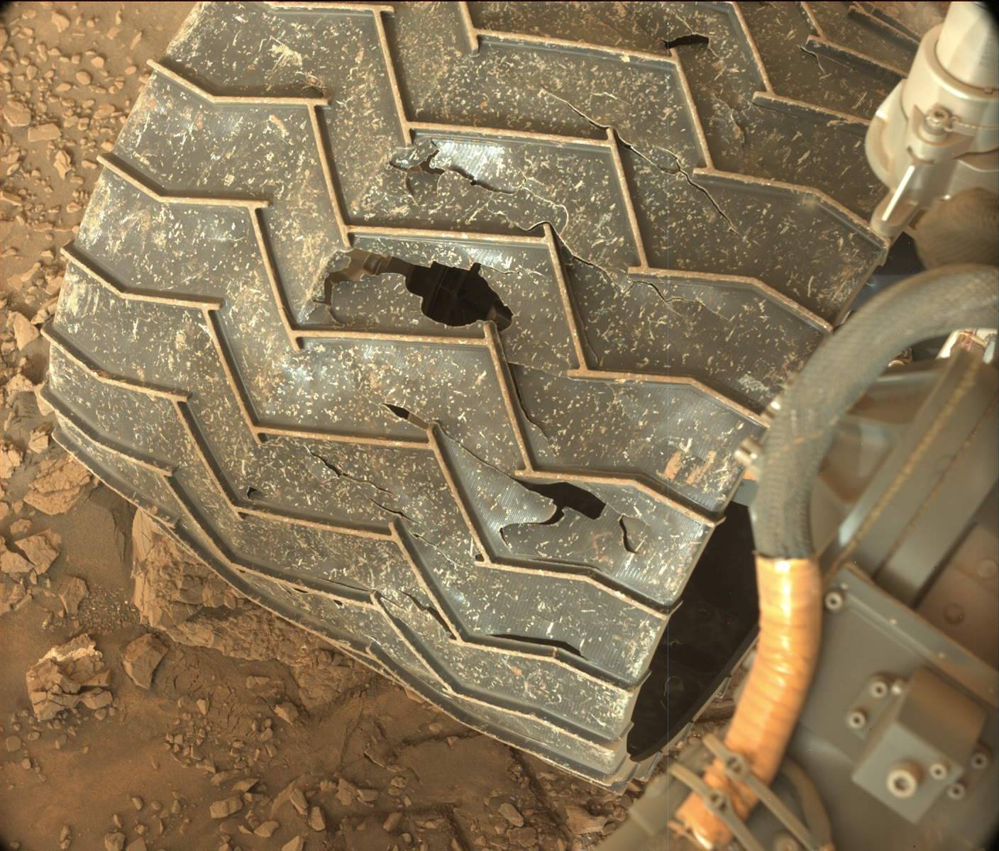
Curiosity produces new 360 degree hi-res panorama

360 degree hi-res panorama from Curiosity
Click for full resolution image.

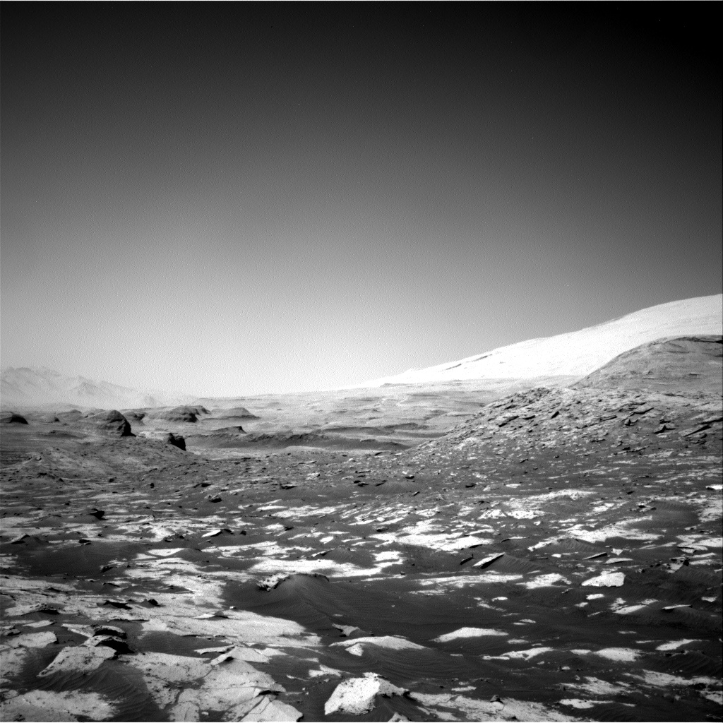
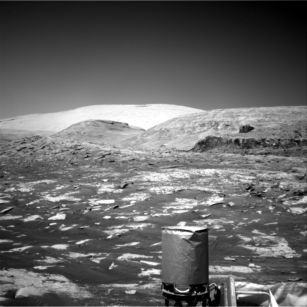
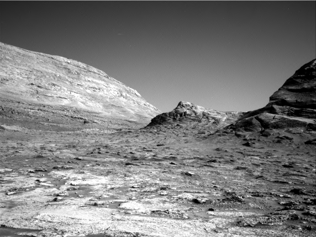
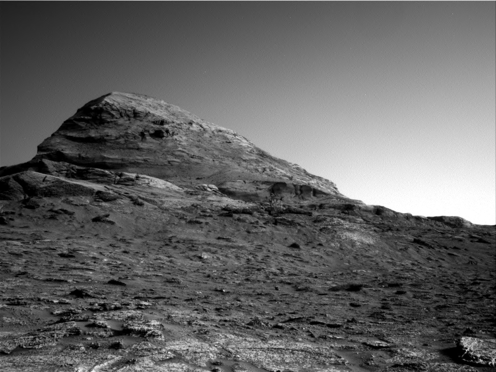
The Curiosity science team has used the rover’s high resolution camera to produce a new 360 degree panorama, with the center of the image looking directly up at Navarro Mountain.

To get a really good idea of what this panorama shows, I have embedded below a video the scientists have produced giving a tour of the image, which reveals two especially interesting details. First, their future route will go between Navarro Mountain (the highest visible peak) and the 80-foot-high dark butte to its right. This is as planned, as indicated by the red dotted line on the overview map show in this July 8, 2021 post.

Second, the air was very clear when this panorama was taken, and so the rim of Gale Crater can be distinctly seen, 20 miles away.

» Read more

2 comments

Curiosity looks backwards

Curiosity panorama looking southeast
Click for full resolution version. For original images go here and here.

Overview map
Click for interactive map.

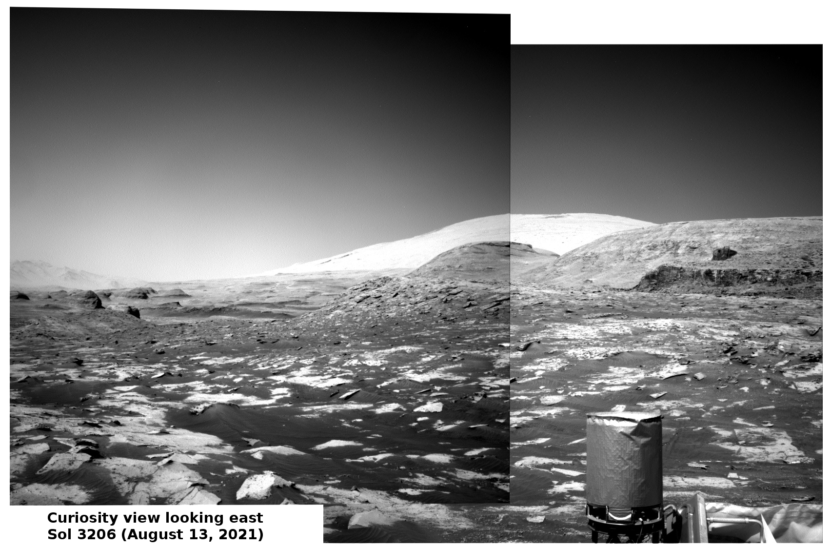
Cool image time! The mosaic above was created from two photos taken on August 13, 2021 by Curiosity’s right navigation camera. It looks to the southeast, at the mountainous Martian terrain that the rover had been traveling just below for the past two months.

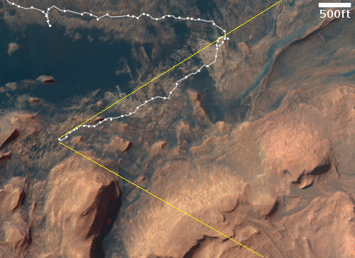
The overview map to the right shows with the yellow lines the approximate area covered by this mosaic. The white mountain at the top is the highest visible flank of Mount Sharp, and is beyond the right/bottom edge of the overview map. Mt. Sharp’s peak itself is not visible, as it is higher up and to the right. It is presently blocked by these mountainous foothills.

The science team probably took this image partly to provide another view of these mountains for comparison with earlier views. They can use this new data to look for changes as well as obtain better three-dimensional data.

They also took the image for the same reason I post it here. Having now climbed more than 1,500 feet from the floor of Gale Crater, Curiosity’s view is routinely spectactular. Why not enjoy it?

Mt. Sharp’s peak however is still about 13,000 feet above the rover. The climb up the mountain has just begun.

14 comments

New data suggests Gale Crater was never filled with lake

The uncertainty of science: A new review of data from Curiosity now suggests that Gale Crater was not filled with a lake in the past — as generally believed — but instead simply had small ponds on its floor.

Previous analyses of data from Curiosity have relied heavily on a measure called the chemical index of alteration to determine how rocks were weathered over time. Joseph Michalski at the University of Hong Kong and his colleagues have suggested that because this measure was developed for use on Earth, it may not be valid in the extreme Martian climate.

Instead, they analysed the concentrations of various compounds that are expected to change based on different types of weathering over time. They found that some of the layers of rock Curiosity examined did interact with water at some point in their past, but more are likely to have formed outside of the water. “Over hundreds of metres of strata, it seems that the only layers that are demonstrably lacustrine [formed in a lake] are the lower few metres,” says Michalski. “Of the rocks visited by the rover… the fraction that is demonstrably lacustrine is something like 1 per cent.”

These rocks were mostly in the lowest few metres of sediments in the crater, suggesting the lake was not nearly as deep or extensive as we thought. “There was likely a small lake or more likely a series of small lakes in the floor of Gale crater, but these were shallow ponds,” says Michalski.

This conclusion also aligns with other recent work proposing that Gale Crater was always cold and never had running water.

None of this is proven, one way or the other, though this new conclusion would make it easier to explain Mars entire geological history. Trying to create models for Mars’ past climate that allowed large amounts of liquid water on its surface have so far been difficult at best, and have generally been unconvincing. Eliminating the need for liquid water will make explaining Mars’ geology much simpler.

9 comments

Curiosity: Nine years since landing on Mars and the way forward

The way forward for Curiosity
Click for full image.

In today’s Curiosity update written by planetary geologist Abigail Fraeman, she noted this significant fact:

Project scientist Ashwin Vasavada pointed out a great fact at the beginning of planning today: At around 4 o’clock in the afternoon on Sol 3199 (the first sol in the plan we are creating today), Curiosity will begin its 10th Earth year on Mars. In the last nine years, the rover has traveled 26.3 km [16.3 miles], climbed over 460 m [1,509 feet] in elevation, and collected 32 drilled samples of rock.

Her update includes the first image taken by Curiosity upon landing, a view of Mount Sharp using the rover’s front hazard camera. In that picture, the mountain is far away, as the rover was sitting on the flat floor of Gale Crater.

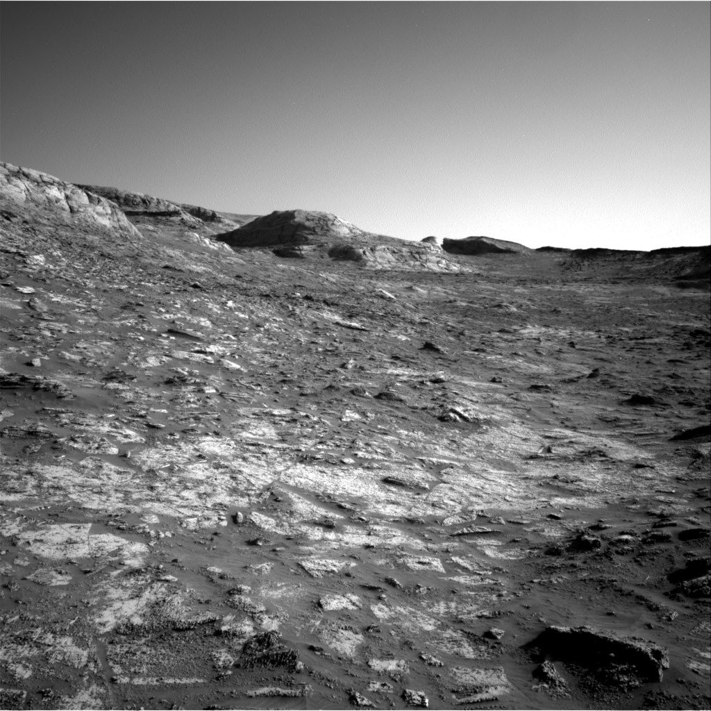
The photo above, cropped and enhanced to post here, was taken yesterday by one of Curiosity’s navigation cameras, and looks out across the rocky mountainous terrain the rover is soon to travel. As Fraeman also notes,
» Read more

9 comments

A hiker’s view from Mount Sharp

A hiker's view of Gale Crater, taken by Curiosity
Click for full image.

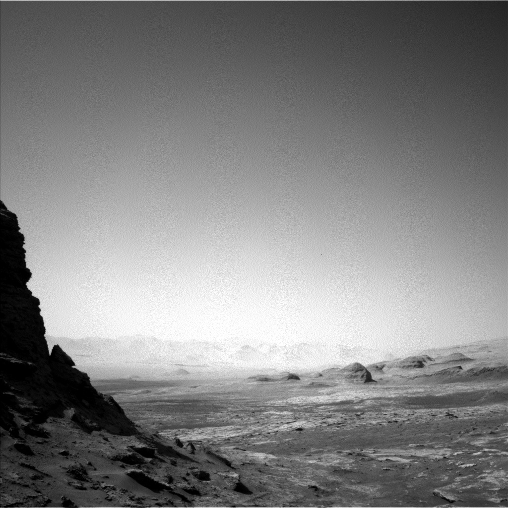
A quick cool image! The photo to the right, reduced to post here, was taken yesterday by Curiosity’s left navigation camera. It looks west across the floor of Gale Crater, at the base of a nearby butte.

The crater rim, as seen by the distant mountains, is about 25 miles away. The butte that towers above Curiosity is probably no more than 50 feet high.

Below is a panorama showing the full view to the west, with Navarro Mountain (the nearby 450-foot-high foothill at the base of Mount Sharp) on the left edge. Based on the rover’s planned route, it will travel to the right of the butte rather than climbing up onto the saddle on the left. This will take it to the western side of Navarro Mt, where it will eventually head south into the canyon Gediz Vallis.
» Read more

4 comments

The lacy rocks of Mars

Lacy rocks on Mars
Click for full image.

Cool image time! The image to the right, cropped and reduced to post here, was taken on July 16, 2021 by the Mars rover Curiosity, using its high resolution mast camera.

There isn’t much to say. These are alien rocks, created in a place with a gravity only about a third that of Earth’s in a climate that is very different. Their delicate nature suggests we are looking at something that was once more substantial and has since been undergoing erosion.

Nor has it been that unusual to find rocks so dainty on Mars. In fact, the more Curiosity has climbed, the more such things have been visible. And similar things were seen by the rovers Spirit and Opportunity.

How such rocks formed initially in the far past, under what climate conditions, remains the number one mystery on Mars. What is now causing it to flake away into such a finespun gossamer of complexity is as much a mystery, tied more to the climate and geology of Mars today.

This rock sits on the bottom flank of Mt Sharp in Gale Crater, at the highest elevation Curiosity has yet climbed. At this point the rover has just entered a new geological unit, what scientists have dubbed the sulfate unit. The evidence gathered from a distance (that so far appears confirmed by recent observations) suggest that this unit was formed under a fluctuating environment that laid down many layers of sediment as conditions ebbed and flowed.

4 comments

Curiosity looks across at the alien landscape of Gale Crater

Curiosity's view across Gale Crater
Click for full image.

Most of the images from Curiosity that I have posted recently have been of the spectacular mountain scenery looking south at Mount Sharp itself. Today’s cool image, taken on July 6, 2021 by the rover’s right navigation camera and cropped to post here, instead looks north, out across the floor of Gale Crater to its distant rim about twenty miles away.

The rover is likely not to move for a week or so, as it has just completed drilling its first drillhole since it moved up into the next geological layer, dubbed the sulfate unit. Because of this they have been using the rover’s cameras to take a lot of pictures of the surrounding terrain, including several high resolution mosaics.

The two overview maps below show what the cool image above is looking at.
» Read more

2 comments

Curiosity’s mountainous view

Curiosity's view uphill on June 23, 2021
Click for full resolution panorama. Note: Navarro Mt is about 450 feet high.

The travels of Curiosity at the base of Mount Sharp continue. In the past week, since my last update on June 16th, the rover has moved west past the entrance to Gediz Vallis to now sit at the base of Raphael Navarro Mountain, as shown by the panorama above. To get a sense of how far the rover has traveled in the past week, compare this panorama with the one posted then. It is also clear now that they are slowly returning to their planned route, and will not push up into Gediz Vallis as I speculated in that post.

The panorama is created from three photos taken by Curiosity’s navigation camera, found here, here, and here.

The map below the fold gives the context.
» Read more

0 comments

The Mountains of Mars

The mountains of Mars
Click for full resolution. The highest mountain on the right is about 450 feet high.

Even as the rover Perseverance is beginning its first science campaign on the floor of Jezero Crater, the rover Curiosity about 3,000 miles to the east has begun its climb into the mountains of Mars that surround the central peak of Gale Crater, Mount Sharp.

The mosaic above, made from two images taken by the rover’s right navigation camera (here and here), shows what Curiosity sees ahead. Since my last update on June 4th describing Curiosity’s future travels, the rover’s science team has pushed forward directly uphill towards the entrance to the canyon Gediz Vallis, visible as the gap between the mountains to the right and left in the above mosaic.

The overview map below shows the rover’s approximate present position, with the yellow lines indicating what the above photo is looking at.
» Read more

0 comments

Curiosity’s dramatic path forward

Curiosity's future travels
Click for full image.

Cool image time! In the coming weeks and months the view from Curiosity is going to give us the most spectacular views of another world since the Apollo astronauts walked on the Moon.

In today’s download of new images from the Mars rover Curiosity was the photo above, reduced to post here. Taken by rover’s right navigation camera, it looks west directly in line with Curiosity’s future travels, and shows that it is now finally entering mountain country.

The overview map below provides the context.
» Read more

3 comments

Curiosity’s mesa-top view of Gale Crater

The view of Gale Crater from on top of Mont Mercou
Click for full image.

Cool image time! The photo above, reduced slightly to post here, was taken on April 14, 2021 by one of the navigation cameras on Curiosity. The rover was then and is still sitting on top of the twenty foot high outcrop dubbed Mont Mercou.

Last week I had posted a panorama made from images at this viewpoint looking south towards Mount Sharp. Today’s image is from the same place, but now looks north across the floor of Gale Crater at the areas that Curiosity had previously traveled. I think the smallest mesas on the left of this image are the Murray Buttes which Curiosity was traveling through back in 2016, but am not certain.

The mountains in the far distance are the rim of the crater, about 30 miles away.

4 comments

Gale Crater’s small mesas were formed by wind, not liquid water

Route through Murray Buttes
The Murray Buttes. Click to see August 11, 2016 post.

The uncertainty of science: Though Curiosity has found apparent evidence of past liquid water during its early travels on the floor of Gale Crater, scientists have now concluded that the first small mesas and buttes it traveled past back in 2016, dubbed the Murray Buttes, were not formed by the flow of liquid water but by wind reshaping ancient sand dunes. From the press release:
» Read more

2 comments

The rovers’ view of Mars

The view from the top of Mont Mercou
Click for higher resolution. For original images, go here and here.

Some cool images to savor from Mars! Above is a panorama from Curiosity, created by me from two images taken by the rover’s left navigation camera today, April 18, 2021. The view is southwest towards the canyon regions where Curiosity will be heading in the coming months. Note the roughness of the ground. Travel is going to be tricky from here on out.

The photo was taken from the top of Mont Mercou, the 20-foot high outcrop that the rover spent several weeks studying at the cliff’s base. The Curiosity science team is presently preparing to drill into the bedrock at the top.

Ingenuity on the floor of Jezero Crater
Click for full image.

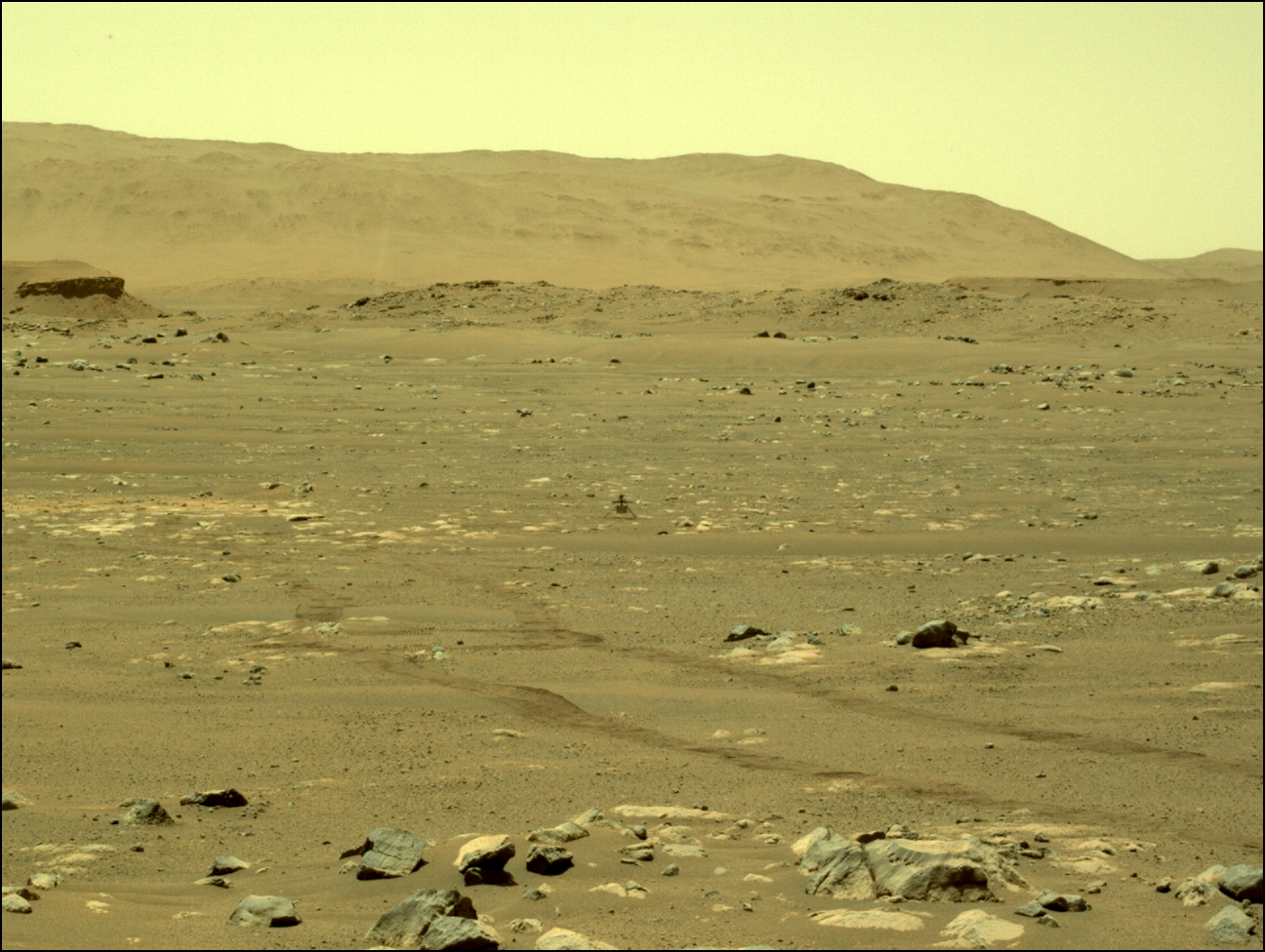
The photo to the right, reduced to post here, was taken by Perseverance on April 13, 2021, and looks west across the floor of Jezero crater. The high mountains in the distance are the crater’s rim. The low and much closer hill is the delta that is the rover’s primary geological target.

In the center of the picture is the helicopter Ingenuity. You can also see the tracks of Perseverance’s wheels just below it.

This will be the rover’s vantage point when Ingenuity attempts its first test flight in the early morning hours of April 19, 2021. The helicopter will head to the right once it lifts off.

2 comments

Clouds over Gale Crater

Clouds over Gale Crater
Click for full image.

Cool image time! In today’s download of new images from Curiosity was a large number looking at the sky. by one of the rover’s navigation cameras. As noted in the science team’s most recent update, their aim was to “watch for clouds in the sky at twilight.”

They were apparently very successful. The picture to the right, reduced to post here, is one example. The other pictures show these clouds and other clouds as they change over time.

I don’t have much more to add, other than to say it is quite breath-taking to be able to sit here on Earth and routinely gaze at the weather on Mars.

UPDATE: I do have one more thing to say. If you have any skills at programming and want to figure out how to process the raw images from Curiosity and Perseverance to bring out their color, you might find the video at this link of interest: How Can You Color Process Mars Rover’s Images In DaVinci Resolve?

I am not a computer programming geek, so some of its details went over my head. Nonetheless, it opened a window into the photo-engineering used to turn the rovers’ black-and-white digital data into color.

Hat tip to Patrick Inhofer, who calls himself the photon wrangler at MixingLight.com.

8 comments

Curiosity faces the mountains

A cropped section from Perseverance's 1st panorama
A cropped section from Perserverance’s 1st panorama.
Click for full image.

Though the present excitement over the spectacular images and sounds coming down from Perseverance is certainly warranted, what must be understood is that this rover is presently only at the beginning of its journey, and is thus sitting on relatively boring terrain, from a merely visual perspective. The scientists might be excited, but to the general public, all we really are seeing is a flat dusty desert with some scattered rocks on the floor. In the far distance can be seen some hills and mountains (Jezero Crater’s rim), but they are very far away.

Curiosity, which the press and the public has largely forgotten about, is actually just beginning what will likely be the most breath-taking part of its journey. As I noted in my last rover update last week, Curiosity is now at the very base of Mount Sharp, and is about to enter the mountain’s canyons and initial slopes. For its past eight-plus years of roving it has been on the flat floor of Gale Crater, followed by some weaving among the smallest foothills of Mount Sharp. The views have been intriguing and exciting from a research perspective, but hardly breath-taking from a picture-taking point of view.

That is now changing. The picture below, taken by Curiosity just this week, gives us a taste of what is to come.
» Read more

11 comments

Rover update: Panorama from Curiosity; Perseverance unwinds

Summary: Curiosity has crept to the foot of Mt Sharp at last, while Perseverance checks out its equipment.

Curiosity

Curiosity panorama Sol 3049
Click for full resolution.

Overview map

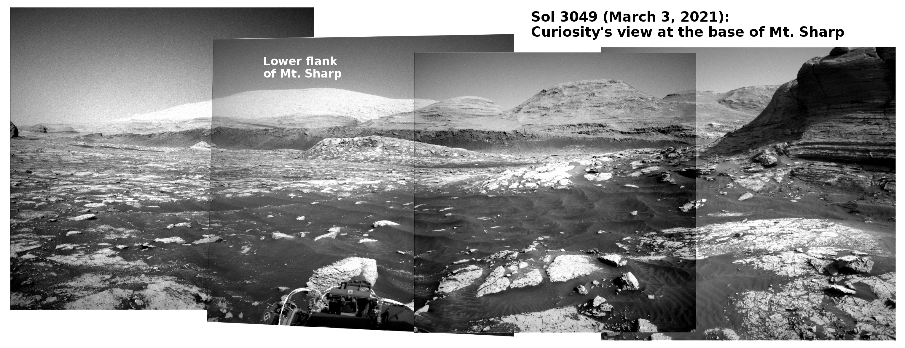
This rover update will be short but very sweet. While the press and public has been oo’ing and ah’ing over the first panorama from Perseverance, Curiosity yesterday produced its own panorama above showing the looming cliffs of Mt. Sharp, now only a short distance away. The original images can be found here, here, here, and here.

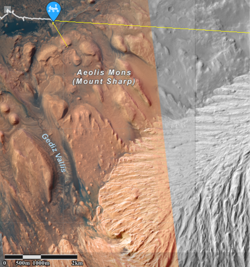
The overview map to the right, from the “Where is Curiosity?” webpage, shows the rover’s location, with the yellow lines roughly indicating the view afforded by the panorama above. If you compare this panorama with the one I posted in my previous rover update on February 12, 2021, you can get a sense of how far the rover has traveled in just the past two weeks. It now sits near the end of the red dotted line pointing at the mountain, right next to what had been a distant cliff and now is only a short distance to the rover’s right.

Somewhere on the mountain slopes ahead scientists have spotted in orbiter images recurring slope lineae, seasonal streaks on slopes that appear in the spring and fade as they year passes. As Curiosity arrives at the next geological layer a short distance ahead at the base of these cliffs (dubbed the sulfate unit), it will spend probably several months studying both that sulfate unit as well as those lineae. Expect the rover to drill a few holes for samples as it watches to see any changes that might occur on that lineae.

Now, on to Perseverance!
» Read more

0 comments

Scientists: Gale Crater never had flowing surface water and was always cold

The uncertainty of science: According to a new analysis of the data from Curiosity and Martian orbiters, scientists now propose that the climate in Gale Crater was never warm, but ranged from Icelandic conditions to far colder.

More importantly, the data suggests that none of chemistry there that required the presence of water was formed by fluvial processes, or flowing water. From the abstract:

We show that the geochemistry and mineralogy of most of the fine‐grained sedimentary rocks in Gale crater display first order similarities with sediments generated in climates that resemble those of present‐day Iceland, while other parts of the stratigraphy indicate even colder baseline climate conditions. None of the lithologies examined at Gale crater resemble fluvial sediments or weathering profiles from warm (temperate to tropical) terrestrial climates. [emphasis mine]

As must be repeated, the mineralogy found by Curiosity points to the presence of water once in Gale Crater, now gone. The initial assumption has always been that this water must have been liquid, as found on Earth. This new research is noting that the conditions show little evidence that liquid water ever existed, but was instead held in frozen lakes and glaciers.

In the coming years I think we are going to learn a lot about the glaciers and ice on Mars, both past and present, and how they reshaped Mars in ways that are alien to processes found on Earth.

1 comment

Curiosity checks out its wheels

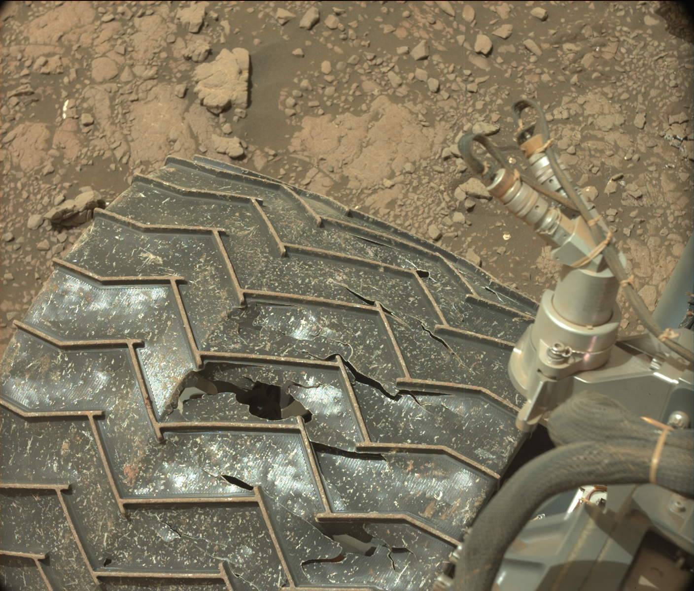
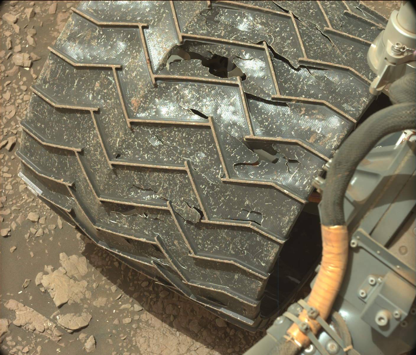
One wheel on Curiosity, as seen in July 2020 and January 2021
For full resolution images, go here and here for the
top image, and here and here for the bottom image.

Having finished a two week look at a sea of sand, Curiosity’ science team has resumed its journey east towards the higher slopes of Mount Sharp.

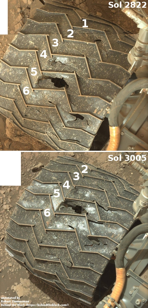
Before they started out however, they decided to aim the rover’s high resolution mast camera at Curiosity’s wheels to see how they are faring and whether any of the damage that occurred in the early days of the mission has worsened. The photo on the right compares what was seen this week with the damage on the same wheel as seen in July 2020. This is also the same wheel I have posted images of since September 2017.

Not only does there appear to be no appreciable new damage to this wheel in the six months since July, remarkably, a comparison between today’s image and the photo from September 2017, shows little change as well.

In the more than three years since that 2017 photo, Curiosity has crossed Vera Rubin Ridge, crossed the clay unit, climbed up the next ridge to take a look at the incredibly rough terrain of the Greenheugh Pedimont, and then continued across the clay unit on its way to higher and possibly more challenging terrain.

In all those travels it appears this particular wheel has fared rather nicely, accumulating in at least this part little new damage. This bodes well for the rover’s future, as the wheels have been a concern since Curiosity’s first two years on Mars, when engineers found they were experiencing more damage than expected. The travel techniques they have adopted since to protect the wheels appear to be working.

4 comments

Published results from Curiosity as it traversed Vera Rubin Ridge

The science results from American Mars rover Curiosity during its traverse of Vera Rubin Ridge at the base of Mount Sharp in Gale Crater have now been released to the public.

This link takes you to the overview paper, available online for free. The abstract notes the key finding, which confirms previously released research:

We conclude Vera Rubin ridge formed because groundwater recrystallized and hardened the rocks that now make up the ridge. Wind subsequently sculpted and eroded Mount Sharp, leaving the harder ridge rocks standing because they resisted erosion compared with surrounding rocks. The implication of these results is that liquid water was present at Mount Sharp for a very long time, not only when the crater held a lake but also much later, likely as groundwater.

The fundamental geological mystery of Mars remains. The evidence strongly says that liquid water must have existed for long periods on the surface of Mars. At the same time, other evidence strongly says that the climate and atmosphere of Mars has never been warm enough or thick enough to allow for liquid water on the planet’s surface.

So far, no global model proposed by any theorist that allows liquid water in the past on Mars has been accepted with any enthusiasm by the planetary community. While possible, the models carry too many assumptions and are based on what is presently far too limited data. We simply do not yet know enough about Mars and its past history to explain this conundrum.

The paper also outlines a number of models for allowing liquid water in the localized area of Gale Crater alone. As with the global models, none fits all the facts, or is entirely satisfactory for explaining the data.

Regardless, the results from Vera Rubin Ridge confirm once again that enough liquid water once did exist on Mars to have allowed it to be habitable for life, even if we have so far found no evidence of any past life.

1 comment

Curiosity data suggests the occurrence of mega floods in Gale Crater

The uncertainty of science: Using Curiosity data a team of scientists are now suggesting that some of the features the rover has seen were created during mega flood within Gale Crater, and this data also requires a rethinking of the present theories of the crater’s geological history.

This case includes the occurrence of giant wave-shaped features in sedimentary layers of Gale crater, often called “megaripples” or antidunes that are about 30-feet high and spaced about 450 feet apart, according to lead author Ezat Heydari, a professor of physics at Jackson State University.

The antidunes are indicative of flowing megafloods at the bottom of Mars’ Gale Crater about 4 billion years ago, which are identical to the features formed by melting ice on Earth about 2 million years ago, Heydari said.

The most likely cause of the Mars flooding was the melting of ice from heat generated by a large impact, which released carbon dioxide and methane from the planet’s frozen reservoirs. The water vapor and release of gases combined to produce a short period of warm and wet conditions on the red planet.

The press release above focuses on the catastrophic floods, but the research paper itself is really much more focused on the need to rethink present hypotheses for explaining the observed geology in Gale Crater. This report notes that they are finding patches of material that could not have been laid down as seen, based on those past theories, and proposes the catastrophic flood event as a possible solution.

In reading the paper however it is evident that even this new hypothesis is based on a limited amount of data, and thus can have holes punched in it as well. This is not to say that the paper is invalid, only that it must be taken with some skepticism. The data being obtained at Gale Crater simply incomplete. Curiosity is following only one path, and has not even left the foothills of Mount Sharp. In order to gain a wider and fuller understanding geologists need to study the entire crater floor, as well as the geology on the mountain.

1 comment
1 6 7 8 9 10 13