
Proteus, Neptune’s second largest moon, discovered by Voyager-2 in 1989
For original images go here and here.
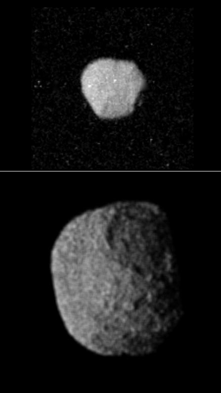
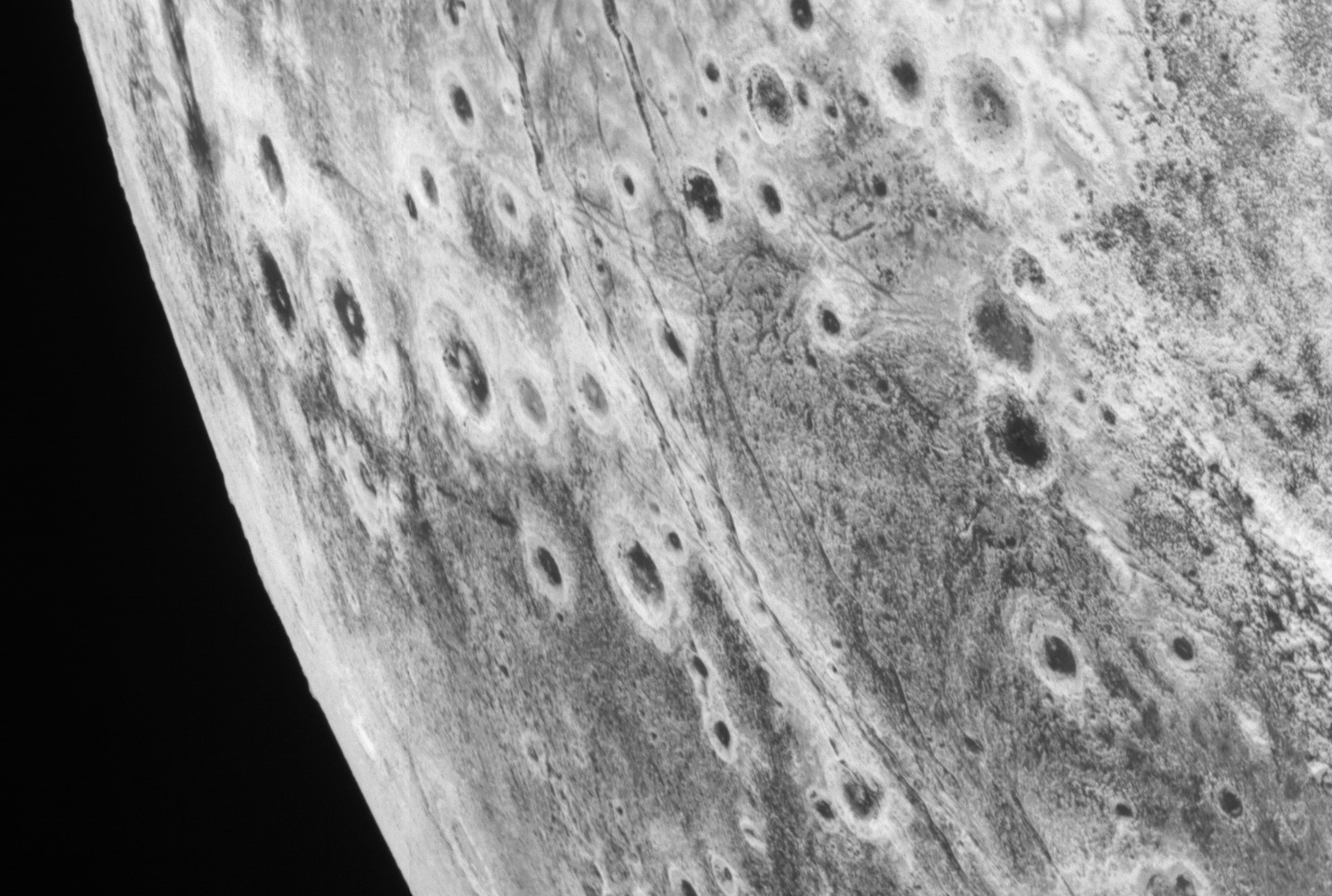
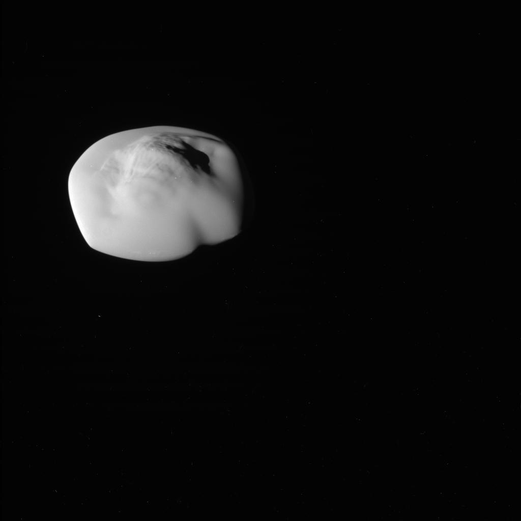
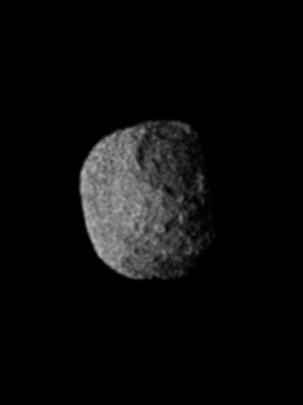
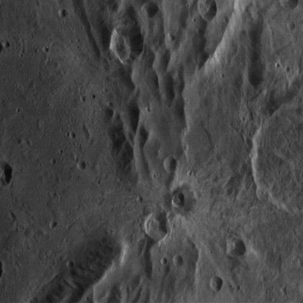
Our tour continues of the only close visit to Neptune on August 25, 1989 by Voyager-2. The two pictures to the right were taken by the spacecraft during that fly-by of Neptune’s second largest moon, dubbed Proteus. Both pictures are shown as Voyager-2 took them.
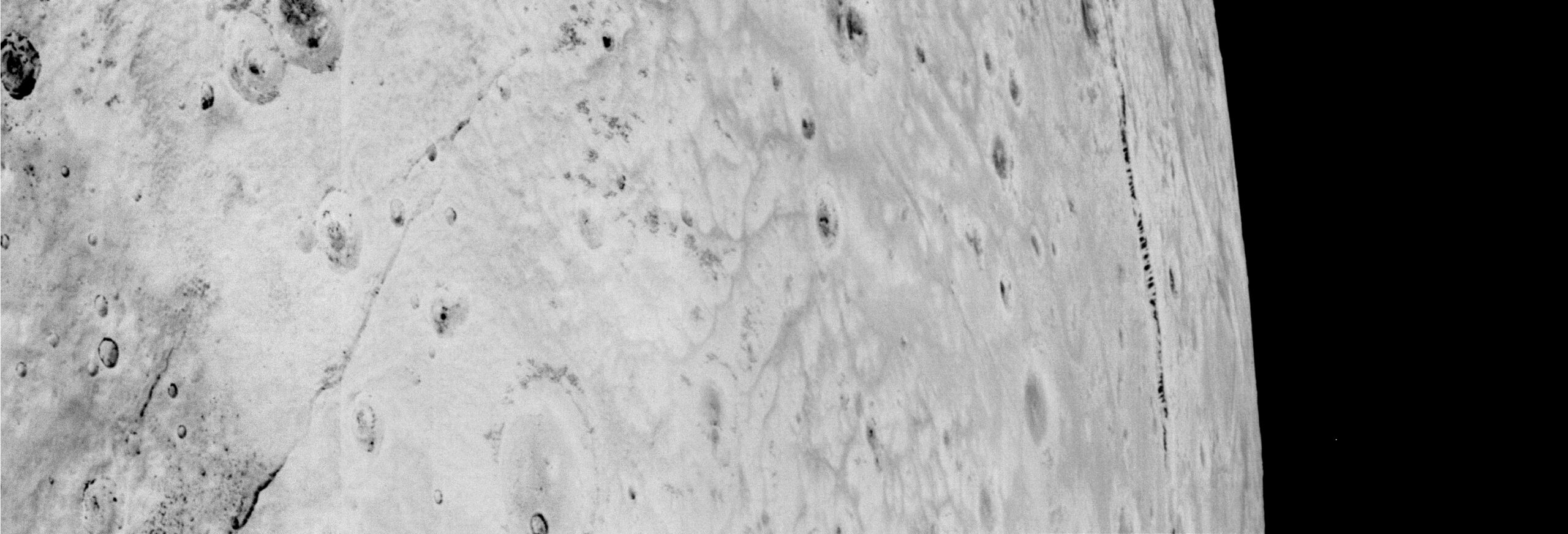
The top picture was taken from a distance of about 540,000 miles, and has a resolution of about five miles per pixel.
The satellite has an average radius of about 120 miles and is uniformly dark with an albedo of about 6 percent. The irregular shape suggests that 1989N1 has been cold and rigid throughout its history and subject to significant impact cratering.
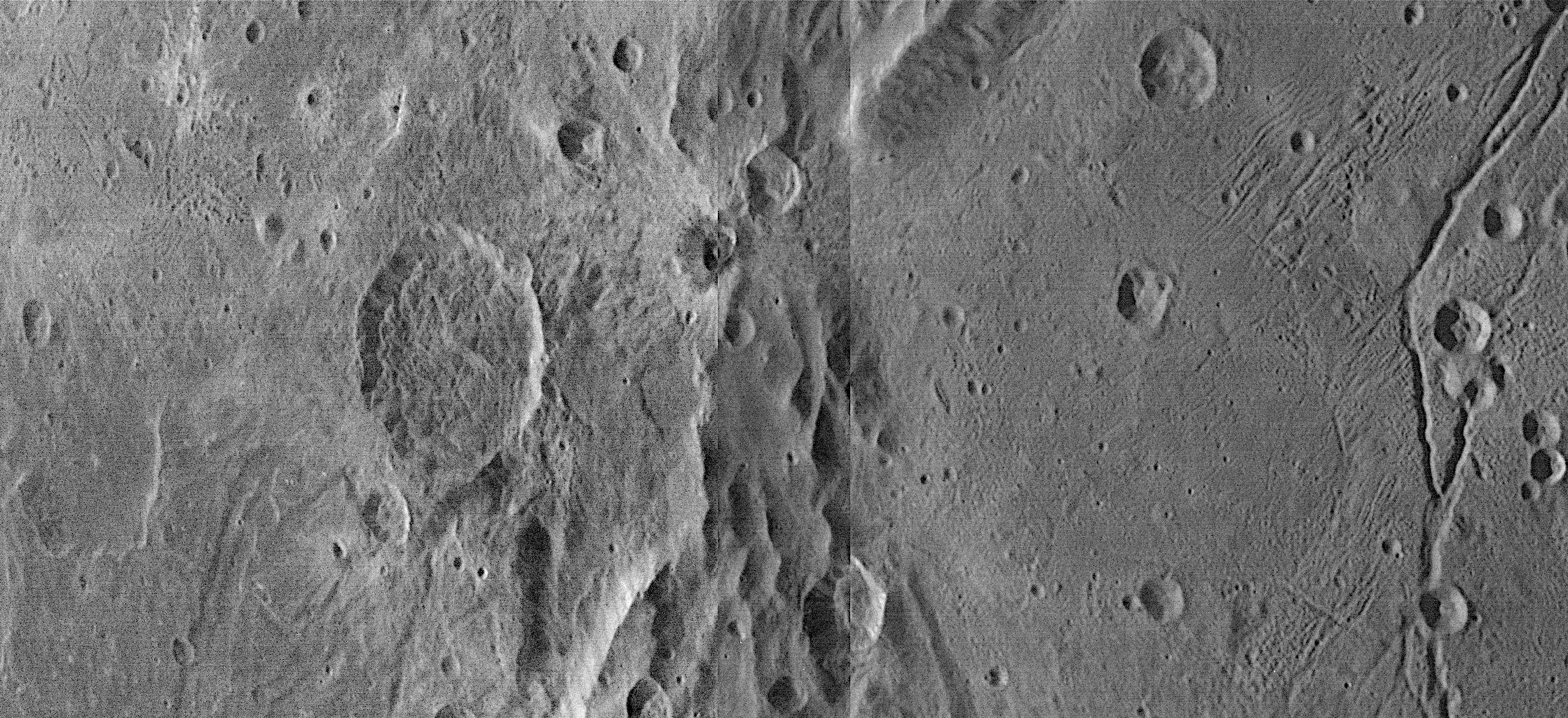
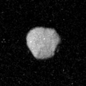
The bottom picture was taken from a distance of about 91,000 miles, and can resolve objects as small as 1.7 miles in size.
Hints of crater-like forms and groove-like lineations can be discerned. The apparent graininess of the image is caused by the short exposure necessary to avoid significant smear.
Proteus was not known prior to Voyager-2’s fly-by, because it orbits so close to Neptune (about 73,000 miles) that the ground-based telescopes of the time could not see it in the glare of the gas giant. It was discovered in early global pictures of Neptune as Voyager-2 approached.
While planetary scientists have made some educated guesses about the moon’s origin and geology based on these two images, they are simply guesses. These are the only detailed images we have of Proteus, and neither is particularly good.
For original images go here and here.
Our tour continues of the only close visit to Neptune on August 25, 1989 by Voyager-2. The two pictures to the right were taken by the spacecraft during that fly-by of Neptune’s second largest moon, dubbed Proteus. Both pictures are shown as Voyager-2 took them.
The top picture was taken from a distance of about 540,000 miles, and has a resolution of about five miles per pixel.
The satellite has an average radius of about 120 miles and is uniformly dark with an albedo of about 6 percent. The irregular shape suggests that 1989N1 has been cold and rigid throughout its history and subject to significant impact cratering.
The bottom picture was taken from a distance of about 91,000 miles, and can resolve objects as small as 1.7 miles in size.
Hints of crater-like forms and groove-like lineations can be discerned. The apparent graininess of the image is caused by the short exposure necessary to avoid significant smear.
Proteus was not known prior to Voyager-2’s fly-by, because it orbits so close to Neptune (about 73,000 miles) that the ground-based telescopes of the time could not see it in the glare of the gas giant. It was discovered in early global pictures of Neptune as Voyager-2 approached.
While planetary scientists have made some educated guesses about the moon’s origin and geology based on these two images, they are simply guesses. These are the only detailed images we have of Proteus, and neither is particularly good.


