
Gully erosion in a Martian dune field
Click for original image.
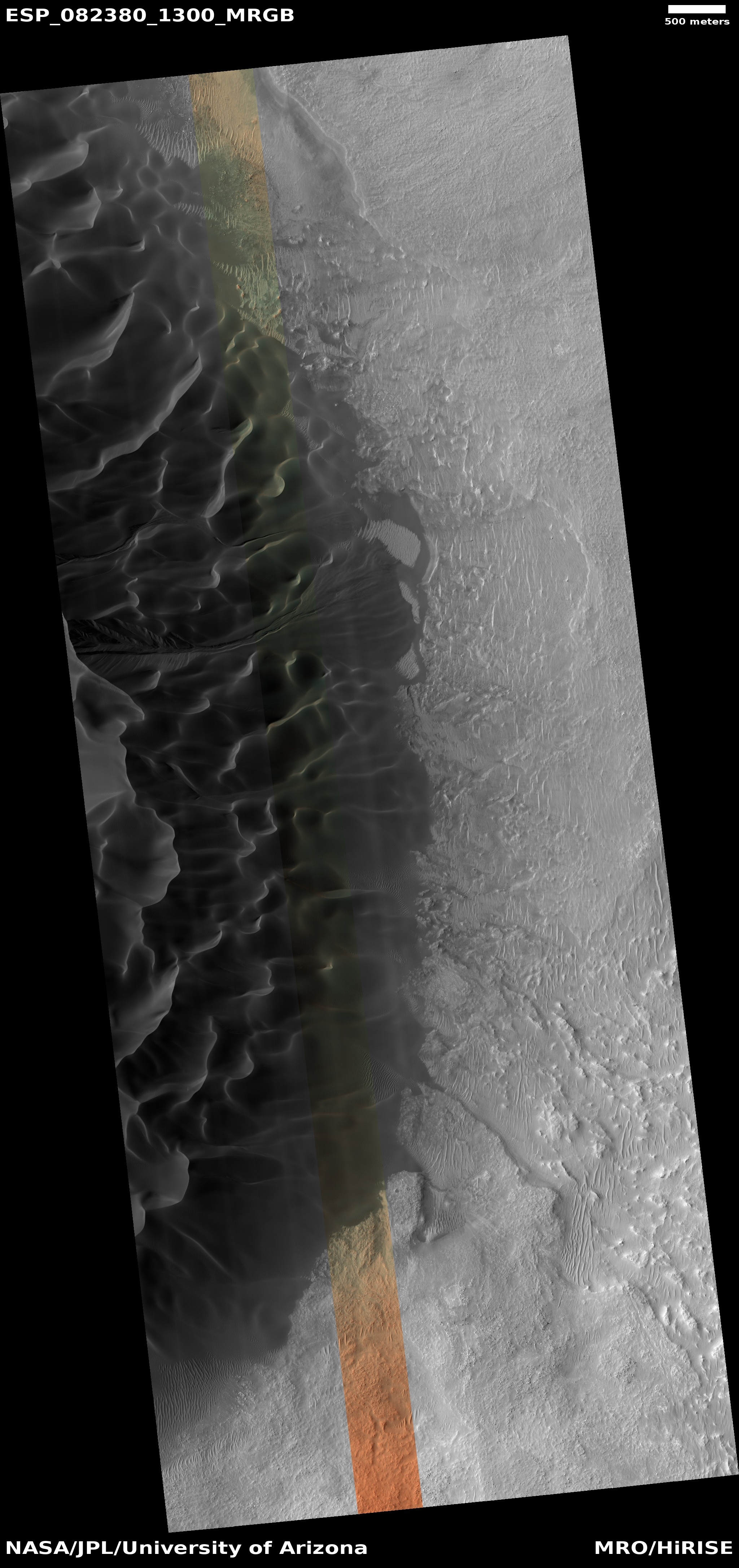
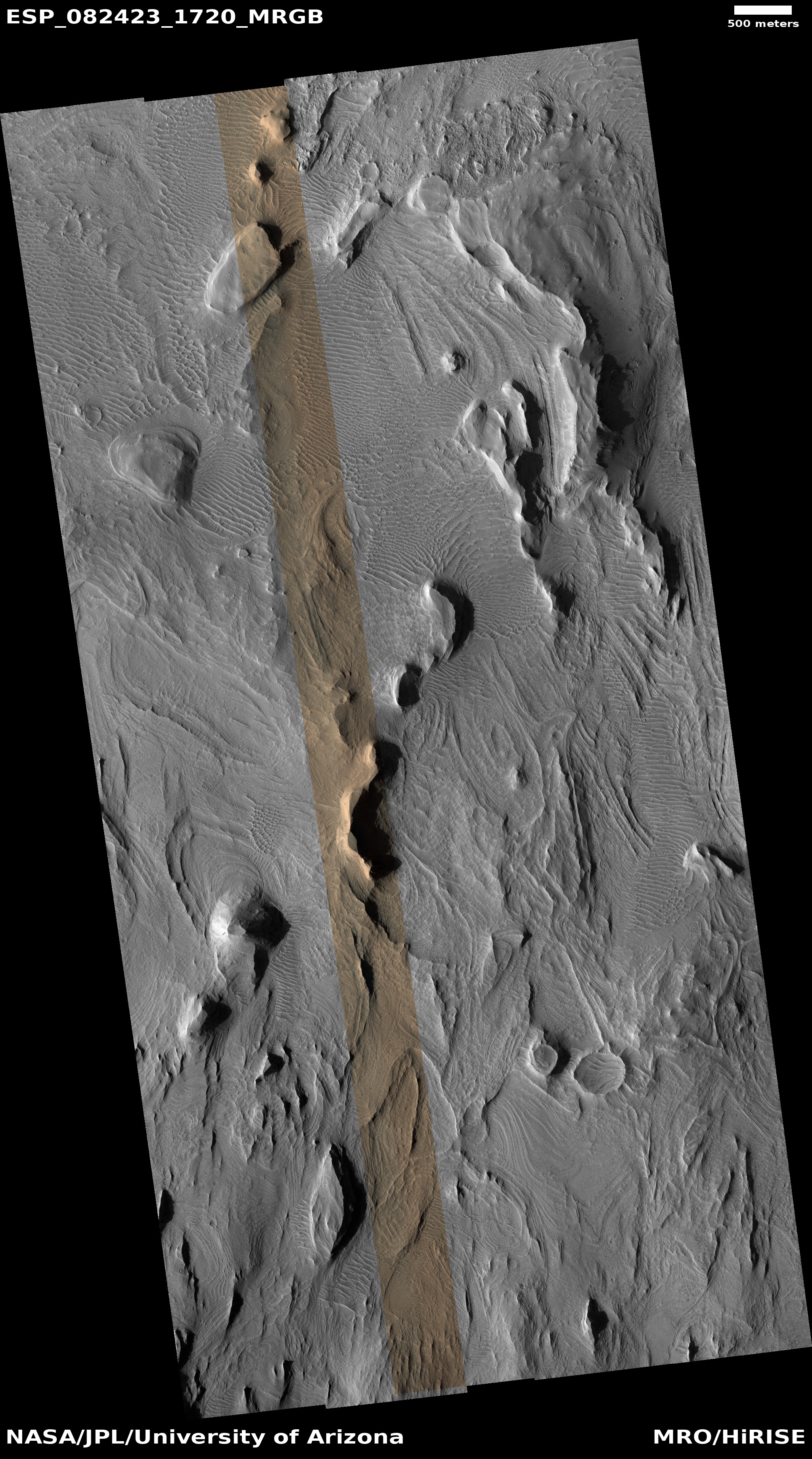
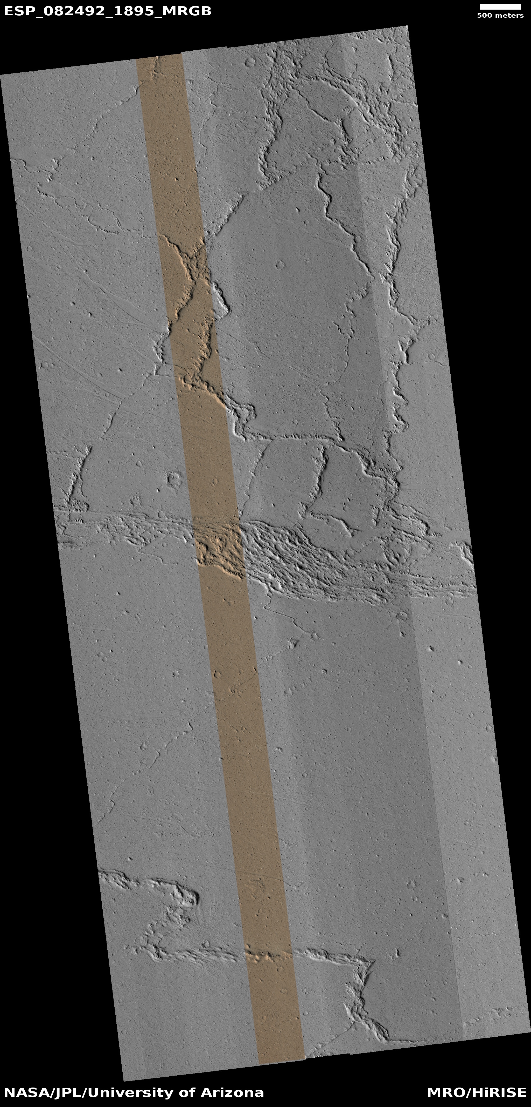
Today’s cool image is another example of how little we really understand the geology of Mars. The picture to the right, rotated, cropped, reduced, and enhanced to post here, was taken on February 22, 2024 by the high resolution camera on Mars Reconnaissance Orbiter (MRO).
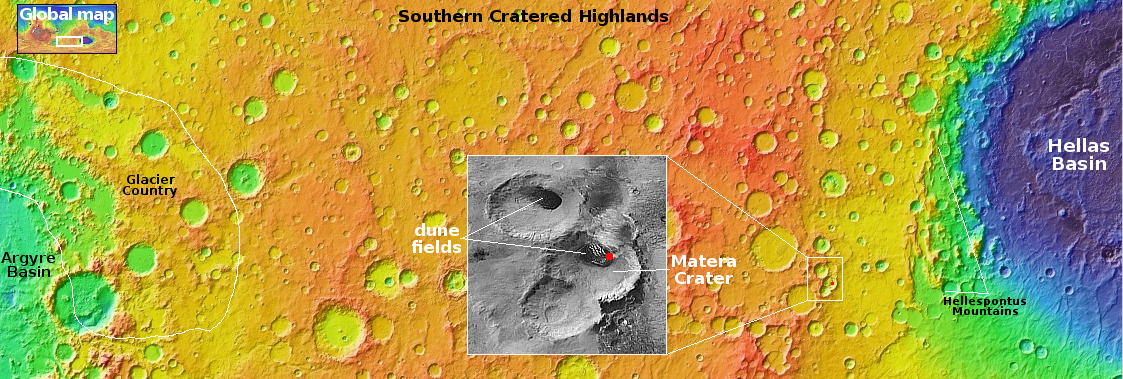
The focus of the image is the eastern end of a large and very distinct dune field inside 31-mile-wide Matera Crater, as shown by the white rectangle in the overview map above. The field fills an area 10 by 11 miles inside the floor of the crater. On that eastern end is a very pronounced drainage gully dropping downhill about 2,000 feet to the east.
Gullies on Martian slopes, especially on the interior rims of craters, are not unusual. Though their true cause is not yet confirmed, the theories behind their existence all relate to some form of water/ice process, mostly relating to the seasonal freeze-thaw cycle.
This picture was taken in the spring, exactly when seasonal changes might be spotted. In fact, scientists have been taking regular MRO images of this gully since 2007, when it was featured image. From that 2007 caption:
» Read more


