
LRO locates and photographs Odysseus on lunar surface
Click for original LRO image of Odysseus
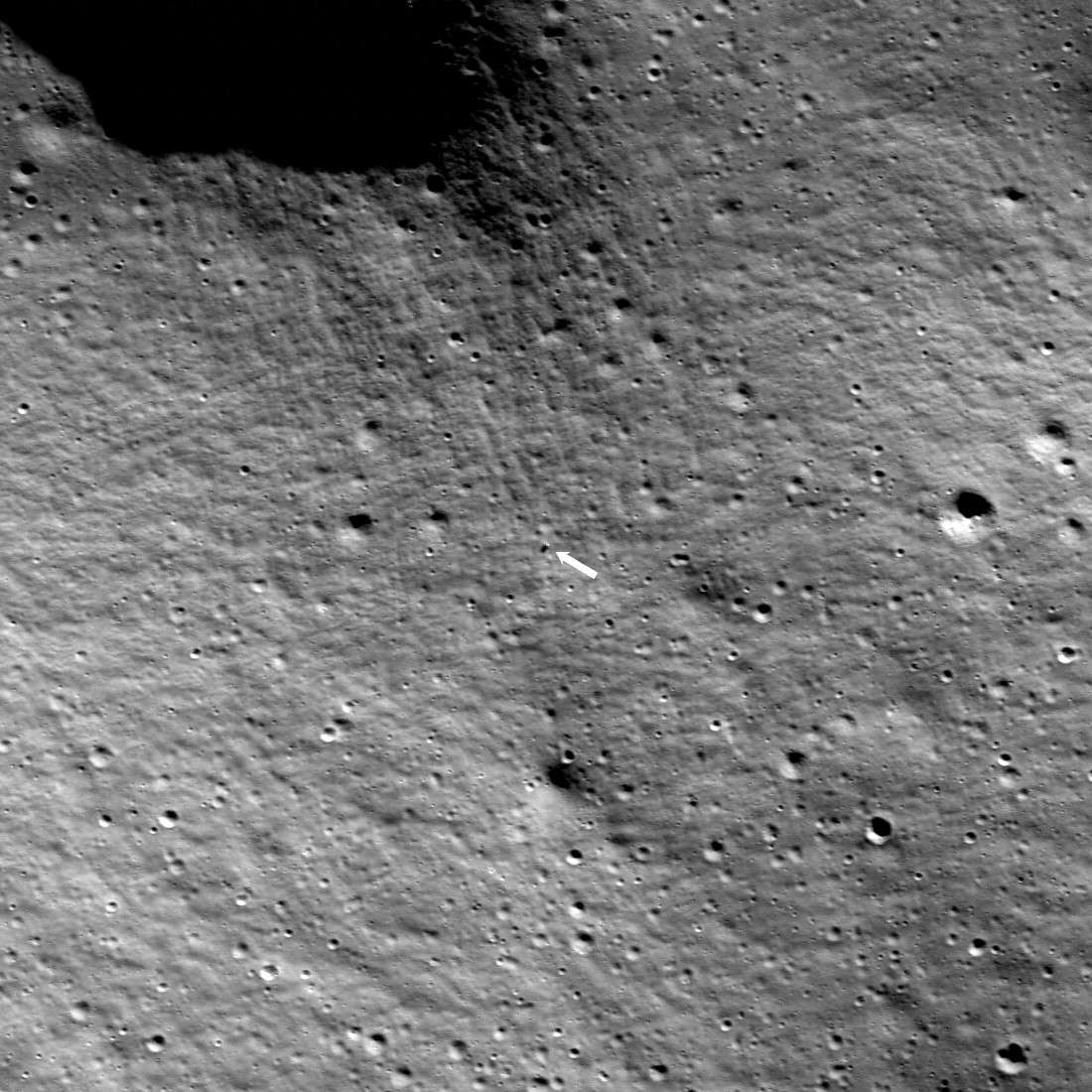
Scientists using Lunar Reconnaissance Orbiter (LRO) this weekend located and photographed Intuitive Machines’ Odysseus Nova-C lunar lander at a height of 56 miles during its first orbit over the site.
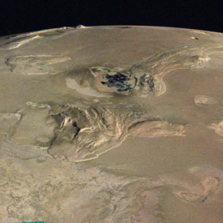
The inset in the map to the right shows the lander, with the white dot marking its landing site, several miles to the south of the planned landing site, as indicated by the yellow dot.
Odysseus came to rest at 80.13 degrees south latitude, 1.44 degrees east longitude, 8,461 feet (2,579 meters) elevation, within a degraded one-kilometer diameter crater where the local terrain is sloped at 12 degrees.
That slope could by itself explain why the lander tipped over and ended up on its side. First, it landed faster than planned. Second, Intuitive Machines designed this Nova-C lander with a relatively tall configuration, which gives it a high center of gravity. Hitting the ground fast and on such a slope could easily have been enough for momentum to tilt it over after touchdown.


