
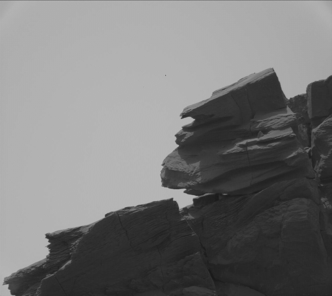
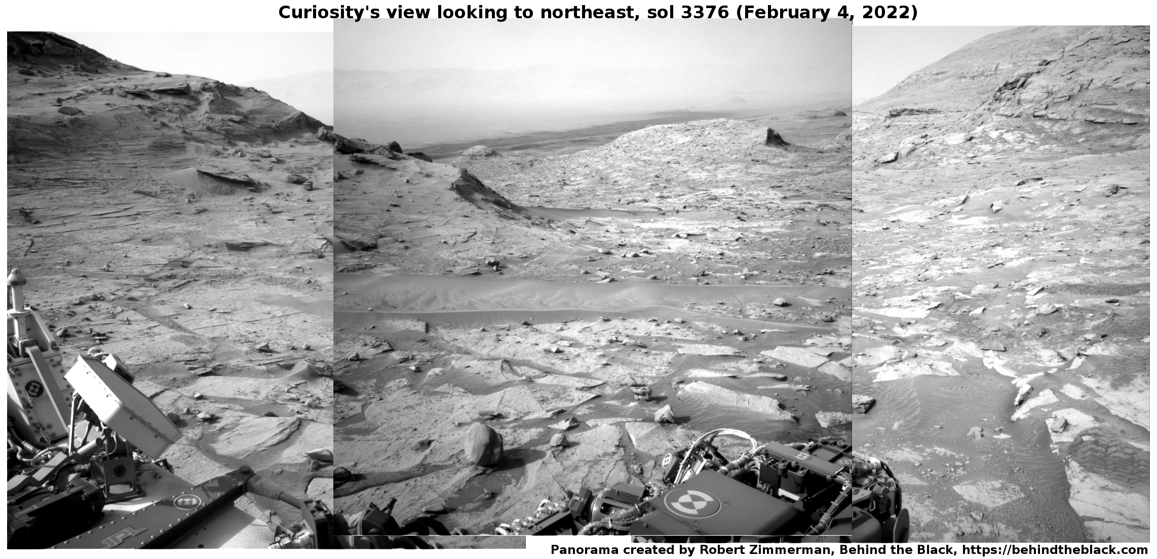
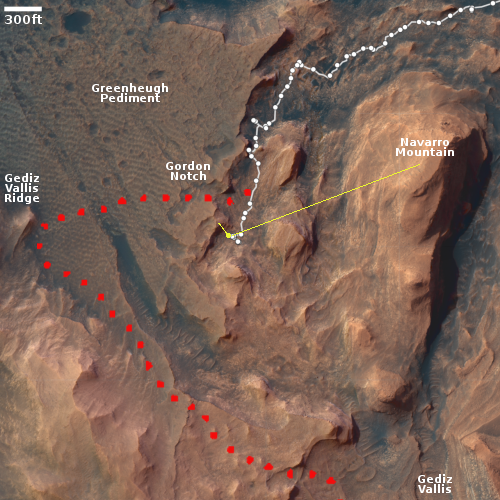
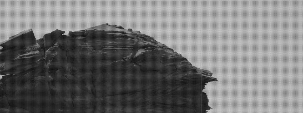
Curiosity images the Martian version of a cave formation
Click for full image.
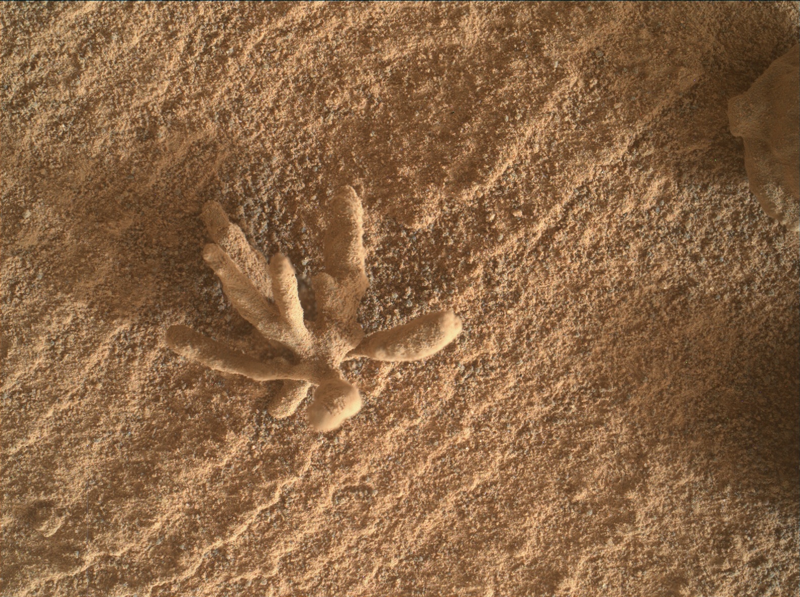
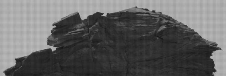
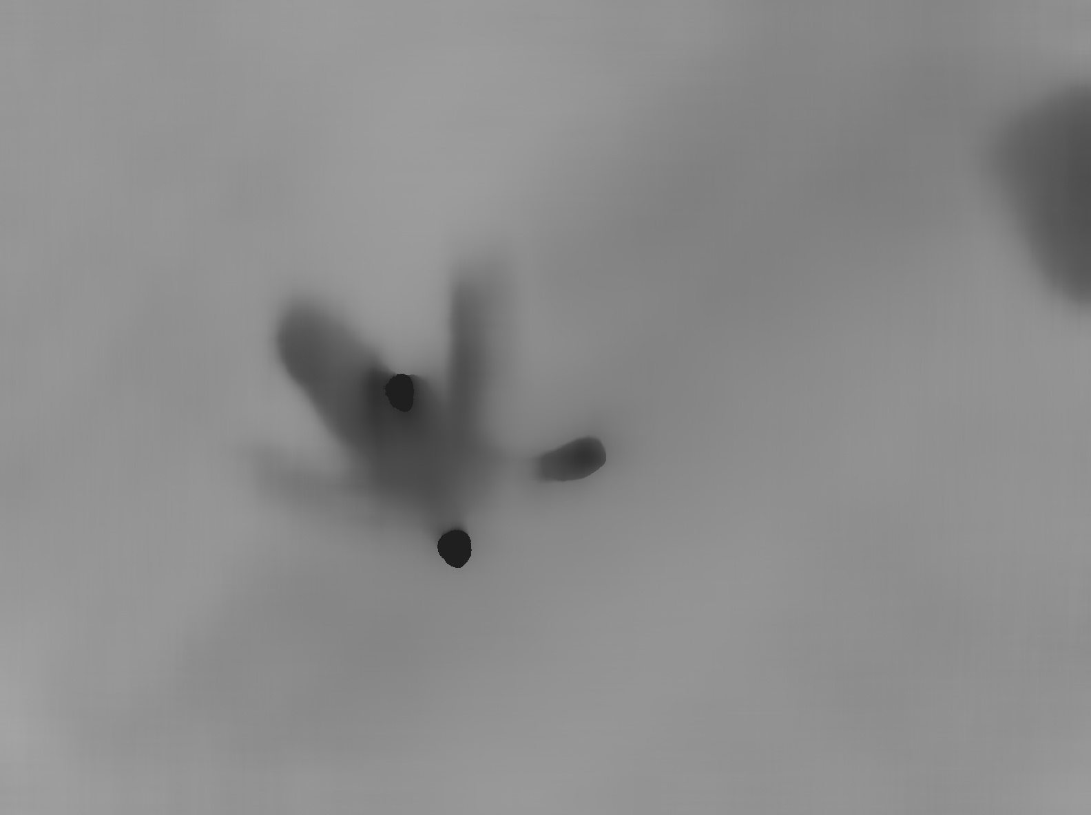
Cool image time! The photo to the right, cropped and reduced to post here, was taken today by Curiosity’s Mars Hand Lens Imager (MAHLI), a camera designed to get close high resolution images of very small features on the surface.
The Curiosity image site does not provide a scale, but MAHLI, located at the end of the rover’s robot arm, is capable of resolutions as small as 14 microns per pixel. Since a micron is one thousandth of a millimeter, and the original image was 1584 by 1184 pixels in size, that means the entire image is likely only slightly larger than 18 to 25 millimeters across, or slightly less than an inch.
This feature, which closely resembles a cave helictite, is thus about a quarter inch in size. Helictites, which in caves often resemble wildly growing roots, are nonetheless made of calcite, not organic material. They grow wildly because the water is being pushed out from their center is under pressure, so that as it drips away from the formation it leaves its calcite deposits randomly, causing the formation to grow randomly.
MAHLI also took what looks to be an infrared or heat image of the formation, which appears to show that the tips of the branches are at a different temperature, I think cooler, than the rest of the formation.
While seeping water causes helictites on Earth, what formed this thing on Mars is beyond my guess. It sure looks cool however.


