
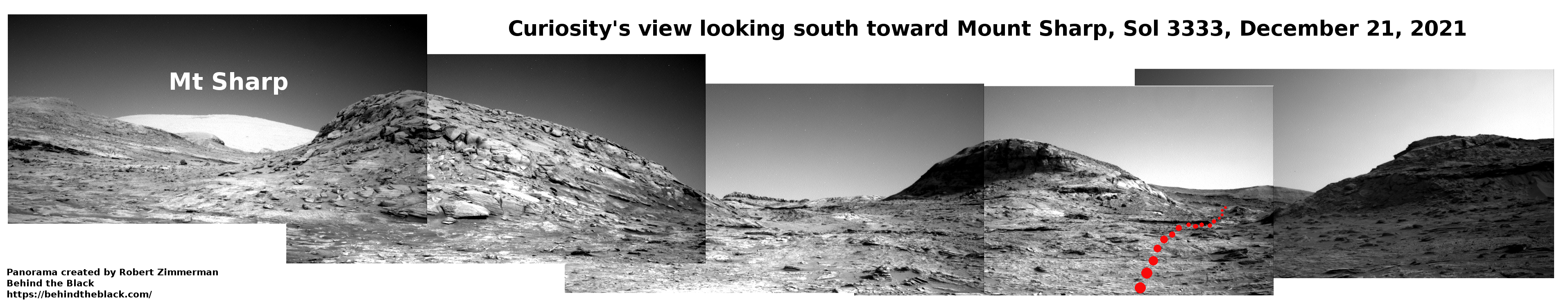
A cracking and collapsing glacier on Mars
Click for full image.
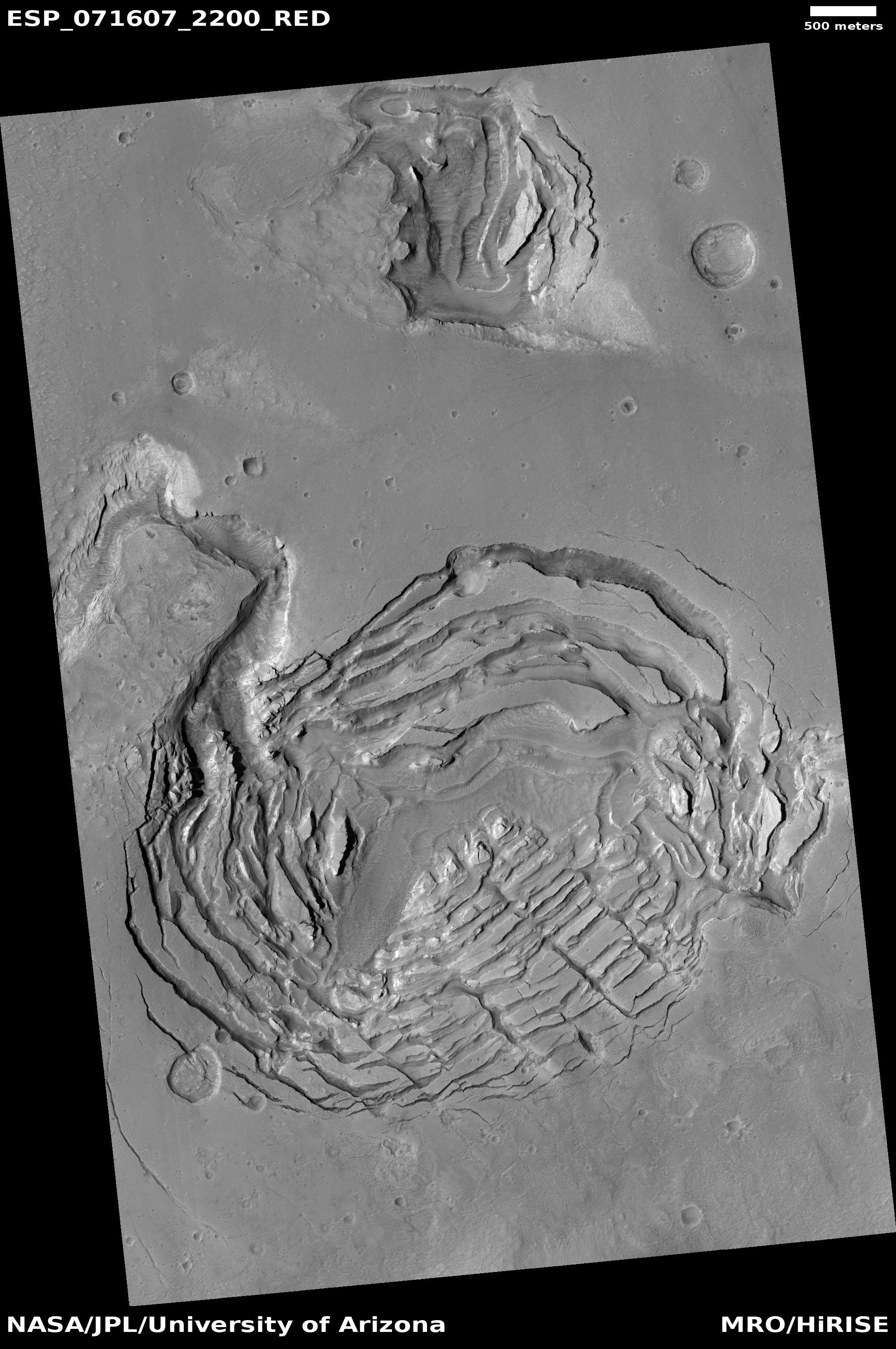
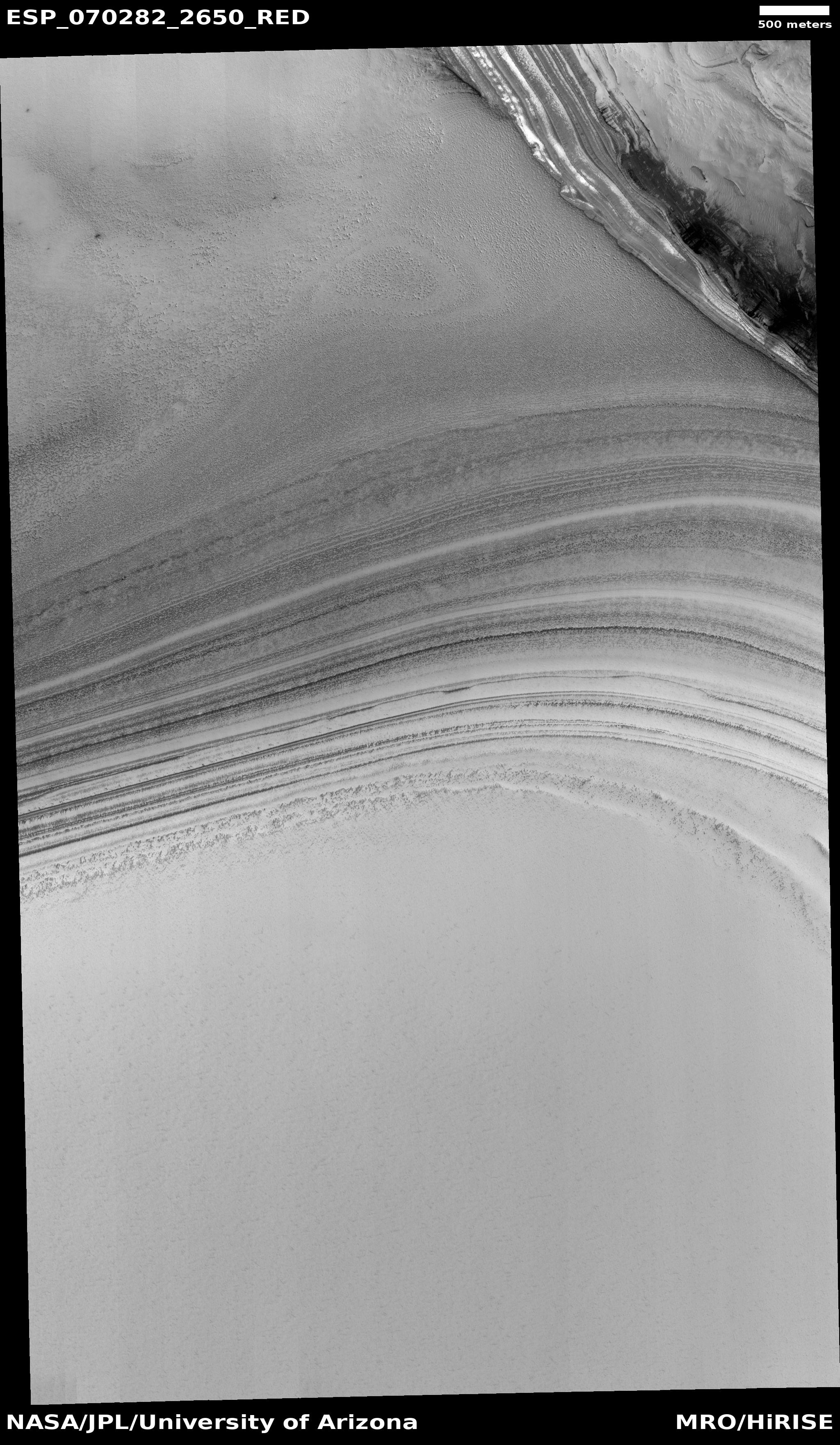
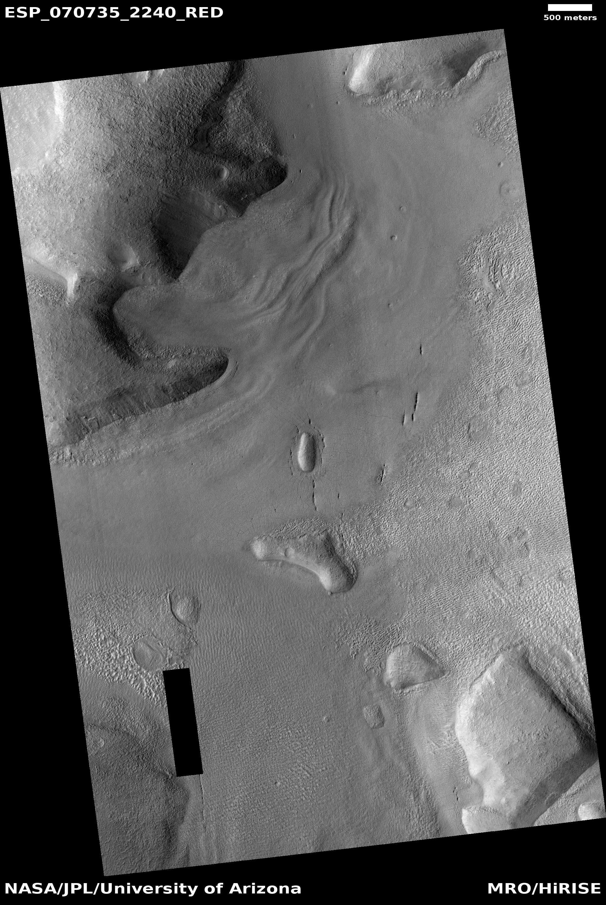
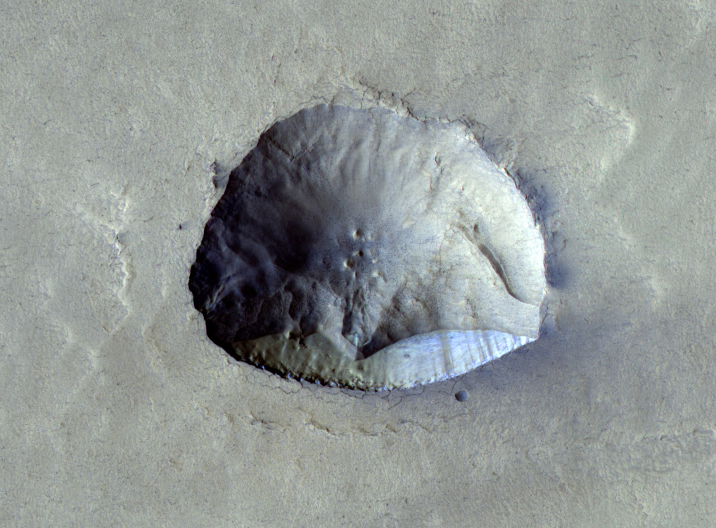
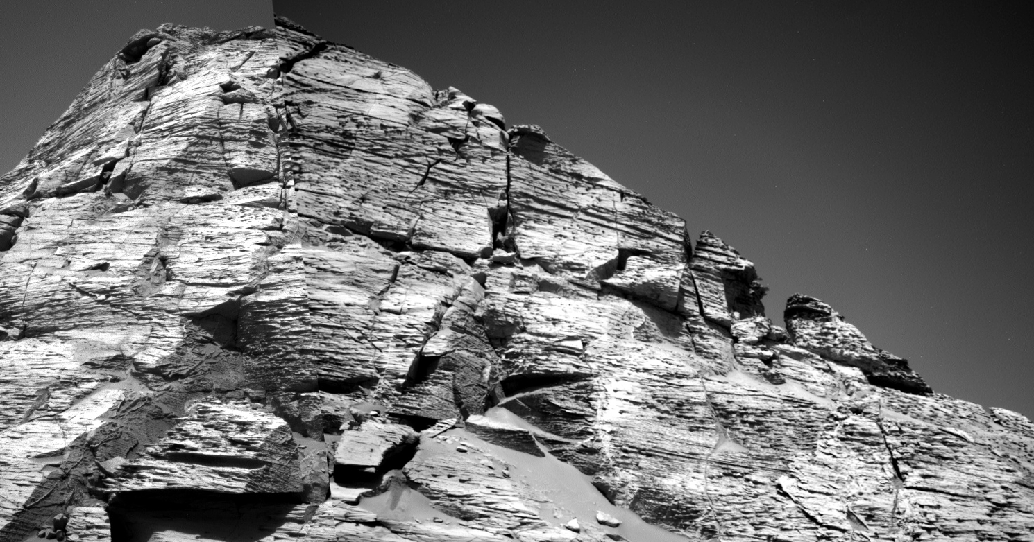
Cool image time! The photo to the right, rotated, cropped, and reduced to post here, was taken on November 4, 2021 by the high resolution camera on Mars Reconnaissance Orbiter (MRO). It shows a small portion of the floor of a very ancient and eroded unnamed 40-mile-wide crater on Mars.
MRO’s science team labeled this picture simply as a “Fractured Feature.” The section I have focused on in the cropped image is clearly the fractures the scientists were interested in. What is heck caused this?
The location is at 39 degrees north latitude and is located at the very western end and in the center of the 2,000-mile-long mid-latitude strip I call glacier country because practically every photo exhibits evidence of glaciers. Thus, this fractured terrain is almost certainly evidence of ice that partly buried and thus protected from sublimating away.
The collapse feature indicates more, however. The circular shape of the fractures suggests that the center of this feature is sinking, with the ice on all sides slipping downward and breaking as it does so. The location however is not in the center of this crater, but near its southern interior rim. Moreover, in a wider image from MRO’s context camera this feature appears to be within what looks like a thick patch of ice filling most of the southeast quadrant of the crater. On it are other similar collapse features.
The data suggests that this ice patch is eroding, but doing so influenced by the rough terrain on which it sits. The sinks suggest the glacial ice is sublimating first over low spots, but this is hardly certain.


