
The flat and mostly featureless flood lava plains of Mars
Click for original image.
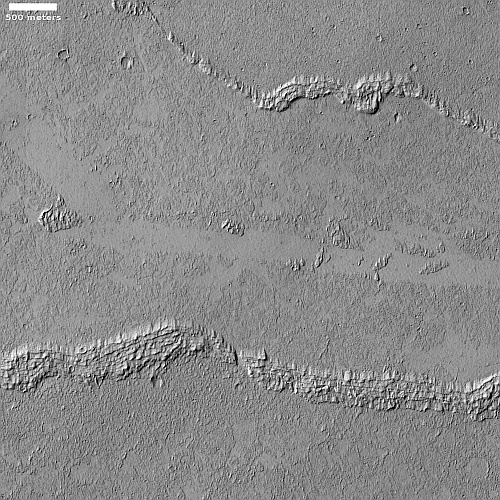
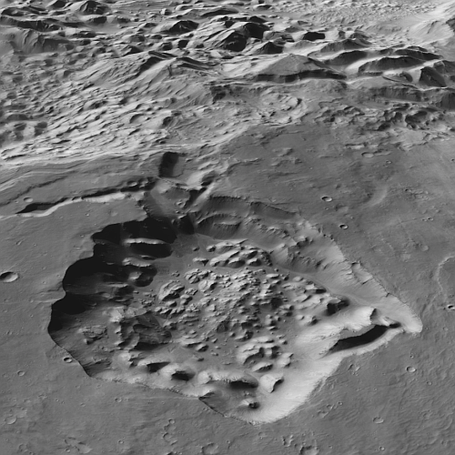
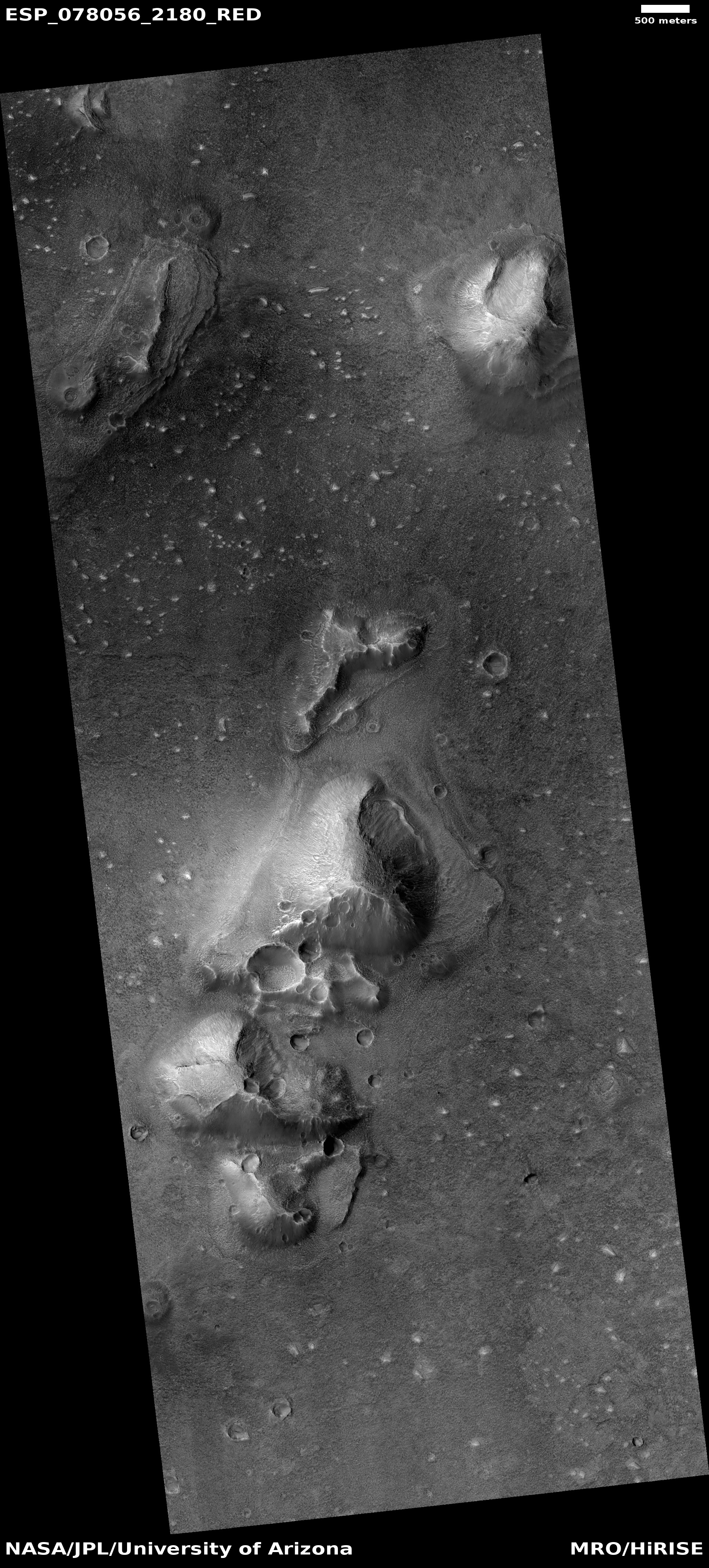
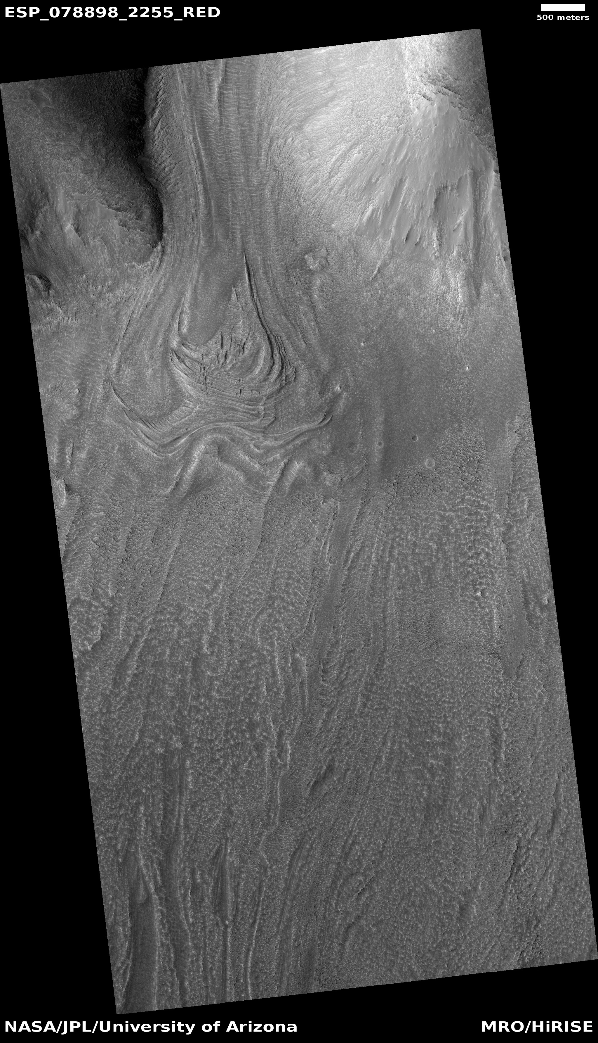
Cool image time! The picture to the right, rotated, cropped, reduced, and sharpened to post here, was taken on July 3, 2023 by the high resolution camera on Mars Reconnaissance Orbiter (MRO). Dubbed a “terrain sample” by the camera team, it was likely taken not as part of any scientist’s specific research program but to fill a gap in the camera’s schedule in order to maintain its proper temperature. When the camera team needs to do this they try to pick something of interest that is below during that gap.
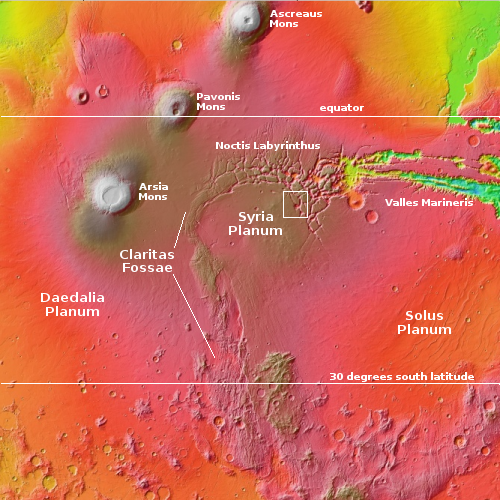
In this case MRO was over the vast flood lava plains of Mars where for many hundreds of miles the only features are small variations produced from different overlapping lava flood events. The layers of lava in this region in fact appear so thick that there are relatively few places where the older topography still sticks up through the lava. In the case of this picture, the ridges might indicate such buried topography, but they also might simply be dikes of lava, pushed up through fissures from underground.
» Read more

Click for original image.
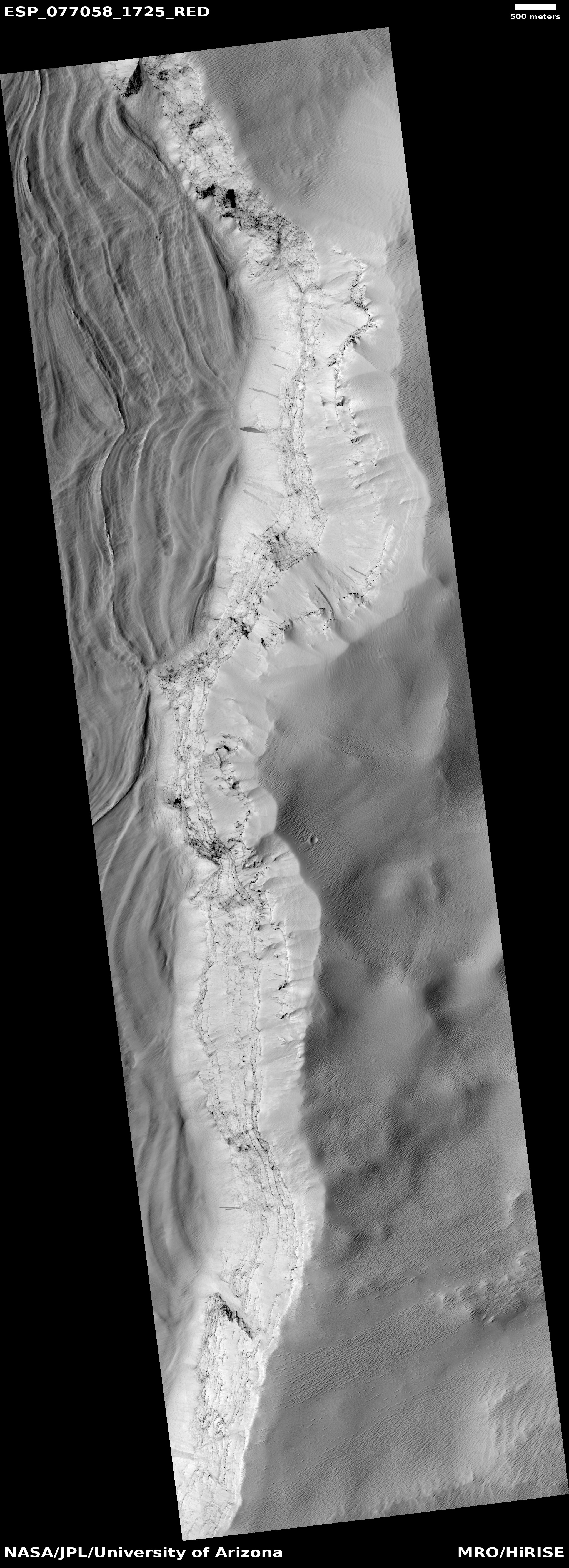
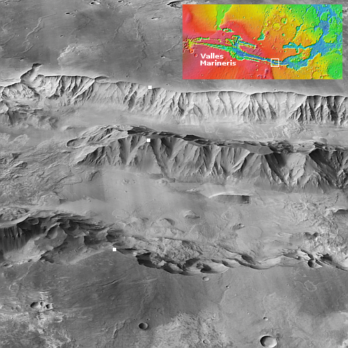
Cool image time! The picture to the right, rotated, cropped, reduced, and sharpened to post here, was taken on July 3, 2023 by the high resolution camera on Mars Reconnaissance Orbiter (MRO). Dubbed a “terrain sample” by the camera team, it was likely taken not as part of any scientist’s specific research program but to fill a gap in the camera’s schedule in order to maintain its proper temperature. When the camera team needs to do this they try to pick something of interest that is below during that gap.
In this case MRO was over the vast flood lava plains of Mars where for many hundreds of miles the only features are small variations produced from different overlapping lava flood events. The layers of lava in this region in fact appear so thick that there are relatively few places where the older topography still sticks up through the lava. In the case of this picture, the ridges might indicate such buried topography, but they also might simply be dikes of lava, pushed up through fissures from underground.
» Read more


