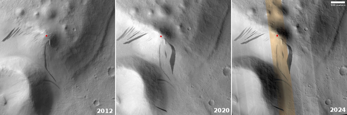
Click for original image.
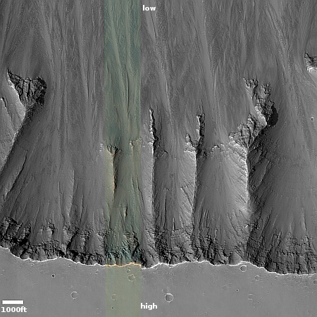
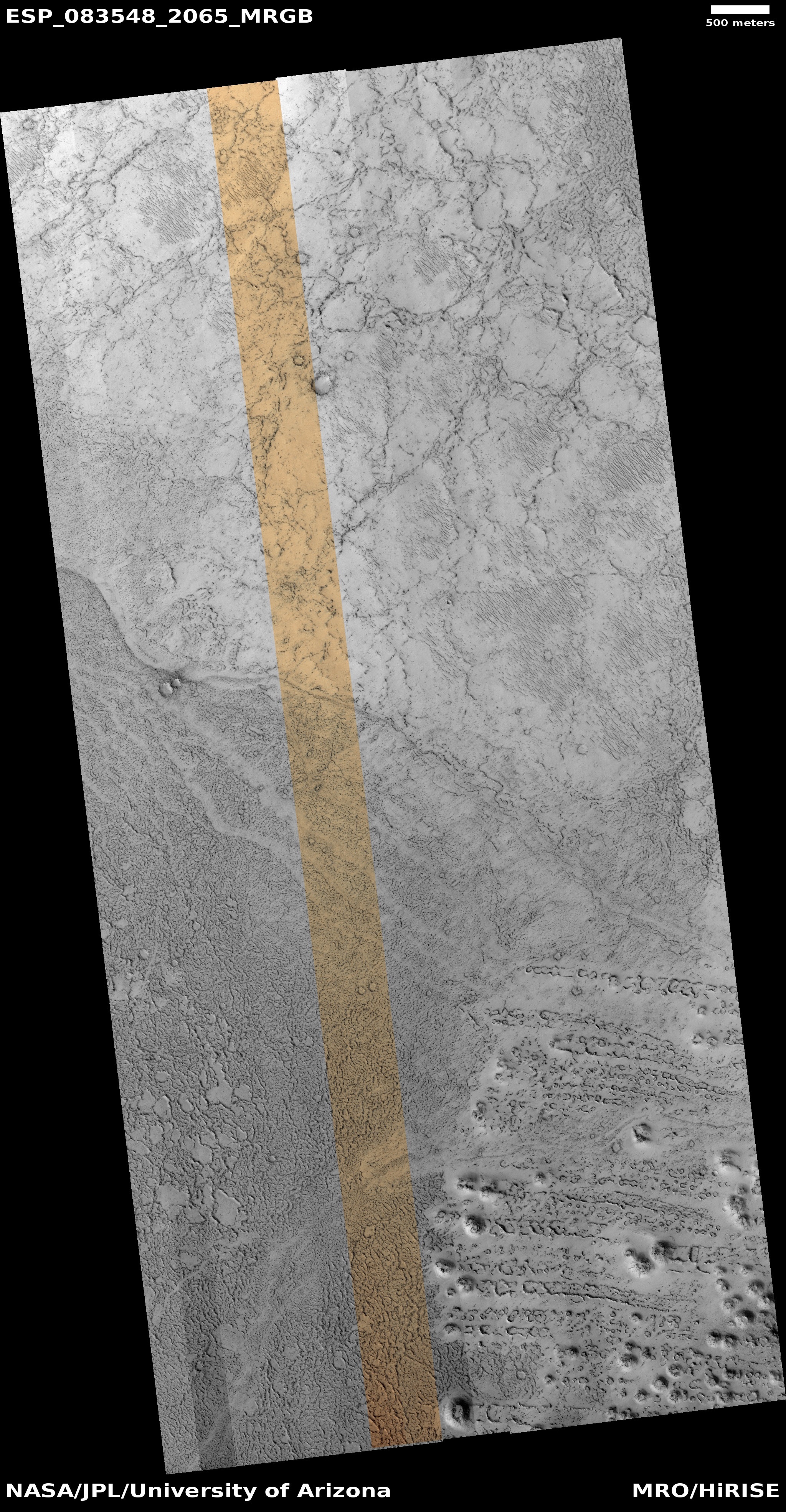
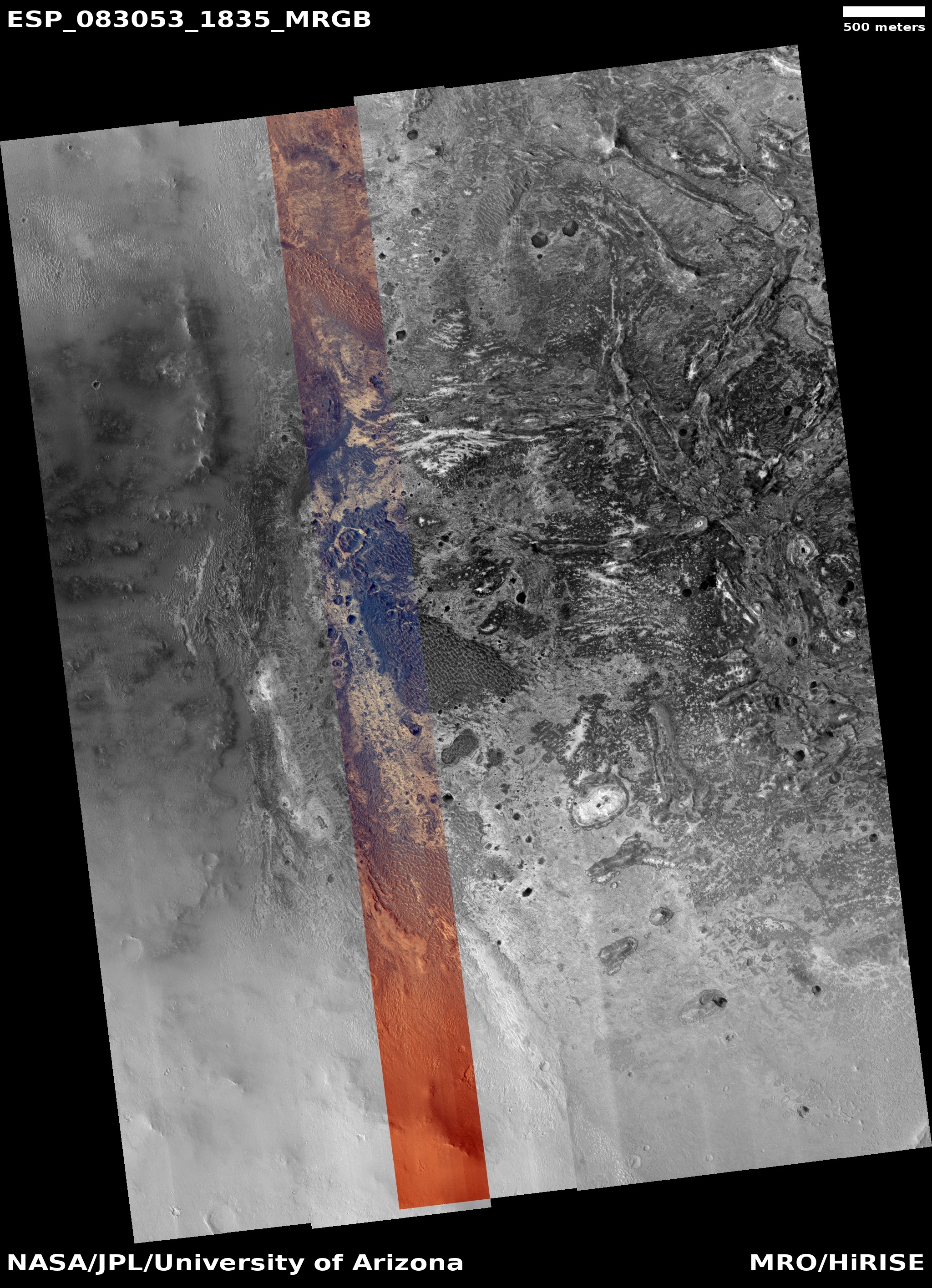
Cool image time! The picture to the right, rotated, cropped, reduced, and sharpened to post here, was taken on May 24, 2024 by the high resolution camera on Mars Reconnaissance Orbiter (MRO). Labeled merely a “terrain sample” by the camera team, it was likely taken not as part of any particular research project, but to fill a gap in the picture-taking schedule in order to maintain the camera’s proper temperature.
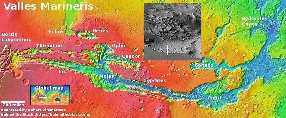
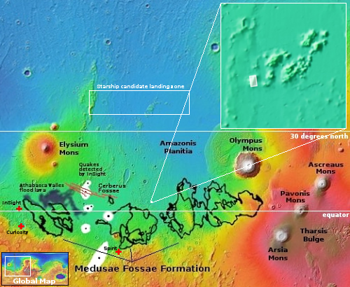
When the camera team needs to do this, they try to pick interesting targets within the required timeframe. Sometimes they succeed, sometimes not. In today’s example, they succeeded quite well. As shown by the overview map above, this picture captures (as indicated by the rectangle) the top of the southern rim of Valles Marineris, the biggest canyon on Mars and quite possibly the biggest in the entire solar system.
For scale, the drop from the rim to the low point in this picture is about 9,000 feet. That’s a 1,000 feet more than the drop from the north rim of the Grand Canyon to the canyon bottom at the Colorado River. In Valles Marineris however our descent has barely begun. To get to the bottom of the southern canyon here you still need to drop 15,000 more feet, for a total descent of 24,000 feet, an elevation change similar to most of the mountains in the Himalayas.
Nor are you yet at the bottom. If you climb over the ridge of 18,000-foot-high mountains that bisect Valles Marineris at this point, you can drop down even further, to a depth 31,000 feet below the southern rim.
Mount Everest is just over 29,000 feet high, which means if placed inside Valles Marineris is peak would still sit 2,000 feet below the rim.
The photo itself highlights part of the erosion process that formed Valles Marineris. This is the dry tropics, so no water was involved in shaping this terrain for many eons. Instead, what appear to be flows within the hollows is alluvial fill, material that over time breaks off and rolls downhill, filling the slopes below. Erosion will grind this material into smaller particles, so given enough time it flows almost like sand.


