
Icy Mars
Today’s cool image once again illustrates the fact that most of Mars Mars is not a dry desert like the Sahara, as most news sources and the general public still believes, but a cold icy place similar to Antarctica, with plenty of near surface ice covering almost the whole planet, except for the dry equatorial regions (the one region we have sent almost all our landers and rovers).
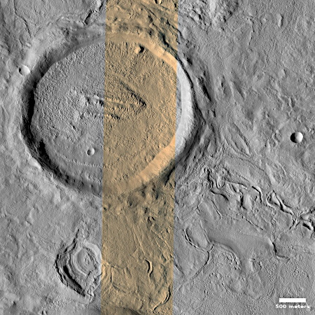
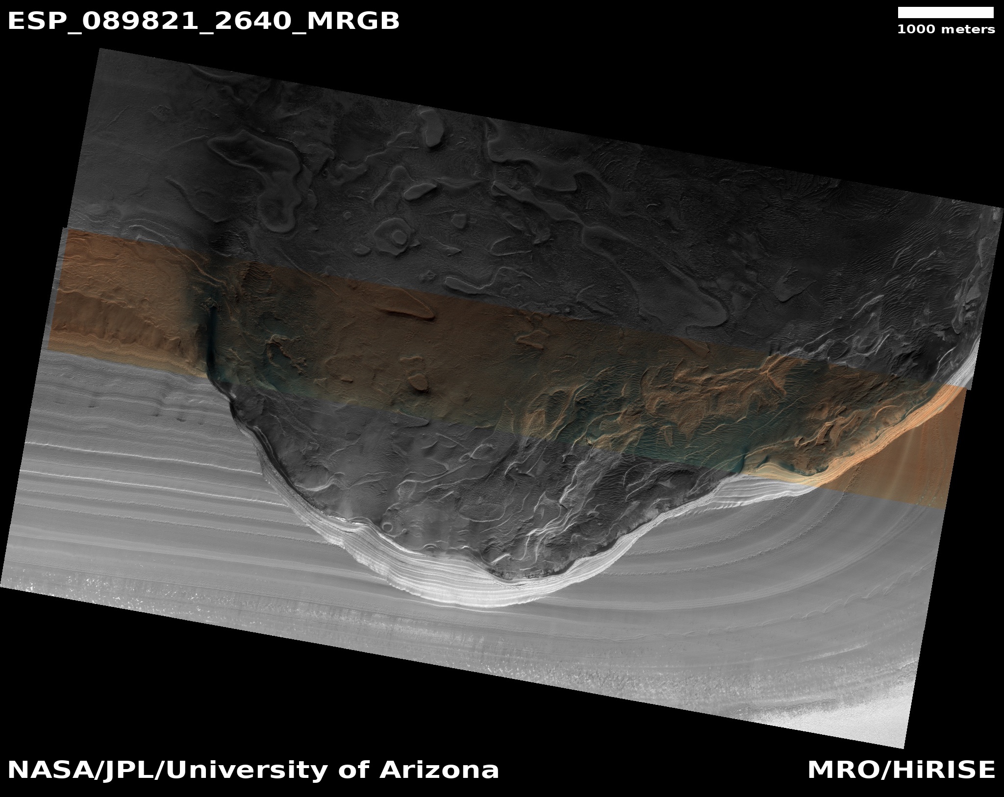
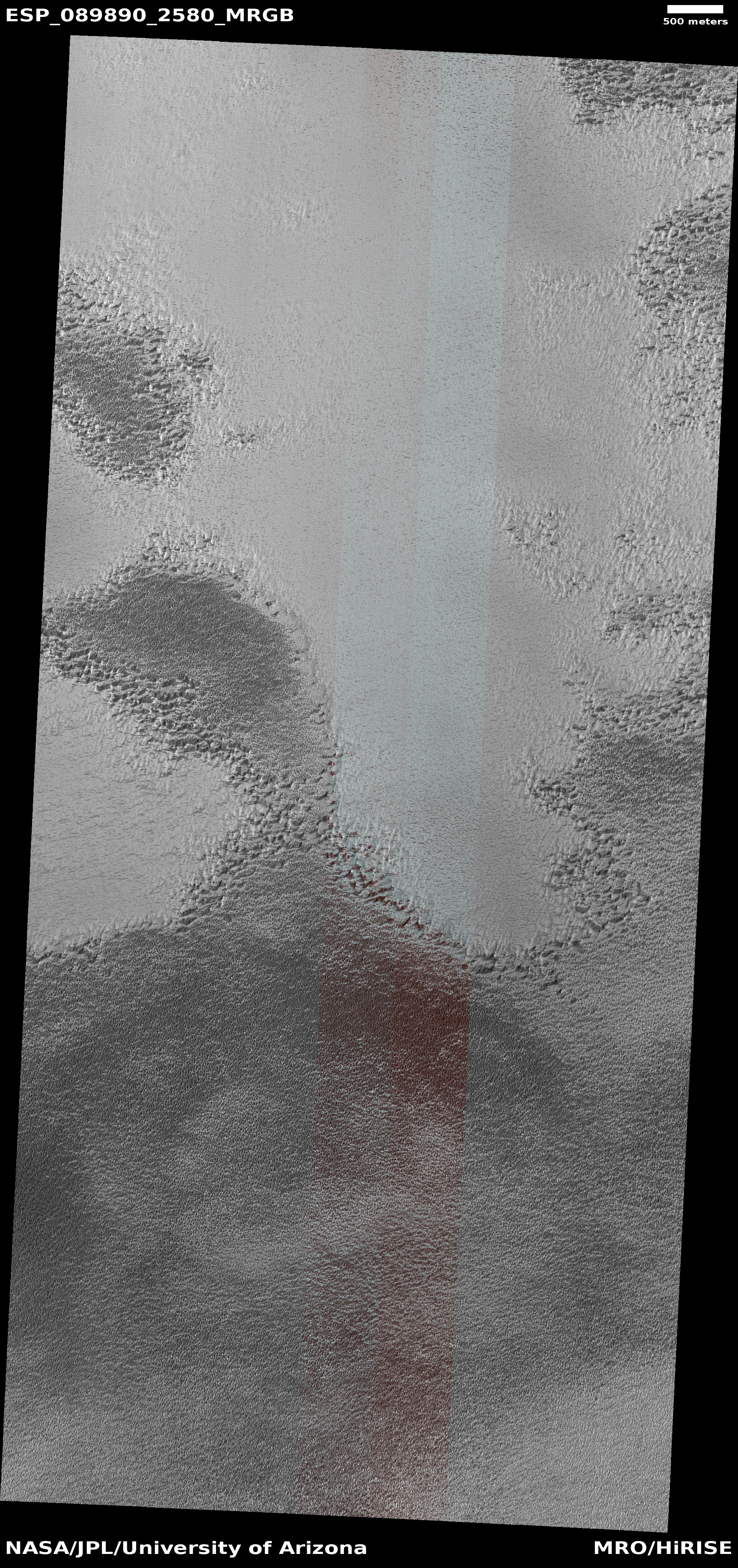
The picture to the right, rotated, cropped, reduced, and sharpened to post here, was taken on November 26, 2025 by the high resolution camera on Mars Reconnaissance Orbiter (MRO). It shows one small section of the floor of an unnamed very old and eroded 82-mile-wide crater located in the northern mid-latitudes of Mars.
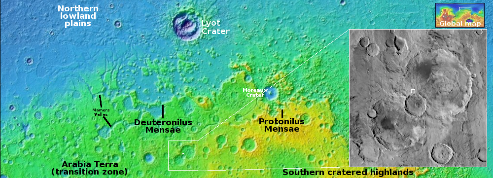
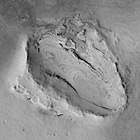
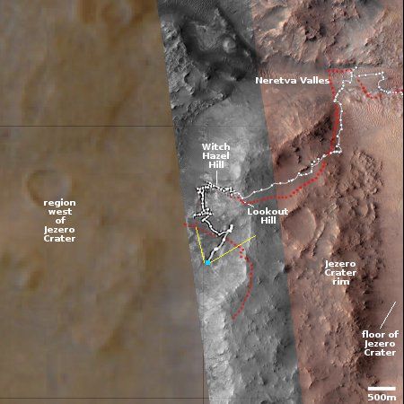
That location is indicated by the white dot on the overview map above. This part of the mid-latitudes is a region I dub “glacier country”, a 2,000-mile long strip where practically every image taken there shows very obvious glacial features.
Today’s image is no different. The 2-mile-wide crater in the upper left appears blobby, as if the impact had landed in mud. Its interior is filled with what the scientists believe is glacial debris. The surrounding landscape has a similar appearance, as if the ground was slushy and easily misshapen by seasonal temperature changes. To the southwest of the crater, within what appears to be a surrounding splash apron, there appears to be an eroded drainage channel, likely created by the flow of glacial ice downward.
So, when you read articles telling you Mars is dry and scientists are still hunting for water there, know that whomever wrote that article had no idea what he or she were talking about. The scientists studying Mars know that Mars has lots of water. Except for the tropics below 30 degrees latitude, there is near surface ice everywhere. Their questions revolve instead on figuring out how deep and extensive it is, and how it has shaped Mars’ overall geology.

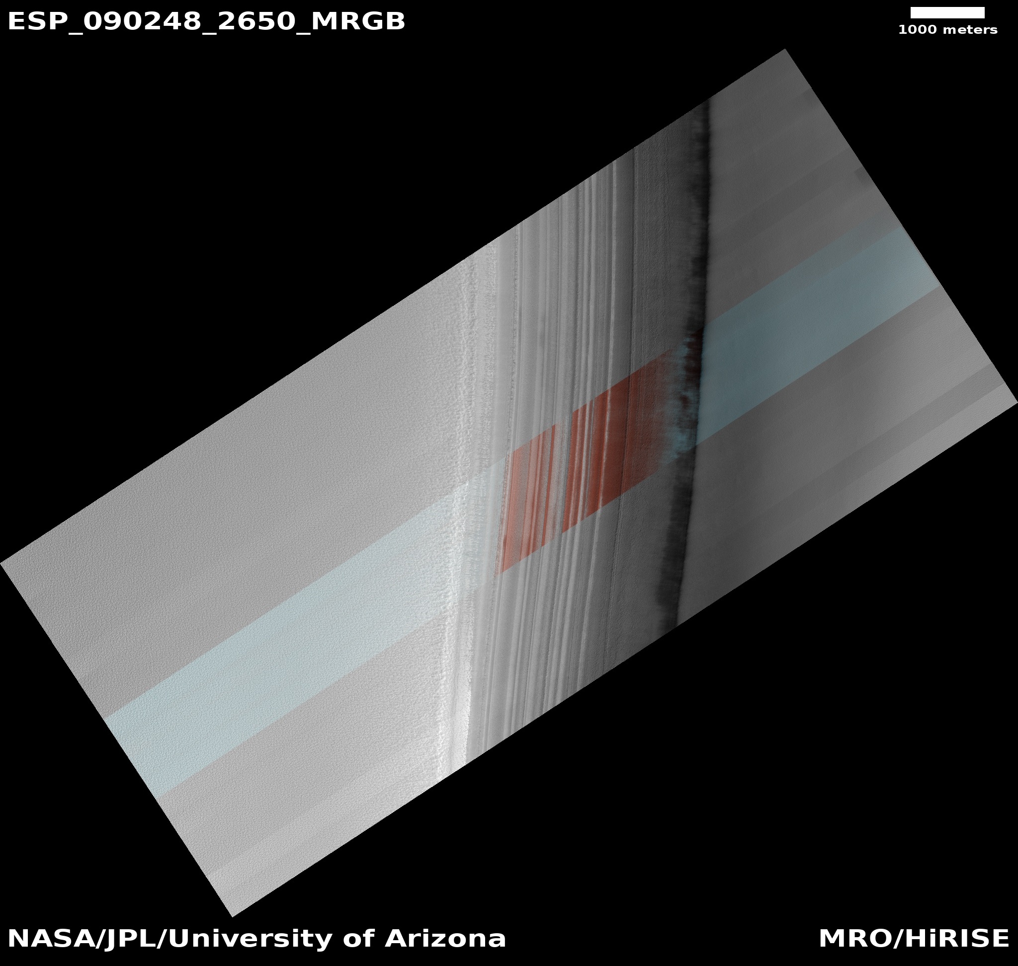
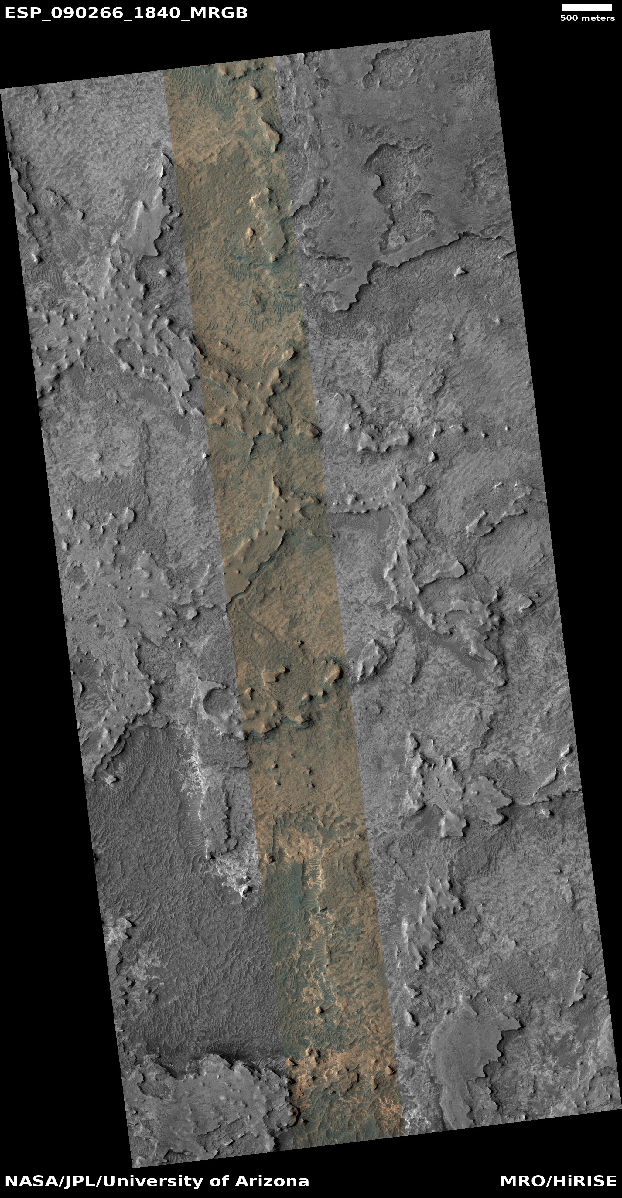
Today’s cool image once again illustrates the fact that most of Mars Mars is not a dry desert like the Sahara, as most news sources and the general public still believes, but a cold icy place similar to Antarctica, with plenty of near surface ice covering almost the whole planet, except for the dry equatorial regions (the one region we have sent almost all our landers and rovers).
The picture to the right, rotated, cropped, reduced, and sharpened to post here, was taken on November 26, 2025 by the high resolution camera on Mars Reconnaissance Orbiter (MRO). It shows one small section of the floor of an unnamed very old and eroded 82-mile-wide crater located in the northern mid-latitudes of Mars.
That location is indicated by the white dot on the overview map above. This part of the mid-latitudes is a region I dub “glacier country”, a 2,000-mile long strip where practically every image taken there shows very obvious glacial features.
Today’s image is no different. The 2-mile-wide crater in the upper left appears blobby, as if the impact had landed in mud. Its interior is filled with what the scientists believe is glacial debris. The surrounding landscape has a similar appearance, as if the ground was slushy and easily misshapen by seasonal temperature changes. To the southwest of the crater, within what appears to be a surrounding splash apron, there appears to be an eroded drainage channel, likely created by the flow of glacial ice downward.
So, when you read articles telling you Mars is dry and scientists are still hunting for water there, know that whomever wrote that article had no idea what he or she were talking about. The scientists studying Mars know that Mars has lots of water. Except for the tropics below 30 degrees latitude, there is near surface ice everywhere. Their questions revolve instead on figuring out how deep and extensive it is, and how it has shaped Mars’ overall geology.


