
When Martian lava meets a Martian mountain

Click for original image.
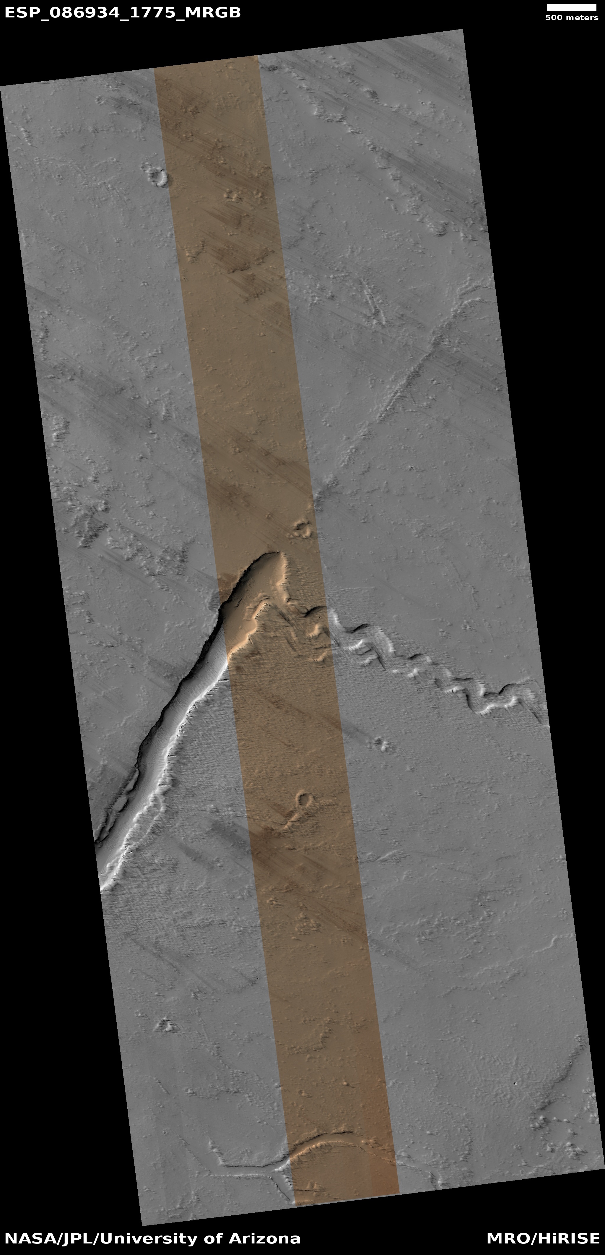
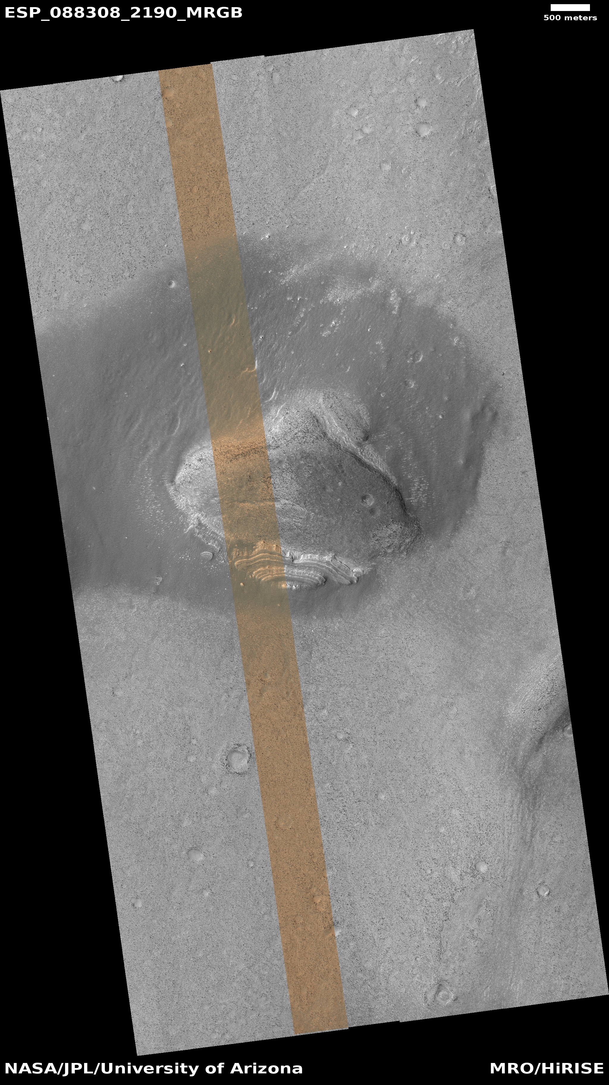
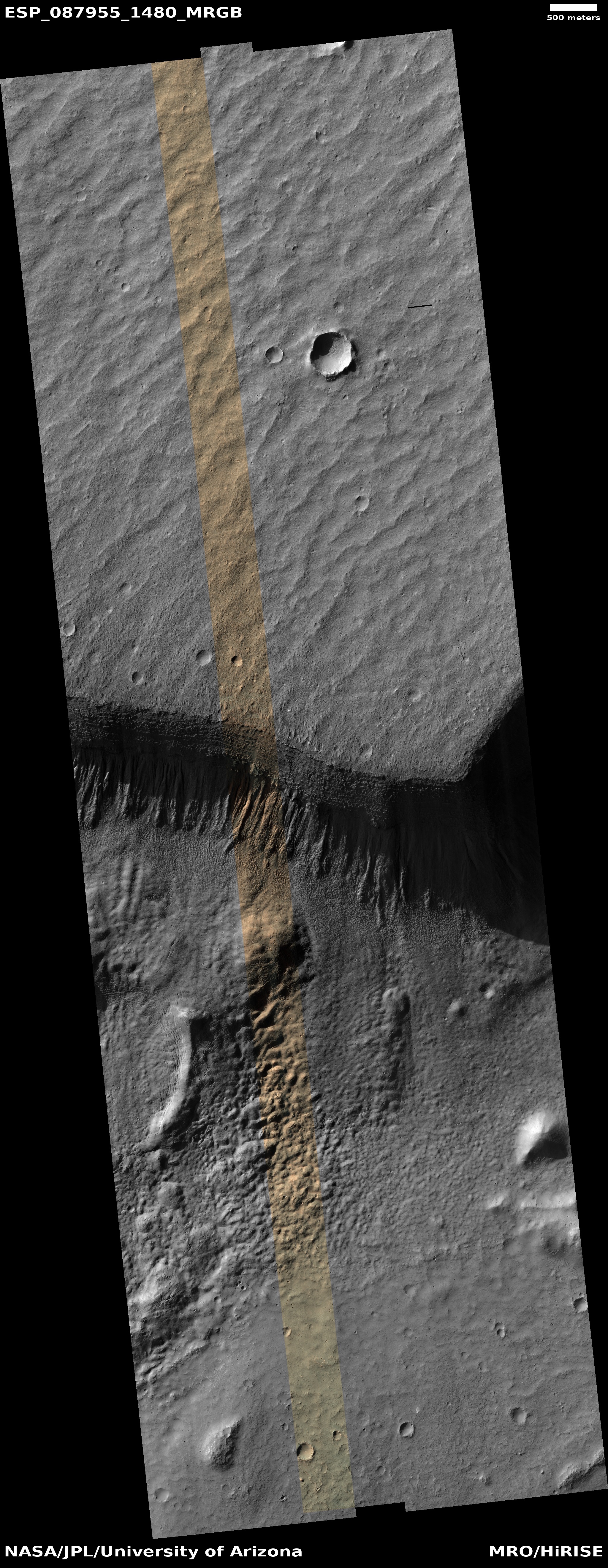
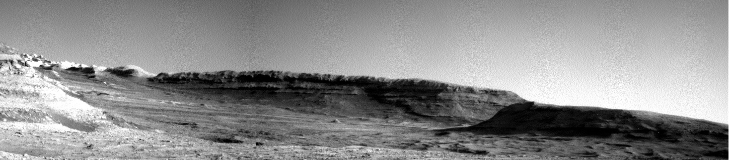
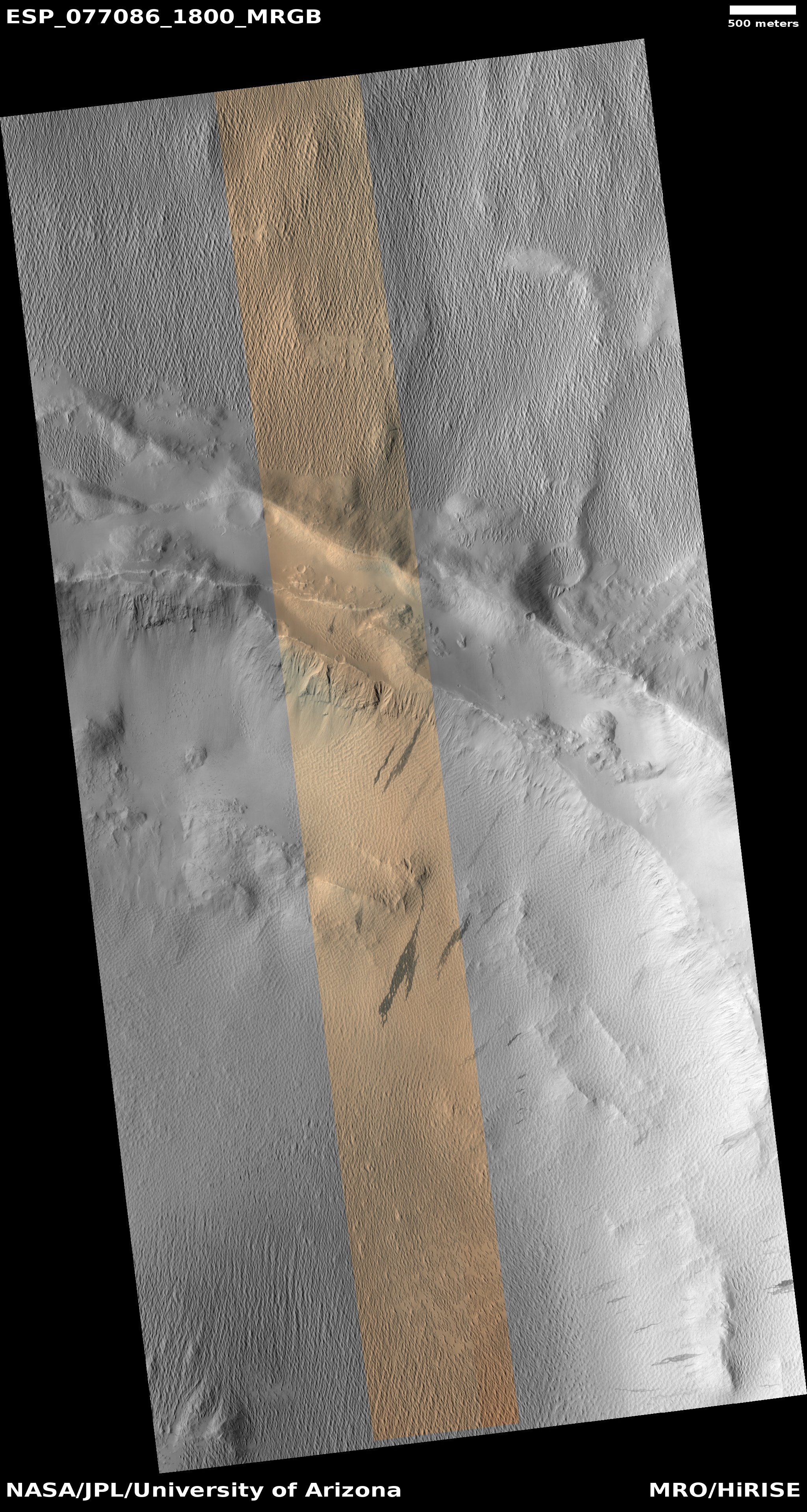
Cool image time! The picture to the right, rotated, cropped, reduced, and sharpened to post here, was taken on April 24, 2025 by the high resolution camera on Mars Reconnaissance Orbiter (MRO), and was posted yesterday by the science team to illustrate the vast lava flows that cover much of Mars. From the caption:
This image captures the edge of a lava flow that partially buries older terrain in the Martian Southern Highlands. Where the edge of the lava flow made contact with the higher-standing topography, it formed a rumpled and ridged surface.
This lava flow is one of many massive flows that extend southwest from Arsia Mons, one of the largest shield volcanoes on Mars.
The mountain to the south rises about 3,700 feet above that rumpled lava ocean at its base.
» Read more


