
Perseverance looks up at the rim of Jezero Crater
Click for full resolution. For original images, go here, here, here, and here.
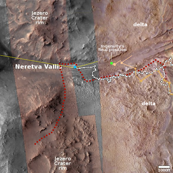
Click for interactive map.
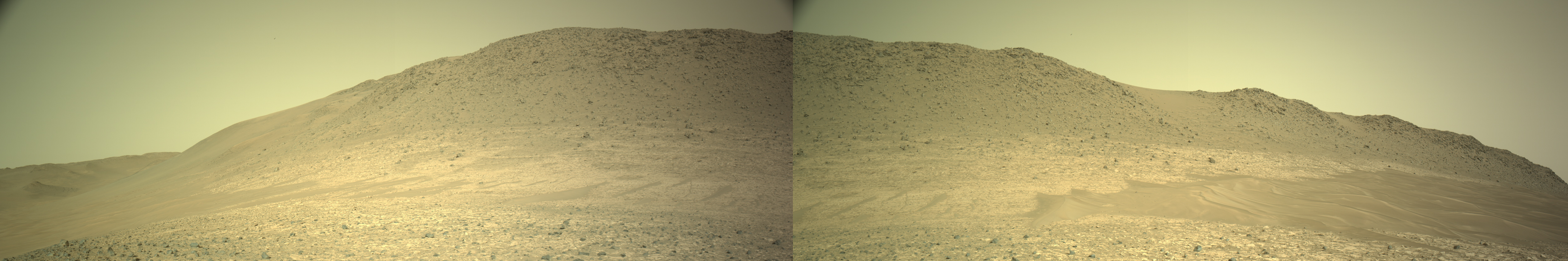
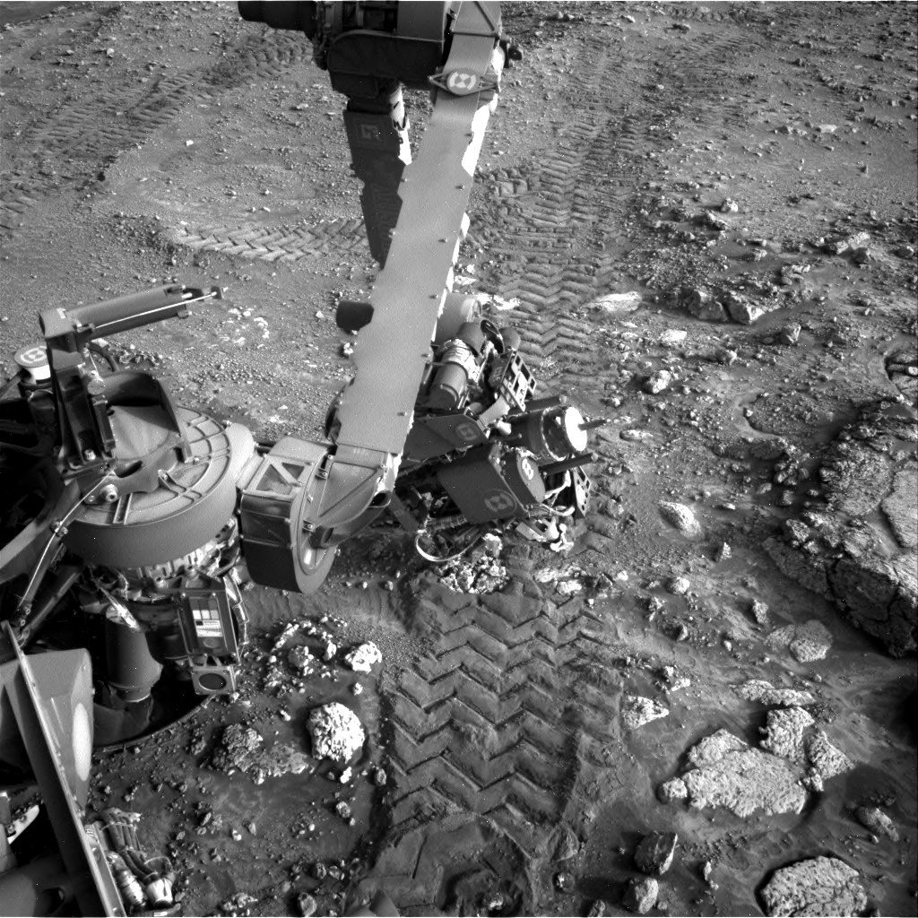
Cool image time. The panorama above was created from four pictures taken on June 10, 2024 by the left navigation camera on the Mars rover Perseverance (captions found here, here, here, and here). It looks north at the nearest hill that forms the north part of the rim of Jezero Crater.
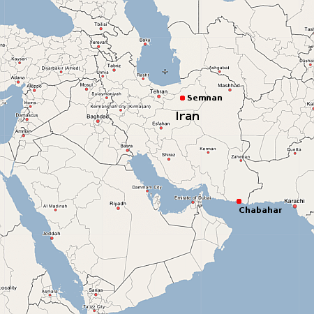
The overview map to the right provides context. The blue dot marks Perseverance’s present location, when it took these pictures. The yellow lines indicate the approximate area covered by the panorama. The red dotted line marks the rover’s planned route, while the white dotted line the route it has actually taken.
Because the rover is now at the base of this hill, it can no longer see the top of the crater’s rim. What it sees instead is the barren foothills of that rim, covered with dust, dunes, and many broken rocks.
As I have noted numerous times, the utter lack of life marks this as a truly alien landscape, compared to Earth. Nowhere on our home planet would you see terrain this empty of life. While NASA likes to claim that Perseverance’s main mission is the search for life on Mars, that claim is always a lie. It is very unlikely any life is going to be found here by Perseverance, and if that was its true scientific purpose it would never have been built nor launched.
What the scientists are doing is studying the alien geology of Mars, to try to understand how this utterly alien planet got to be the way it is now. Such knowledge is critical for the future explorers of space, as it will make it easier for them to understand the alien landscapes they will find elsewhere, within the solar system and eventually in other solar systems far beyond.


