
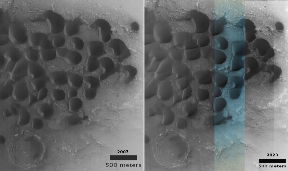
Have these Martian dunes changed in sixteen years?
Click here and here for the original images.
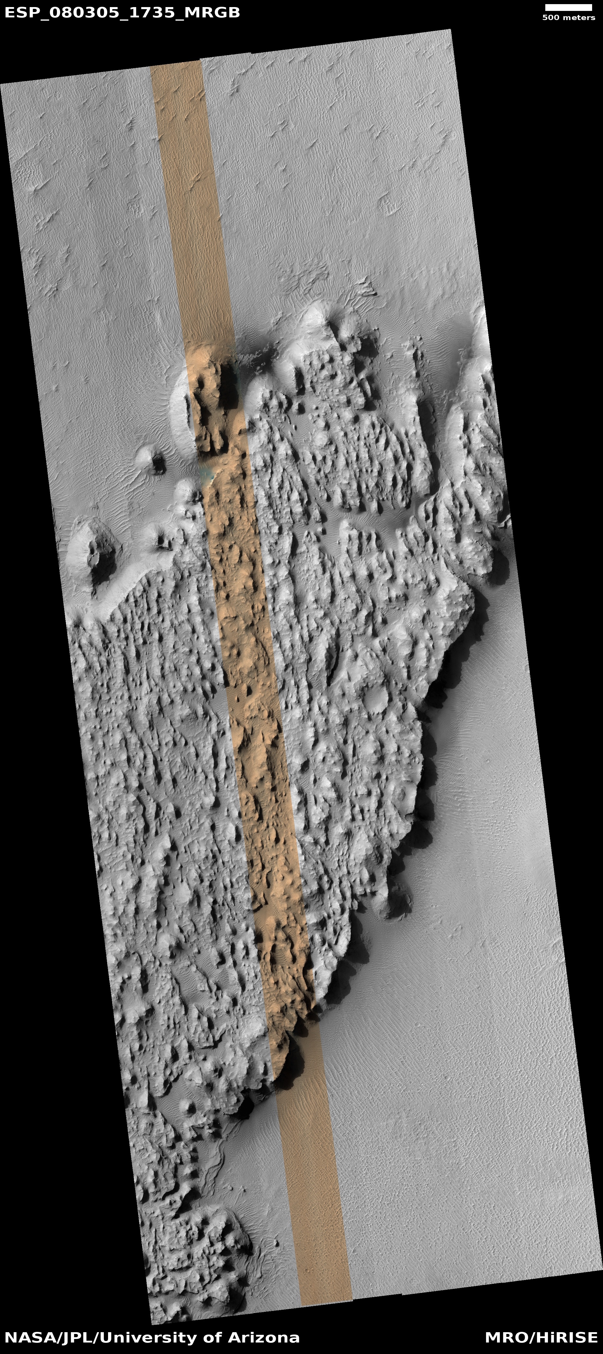
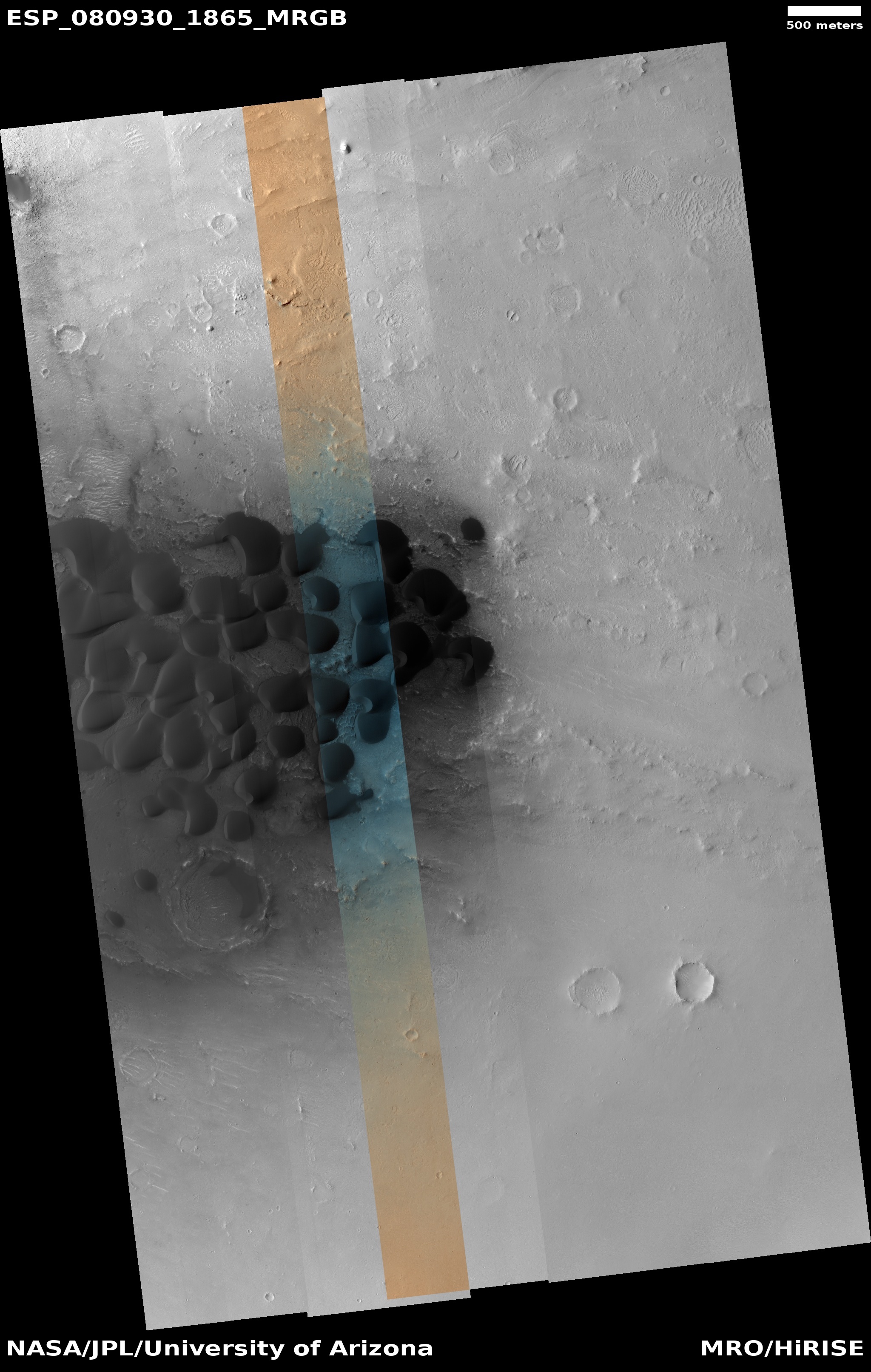
Cool image time! The two pictures above, both rotated, cropped, reduced, and enhanced to match and to post here, were taken by the high resolution camera on Mars Reconnaissance Orbiter (MRO) sixteen years apart. The first, on the left, was taken on February 23, 2007, while the second, on the right, was taken on November 1, 2023.
What drew me to both images was the label for the second: “Dune Change in Arabia Region Crater.” To find out if this image had revealed any changes in the dunes I went back and found the earliest MRO picture of this location, and sized and enhanced the dunes in both to match.
Do you see any changes? I don’t. However, that really means nothing. These are not the highest resolution versions that MRO obtains, and a very careful comparison of those best images might detect more subtle changes than our eyes can perceive in the versions above. Also, there might be brightness changes that require careful software analysis.
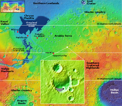
The white dot on the overview map to the right marks the location, in Arabia Terra, the largest transition region on Mars between the northern lowland plains and the southern cratered highlands. The inset shows the half filled crater in which these dunes sit. The grayed area on the floor of the crater marks the entire dune field, extending eastward to the crater rim from this one spot, indicated by the black dot.
It is likely that the dust is blown into this crater and gets trapped there. Whether the dunes move or change is not clear, though if they do the changes are small, even after almost two decades. Instead, the two pictures suggest these dunes have hardened into a form of sandstone, that can be eroded over time by the wind, but only very very slowly.

