
Bright-tipped perplexing terrain on Mars
Click for full image.
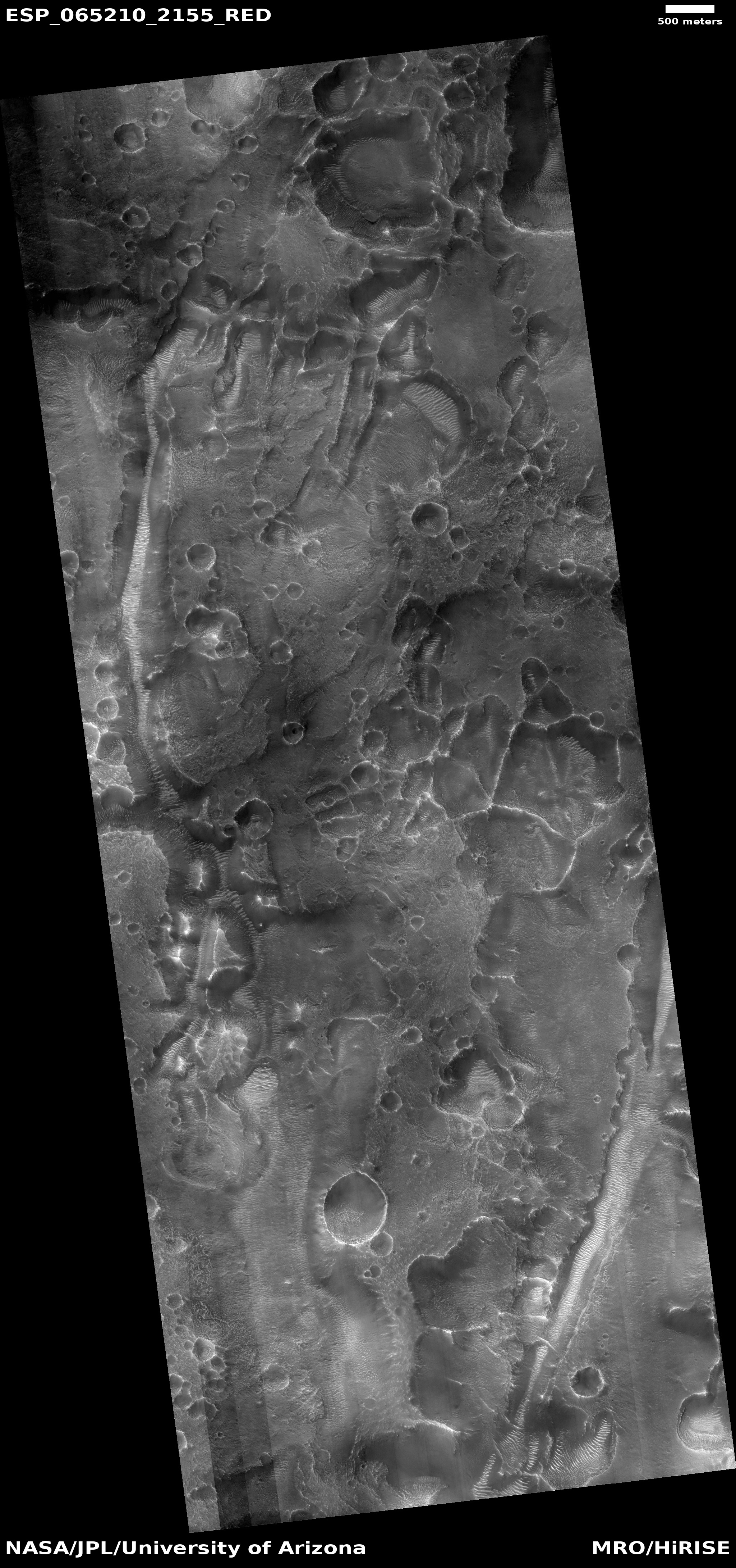
The photo to the right, rotated, cropped, and reduced to post here, was taken by the high resolution camera on Mars Reconnaissance Orbiter (MRO) on June 24, 2020, and shows a bit of inexplicable country in Arabia Terra, the widest and largest transition zone region on Mars between the northern lowland plains and southern cratered highlands.
The stuff visible in this image falls into what I call “What the heck?” geology. It is very clear we are looking at a collection of straight and curved ridges and mesas, all of which for some reason are bright at their tips and edges. Some of the curved ridges might be the rims of craters, but only some. Other ridge lines look more like leftovers following a strange erosion process. The problem is that to my uneducated eye I can find little rhyme or reason to these shapes. The mesas and canyon on the image’s right edge might be explained by the erosion processes that create chaos terrain on Mars, but that process does not do a good job of explaining anything else in the photo.
That this uncaptioned image is merely labeled “Arabia Terra” suggests that the scientists involved in getting this image were equally perplexed by it, and could not give it a better description.
The overview map below provides some location context, including how this geology relates to the landing site of Europe’s Rosalind Franklin rover, now scheduled for a 2022 launch.
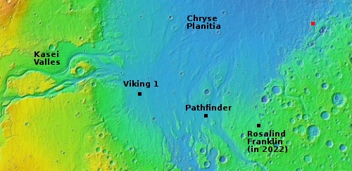
The red square indicates the location of this photo. About 600 miles to the southwest is the planned landing site for Rosalind Franklin, in a location dubbed Oxia Planum. Interestingly, images in Oxia Planum show the same bright edges, even though the two sites are a considerable distance apart.

On Christmas Eve 1968 three Americans became the first humans to visit another world. What they did to celebrate was unexpected and profound, and will be remembered throughout all human history. Genesis: the Story of Apollo 8, Robert Zimmerman's classic history of humanity's first journey to another world, tells that story, and it is now available as both an ebook and an audiobook, both with a foreword by Valerie Anders and a new introduction by Robert Zimmerman.
The print edition can be purchased at Amazon or from any other book seller. If you want an autographed copy the price is $60 for the hardback and $45 for the paperback, plus $8 shipping for each. Go here for purchasing details. The ebook is available everywhere for $5.99 (before discount) at amazon, or direct from my ebook publisher, ebookit. If you buy it from ebookit you don't support the big tech companies and the author gets a bigger cut much sooner.
The audiobook is also available at all these vendors, and is also free with a 30-day trial membership to Audible.
"Not simply about one mission, [Genesis] is also the history of America's quest for the moon... Zimmerman has done a masterful job of tying disparate events together into a solid account of one of America's greatest human triumphs."--San Antonio Express-News
My best guess, is the whole terrain is light colored and is covered by dark dust. The dark dust is blown off the steep tops of the terrain.
Reminds me of the gypsum layers of the Caprock in western Texas/ eastern New Mexico, as they are exposed by erosion. Might there be limestone on Mars? Opens up a whole new can of worms, so to speak.