Brain terrain on top of Martian mountains
Click for original image.
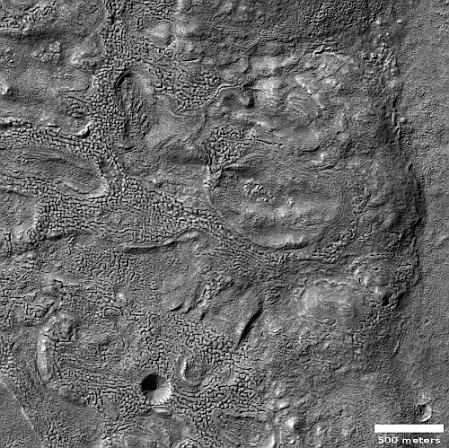
Cool image time! The picture to the right, cropped and reduced to post here, was taken on March 26, 2023 by the high resolution camera on Mars Reconnaissance Orbiter (MRO). It is labeled by the scientists “Brain Terrain on Floor of Crater in Warrego Valles.”
Brain terrain is a geological feature entirely unique to Mars that remains unexplained in any way by geologists. The scientists know it is almost certainly related to near-surface ice and its sublimation into gas, but their theories as to its precise formation process remain incomplete and unconvincing, even to them.
In this case the brain terrain’s interweaving nodules seem to show flow patterns, but strangely those patterns go around depressions and hollows. Yet, the overall flow direction also seems to point downhill towards the slope on the image’s right edge.
» Read more
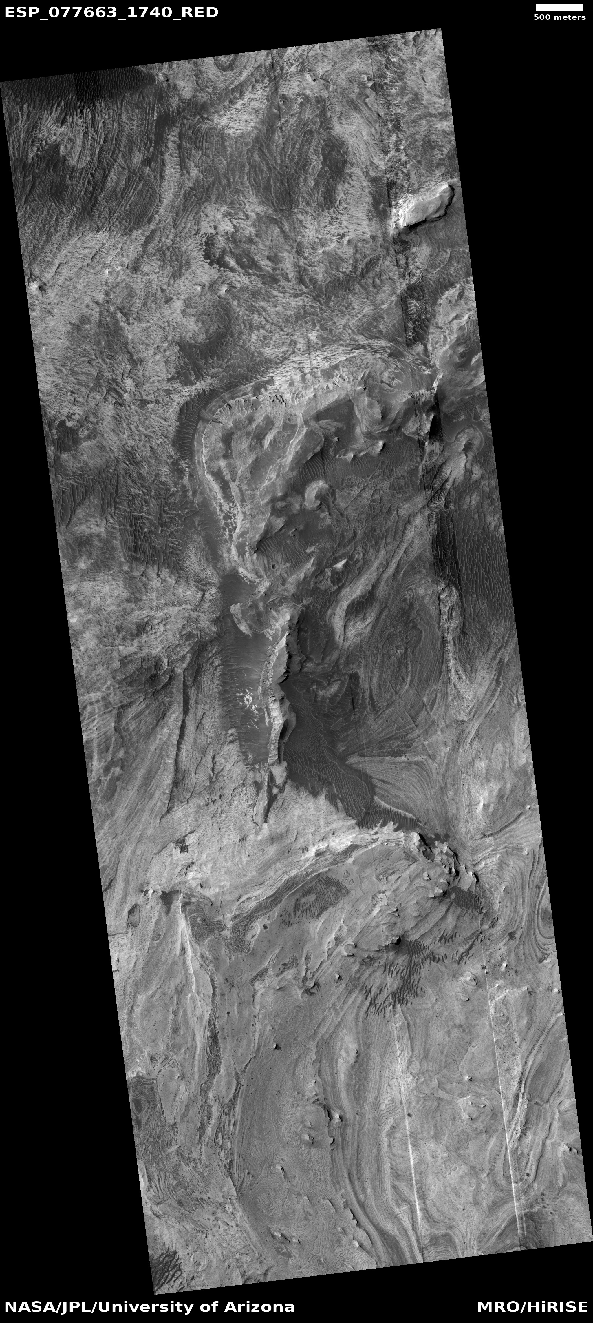
Click for original image.
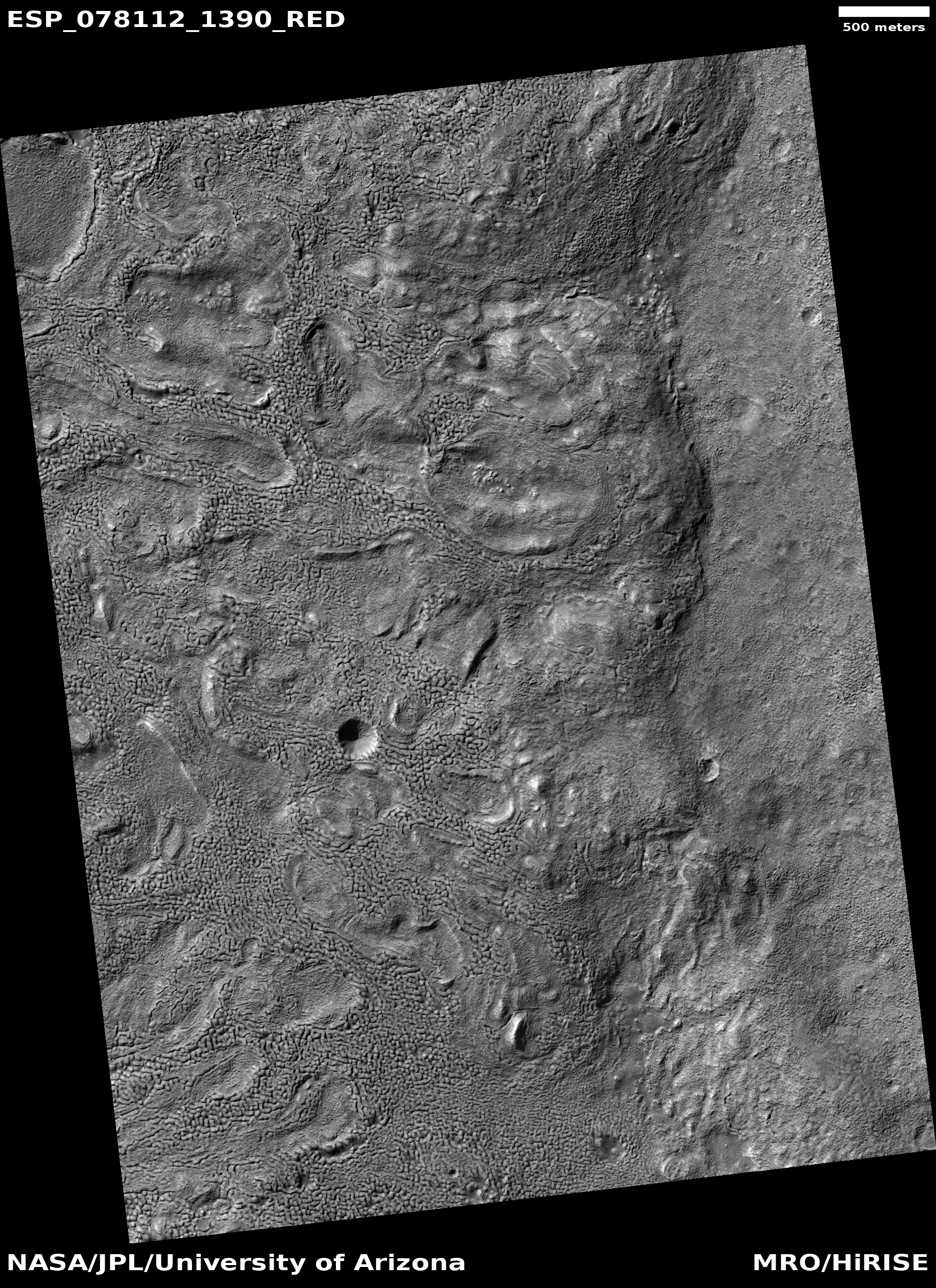
Cool image time! The picture to the right, cropped and reduced to post here, was taken on March 26, 2023 by the high resolution camera on Mars Reconnaissance Orbiter (MRO). It is labeled by the scientists “Brain Terrain on Floor of Crater in Warrego Valles.”
Brain terrain is a geological feature entirely unique to Mars that remains unexplained in any way by geologists. The scientists know it is almost certainly related to near-surface ice and its sublimation into gas, but their theories as to its precise formation process remain incomplete and unconvincing, even to them.
In this case the brain terrain’s interweaving nodules seem to show flow patterns, but strangely those patterns go around depressions and hollows. Yet, the overall flow direction also seems to point downhill towards the slope on the image’s right edge.
» Read more