Update on Lucy: panels generating more than 90% of expected power
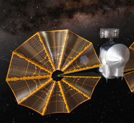
According the Lucy science team, the spacecraft’s solar panels are generating more than 90% of the expected power at this stage of the mission, despite the fact that one panel did not deploy completely and has not latched in final position.
“We’re very happy to report that we are getting most of the power we expected at this point in the mission,” said Joan Salute, associate director for flight programs at NASA’s planetary science division. “It’s not 100%, but it is fairly close. So that is great news.’
In an interview with Spaceflight Now, Salute said the power output from the solar arrays appears to be “most likely above 90%” of the expected level of 18,000 watts. “We don’t know if it’s a latch problem, or that it is only partially deployed,” Salute said.
If correct, there is an excellent chance the mission will not be seriously hindered, even if they cannot get the panel fully deployed or latched. At the same time, there are worries about firing Lucy’s main engine for major course corrections with the panel unlatched. The first major course correction is scheduled for mid-November.
The engineers are presently reviewing their data. One option might be to order the spacecraft to re-attempt a full deployment, in the hope that the process will complete during that second attempt.

