
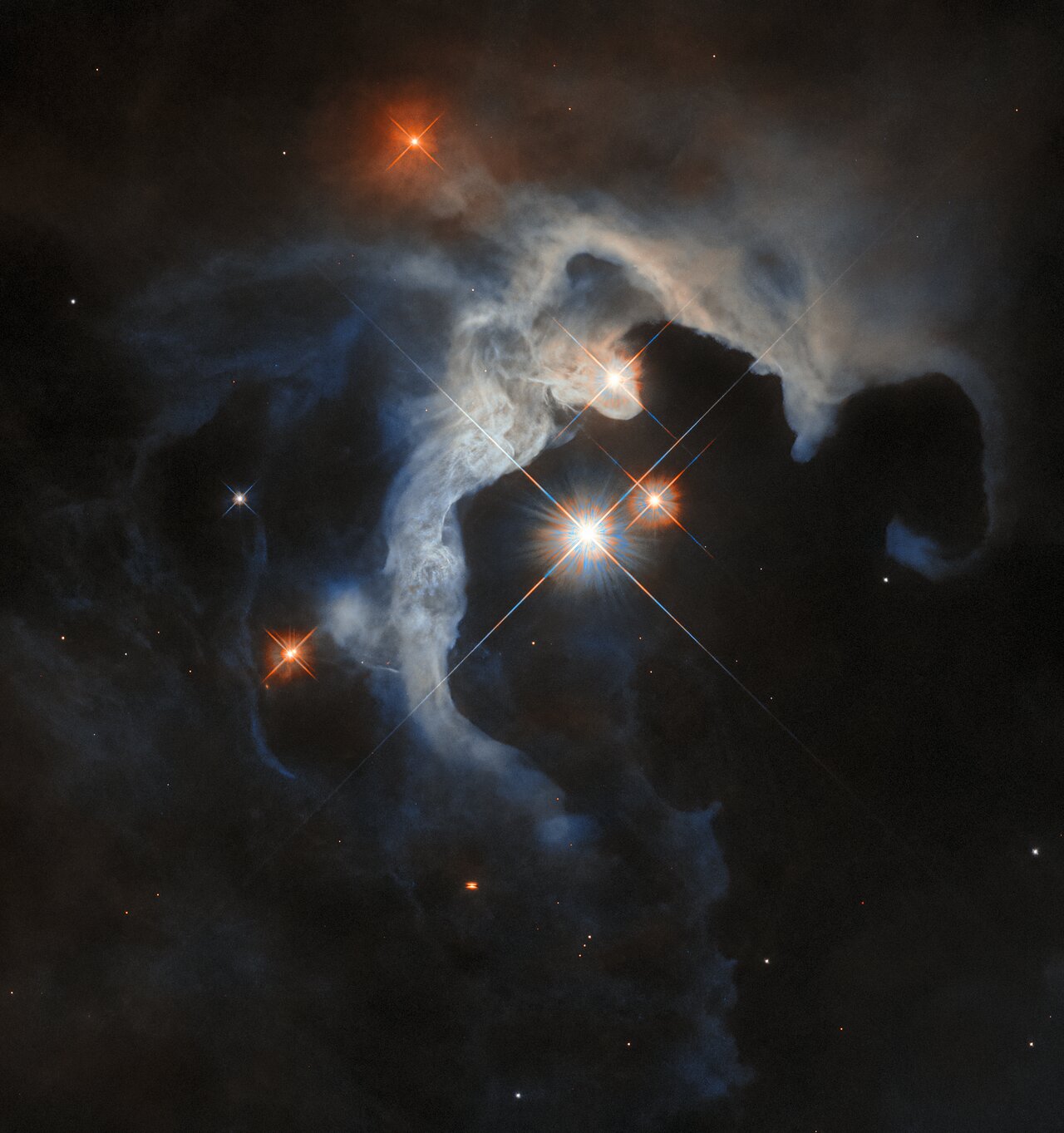
Strange rocks on Mars
Click for original image.
Click for original image.
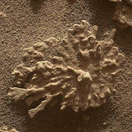
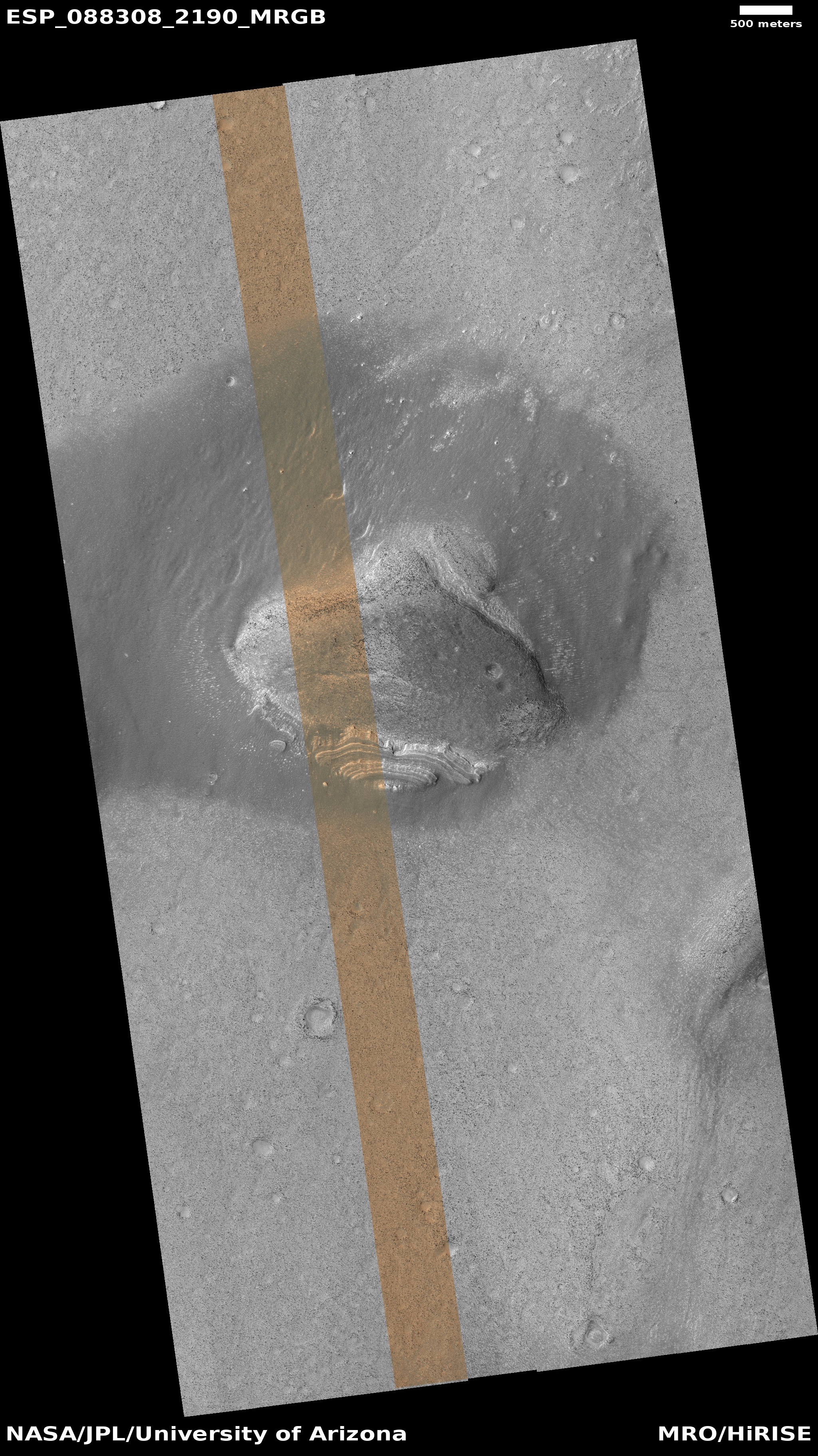
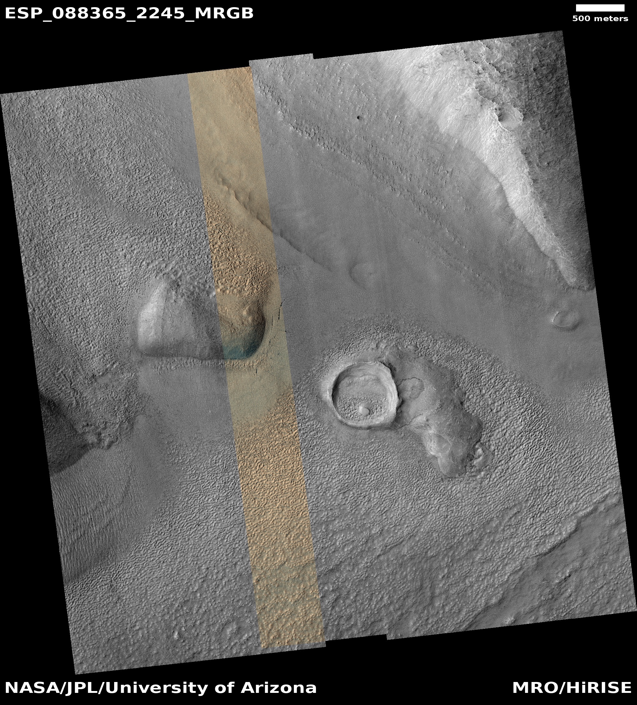
Time for two cool images, from two different craters separated by thousands of miles on Mars! The first image to the right, cropped, reduced, and sharpened to post here, was taken on July 24, 2025 by the Mars Hand Lens Imager (MAHLI) at the end of the robot arm of Mars rover Curiosity, and shows a really strange rock formation that resembles a piece of coral on Earth.
Curiosity has found many small features like this one, which formed billions of years ago when liquid water still existed on Mars [in this region]. Water carried dissolved minerals into rock cracks and later dried, leaving the hardened minerals behind. Eons of sandblasting by the wind wore away the surrounding rock, producing unique shapes.
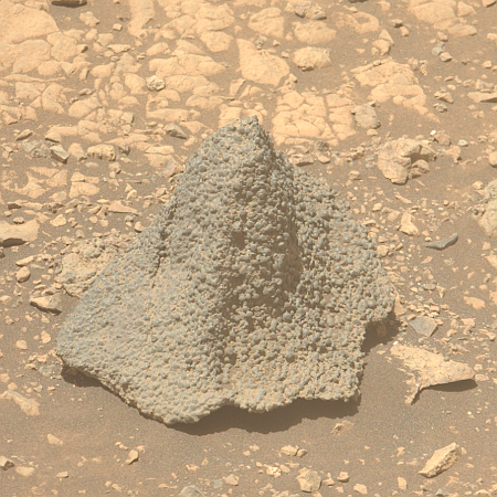
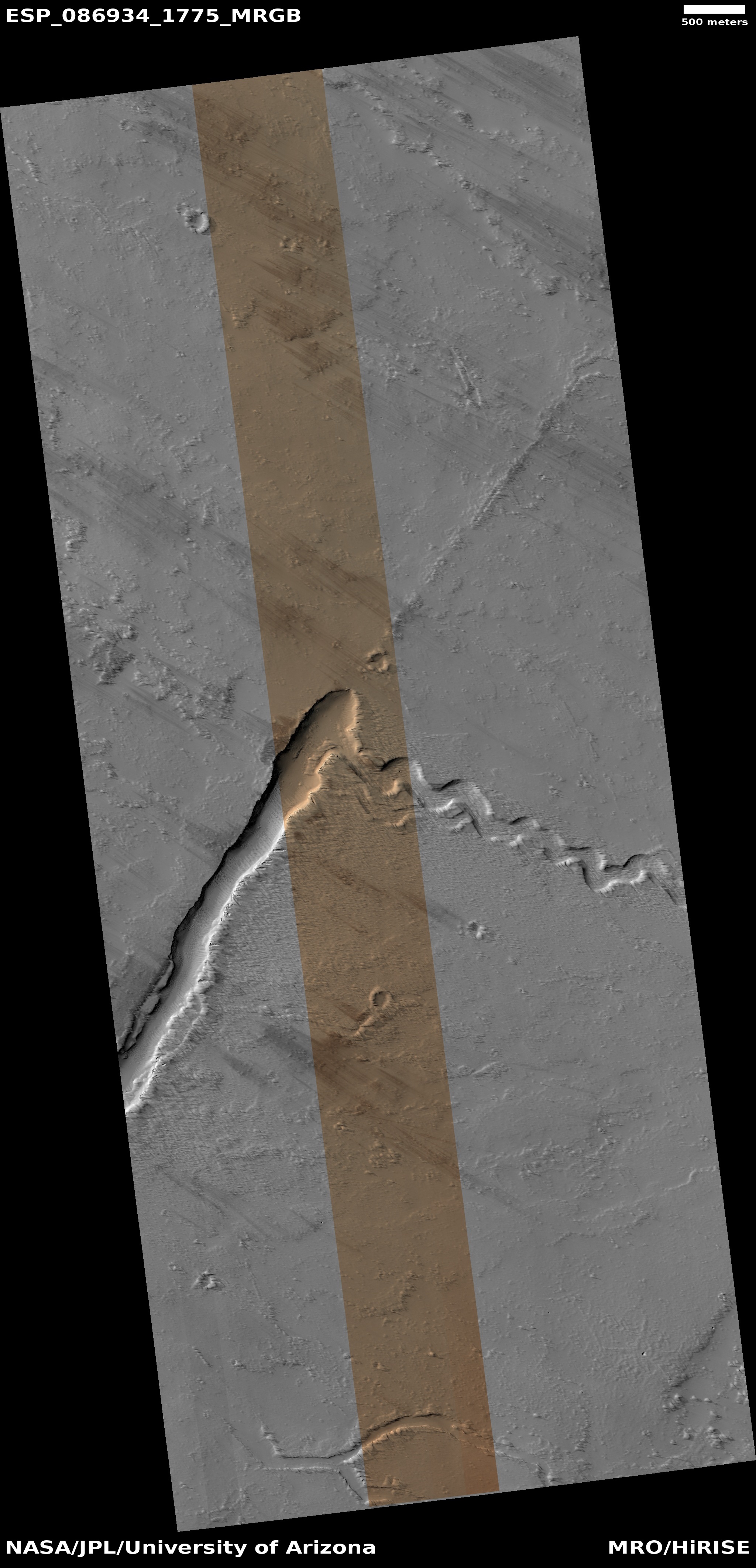
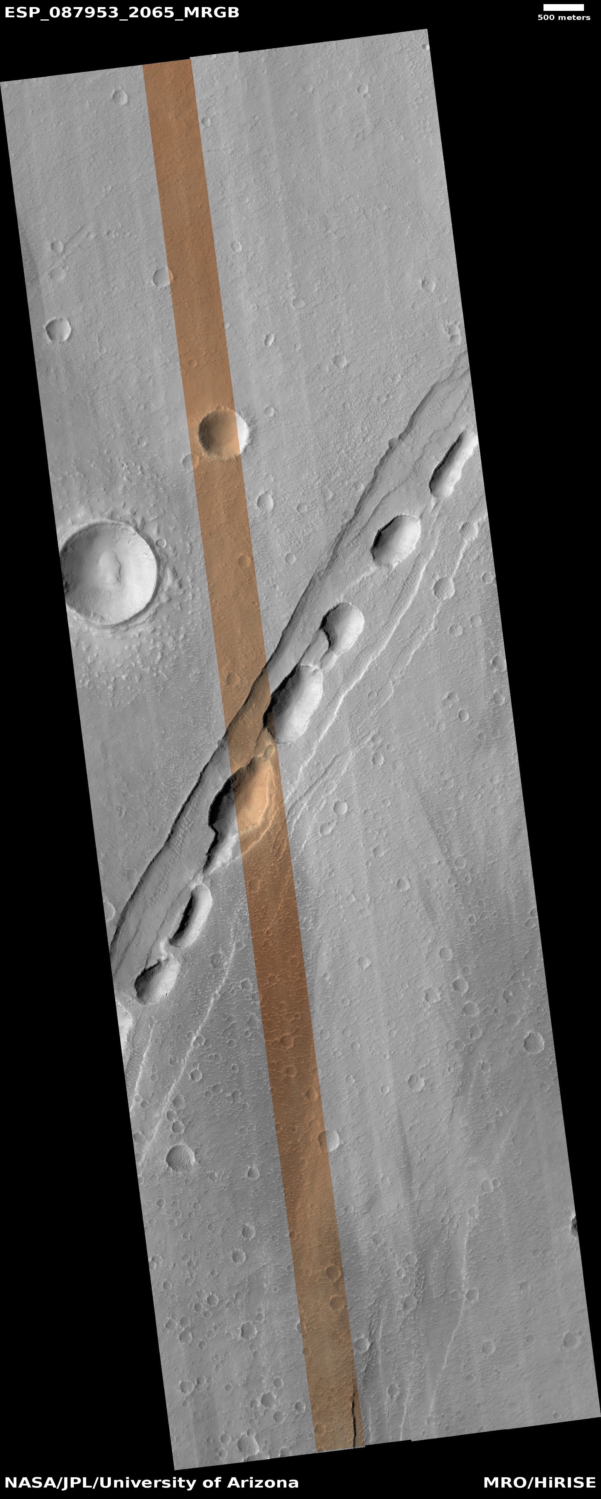
The second image, cropped, reduced, and sharpened to post here, was taken on August 5, 2025 by the left high resolution camera on the rover Perseverance. It shows what appears what geologists call a “float rock”, something that was created geologically somewhere else and transported to this location later.
In this case the rock appears lavalike in nature. Since Perseverance is exploring the exterior rim of Jezero Crater, we could be looking at the impact melt created when the bolide hit the ground to create the crater. Material would be instantly melted as well as flung outward as ejecta, with this strangely shaped rock an example.
The problem with this theory however is that the rock appears to have solidified well before it hit the ground at this location. Its shape also suggests it solidified within a crack, thus molding it to this shape, with its top once at the bottom, the lava flowing downward. The mystery then is how it ended up as we see it, upside down and exposed.
Click for original image.

Click for original image.
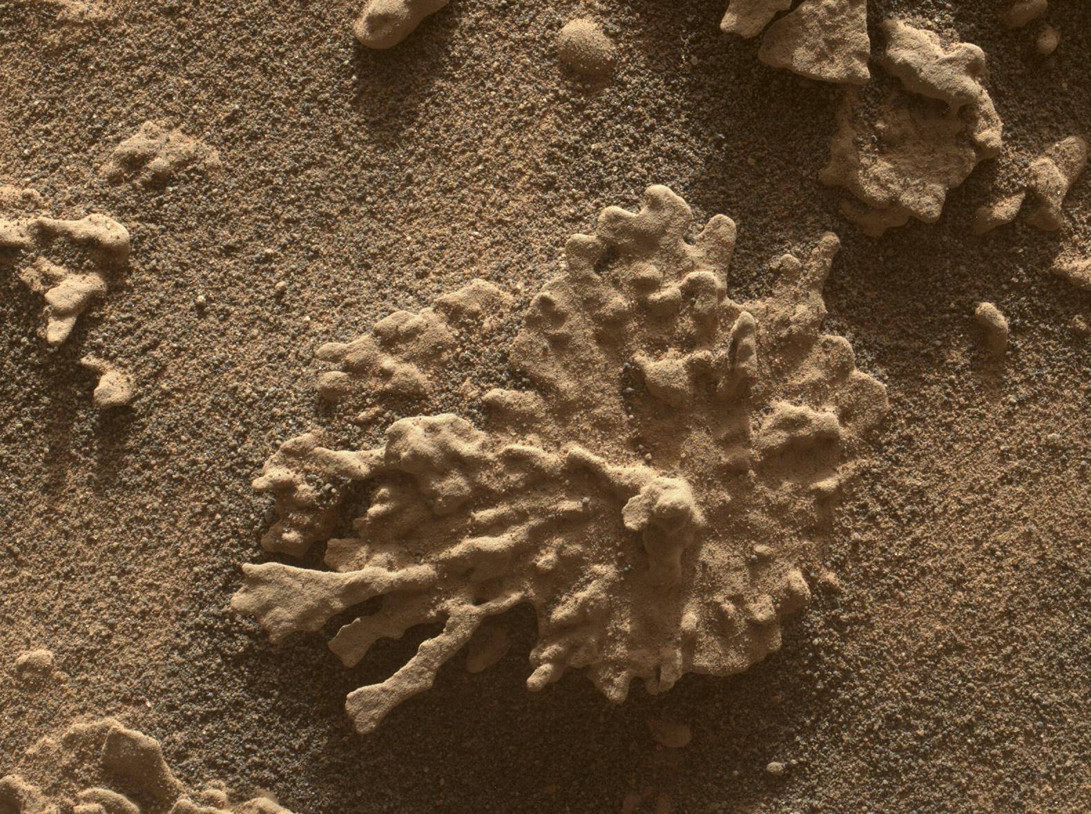
Time for two cool images, from two different craters separated by thousands of miles on Mars! The first image to the right, cropped, reduced, and sharpened to post here, was taken on July 24, 2025 by the Mars Hand Lens Imager (MAHLI) at the end of the robot arm of Mars rover Curiosity, and shows a really strange rock formation that resembles a piece of coral on Earth.
Curiosity has found many small features like this one, which formed billions of years ago when liquid water still existed on Mars [in this region]. Water carried dissolved minerals into rock cracks and later dried, leaving the hardened minerals behind. Eons of sandblasting by the wind wore away the surrounding rock, producing unique shapes.
The second image, cropped, reduced, and sharpened to post here, was taken on August 5, 2025 by the left high resolution camera on the rover Perseverance. It shows what appears what geologists call a “float rock”, something that was created geologically somewhere else and transported to this location later.
In this case the rock appears lavalike in nature. Since Perseverance is exploring the exterior rim of Jezero Crater, we could be looking at the impact melt created when the bolide hit the ground to create the crater. Material would be instantly melted as well as flung outward as ejecta, with this strangely shaped rock an example.
The problem with this theory however is that the rock appears to have solidified well before it hit the ground at this location. Its shape also suggests it solidified within a crack, thus molding it to this shape, with its top once at the bottom, the lava flowing downward. The mystery then is how it ended up as we see it, upside down and exposed.


