Perseverance looks back at the floor of Jezero Crater
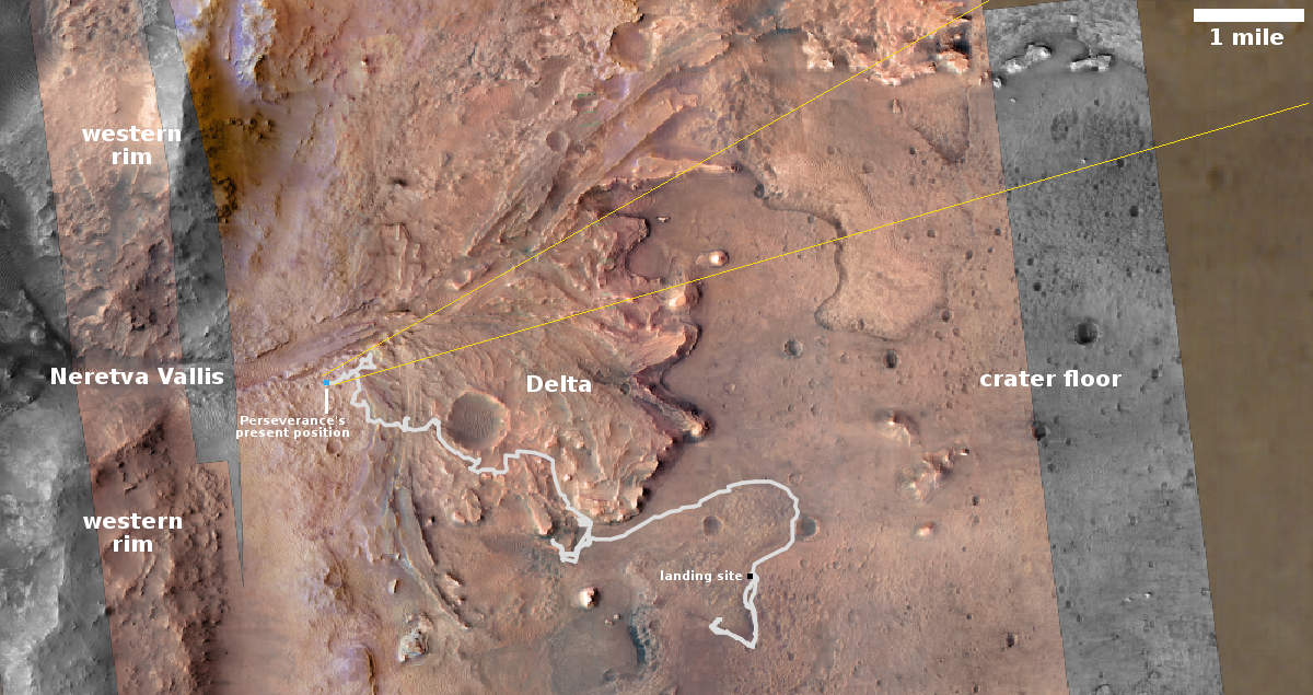
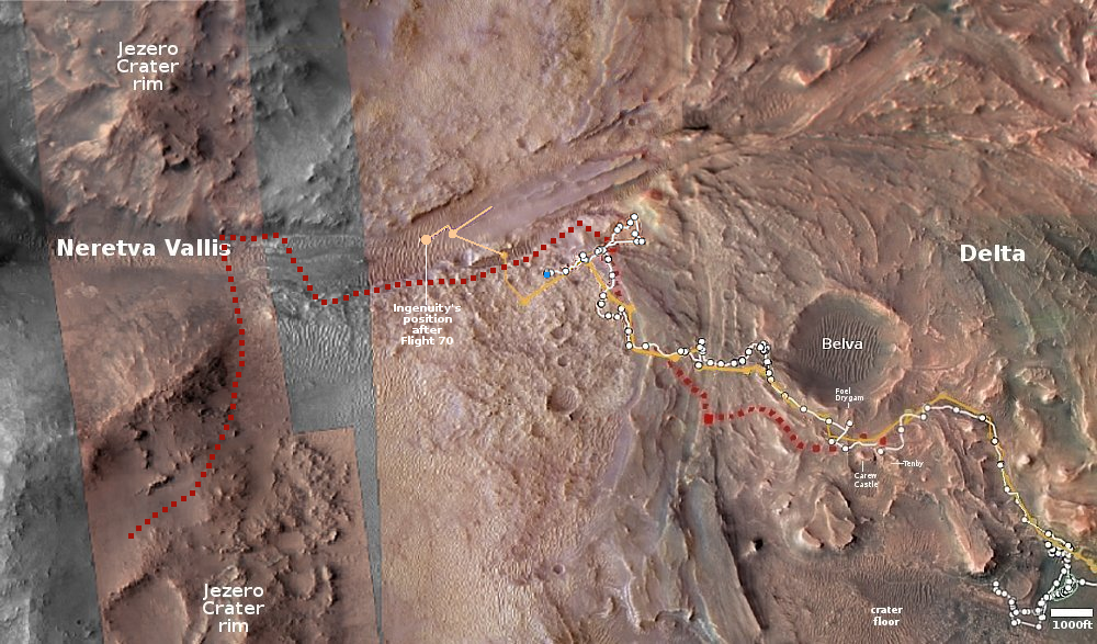
Click for interactive map.
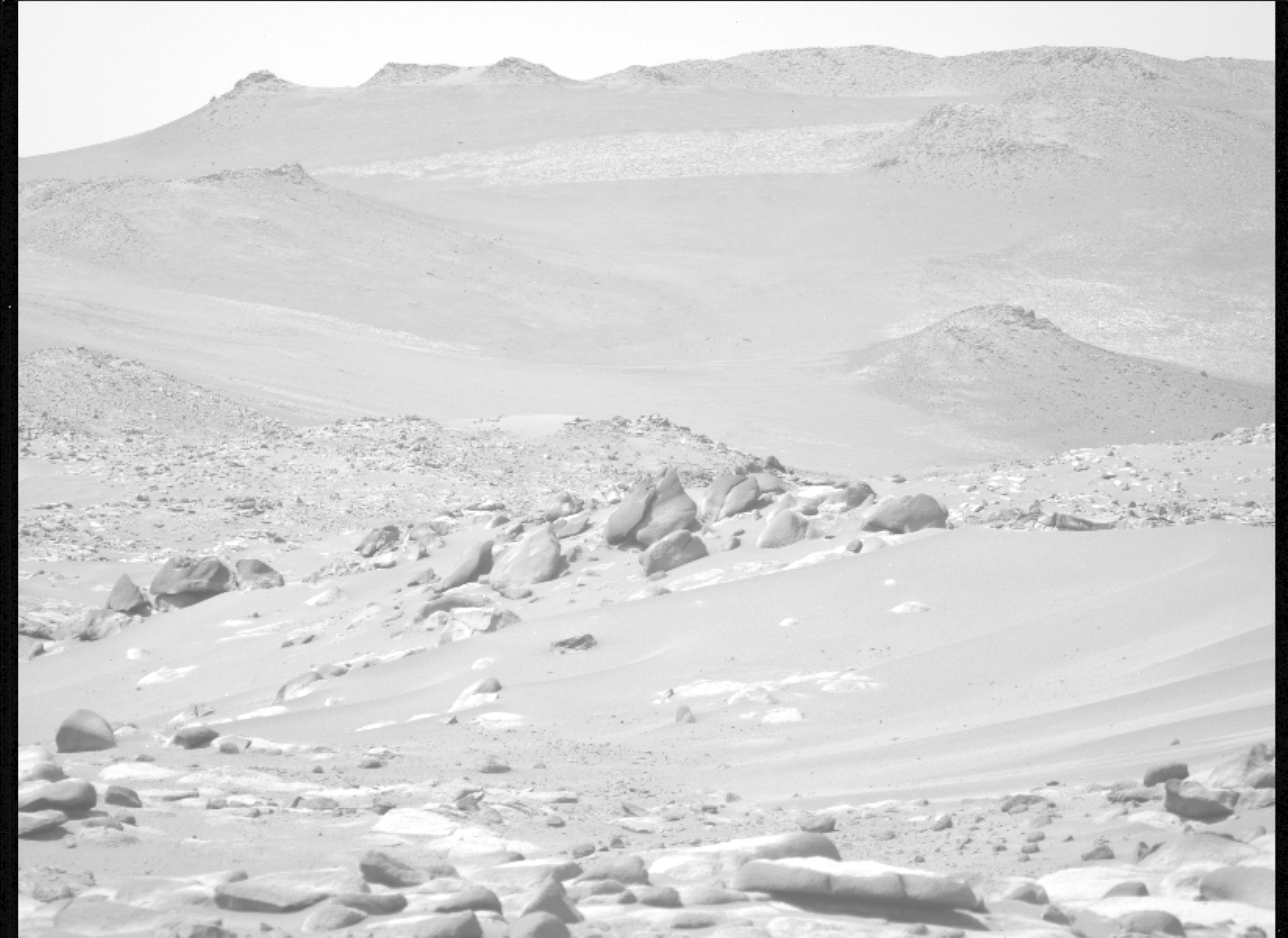
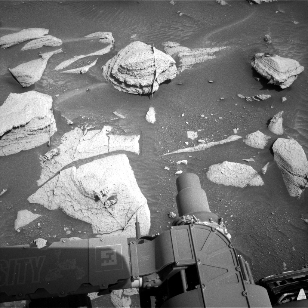
Click for original image.
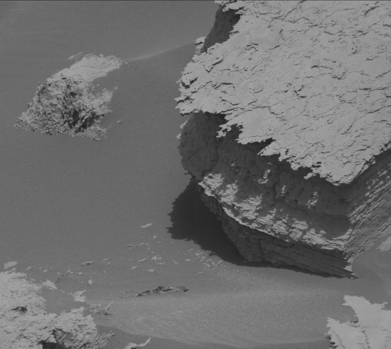
Cool image time. The picture to the right, cropped, reduced, and enhanced to post here, was taken today by the left high resolution camera on the Mars rover Perseverance.
Though I am guessing somewhat, I think this image looks east and down into the floor of Jezero Crater, as indicated by the yellow lines in the overview map above. The mountains in the distance are not the easter rim of Jezero, which is generally indistinct, but some peaks inside the crater itself. They appear higher because Perseverance is looking down at them from the delta, near the western rim.
The white line on the map shows the rover’s entire journey so far since landing in February 2021, about 14.77 miles. Since Perseverance’s recent travels should be within this picture, and I can see no rover tracks, it suggests my guess as to what the picture looks at could be very wrong. No matter. Up until now the landscape inside Jezero Crater has in general been less spectacular than seen by Curiosity in Gale Crater many miles away. This picture however shows us that Perseverance can provide us some good views also. It is also a precursor to the views we shall get once the rover exits Jezero and begins to explore the rough regions to the west.