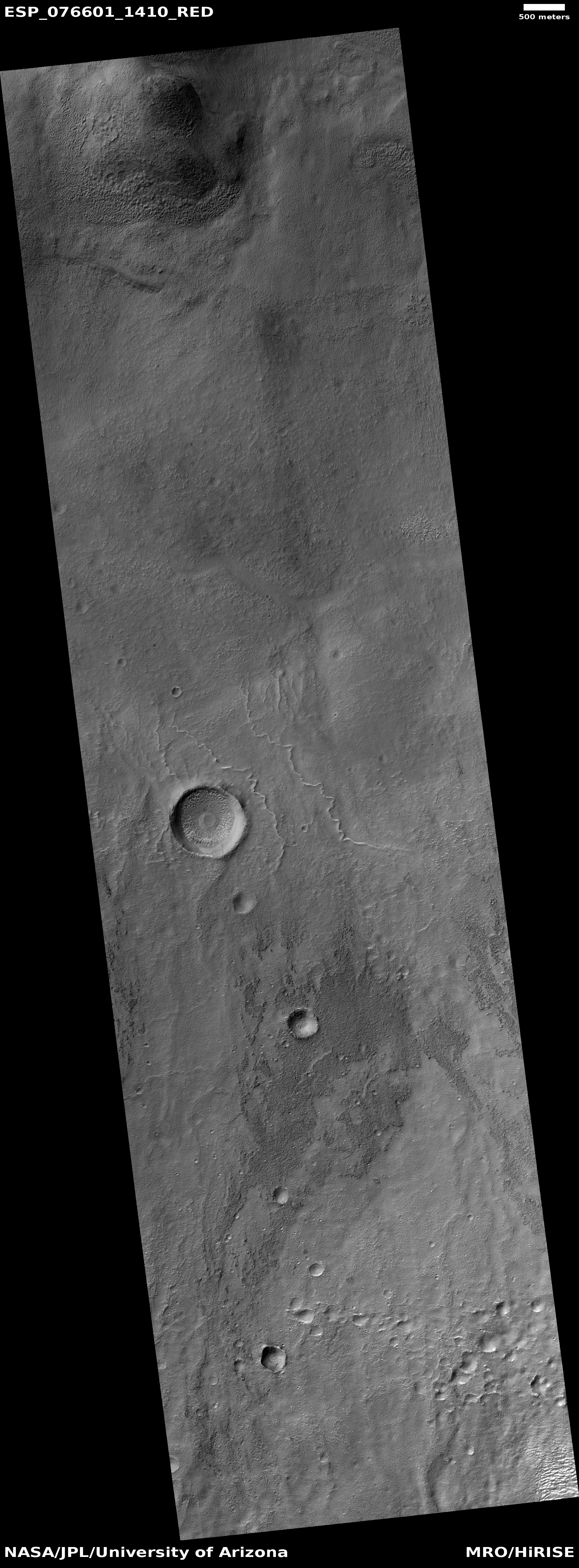
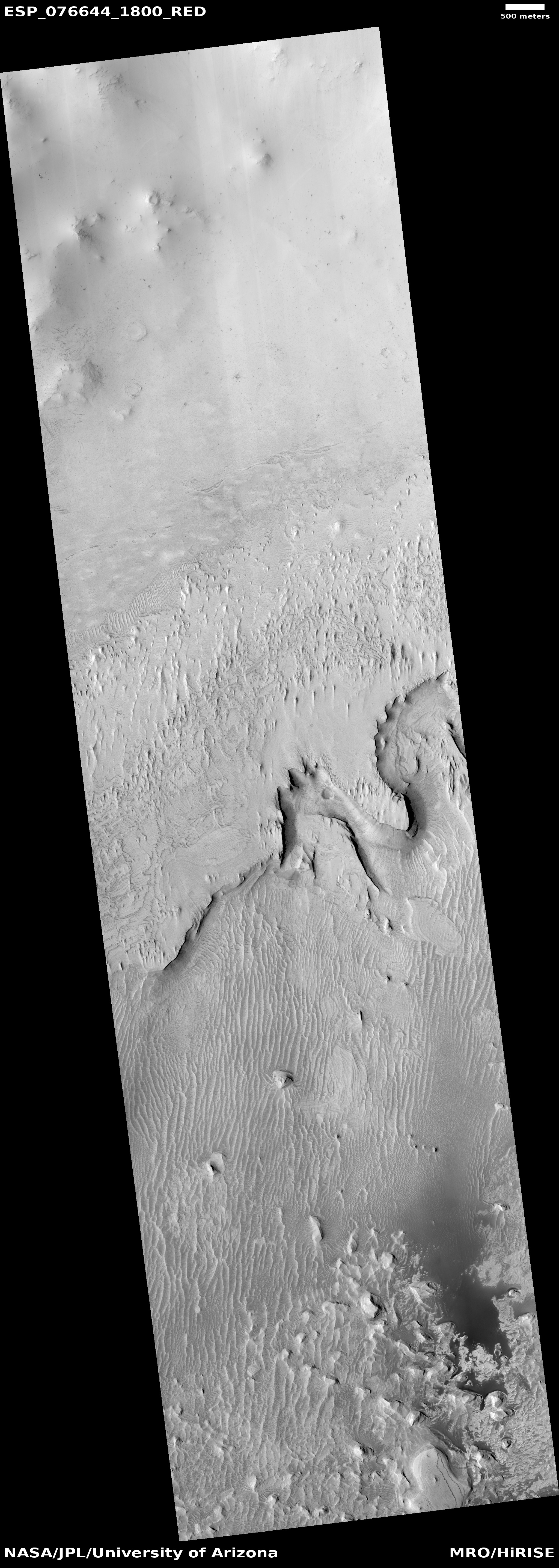
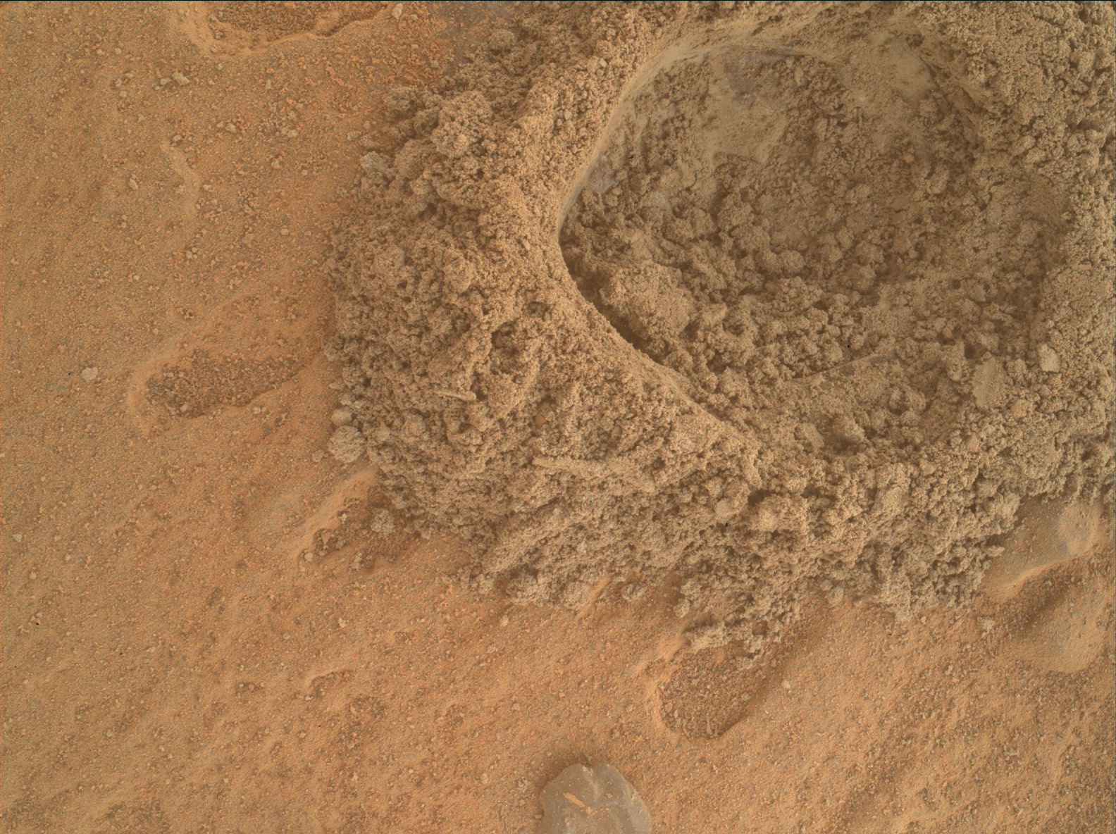
Ingenuity completes 47th flight, scouting ahead of Perseverance
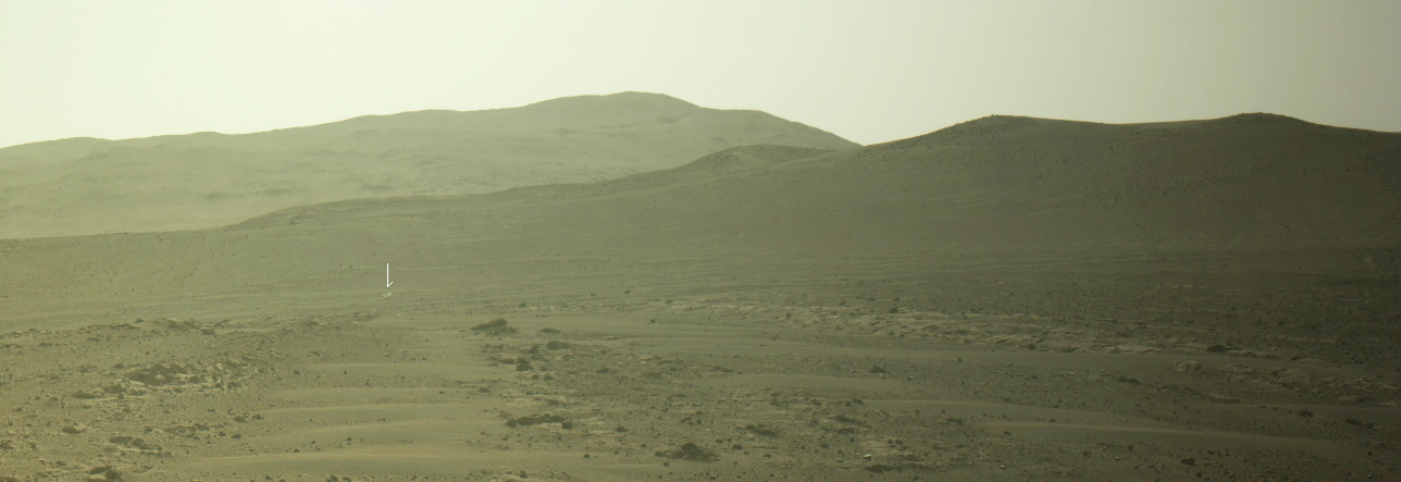
Click for original image.
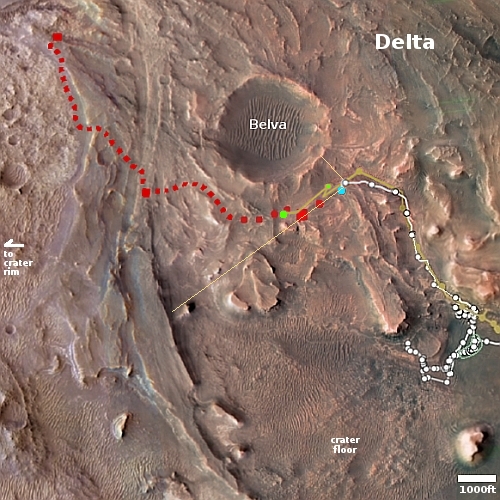
Click for interactive map.
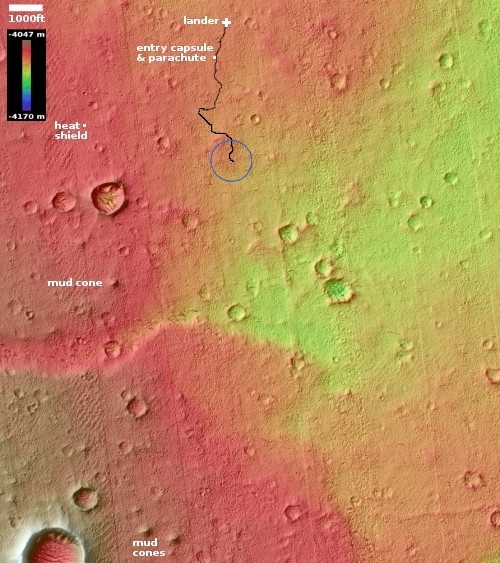
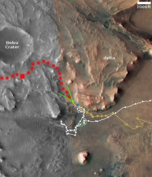
Though the science team has not, as of this posting, added the flight to Ingenuity’s flight log, according to the interactive map showing the positions of both Ingenuity and Perseverance on Mars, the helicopter completed its 47th flight yesterday as planned.
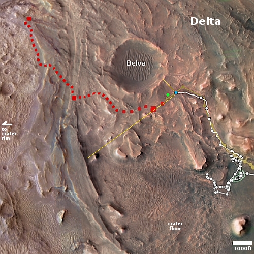
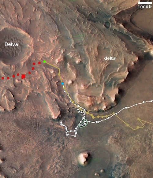
An annotated version of that map is to the right. The larger green dot marks Ingenuity’s new position. The smaller green dot marks its position when the panorama above was taken on February 27, 2023, capturing the helicopter in the distance (as indicated by the arrow). The yellow lines indicate the approximate area covered by that panorama. The blue dot marks Perseverance’s present position.
The flight’s planned distance was to go 1,410 feet to the southwest and “image science targets along the way.” As the helicopter also flew above Perseverance’s planned route, as indicated by the red dotted line, it also provided the rover team information about the ground Perseverance will travel along the way. Since the terrain here is generally not very rough, the information is not critical for route-picking. It might however spot some geological feature that bears a closer look that would not have been noticed by the rover alone.
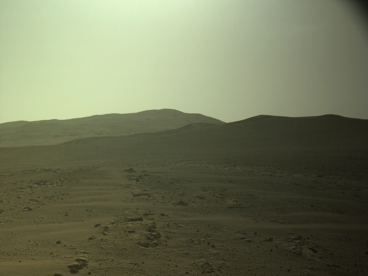
Click for original image.
Click for interactive map.
Though the science team has not, as of this posting, added the flight to Ingenuity’s flight log, according to the interactive map showing the positions of both Ingenuity and Perseverance on Mars, the helicopter completed its 47th flight yesterday as planned.
An annotated version of that map is to the right. The larger green dot marks Ingenuity’s new position. The smaller green dot marks its position when the panorama above was taken on February 27, 2023, capturing the helicopter in the distance (as indicated by the arrow). The yellow lines indicate the approximate area covered by that panorama. The blue dot marks Perseverance’s present position.
The flight’s planned distance was to go 1,410 feet to the southwest and “image science targets along the way.” As the helicopter also flew above Perseverance’s planned route, as indicated by the red dotted line, it also provided the rover team information about the ground Perseverance will travel along the way. Since the terrain here is generally not very rough, the information is not critical for route-picking. It might however spot some geological feature that bears a closer look that would not have been noticed by the rover alone.